 Most viewed - IOTA Island QSLs (1091 worked - 1090 confirmed) - I no longer submit QSLs to the IOTA checkpoint as I do not agree with recent rules changes made to this program Most viewed - IOTA Island QSLs (1091 worked - 1090 confirmed) - I no longer submit QSLs to the IOTA checkpoint as I do not agree with recent rules changes made to this program |

af-048r.jpgAF-048 Kerguelen Islands133 viewsThe Kerguelen Islands are a group of islands in the Antarctic. They are among the most isolated places on Earth, located 450 km (280 mi) northwest of the uninhabited Heard Island and McDonald Islands (Australia) and more than 3,300 km (2,100 mi) from Madagascar. They are part of the French Southern and Antarctic Lands
|
|

AF-065.jpgAF-065 Morocco Safi / Essaouira / Agadir Region group133 viewsMogador Island is the main island of the Iles Purpuraires near Essaouira in Morocco
|
|

AF-066R.jpgAF-066 Mozambique Gaza / Maputo District group133 viewsInhaca Island is a subtropical island of Mozambique off the East African coast. The 52 km² island separates Maputo Bay to the west from the Indian Ocean off its eastern shores
|
|

AF-085R.jpgAF-085 South Africa Western Cape Province North West group133 viewsElephant Rock located off the Cape of Good Hope South Africa
|
|

AF-087.jpgAF-087 Tanzania Tanga Region group133 viewsYambe Island, Tanzania is an island nearby to Ras Nyamaku and Mtambwe
|
|

AF-090R.jpgAF-090 Madagascar's Coastal Islands East133 viewsNosy Boraha, or Île Sainte-Marie, is an island off Madagascar’s east coast. Near the main town of Ambodifotatra,
|
|

AS-134.jpgAS-134 China Hebei / Tianjin Province group133 viewsShijiutuo, Hebei is an island to the east of Yuetuo and southeast of Laoyujian in northern China.
|
|

AS-201.jpgAS-201 Turkey Sea of Marmara Islands133 viewsBüyükada is the largest of the nine so-called Princes' Islands in the Sea of Marmara, near Istanbul, with an area of about 2 square miles. It is officially a neighbourhood in the Adalar district of Istanbul Province,
|
|

AF-051.jpgAF-051 Guinee-Maritime Province South group132 viewsÃŽles de Los (English: Los Islands) are an island group lying off Conakry in Guinea, on the west coast of Africa. Their name is derived from the Portuguese: Ilhas dos Ãdolos, "Island of the Idols".[1] They are located about 2 kilometres (1.2 mi) off the headland limiting the southern side of Sangareya Bay.[2]
|
|
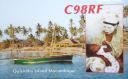
AF-061.jpgAF-061 Mozambique Cabo Delgado District group132 viewsThe Quirimbas Islands lie in the Indian Ocean off northeastern Mozambique, close to Pemba, the capital of the province of Cabo Delgado
|
|

AF-067R.jpgAF-067 Kenya Coast Province South group132 viewsWasini Island lies in southeast Kenya 3 kilometres off the coast of the Indian Ocean, 75 kilometres south of Mombasa, and 3 kilometres opposite the harbour of the village Shimoni.
|
|

AF-074.jpgAF-074 Tanzania Lindi / Mtwara Region group132 viewsSongo Songo Island is a small island located in Lindi Region in Tanzania
|
|
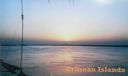
AF-081.jpgAF-081 Eritrea Red Sea Coast South group132 viewsGerebsasa Deset Island southern coast of Eritrea in the Red Sea
|
|

AF-084R.jpgAF-084 Ghana group132 viewsAbokwa Island is in the Western Region of, Ghana (Africa)
|
|

AF-090.jpgAF-090 Madagascar's Coastal Islands East132 viewsNosy Boraha, or Île Sainte-Marie, is an island off Madagascar’s east coast. Near the main town of Ambodifotatra
|
|

AS-102.jpgAS-102 Taiwan Kinmen (Quemoy) Island132 viewsKinmen 金門 (pronounced Jinmen, literal meaning "golden gate", formerly known as Quemoy) is an outlying island located near the People's Republic of China, but is controlled by the Republic of China on Taiwan. It has a large number of traditional Min style buildings and military sites that are open to tourists
|
|

as-176r.jpgAS-176 India Gujarat State East group132 viewsShiyal Bet, an island located off Pipavav port in Amreli district
|
|

sa-016r.jpgSA-016 Maranhao State Centre group, Brazil132 viewsSão LuÃs Island also known as Upaon-açu Island or Maranhão Island is an island in state of Maranhão, Brazil with an area of 1,410 km², located between the BaÃa de São Marcos and the BaÃa de São José.
|
|

AF-031.jpgAF-031 Tromelin Island131 viewsTromelin Island is a low, flat, island in the Indian Ocean about 500 kilometres (310 mi) north of Réunion, and about 450 kilometres (280 mi) east of Madagascar.
|
|

AF-037.jpgAF-037 Sierra Leone Northern/Western Province group131 viewsThe Banana Islands are a group of islands that lie off the coast of Yawri Bay, south west of the Freetown Peninsula in the Western Area of Sierra Leone.
|
|

AF-039R.jpgAF-039 Annobon (Pagalu) Island131 viewsAnnobón, also called Pagalu, volcanic island in the South Atlantic Ocean near the Equator; it is part of Equatorial Guinea. Located about 350 miles (565 km) southwest of continental Equatorial Guinea
|
|

AF-043.jpgAF-043 Gabon Estuaire Province group131 viewsIsl de Banie -- located of the coast of Gabon, West Africa
|
|

AF-045R.jpgAF-045 Senegal North group131 viewsNgor Island is located only 700 meters from the Cap Vert peninsula in Dakar, Senegal, West Africa
|
|
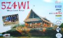
AF-067.jpgAF-067 Kenya Coast Province South group131 viewsWasini Island lies in southeast Kenya 3 kilometres off the coast of the Indian Ocean, 75 kilometres south of Mombasa, and 3 kilometres opposite the harbour of the village Shimoni.
|
|

AF-068.jpgAF-068 Morocco Western Sahara South group131 viewsHerne Island is located off the Atlantic Coast of Western Sahara, a disputed territory currently administered by Morocco.
|
|

AF-084.jpgAF-084 Ghana group131 viewsAbokwa Island is in the Western Region of, Ghana (Africa)
|
|

AF-095R.jpgAF-095 Cameroon group131 viewsMondoleh Island) is an island in the south west province of Cameroon in the Bay of Ambas, 258 kilómetres to the west of Yaounde, the capital
|
|

AS-185.jpgAS-185 Vietnam Gulf of Tongking South group131 viewsCồn CỠis a rural district of Quảng Trị Province in the North Central Coast region of Vietnam. It is an island and is located 27 km to the east of Mũi Lay. Con Co Island has an area of 2.3 km², the isometric form of hills, the highest peak of 63m
|
|

AS-193.jpgAS-193 Saudi Arabia Farasan Islands131 viewsFarasan Island is the largest island of the Farasan Islands, in the Red Sea. It is located some 50 km offshore from Jizan, the far southwestern part of Saudi Arabia. It is located at around 16°42′21″N 41°59′0″E. The main town on the island is Farasan.
|
|

AF-036.jpgAF-036 Chafarinas Islands130 viewsThe Chafarinas Islands (Spanish: Islas Chafarinas IPA: [ˈizlas tʃafaˈɾinas], Berber: Igumamen Iceffaren or Takfarinas, Arabic: جزر الشÙارين or الجزر الجعÙرية), also spelled Zafarin, Djaferin[1] or Zafarani,[2] are a group of three small islets located in the Alboran Sea off the coast of Morocco. The Chafarinas Islands are one of the Spanish territories in North Africa off the Moroccan coast known as plazas de soberanÃa.
|
|

AF-061R.jpgAF-061 Mozambique Cabo Delgado District group130 viewsThe Quirimbas Islands lie in the Indian Ocean off northeastern Mozambique, close to Pemba, the capital of the province of Cabo Delgado
|
|

AF-072R.jpgAF-072 Mozambique Inhambane District group130 viewsBazaruto is a sandy island located approximately 80 kilometres (50 mi) southeast of the mouth of the Save River, Mozambique
|
|

AF-074R.jpgAF-074 Tanzania Lindi / Mtwara Region group130 viewsSongo Songo Island is a small island located in Lindi Region in Tanzania
|
|

AF-075R.jpgAF-075 Tanzania Dar Es Salaam / Pwani Region group130 viewsTanzania's Kwale Island has an area of 7.1 square kilometers (2.7 square miles) and is located approximately 140 kilometers (87 miles) south of Dar es Salaam.
|
|

AF-078R.jpgAF-078 Senegal South group130 viewsCarabane, also known as Karabane, is an island located in the extreme south-west of Senegal, in the mouth of the Casamance River.
|
|

AF-094.jpgAF-094 Algeria Mediterranean Sea Coast West group130 viewsThe Habibas islands WikiMiniAtlas35°43′29″N 1°8′00″W are located about 12 km off the Algerian coast, northwest of Oran. The islands consist of a principal island 1.3 km long surrounded by an archipelago covering a total area of about 40 ha.
|
|
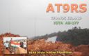
AS-177.jpgAS-177 India Goa State group130 viewsSt George’s Islands consists of three islands between 1.5 and 2.5 miles SSW of Marmagao Head. Grandi Island is the collective name of the two S islands of the group, which are connected by a narrow reef of rock and shingle
|
|

AS-177R.jpgAS-177 India Goa State group130 viewsSt George’s Islands consists of three islands between 1.5 and 2.5 miles SSW of Marmagao Head. Grandi Island is the collective name of the two S islands of the group, which are connected by a narrow reef of rock and shingle
|
|
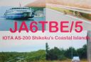
AS-200.jpgAS-200 Japan Shikoku's Coastal Islands130 views
|
|

sa-017r.jpgSA-017 Cauca / Valle Department group, Colombia130 viewsGorgona is a Colombian island in the Pacific Ocean situated about 35 km off the Colombian Pacific coast. The island is 9 km long and 2.5 km wide, with a maximum height of 338 m and a total area of 26 km². Gorgona is separated from the continent by a 270 m deep underwater depression.
|
|
| 1895 files on 48 page(s) |
 |
|
|
|
|
7 | |
|
|
|
|
|
|
|
|
|
|
|
|
 Contact
