 Most viewed - IOTA Island QSLs (1091 worked - 1090 confirmed) - I no longer submit QSLs to the IOTA checkpoint as I do not agree with recent rules changes made to this program Most viewed - IOTA Island QSLs (1091 worked - 1090 confirmed) - I no longer submit QSLs to the IOTA checkpoint as I do not agree with recent rules changes made to this program |

AF-072.jpgAF-072 Mozambique Inhambane District group136 viewsBazaruto is a sandy island located approximately 80 kilometres (50 mi) southeast of the mouth of the Save River, Mozambique
|
|
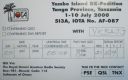
AF-087R.jpgAF-087 Tanzania Tanga Region group136 viewsYambe Island, Tanzania is an island nearby to Ras Nyamaku and Mtambwe
|
|

af-098.jpgAF-098 Mozambique Sofala District group136 viewsIlha Chiloane is an island located in the Sofala province of Mozambique
|
|

as-036.jpgAS-036 Japan Iki / Tsushima Islands136 viewsTsushima Island (対馬 Tsushima) is an island of the Japanese archipelago situated in-between the Tsushima Strait and Korea Strait, approximately halfway between the Japanese mainland and the Korean Peninsula.[3][4] The main island of Tsushima was once a single island but was divided into two in 1671 by the Ōfunakoshiseto canal and into three in 1900 by the Manzekiseto canal.
|
|

AS-190R.jpgAS-190 Saudi Arabia Red Sea Coast North (Tabuk Province) group136 viewsAl Dhahrah Island / Tabuk / al-Wajh / Saudi Arabia
|
|

eu-004.jpgEU-004 Balearic Islands136 viewsThe Balearic Islands are an archipelago of Spain in the western Mediterranean Sea, near the eastern coast of the Iberian Peninsula.
The four largest islands are Mallorca, Menorca, Ibiza, and Formentera. Many minor islands and islets are close to the larger islands, including Cabrera, Dragonera, and S'Espalmador.
|
|

sa-008r.jpgSA-008 Tierra del Fuego Island, Argentina136 viewsIsla Grande de Tierra del Fuego (English: Big Island of Land of Fire) is an island near the southern tip of South America from which it is separated by the Strait of Magellan. The western portion (61.4%) of the island (29,484.7 km2 (11,384.1 sq mi)) is in Chile (Province of Tierra del Fuego and Antártica Chilena Province), while the eastern portion (38.6%, 18,507.3 km2 (7,145.7 sq mi)) is in Argentina
|
|

sa-017.jpgSA-017 Cauca / Valle Department group, Colombia136 viewsGorgona is a Colombian island in the Pacific Ocean situated about 35 km off the Colombian Pacific coast. The island is 9 km long and 2.5 km wide, with a maximum height of 338 m and a total area of 26 km². Gorgona is separated from the continent by a 270 m deep underwater depression.
|
|

sa-019r.jpgSA-019 Abrolhos Archipelago, Brazil136 viewsThe Abrolhos are a group of 5 uninhabited islands in the Atlantic Ocean off Brazil's southern Bahia coast. The Abrolhos Marine National Park encompasses 4 of these islands.
|
|

AF-030R.jpgAF-030R Gough Island135 viewsis a rugged volcanic island in the South Atlantic Ocean. It is a dependency of Tristan da Cunha and part of the British overseas territory of Saint Helena, Ascension and Tristan da Cunha. It is about 400 km (250 mi) south-east of the Tristan da Cunha archipelago, 2,400 km (1,500 mi) north-east from South Georgia Island, 2,700 km (1,700 mi) west from Cape Town, and over 3,200 km (2,000 mi) from the nearest point of South America. Gough Island is uninhabited except for the personnel of a weather station (usually six people) which the South African National Antarctic Programme has maintained, with British permission, continually on the island since 1956. It is one of the most remote places with a constant human presence.
|
|

AF-033.jpgAF-033 Amirante Islands135 viewsThe Amirante Islands (Les Amirantes) are a group of coral islands and atolls that belong to the Outer Islands of the Seychelles. They stretch about 155 km from the African Banks (African Islands) in the north to Desnœufs (Isle des Noeufs) in the south, all on the shallow Amirantes Bank
|
|

AF-033R.jpgAF-033 Amirante Islands135 viewsThe Amirante Islands (Les Amirantes) are a group of coral islands and atolls that belong to the Outer Islands of the Seychelles. They stretch about 155 km from the African Banks (African Islands) in the north to Desnœufs (Isle des Noeufs) in the south, all on the shallow Amirantes Bank
|
|

AF-042R.jpgAF-042 Alboran Island135 viewsAlboran Island (Spanish: Isla de Alborán) is a small islet in the Alboran Sea, part of the western Mediterranean, about 50 km (31 mi) north of the Moroccan coast and 90 kilometres (56 miles) south of the Spanish province of AlmerÃa. A Spanish possession since 1540, it was taken from the Tunisian pirate Al Borani in the Battle of Alboran. It is now home to a small Spanish Navy garrison and an automated lighthouse.
|
|

AF-048.jpgAF-048 Kerguelen Islands135 viewsThe Kerguelen Islands are a group of islands in the Antarctic. They are among the most isolated places on Earth, located 450 km (280 mi) northwest of the uninhabited Heard Island and McDonald Islands (Australia) and more than 3,300 km (2,100 mi) from Madagascar. They are part of the French Southern and Antarctic Lands
|
|

AF-056R.jpgAF-056 Sierra Leone Southern Province group135 viewsSherbro Island is in the Atlantic Ocean, and is included within Bonthe District, Southern Province, Sierra Leone. The island is separated from the African mainland by the Sherbro River in the north and Sherbro Strait in the east.
|
|

AF-063.jpgAF-063 Pemba Island135 viewsPemba Island is an island forming part of the Zanzibar Archipelago, lying within the Swahili Coast in the Indian Ocean
|
|

AF-077.jpgAF-077 South Africa Western Cape Province South group135 viewsSeal Island is a small land mass located 5.7 kilometres off the northern beaches of False Bay, near Cape Town, in South Africa. The island is so named because of the great number of Cape fur seals that occupy it
|
|

AF-080R.jpgAF-080 Eritrea Red Sea Coast North group135 viewsGreen Island (Sheikh Said), a short boat trip from Massawa, Red Sea, Eritrea,
|
|

AF-086REAR.jpgAF-086 Cape Verde Islands Windward Islands (aka Barlavento)135 viewsSal (Portuguese for "salt") is an island in Cape Verde. It belongs to the northern group of islands, called Barlavento ("windwards"),
|
|

as-176.jpgAS-176 India Gujarat State East group135 viewsShiyal Bet, an island located off Pipavav port in Amreli district
|
|

sa-021.jpgSA-021 Buenos Aires (Bahia Blanca) Province group, Argentina135 viewsIsla Bermejo is an island that is part of the eastern coast of Argentina, forming part of a row of islands that stand at the entrance of the ria of BahÃa Blanca[1] near the city of BahÃa Blanca.
|
|

AS-087R.jpgAS-087 Asiatic Russia Arkticheskogo Instituta Islands135 viewsThe Arkticheskiy Institut Islands or Arctic Institute Islands (Russian: ОÑтрова ÐрктичеÑкого инÑтитута) is a compact archipelago of narrow islands covered with tundra vegetation. The islands are located in the Kara Sea, about 173 km (107 mi)north of the coast of Siberia, and just 45 km (28 mi) south of the nearest island group, the Izvesti Tsik Islands.
|
|

AF-028.jpgAF-028 Socotra (Suqutra)134 viewslocated between the Guardafui Channel and the Arabian Sea, is the largest of four islands in the Socotra archipelago. The territory is officially part of Yemen
|
|
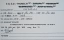
AF-031R.jpgAF-031R Tromelin Island134 viewsTromelin Island is a low, flat, island in the Indian Ocean about 500 kilometres (310 mi) north of Réunion, and about 450 kilometres (280 mi) east of Madagascar.
|
|

AF-047R.jpgAF-047 Selvagens Islands134 viewsThe Savage Islands or Selvagens Islands (Portuguese: Ilhas Selvagens IPA: [ˈiÊŽÉʃ sɛɫˈvaÊ’É̃jʃ]) are a small Portuguese archipelago in the North Atlantic, 280 kilometres (175 mi) south of Madeira, and 165 kilometres (105 mi) north of the Canary Islands.
|
|
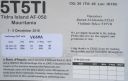
AF-050R.jpgAF-050 Mauritania Dakhlet Nouadhibou / Inchiri Region group134 viewsTidra (Arabic: تيدرة‎) is an offshore island 18-mile (29-kilometre) long and 5-mile (8.0-kilometre) wide. It is the largest island off the shore of Banc d' Arguin, Mauritania (also being the largest in the nation) and is home to a community of Imraguen fishing tribe. The island is part of the Banc d'Arguin National Park.
|
|

AF-053.jpgAF-053 Djibouti Gulf of Tadjoura group134 viewsMoucha Island is a small coral island off the coast of Djibouti. It is located at the center of the Gulf of Tadjoura.
|
|

af-054r.jpgAF-054 Mafia Island134 viewsMafia Island ("Chole Shamba") is an island in Tanzania. As one of the six districts of the Pwani Region, Mafia Island is governed from the mainland, not from the semi-autonomous region of Zanzibar, of which it has never been considered to be a part politically.
|
|

AF-064R.jpgAF-064 South Africa Western Cape Province South West group134 viewsRobben Island (Afrikaans: Robbeneiland) is an island in Table Bay, 6.9 kilometres (4.3 mi) west of the coast of Bloubergstrand, Cape Town, South Africa
|
|

AF-073R.jpgAF-073 Tunisia Sfax Region group134 viewsKerkennah Islands are a group of islands lying off the east coast of Tunisia in the Gulf of Gabès, at 34°42′N 11°11′E.
|
|
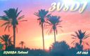
AF-083.jpgAF-083 Tunisia Gabes / Medenine Region group134 viewsDjerba at 514 square kilometres (198 sq mi), the largest island of North Africa, located in the Gulf of Gabès,[1] off the coast of Tunisia.
|
|
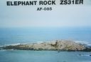
AF-085.jpgAF-085 South Africa Western Cape Province North West group134 viewsElephant Rock located off the Cape of Good Hope South Africa
|
|

AF-091.jpgAF-091 Tunisia Jendouba / Bizerte / Tunis / Nabeul Region group134 viewsPlane Island, also known as Piana or Plana Island and—in Tunisian Arabic—as Jaziret el-Monbasta, is a flat, rocky island in the Mediterranean Sea roughly 3.75 kilometers off Cape Farina, Tunisia.
|
|

AF-096R.jpgAF-096 Guinee-Maritime Province North group134 viewsAlcatrack Island in the coastal zone between the border with Guinea Bissau and the Rio Komponi, about 70km west of the city of Boké, northwesternmost Guinea and 300 km from the capital Conakry
|
|

AF-097.jpgAF-097 Algeria Mediterranean Sea Coast Centre group134 viewsÎles Sandja, Algeria, is an island to northeast of El Marsa and northwest of 'Aïn Beïda. Îles Sandja is nearby the Cap Matifou Lighthouse.
|
|

eu-001.jpgEU-001 Dodecanese Islands134 viewsThe Dodecanese, literally "twelve islands") are a group of 15 larger plus 150 smaller Greek islands in the southeastern Aegean Sea, off the coast of Asia Minor (Turkey), of which 26 are inhabited. Τhis island group generally defines the eastern limit of the Sea of Crete. They belong to the wider Southern Sporades island group. The most historically important and well-known island, Rhodes, has been the area's dominant
|
|

AF-028R.jpgAF-028 Socotra (Suqutra)133 viewslocated between the Guardafui Channel and the Arabian Sea, is the largest of four islands in the Socotra archipelago. The territory is officially part of Yemen
|
|

AF-029.jpgAF-029 Tristan da Cunha Island133 views It is the most remote inhabited archipelago in the world, lying approximately 1,511 miles (2,432 km) off the coast of Cape Town in South Africa, 1,343 miles (2,161 km) from Saint Helena and 2,166 miles (3,486 km) off the coast from the Falkland Islands.
|
|

AF-039.jpgAF-039 Annobon (Pagalu) Island133 viewsAnnobón, also called Pagalu, volcanic island in the South Atlantic Ocean near the Equator; it is part of Equatorial Guinea. Located about 350 miles (565 km) southwest of continental Equatorial Guinea
|
|
AF-043R.jpgAF-043 Gabon Estuaire Province group133 viewsIsl de Banie -- located of the coast of Gabon, West Africa
|
|
| 1895 files on 48 page(s) |
 |
|
|
|
6 | |
|
|
|
|
|
|
|
|
|
|
|
|
|
 Contact
