 Most viewed - IOTA Island QSLs (1091 worked - 1090 confirmed) - I no longer submit QSLs to the IOTA checkpoint as I do not agree with recent rules changes made to this program Most viewed - IOTA Island QSLs (1091 worked - 1090 confirmed) - I no longer submit QSLs to the IOTA checkpoint as I do not agree with recent rules changes made to this program |

eu-018.jpgEU-018 Faroe Islands105 viewsThe Faroe Islands, or the Faeroe Islands, is a North Atlantic archipelago located 320 kilometres (200 mi) north-northwest of Scotland, and about halfway between Norway and Iceland. It is an autonomous country of the Kingdom of Denmark. Their total area is about 1,400 square kilometres (540 sq mi) with a population of 50,322 in October 2017.
|
|

OC-020.jpgOC-020 Kure Atoll105 viewsKure Atoll or Ocean Island is an atoll in the Pacific Ocean 48 nautical miles (89 km; 55 mi) beyond Midway Atoll in the Northwestern Hawaiian Islands. The only land of significant size is called Green Island and is a habitat for hundreds of thousands of seabirds. A short, unused and unmaintained runway and a portion of one building, both from a former United States Coast Guard LORAN station, are located on the island.
|
|

dxcc_logo~1.jpgdxcclogo105 views
|
|

as-054.jpgAS-054 Asiatic Russia Laptev Sea Coast West group104 viewsThe Komsomolskaya Pravda Islandsa re an archipelago in the far north of the Russian Federation. The islands are uninhabited and are covered with tundra vegetation, shingle and ice. The climate in these islands and the surrounding waters is extremely severe with frequent gales and blizzards in the winter. The sea surrounding the archipelago is covered with fast ice most of the year and is obstructed by pack ice even in the summer.
|
|

as-057.jpgAS-057 Asiatic Russia Uyedineniya Island104 viewsUyedineniya Island is an island located in the central part of the Kara Sea, roughly midway between Novaya Zemlya and Severnaya Zemlya. Its latitude is 77° 29' N and its longitude 82° 30' E. It is often labelled as Einsamkeit Island as well as Lonely Island or Solitude Island in English maps
|
|

as-057r.jpgAS-057 Asiatic Russia Uyedineniya Island104 viewsUyedineniya Island is an island located in the central part of the Kara Sea, roughly midway between Novaya Zemlya and Severnaya Zemlya. Its latitude is 77° 29' N and its longitude 82° 30' E. It is often labelled as Einsamkeit Island as well as Lonely Island or Solitude Island in English maps
|
|

AS-064R.jpgAS-064 Asiatic Russia Bering Sea Coast Centre group104 viewsKaraginsky Island is an island in the Karaginsky Gulf of the Bering Sea. The 40 km-wide strait between the Kamchatka Peninsula and this island is called Litke Strait. Karaginsky Island is a Ramsar site. Even though the island is uninhabited, the Karagin Koryaks have traditionally lived in Karaginskiy Island. Migrant reindeer herders still live in temporary shelters on the island. The island is 101 km long and up to 27 km wide, with an area of 2,404 km².
|
|

AS-105R.jpgAS-105 South Korea Kyonggi-do Province group104 viewsJebudo is an island in South Korea, located in Jebu-ri, Seosin-myeon, Hwaseong-si, Gyeonggi-do. It is connected to Songgyo-ri, Seosin-myeon, Hwaseong-si, Keonggi-do by a two-lane road, but it is impassable twice a day for three to four hours, due to the high tide
|
|

AS-120R.jpgAS-120 Cyprus Cyprus's Coastal Islands104 viewsAgios Georgios or San Giorgio is a Greek uninhabited island in the entry of Saronic Gulf. It’s the largest uninhabited island of the Saronic Islands with an area of 4.3 km²
|
|

eu-003.jpgEU-003 Eastern Azores group104 viewsThe Azores is one of the two autonomous regions of Portugal (along with Madeira). It is an archipelago composed of nine volcanic islands in the North Atlantic Ocean about 1,360 km (850 mi) west of continental Portugal, about 1,643 km (1,021 mi) west of Lisbon, in continental Portugal, about 1,507 km (936 mi) northwest of Morocco, and about 1,925 km (1,196 mi) southeast of Newfoundland, Canada.
|
|

eu-011r.jpgEU-011 Isles of Scilly104 viewsThe Isles of Scilly are an archipelago off the southwestern tip of Cornwall. One of the islands, St Agnes, is the most southerly point in England, being over 4 miles (6.4 km) further south than the most southerly point of the British mainland at Lizard Point.
|
|

eu-014r.jpgEU-014 Corsica Island104 viewsCorsica is an island in the Mediterranean Sea and one of the 18 regions of France. It is located southeast of the French mainland and west of the Italian Peninsula, with the nearest land mass being the Italian island of Sardinia to the immediate south. A single chain of mountains makes up two-thirds of the island.
|
|

eu-016.jpgEU-016 Serbia Croatia Dalmatia South group104 viewsHvar is a Croatian island in the Adriatic Sea, located off the Dalmatian coast, lying between the islands of BraÄ, Vis and KorÄula. Approximately 68 km (42.25 mi) long, with a high east-west ridge of Mesozoic limestone and dolomite, the island of Hvar is unusual in the area for having a large fertile coastal plain, and fresh water springs.
|
|

eu-020r.jpgEU-020 Sweden Gotland County (Gotland Island) group104 viewsGotland is a province, county, municipality, and diocese of Sweden. It is Sweden's largest island.The province includes the islands of Fårö and Gotska Sandön to the north, as well as the Karlsö Islands (Lilla and Stora) to the west. The population is 58,595, of which about 23,600 live in Visby, the main town.
|
|

OC-009.jpgOC-009 Palau Islands104 viewsPalau is an island country located in the western Pacific Ocean. The country contains approximately 340 islands, forming the western chain of the Caroline Islands in Micronesia, and has an area of 466 square kilometers (180 sq mi). The most populous island is Koror.
|
|

OC-017.jpgOC-017 Gilbert Islands104 viewsThe Gilbert Islands are a chain of sixteen atolls and coral islands in the Pacific Ocean about halfway between Papua New Guinea and Hawaii. They form the main part of Kiribati ("Kiribati" is the Kiribati rendition of "Gilberts".
|
|

160MWAZ.jpgwazlogo104 views
|
|

eu-011.jpgEU-011 Isles of Scilly103 viewsThe Isles of Scilly are an archipelago off the southwestern tip of Cornwall. One of the islands, St Agnes, is the most southerly point in England, being over 4 miles (6.4 km) further south than the most southerly point of the British mainland at Lizard Point.
|
|

eu-012.jpgEU-012 Shetland Islands103 viewsShetland also called the Shetland Islands and formerly Zetland, is a subarctic archipelago in the Northern Isles of Scotland. The islands lie some 80 km (50 mi) to the northeast of Orkney, 168 km (104 mi) from the Scottish mainland and 280 km (170 mi) southeast of the Faroe Islands. They form part of the division between the Atlantic Ocean to the west and the North Sea to the east. The total area is 1,466 km2 (566 sq mi), and the population totalled 23,210
|
|

eu-012r.jpgEU-012 Shetland Islands103 viewsShetland also called the Shetland Islands and formerly Zetland, is a subarctic archipelago in the Northern Isles of Scotland. The islands lie some 80 km (50 mi) to the northeast of Orkney, 168 km (104 mi) from the Scottish mainland and 280 km (170 mi) southeast of the Faroe Islands. They form part of the division between the Atlantic Ocean to the west and the North Sea to the east. The total area is 1,466 km2 (566 sq mi), and the population totalled 23,210
|
|

eu-019.jpgEU-019 Franz Josef Land103 viewsFranz Josef Land, is a Russian archipelago, inhabited only by military personnel, located in the Arctic Ocean and constituting the northernmost part of Arkhangelsk Oblast. It consists of 192 islands, which cover an area of 16,134 square kilometers (6,229 sq mi), stretching 375 kilometers (233 mi) from east to west and 234 kilometers (145 mi) from north to south.
|
|

eu-022.jpgEU-022 Jan Mayen Island103 viewsJan Mayen is a Norwegian volcanic island situated in the Arctic Ocean. It is 55 km (34 mi) long (southwest-northeast) and 373 km2 (144 sq mi) in area, partly covered by glaciers (an area of 114.2 km2 (44.1 sq mi) around the Beerenberg volcano). It has two parts: larger northeast Nord-Jan and smaller Sør-Jan, linked by a 2.5 km (1.6 mi) wide isthmus. It lies 600 km (370 mi) northeast of Iceland (495 km (305 mi) NE of Kolbeinsey), 500 km (310 mi) east of central Greenland and 1,000 km (620 mi) west of Norway
|
|

eu-025.jpgEU-025 Sicily Island103 viewsSicily is located in the central Mediterranean Sea, south of the Italian Peninsula, from which it is separated by the narrow Strait of Messina. Its most prominent landmark is Mount Etna, the tallest active volcano in Europe,[5] and one of the most active in the world, currently 3,329 m (10,922 ft) high.
|
|

OC-002R.jpgOC-002 Christmas Island103 viewsThe Territory of Christmas Island is an Australian external territory comprising the island of the same name. Christmas Island is located in the Indian Ocean, around 350 kilometres (220 mi) south of Java and Sumatra and around 1,550 kilometres (960 mi) north-west of the closest point on the Australian mainland. It has an area of 135 square kilometres (52 sq mi).
|
|

OC-005R.jpgOC-005 Norfolk Island103 viewsNorfolk Island is in the Pacific Ocean located between Australia, New Zealand, and New Caledonia, 1,412 kilometres (877 mi) directly east of mainland Australia's Evans Head, and about 900 kilometres (560 mi) from Lord Howe Island. The evergreen Norfolk Island pine is a symbol of the island and is pictured on its flag.
|
|

OC-008.jpgOC-008 Bismarck Archipelago103 viewsThe Bismarck Archipelago is a group of islands off the northeastern coast of New Guinea in the western Pacific Ocean and is part of the Islands Region of Papua New Guinea. Its area is about 50,000 square km.
|
|

OC-010.jpgOC-010 Pohnpei Islands103 viewsPohnpei is an island of the Senyavin Islands which are part of the larger Caroline Islands group. It belongs to Pohnpei State, one of the four states in the Federated States of Micronesia (FSM).
|
|

eu-009.jpgEU-009 Orkney Island102 viewsOrkney, also known as the Orkney Islands, is an archipelago in the Northern Isles of Scotland, situated off the north coast of the isle of Great Britain. Orkney is 10 miles (16 km) north of the coast of Caithness and comprises approximately 70 islands, of which 20 are inhabited. The largest island, Mainland, is often referred to as "the Mainland", and has an area of 523 square kilometres (202 sq mi), making it the sixth-largest Scottish island and the tenth
|
|

eu-015.jpgEU-015 Crete Island102 viewsCrete is the largest and most populous of the Greek islands, the 88th largest island in the world and the fifth largest island in the Mediterranean Sea, after Sicily, Sardinia, Cyprus, and Corsica. It bounds the southern border of the Aegean sea. Crete lies approximately 160 km (99 mi) south of the Greek mainland. With an area of 8,336 km2 (3,219 sq mi) and a coastline of 1,046 km (650 mi), Crete is a recognisable feature of the islands of Greece.
|
|

eu-017r.jpgEU-017 Italy Eolie Islands;Lipari Islands102 viewsThe Aeolian Islands, sometimes referred to as the Lipari Islands or Lipari group after their largest island, are a volcanic archipelago in the Tyrrhenian Sea north of Sicily, named after the demigod of the winds Aeolus. The islands' inhabitants are known as Aeolians (Italian: Eoliani). The islands have a permanent population of 14,224 at the 2011 Census.
|
|

eu-021.jpgEU-021 Iceland102 viewsIceland is a Nordic island country in the North Atlantic, with a population of 358,780 and an area of 103,000 km2 (40,000 sq mi), making it the most sparsely populated country in Europe. The capital and largest city is ReykjavÃk, with ReykjavÃk and the surrounding areas in the southwest of the country being home to over two-thirds of the population. Iceland is volcanically and geologically active.
|
|

eu-023.jpgEU-023 Malta group102 viewsMalta known as the Republic of Malta, is a Southern European island country consisting of an archipelago in the Mediterranean Sea. It lies 80 km (50 mi) south of Italy, 284 km (176 mi) east of Tunisia, and 333 km (207 mi) north of Libya.] With a population of about 475,000 over an area of 316 km2 (122 sq mi),[ Malta is the world's tenth smallest and fifth most densely populated country
|
|

OC-016R.jpgOC-016 Fiji Viti Levu and Vanua Levu group102 viewsThe Vanua Levu Group is an archipelago in northern Fiji. It takes its name from its predominant island, Vanua Levu. Among the other islands in the group, the most important is Taveuni. Other islands in the group include Laucala, Matagi, Namena Lala, Qamea, Rabi, Vorovoro and Yadua Tabu. They have an aggregate area of 6,199 square kilometres (2,393 square miles).
|
|

eu-005.jpgEU-005 Great Britain101 viewsGreat Britain is an island in the North Atlantic Ocean off the northwest coast of continental Europe. With an area of 209,331 km2 (80,823 sq mi), it is the largest of the British Isles, the largest European island, and the ninth-largest island in the world.[6][note 1] In 2011, Great Britain had a population of about 61 million people, making it the world's third-most populous island after Java in Indonesia and Honshu in Japan.
|
|

eu-006.jpgEU-006 Aran Islands101 viewsThe Aran Islands or The Arans are a group of three islands located at the mouth of Galway Bay, on the west coast of Ireland, with a total area of about 46 km2 (18 sq mi). They constitute the barony of Aran in County Galway, Ireland.
|
|
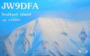
eu-026.jpgEU-026 Spitsbergen Island;Svalbard Island101 viewsSvalbard (known by its Dutch name Spitsbergen) is a Norwegian archipelago in the Arctic Ocean. Situated north of mainland Europe, it is about midway between continental Norway and the North Pole. The islands of the group range from 74° to 81° north latitude, and from 10° to 35° east longitude. The largest island is Spitsbergen, followed by Nordaustlandet and Edgeøya. It is the northernmost settlement in the world with a permanent civilian population.
|
|

na-006.jpgNA-006 Canada NWT/Nunavut (Victoria Island) group101 viewsVictoria Island is a large island in the Canadian Arctic Archipelago that straddles the boundary between Nunavut and the Northwest Territories of Canada. It is the eighth largest island in the world, and at 217,291 km² in area, it is Canada's second largest island.
|
|

na-027.jpgNA-027 Newfoundland Island (main island)101 viewsNewfoundland is a large Canadian island off the east coast of the North American mainland, and the most populous part of the Canadian province of Newfoundland and Labrador. It has 29 percent of the province's land area. The island is separated from the Labrador Peninsula by the Strait of Belle Isle and from Cape Breton Island by the Cabot Strait.
|
|

OC-004.jpgOC-004 Lord Howe Island101 viewsLord Howe Island is an irregularly crescent-shaped volcanic remnant in the Tasman Sea between Australia and New Zealand, 600 km (320 nmi) directly east of mainland Port Macquarie, 780 km (420 nmi) northeast of Sydney, and about 900 km (490 nmi) southwest of Norfolk Island. It is about 10 km (6.2 mi) long and between 0.3 and 2.0 km (0.19 and 1.24 mi) wide with an area of 14.55 km2 (3,600 acres).
|
|

OC-016.jpgOC-016 Fiji Viti Levu and Vanua Levu group101 viewsThe Vanua Levu Group is an archipelago in northern Fiji. It takes its name from its predominant island, Vanua Levu. Among the other islands in the group, the most important is Taveuni. Other islands in the group include Laucala, Matagi, Namena Lala, Qamea, Rabi, Vorovoro and Yadua Tabu. They have an aggregate area of 6,199 square kilometres (2,393 square miles).
|
|
| 1895 files on 48 page(s) |
 |
|
|
|
|
|
|
|
|
16 | |
|
|
|
|
|
|
|
|
 Contact
