 Most viewed Most viewed |

zs8mr~1.jpg46 views
|
|

zzdelr1mvaaaa.jpg46 views
|
|

OC-284R.jpgOC-284 Nukumanu Islands46 viewsNukumanu, formerly Tasman Islands, is an atoll of Papua New Guinea, located in the Southwestern Pacific Ocean, 4 degrees south of the equator. Administratively Nukumanu is part of Papua New Guinea, but it lies quite far away from the closest territory of Papua New Guinea proper, which is the coast of New Ireland island at 682 km to the west. The nearest land is Ontong Java Atoll, located only 38 km to the south of Nukumanu. The border between Papua New Guinea and the Solomon Islands runs between these neighboring atolls, which form a small geographic group together with the wholly submerged Roncador Reef at the southern end.
|
|

OC-286.jpgOC-286 Antipodes Islands46 viewsThe Antipodes Islands are inhospitable and uninhabited volcanic islands in subantarctic waters to the south of – and territorially part of – New Zealand. They lie 860 kilometres (534 mi) to the southeast of Stewart Island/Rakiura, and 730 kilometres (454 mi) to the northeast of Campbell Island. The islands are inscribed on the UNESCO World Heritage List, together with other subantarctic New Zealand islands. The island group is a nature reserve and there is no general public access.
|
|

OC-296.jpgOC-296 Tobi and Helen Islands46 viewsTobi Island, or Hatohobei (Tobian language), is the southernmost of Palau's sixteen states, consisting of Tobi Island and Helen Reef. The individual islands of Hatohobei, together with the islands of the state of Sonsorol, form the Southwest Islands of Palau. Pop in 2014 was just 40 persons. The island is covered with coconut palms. A cultivated area is situated near the center of the island. The island is fringed by a reef that extends up to 800 m from the shore in the north.
|
|
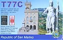
t77cp.jpgt77c - San Marino46 viewsvia EME moon bounce - EME dxpedition by s59a
|
|
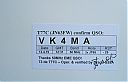
t77cr~2.jpgt77c - San Marino46 viewsvia EME moon bounce - EME dxpedition by s59a
|
|

EU-063S.jpgEU-063 Spitsbergen's Coastal Islands;Svalbard's Coastal Islands46 viewsPrins Karls Forland or Forlandet, occasionally anglicized as Prince Charles Foreland, is an island off the west coast of Oscar II Land on Spitsbergen in the Arctic archipelago of Svalbard, Norway. The entire island and the surrounding sea area constitutes Forlandet National Park.
|
|

as-063r.jpgAS-063 Laptev Sea Coast East group46 viewsPopigay-Ary Island is located in Northern Asiatic Russia in Khatanga Bay which is a large tidal estuary in the Laptev Sea. The bay is relatively narrow, its length being 220 km with a maximum width of 54 km and is iced covered for much of the year. This island is uninhabited
|
|
6o7or.jpg46 views
|
|
s92hpr.jpg46 views
|
|

v51bq.jpg46 views
|
|

v51br.jpg46 views
|
|
z6dl7ucxr.jpg46 views
|
|

IA-Dubuque.jpg46 views
|
|

hk0rmrr.jpgHK0RMR - SAN ANDRES ISLAND46 viewsworked via F2
|
|
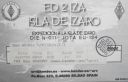
EU-134R.jpgEU-134 Spain Bilbao / San Sebastian (Basque Country) Province group45 viewsÃzaro is an island of Spain in the waters of the Cantabrian Sea, located on the coast of the province of Vizcaya , in front of the towns of Bermeo and Mundaca at a distance of 3 km from the first and 2.2 km from the second. However, the territory belongs to the town of Bermeo . The island occupies the center of the estuary of the Mundaca estuary, and is flanked by the capes of Ogoño and Machichaco . It is included in the natural area of Urdaibai .
|
|
EU-138.jpgEU-138 Sweden Blekinge County group45 viewsHanö is an island off Listerlandet peninsula, western Blekinge, Sweden.
Between 1810 and 1812 the Royal Navy of the United Kingdom used the island as its base during its operations in the Baltic Sea. The "English Seaman's Graveyard" is situated on the island, and still today British warships visit the island to pay tribute to the fifteen sailors who rest there.
|
|

EU-181R.jpgEU-181 Bulgaria group45 viewsSt. Peter Island is a Bulgarian island in the Black Sea, with an area of 0.025 square kilometres (0.010 square miles) and a height of 9 metres (30 feet) above sea level. Also known as Bird Island, it is located in the Bay of Sozopol, close to the St. Ivan and St. Cyricus Islands. As it was not mentioned in any sources until the mid-19th century, it is presumed to have separated from the larger St. Ivan Island (which is a few hundred meters to the west) as a consequence of some kind of natural phenomenon around that time
|
|

EU-183R.jpgEU-183 Romania Sacalinu Mare Island45 viewsSacalin Island is a newly formed island in the Black Sea, right off the coast of the Romanian Danube Delta, off the Sfântu Gheorghe branch. Initially Sacalin was made up of two smaller islands, Sacalinu Mare and Sacalinu Mic. In time, however, the two merged into one continuous landmass.
|
|
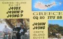
EU-187.jpgEU-187 Crete's Coastal Islands45 viewsChrissi is an uninhabited Greek island approximately 15 kilometres south of Crete close to Ierapetra in the South Cretan Sea. Approximately 700 metres east of the island is the island of Mikronisi. Administratively these islands fall within the Ierapetra municipality in Lasithi.
|
|
6Y5PAR.jpg45 views
|
|
7o2aa.jpg45 views
|
|
7P8DX.jpg45 views
|
|

8R1PYR.jpg45 views
|
|

9G5TT.jpg45 views
|
|
9M2CO.jpg45 views
|
|
9q0hqr.jpg45 views
|
|
9U4UR.jpg45 views
|
|
A35EA.jpg45 views
|
|

A45XJZ.jpg45 views
|
|
a52nhr.jpg45 views
|
|

bq9pr~0.jpg45 views
|
|

C56DK3FW.jpg45 views
|
|
C65AKP.jpg45 views
|
|

CE8EIOR~0.jpg45 views
|
|

CN2AQ.jpg45 views
|
|

ct1cjj~0.jpg45 views
|
|

CU3LF.jpg45 views
|
|

CY0XXR.jpg45 views
|
|
| 15303 files on 383 page(s) |
 |
|
|
|
|
|
|
|
|
92 | |
|
|
|
|
|
|
|
|
 Contact
