 Most viewed |

zzdelkh5kad0sr.jpg50 views
|
|

zzdelom7jw.jpg50 views
|
|

zzdelr1m4j1fsa.jpg50 views
|
|

9u5da.jpg50 views
|
|

el2wwaaaa.jpg50 views
|
|

OC-295R.jpgOC-295 Sebatik Island50 viewsSebatik Island (Indonesian/Malay: Pulau Sebatik) is an island off the eastern coast of Borneo, partly within Indonesia and partly within Malaysia. Sebatik Island lies between Tawau Bay (Teluk Tawau) to the north and Sibuku Bay (Teluk Sibuku) to the south. The town of Tawau lies in Sabah just to the north. The island is bisected at roughly 4° 10' north by the Indonesia–Malaysia border - the northern part belongs to Sabah, Malaysia (Sebatik Malaysia) while the southern part belongs to North Kalimantan.
|
|
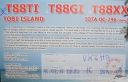
OC-296R.jpgOC-296 Tobi and Helen Islands50 viewsTobi Island, or Hatohobei (Tobian language), is the southernmost of Palau's sixteen states, consisting of Tobi Island and Helen Reef. The individual islands of Hatohobei, together with the islands of the state of Sonsorol, form the Southwest Islands of Palau. Pop in 2014 was just 40 persons. The island is covered with coconut palms. A cultivated area is situated near the center of the island. The island is fringed by a reef that extends up to 800 m from the shore in the north.
|
|

t77cr~2.jpgt77c - San Marino50 viewsvia EME moon bounce - EME dxpedition by s59a
|
|

EU-098.jpgEU-098 Germany (DELETED - MECKLEMBURG-VORPOMMERN STATE W GR)50 viewsPoel or Poel Island, is an island in the Baltic Sea. It forms the natural northern and eastern boundaries of the Bay of Wismar on the German coast. The northern coast of the island is also on the south side of the large gulf known as the Bay of Mecklenburg, which Wismar Bay enters into.
|
|
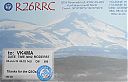
as-204r.jpgAS-204 Kuril'skiye (Kuril) Islands North50 viewsParamushir Island is located in Sea of Okhotsk, in the northern part of Kuril Islands group (northwest Pacific Ocean). The island covers a total area of approx 2053 km2 (793 ml2) and has A population around 3,000. Severo-Kurilsk is the only permanently populated settlement on the island. In November 1952, the original Severo-Kurilsk was destroyed by a tsunami, then rebuilt in another location. After USSR's dissolution (1990), island's population decreased and most villages along the coast are now ghost town
|
|

6o7or.jpg50 views
|
|

zp5dbc.jpg50 views
|
|

s92hpr.jpg50 views
|
|
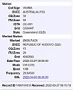
z6dl7ucxr.jpg50 views
|
|

zd9mr.jpg50 views
|
|

MN-Hubbard1.jpg50 views
|
|

EU-180r.jpgEU-180 Ukraine Black Sea Coast group49 viewsTuzla Island, is a sandy islet in the form of a spit located in the middle of the Strait of Kerch between the Kerch Peninsula in the west and the Taman Peninsula in the east. The Strait of Kerch connects the Sea of Azov and the Black Sea. Administratively, Tuzla is part of Kerch in eastern Crimea.
|
|

EU-184R.jpgEU-184 Finland Oulu Province group49 viewsHailuoto is located on an island of the same name opposite the city of Oulu in the Gulf of Bothnia. A ferry operates regularly between Hailuoto and Oulunsalo. In winter an official ice road connects the island to the mainland.
|
|
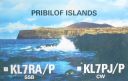
na-028.jpgNA-028 Alaska Pribilof Islands49 viewsThe Pribilof Islands are a group of four volcanic islands off the coast of mainland Alaska, in the Bering Sea, about two hundred miles north of Unalaska and 200 miles southwest of Cape Newenham. The Siberian coast is roughly 500 miles northwest
|
|

E5NZK1XXPR.jpg49 views
|
|

er4kaa.jpg49 views
|
|

HL4GHT.jpg49 views
|
|

YO4AUL.jpg49 views
|
|
6W1CK.jpg49 views
|
|

7Q7XX.jpg49 views
|
|

9M2COR.jpg49 views
|
|

9q0hqr.jpg49 views
|
|

A25NW.jpg49 views
|
|

A35EA.jpg49 views
|
|

A61AC.jpg49 views
|
|

AP2N.jpg49 views
|
|

bq9pr~0.jpg49 views
|
|

ce9ft5ye.jpg49 views
|
|

ct1cjj~0.jpg49 views
|
|

CX4CC.jpg49 views
|
|

D44BS.jpg49 views
|
|

e6zk2el.jpg49 views
|
|

e6zk2elr.jpg49 views
|
|

E77ER~0.jpg49 views
|
|

EA9IE.jpg49 views
|
|
| 15630 files on 391 page(s) |
 |
|
|
|
|
|
|
|
|
90 | |
|
|
|
|
|
|
|
|
 Contact

