 Most viewed Most viewed |

sa-044r.jpgSA-044 Venezuala La Tortuga60 viewsLa Tortuga Island is an uninhabited island of Venezuela, the largest in the Federal Dependencies of Venezuela. It is part of a group of islands that include the Tortuguillos and Cayo Herradura. Isla La Tortuga has an area of 156 km²
|
|

sa-047r.jpgSA-047 Brazil Parana State group60 viewsThe Ilha do Mel State Park (Portuguese: Parque Estadual da Ilha do Mel) is a state park in the state of Paraná, Brazil, located in the municipality of Paranaguá. It is a very small island, with a lot of fauna and flora, due to its small index of urbanization. It has 25 kilometers of beautiful beaches, and the population of the Island is distributed among some small villages: Encantadas, Nova Brasilia, Farol, Praia Grande and Fortaleza.
|
|

sa-064.jpgSA-064 Chile Aisen Region Centre group60 viewsLas Huichas islands, are adjacent to the Moraleda channel, between the mouth of the Aysén fjord (to the south) and the Puyuhuapi channel (to the north) in southern Chile
|
|

7q7eir.jpg60 views
|
|
8q7aar.jpg60 views
|
|

9k2mu.jpg60 views
|
|
9x4wwr.jpg60 views
|
|
a61aj.jpg60 views
|
|

ea9pyr.jpg60 views
|
|
gu3whnr.jpg60 views
|
|
OD5NJ.jpg60 views
|
|

oe5nnn.jpg60 views
|
|
zf2ww.jpg60 views
|
|

zl8rs.jpg60 views
|
|
zl9cir.jpg60 views
|
|

es1hr.jpg60 views
|
|

du7-pa0hip.jpgdu7/pa0hip - Philippines60 viewsVia summer Es
|
|
oz1djjr.jpgoz1djj - Denmark60 viewsVia Winter Es - the best opening I have seen to Europe / Central Asia via Winter Es on 6m. Band open to ER, UK8, JT1, UT, ER, SM, F, OZ, DL on this day.
|
|

zl8xr~0.jpgzl8x - Kermadec Island60 viewsvia summer Es
|
|

ZON6R.jpg60 views
|
|

ZON8.jpg60 views
|
|

zone13.jpg60 views
|
|

6y5wc.jpg60 views
|
|

an-006r~0.jpg60 views
|
|

AN-009~0.jpg60 views
|
|
AN-010R~0.jpg60 views
|
|

AN-015~0.jpg60 views
|
|

AN-015R~0.jpg60 views
|
|

1s19m6tpr.jpg60 views
|
|

1s19m6tprr.jpg60 views
|
|

3w3zz.jpg60 views
|
|

3w7tk.jpg60 views
|
|

3w7tkr.jpg60 views
|
|

4a7rm.jpg60 views
|
|

4kud6dll~0.jpg60 views
|
|

ya1rsr~0.jpg60 views
|
|
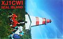
NA-126B.jpgNA-126 Nova Scotia Province South group60 viewsSeal Island (also known as Great Seal Island) is an island on the outermost extreme of Southwestern Nova Scotia, Canada, in the Municipality of the District of Argyle in Yarmouth County.[1] It is approximately 4.3 kilometres (2.7 mi) long and 0.8 kilometres (0.50 mi) wide and is surrounded on its east, south and west sides by dangerous shoals.[2] It is surrounded by the Atlantic Ocean and is the biggest of a group of five islands which extend north for 12 kilometres (7.5 mi).
|
|

AL-Franklin.jpg60 views
|
|

NJ-Morris.jpg60 views
|
|

NM-Eddy.jpg60 views
|
|
| 15297 files on 383 page(s) |
 |
|
|
|
|
|
|
|
|
52 | |
|
|
|
|
|
|
|
|
 Contact
