 Most viewed |

9y50np.jpg69 views
|
|

4k1ah.jpg69 views
|
|

NA-060.jpgNA-060 Honduras Valle / Choluteca Department group69 viewsConejo Island, in Spanish Isla Conejo, meaning "rabbit island", is a disputed island between El Salvador and Honduras located in the Gulf of Fonseca
|
|

NA-060R.jpgNA-060 Honduras Valle / Choluteca Department group69 viewsConejo Island, in Spanish Isla Conejo, meaning "rabbit island", is a disputed island between El Salvador and Honduras located in the Gulf of Fonseca
|
|

NA-078.jpgNA-078 Mexico Baja California Sur State South West group69 viewsIsla Magdalena is located on the western coast of the Baja California Peninsula, separated from Puerto San Carlos by the waters of Magdalena Bay. The approximately 90-kilometer long island hosts mangrove forests, coastal dunes and an extensive list of flora and fauna.
|
|

NA-193R.jpgNA-193 Canada Yukon Territory group69 viewsHerschel Island (French: ÃŽle d'Herschel; Inuit: Qikiqtaruk)[2] is an island in the Beaufort Sea (part of the Arctic Ocean), which lies 5 km (3.1 mi) off the coast of Yukon in Canada, of which it is administratively a part. It is Yukon's only offshore island.
|
|

zzzdxcc_logo~3.jpgdxcc69 views
|
|

PA-Lehigh.jpg69 views
|
|
AL-Elmore.jpg69 views
|
|

IA-Mahaska.jpg69 views
|
|

IA-Cedar.jpg69 views
|
|

MD-Alegany.jpg69 views
|
|
PA-Juniata.jpg69 views
|
|

IA-Clinton.jpg69 views
|
|

3c3ca.jpg69 views
|
|

CO-Costilla.jpg69 views
|
|

na-225.jpgNA-225 Canada Nunavut (Prince of Wales and Somerset Islands) group68 viewsIn the Canadian Arctic Archipelago, Somerset Island (Inuktitut Kuganajuup Qikiqtanga) is a large, uninhabited island separated by the 2 km (1.2 mi) wide Bellot Strait from the Boothia Peninsula in the Qikiqtaaluk Region of Nunavut, Canada, lying between Peel Sound (across which lies Prince of Wales Island) and Prince Regent Inlet (across which lies Baffin Island). It has an area of 24,786 km2 (9,570 sq mi), making it the 46th largest island in the world and Canada's twelfth largest island.
|
|

na-228.jpgNA-228 Nicaragua Caribbean Sea Coast North group68 viewsThe Miskito Cays (Spanish: Cayos Miskitos) are an archipelago with an area of 27 km² located off shore in the northeastern Caribbean coast of Nicaragua, part of the North Caribbean Coast Autonomous Region. The Miskito Cays are composed of 76 formations that include estuaries, coral reefs, cays, seagrass beds, and islets, of which 12 of the formations are covered with vegetation and consequently form islands which are lined with white sand beaches.
|
|
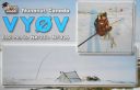
na-231.jpgNA-231 Canada Nunavut (Hudson Bay - Ontario Coast) North group68 viewsEast Pen Island, sometimes referred to shortly as Pen Island, is one of several uninhabited Canadian arctic islands in Nunavut, Canada located within southwestern Hudson Bay. It is part of the Pen Islands, though West Pen Island is more properly termed a spit, rather than an island. East Pen Island is situated off the shore of Ontario, a few kilometers southeast of Manitoba. The closest community is Fort Severn, Ontario.
|
|

na-236r.jpgNA-236 Alaska Sanak Islands68 viewsThe Sanak Islands are a subgroup of the Fox Islands group of islands, located in the Aleutians East Borough of Alaska. Located in the Gulf of Alaska, they are in the Aleutian Islands archipelago. The Sanak Islands have a total land area of 157.617 km² (60.856 sq mi) and are unpopulated.
|
|

sa-027.jpgSA-027 Brazil Santa Catarina State North group68 viewsSao Francisco island is home to São Francisco do Sul a municipality in the Brazilian state of Santa Catarina. It covers an area of 540 km² (208 miles)
|
|

sa-027r.jpgSA-027 Brazil Santa Catarina State North group68 viewsSao Francisco island is home to São Francisco do Sul a municipality in the Brazilian state of Santa Catarina. It covers an area of 540 km² (208 miles)
|
|

sa-028.jpgSA-028 Brazil Sao Paulo State East group68 viewsIlha da Couves
|
|

sa-028r.jpgSA-028 Brazil Sao Paulo State East group68 viewsIlha da Couves
|
|

sa-029.jpgSA-029 Brazil Rio de Janeiro State West group68 viewsIlha Grande is an island in the Brazilian state of Rio de Janeiro ringed by beaches, covered by Atlantic forest and crossed by winding trails. On its southeastern shore, the long, palm-lined stretch of Lopes Mendes Beach is known for its strong surf. Lagoa Azul, in the island’s north, has sheltered, fish-filled waters. On the northeast coast, the village of Abraão has the 19th-century São Sebastião Church.
|
|

sa-048.jpgSA-048 Venezuala Sucre State East group68 viewsPatos Island is a small uninhabited island in the northwestern Gulf of Paria. The island is a part of the Dependencias Federales of Venezuela.
|
|

sa-049r.jpgSA-049 Argentina Tierra del Fuego's Coastal Islands68 viewsIsla de los Estados is an Argentine island that lies 29 kilometres off the eastern extremity of the Argentine portion of Tierra del Fuego, from which it is separated by the Le Maire Strait.
|
|

sa-050.jpgSA-050 Chile Antartica Chilena Province group68 viewsNavarino Island is a Chilean island located between Isla Grande de Tierra del Fuego, to the north, and Cape Horn, to the south.
|
|

sa-054r.jpgSA-054 Venezuala Orchila Island68 viewsLa Orchila is an island and a military base off the coast of Venezuela, north of Caracas. It has numerous beaches, including one where the sand is markedly pink.
|
|

sa-057r.jpgSA-057 Uruguay Colonia Department group68 viewsIsla San Gabriel is a island located off the coast of the city of Colonia in Uruguay
|
|

sa-059r.jpgSA-059 Venezuala Los Testigos group68 viewsLos Testigos Islands (Spanish: Islas Los Testigos, Witnesses Islands) are a group of islands in the southeastern Caribbean Sea. They are a part of Venezuela and are located about 400 km (250 mi) northeast of Caracas and about 80 km (50 mi) northeast of Isla Margarita.
|
|

sa-060.jpgSA-060 Brazil Para State East group68 viewsIsland Cotijuba is in the bay of Marajo near the city of Belem. It has fifteen miles of coastline and its beaches are little explored.
|
|

sa-061.jpgSA-061 Chile La Araucania Reg / Los Lagos Reg North group68 viewsMocha is a small Chilean island located west of the coast of Arauco Province in the Pacific Ocean. The island is approximately 48 km² in area, with a small chain of mountains running roughly in north-south direction.
|
|

sa-061r.jpgSA-061 Chile La Araucania Reg / Los Lagos Reg North group68 viewsMocha is a small Chilean island located west of the coast of Arauco Province in the Pacific Ocean. The island is approximately 48 km² in area, with a small chain of mountains running roughly in north-south direction.
|
|

sa-067r.jpgSA-067 Brazil Espirito Santo State group68 viewsArchipelago of Sant'Anna located near the city of Macaé, north coast of Rio de Janeiro state.
|
|

sa-069r.jpgSA-069 Chile Antofagasta Region group68 viewsIsla Santa Maria, is a deserted island 5 km offshore the northern city of Antofagasta
|
|

sa-070.jpgSA-070 Chile Bio-Bio Region group68 viewsSanta MarÃa is a Chilean island, sparsely inhabited, that is located off the coast of Coronel. The island is the place where the Herman Melville novel Benito Cereno takes place.
|
|

sa-074.jpgSA-074 Peru Ancash Department group68 viewsIsla Los Chimús , [ 1 ] also known as Isla La Viuda , [ 2 ] is an uninhabited island belonging to Peru located in the Pacific Ocean , off the coast of the department of Ancash . It is located about 4 km north of Tortuga Island and about 2 km south of Tayta Justo Point . The island has an approximate area of ​​74.10 hectares and has a length of about 1290 m.
|
|
7q7ei.jpg68 views
|
|
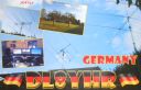
dl8yhr.jpgdl8yhr - Germany68 viewsVia Winter Es - the best opening I have seen to Europe via Winter Es on 6m. Band open to JT, UK8, UT, ER, SM, F, OZ on this day. DL8YHR in here for well over an hour.
|
|
| 15621 files on 391 page(s) |
 |
|
|
|
|
|
|
|
|
46 | |
|
|
|
|
|
|
|
|
 Contact

