 Most viewed |

8p6ja.jpg70 views
|
|

8p6kxu.jpg70 views
|
|

8r1rpn~3.jpg70 views
|
|

9y4lk.jpg70 views
|
|

9y4vu.jpg70 views
|
|

9y4vub.jpg70 views
|
|

9y4w.jpg70 views
|
|

4k1hk.jpg70 views
|
|

4k1ua3xbp.jpg70 views
|
|

sp3doir.jpgsp3doi - Poland70 viewsvia Winter Es over Japan - latest (in the year) opening I have seen on this path
|
|
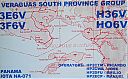
NA-071.jpgNA-071 Panama Chiriqui / Veraguas South Province group70 viewsCébaco island is located off the Pacific Coast of the Republic of Panama, in Montijo District, Veraguas Province. The island is located in the Gulf of Montijo and has a small town of approximately 30 homes on the northern coast of the island. Most locals live off commercial fishing
|
|

NA-054_28229.jpgNA-054 Bahamas Berry Islands70 viewsThe Berry Islands are a chain of islands and a district of the Bahamas, covering about thirty square miles of the northwestern part of the Out Islands. The Berry Islands consist of about thirty islands and over one hundred small islands or cays, often referred to as "The Fish Bowl of the Bahamas.
|
|

NA-063_28129.jpgNA-063 Sable Island70 viewsSable Island (French: île de Sable), literally "island of sand", is a small Canadian island situated 300 km (190 mi) southeast of Halifax, Nova Scotia, and about 175 km (109 mi) southeast of the closest point of mainland Nova Scotia in the Atlantic Ocean. The island is staffed year round by four federal government staff.
|
|

NA-063_28229.jpgNA-063 Sable Island70 viewsSable Island (French: île de Sable), literally "island of sand", is a small Canadian island situated 300 km (190 mi) southeast of Halifax, Nova Scotia, and about 175 km (109 mi) southeast of the closest point of mainland Nova Scotia in the Atlantic Ocean. The island is staffed year round by four federal government staff.
|
|

NA-126R.jpgNA-126 Nova Scotia Province South group70 viewsSeal Island (also known as Great Seal Island) is an island on the outermost extreme of Southwestern Nova Scotia, Canada, in the Municipality of the District of Argyle in Yarmouth County.[1] It is approximately 4.3 kilometres (2.7 mi) long and 0.8 kilometres (0.50 mi) wide and is surrounded on its east, south and west sides by dangerous shoals.[2] It is surrounded by the Atlantic Ocean and is the biggest of a group of five islands which extend north for 12 kilometres (7.5 mi).
|
|

CA-Inyo~0.jpg70 views
|
|

CA-Plumas.jpg70 views
|
|

PA-Columbia.jpg70 views
|
|

IA-Black_Hawk.jpg70 views
|
|

NJ-Warren~0.jpg70 views
|
|

AL-Izard.jpg70 views
|
|

KS-Mitchell1.jpg70 views
|
|

NC-Burke.jpg70 views
|
|

na-222.jpgNA-222 Southern Alaska Peninsula West group69 viewsThe Pavlof Islands (Qudugin in Aleut) are a group of seven islands that lie south of Pavlof Bay on the Alaska Peninsula. They are part of the Aleutians East Borough in the U.S. state of Alaska.
|
|

na-223.jpgNA-223 Honduras Gracias a Dios Department group69 viewsThe Vivorillos are one of a number of Cays lying at the eastern end of North Honduras. They are sometimes used for Navy training exercises
|
|
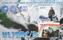
na-240.jpgNA-240 Alaska Bethel Census Area group69 viewsPingurbek Island is located near the native village of Kipnuk in south central Alaska
|
|

na-240r.jpgNA-240 Alaska Bethel Census Area group69 viewsPingurbek Island is located near the native village of Kipnuk in south central Alaska
|
|

sa-039.jpgSA-039 Uruguay Maldonado / Rocha Department group69 viewsThe Isla de Lobos is a small island located about 8 kilometres southeast of Punta del Este.
|
|

sa-041.jpgSA-041 Brazil Maranhao State West group69 viewsIlha Maiau, an island about 25 km off the coast and about 210 km northwest of São LuÃs, Brazil
|
|

sa-043.jpgSA-043 Chile Aisen Region North group69 viewsGuaitecas Archipelago is an archipelago in the Aisén region. The archipelago is made up of eight main islands and numerous smaller ones. The eight largest islands are from northwest to southeast: Gran Guaiteca, Ascención, Betecoy, Clotilde, Leucayec, Elvira, Sánchez and Mulchey. The main settlement in the sparsely inhabited archipelago is Melinka, a port town.
|
|

sa-050r.jpgSA-050 Chile Antartica Chilena Province group69 viewsNavarino Island is a Chilean island located between Isla Grande de Tierra del Fuego, to the north, and Cape Horn, to the south.
|
|

sa-065.jpgSA-065 Argentina Chubut Province South group69 viewsLeones Island is a rocky maritime island off the Argentine Patagonia that is 1 km off the coast of the Department Florentino Ameghino in the Southeast of the Province of Chubut .
|
|

sa-065r.jpgSA-065 Argentina Chubut Province South group69 viewsLeones Island is a rocky maritime island off the Argentine Patagonia that is 1 km off the coast of the Department Florentino Ameghino in the Southeast of the Province of Chubut .
|
|

sa-073.jpgSA-073 Peru Ica Department group69 viewsSan Gallán Island, also known as Sangayán Island, is a Peruvian island located in the Pacific Ocean, 5,2 km west off Paracas Peninsula, separated from it by El Boquerón strait. The island lies within Paracas District, Pisco Province, region of Ica; and is also part of Paracas National Reserve.
|
|
sa-078r.jpgSA-078 Colombia Cordoba / Sucre Department group69 viewsPalma Island is a coral island located in the Archipelago of San Bernardo, Gulf of Morrosquillo, Caribbean Sea. It is governed by Colombia, and is a part of the Colombian BolÃvar Department.
|
|

9k2ah.jpg69 views
|
|

Abzone8.jpg69 views
|
|

dzone11.jpg69 views
|
|

Afzone7.jpg69 views
|
|

Afzone8.jpg69 views
|
|
| 15609 files on 391 page(s) |
 |
|
|
|
|
|
|
|
|
44 | |
|
|
|
|
|
|
|
|
 Contact

