 Most viewed |

3d2f3d2tl~0.jpg71 views
|
|

3d2f3d2vd~0.jpg71 views
|
|

3d2f3d2wd.jpg71 views
|
|

6y5hd.jpg71 views
|
|

6y5hdr.jpg71 views
|
|

8p5ar.jpg71 views
|
|

8r1ks.jpg71 views
|
|

8r30k.jpg71 views
|
|

9y4el2clr.jpg71 views
|
|

9y4ll.jpg71 views
|
|

4k1aat.jpg71 views
|
|

AN-011~0.jpg71 views
|
|

NA-078R.jpgNA-078 Mexico Baja California Sur State South West group71 viewsIsla Magdalena is located on the western coast of the Baja California Peninsula, separated from Puerto San Carlos by the waters of Magdalena Bay. The approximately 90-kilometer long island hosts mangrove forests, coastal dunes and an extensive list of flora and fauna.
|
|

NJ-Atlantic.jpg71 views
|
|

AL-Cherokee.jpg71 views
|
|

CA-Del_Norte~0.jpg71 views
|
|

FL-Clay~0.jpg71 views
|
|

KS-Jefferson~0.jpg71 views
|
|

na-223r.jpgNA-223 Honduras Gracias a Dios Department group70 viewsThe Vivorillos are one of a number of Cays lying at the eastern end of North Honduras. They are sometimes used for Navy training exercises
|
|

na-234.jpgNA-234 Alaska Islands of Four Mountains70 viewsIslands of Four MountainsCoordinates: 52°52′33″N 169°47′42″W is an island grouping of the Aleutian Islands in Alaska, United States. The chain includes, from west to east, Amukta, Chagulak, Yunaska, Herbert, Carlisle, Chuginadak, Uliaga, and Kagamil islands. This island chain is located between Amukta Pass and the Andreanof Islands to the west, and Samalga Pass and the Fox Islands to the east. These islands have a total land area of 210.656 sq mi (545.596 km²) and have no permanent population.[1] The two largest islands are Yunaska and Chuginadak. Chuginadak is mainly made up of the active volcano Mount Cleveland.
|
|

na-239r.jpgNA-239 Alaska Northern Alaska Peninsula East group70 viewsThe Seal Islands are a group of 12/+ islands in the Bering Sea, trending northeast 7 miles (11 km), close to the shores of Bristol Bay, Alaska, 33 miles (53 km) southwest of Port Heiden, Alaska Airfield; Bristol Bay Low
|
|

na-246r.jpgNA-246 Mexico Tamaulipas State group70 viewsLarga Island is located in the Laguna Madre region of Tamaulipas State. Mexico. It is a low island made of sand and sea shells
|
|

na-248.jpgNA-248 Canada NWT / Nunavut (Melville Island) group70 viewsMelville Island is an uninhabited island of the Canadian Arctic Archipelago with an area of 42,149 km2 (16,274 sq mi). It is the 33rd largest island in the world and Canada's eighth largest island. Melville Island is shared by the Northwest Territories, which is responsible for the western half of the island, and Nunavut, which is responsible for the eastern half. The border runs along the 110th meridian west. The mountains on Melville Island, some of the largest in the western Canadian Arctic, reach heights of 1,000 m (3,300 ft). There are two subnational pene-exclaves that lie west of the 110th meridian and form part of the Northwest Territories. These can only be reached by land from Nunavut or boat from the Northwest Territories.
|
|
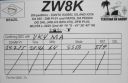
sa-025r.jpgSA-025 Brazil Piaui State group70 viewsThe Big Island of Santa Isabel, is one of the neighborhoods that is located in the city of ParnaÃba-PI, Brazil
|
|

sa-030r.jpgSA-030 Uruguay San Jose / Montevideo / Canelones Dept group70 viewsIsla de Flores is a small island in the Rio de la Plata, 21 miles (34 km) south-east of Punta Carretas, Montevideo, Uruguay.
|
|

sa-055r.jpgSA-055 Argentina Buenos Aires (Delta del Parana) Prov group70 viewsMartÃn GarcÃa Island is an island in the RÃo de la Plata. The island is in Uruguayan waters but in 1973 Uruguay and Argentina reached an agreement establishing MartÃn GarcÃa as Argentine territory and a nature reserve
|
|

sa-058r.jpgSA-058 Venezuala Carabobo / Aragua / DF /Miranda State group70 viewsIsla del Rey is one of the four Venezuelan islands located off the coast of Puerto Cabello. It is surrounded by reefs and corals, administratively part of the central Venezuelan state of Carabobo and the Municipality of Puerto Cabello from the same state.
|
|

sa-062.jpgSA-062 Brazil Bahia State South group70 viewsCoroa Vermelha Island, a coral reef 13 kilometers offshore the south coast of Bahia, Brazil. The island is uninhabited.
|
|

sa-062r.jpgSA-062 Brazil Bahia State South group70 viewsCoroa Vermelha Island, a coral reef 13 kilometers offshore the south coast of Bahia, Brazil. The island is uninhabited.
|
|

sa-068.jpgSA-068 Guyana group70 viewsWakenaam is an island of about 17.5 square miles at the mouth of the Essequibo River of Guyana. One of the largest islands in the Essequibo Islands group,
|
|

sa-071.jpgSA-071 Brazil Sao Paulo State Centre group70 viewsGatos†is a small island located a couple of miles off the coast of Sao Paulo, the island is uninhabited
|
|

sa-072r.jpgSA-072 Brazil Maranhao State East group70 viewsCanarias Island is in the Brazilian state of Maranhão in the far north of Brazil. It lies near the ParnaÃba River's delta.
|
|

sa-073r.jpgSA-073 Peru Ica Department group70 viewsSan Gallán Island, also known as Sangayán Island, is a Peruvian island located in the Pacific Ocean, 5,2 km west off Paracas Peninsula, separated from it by El Boquerón strait. The island lies within Paracas District, Pisco Province, region of Ica; and is also part of Paracas National Reserve.
|
|

sa-080.jpgSA-080 Brazil Bahia State Centre group70 viewsIlha de Tinhar is an island located in the municipality of Cairu, on the coast of the Brazil. The town of Tinharé is accessible via catamaran or boat from the river that passes through the municipality of Valença.
|
|

sa-092r.jpgSA-092 Suriname group70 viewsPapegaaien Eiland is an island of Suriname located in the district of Distrikt Nickerie , in the north-west of the country, 210 km west of Paramaribo.
|
|

sa-093r.jpgSA-093 Colombia Choco Department North / Antioquia Department group70 viewsIslas Titumate are islands in Colombia . They are located in the department of Chocó , in the northwestern part of the country, 500 km northwest of the capital Bogotá .
|
|

i6wjb.jpgi6wjb - Italy70 viewsvia Winter Es -
|
|

jt1cor.jpgjt1co - Mongolia 70 viewsVia Winter Es - the best opening I have seen to Europe / Central Asia via Winter Es on 6m. Band open to ER, UK8, UT, ER, SM, F, OZ, DL on this day.
|
|

sv1dhr.jpgsv1dh - Greecce70 viewsMy 2nd EU qso via Winter Es which proved my qso a few weeks earlier with yo9hp was not a one off
|
|
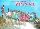
zp5sna.jpgzp5sna - Paraguay70 viewsvia summer Es polar path to South America
|
|
| 15605 files on 391 page(s) |
 |
|
|
|
|
|
|
|
|
42 | |
|
|
|
|
|
|
|
|
 Contact

