 Most viewed |

zon9r.jpg74 views
|
|

zone24.jpg74 views
|
|

zon1r~0.jpg74 views
|
|

zon6~0.jpg74 views
|
|
zon8~0.jpg74 views
|
|

zon9~0.jpg74 views
|
|

3b9dk9xpr.jpg74 views
|
|

3b9wr~0.jpg74 views
|
|

3b9wrr~0.jpg74 views
|
|

3c0agsr~0.jpg74 views
|
|

3d2ci_28229.jpg74 views
|
|

3d2cr.jpg74 views
|
|

3d2er.jpg74 views
|
|

3d2f3d2aa.jpg74 views
|
|
3d2f3d2tkr~0.jpg74 views
|
|

6y5da1.jpg74 views
|
|

8j1rl.jpg74 views
|
|

ZS6NK.jpgzs6nk - South Africa74 viewsvia EME Moon Bounce - my first ever eme qso was with zs4tx but this qso with zs6nk was my easiest - three strong decodes in a row at each end
|
|

CA-San_Benito.jpg74 views
|
|

PA-Adams~0.jpg74 views
|
|

VA-Lancaster1.jpg74 views
|
|

na-227r.jpgNA-227 Canada Nunavut (Kitikmeot Region) West group73 viewsChantry Island is approx 70 miles from Kugluktuk a hamlet located at the mouth of the Coppermine River in the Kitikmeot Region of Nunavut, Canada, on Coronation Gulf, southwest of Victoria Island. It is the westernmost community in Nunavut, near the border with the Northwest Territories.
|
|

na-228r.jpgNA-228 Nicaragua Caribbean Sea Coast North group73 viewsThe Miskito Cays (Spanish: Cayos Miskitos) are an archipelago with an area of 27 km² located off shore in the northeastern Caribbean coast of Nicaragua, part of the North Caribbean Coast Autonomous Region. The Miskito Cays are composed of 76 formations that include estuaries, coral reefs, cays, seagrass beds, and islets, of which 12 of the formations are covered with vegetation and consequently form islands which are lined with white sand beaches.
|
|

na-236.jpgNA-236 Alaska Sanak Islands73 viewsThe Sanak Islands are a subgroup of the Fox Islands group of islands, located in the Aleutians East Borough of Alaska. Located in the Gulf of Alaska, they are in the Aleutian Islands archipelago. The Sanak Islands have a total land area of 157.617 km² (60.856 sq mi) and are unpopulated.
|
|

na-248r.jpgNA-248 Canada NWT / Nunavut (Melville Island) group73 viewsMelville Island is an uninhabited island of the Canadian Arctic Archipelago with an area of 42,149 km2 (16,274 sq mi). It is the 33rd largest island in the world and Canada's eighth largest island. Melville Island is shared by the Northwest Territories, which is responsible for the western half of the island, and Nunavut, which is responsible for the eastern half. The border runs along the 110th meridian west. The mountains on Melville Island, some of the largest in the western Canadian Arctic, reach heights of 1,000 m (3,300 ft). There are two subnational pene-exclaves that lie west of the 110th meridian and form part of the Northwest Territories. These can only be reached by land from Nunavut or boat from the Northwest Territories.
|
|

sa-032.jpgSA-032 Chile Ultima Esperanza Province North group73 viewsWellington Island is an island west of Southern Patagonian Ice Field, Chile. It has an area of 5,556 km² and most of the island forms part of Bernardo O'Higgins National Park. It is home to the last Kawésqar people, living in the village of Puerto Edén, the only inhabited place on the island.
|
|

sa-055.jpgSA-055 Argentina Buenos Aires (Delta del Parana) Prov group73 viewsMartÃn GarcÃa Island is an island in the RÃo de la Plata. The island is in Uruguayan waters but in 1973 Uruguay and Argentina reached an agreement establishing MartÃn GarcÃa as Argentine territory and a nature reserve
|
|

sa-072.jpgSA-072 Brazil Maranhao State East group73 viewsCanarias Island is in the Brazilian state of Maranhão in the far north of Brazil. It lies near the ParnaÃba River's delta.
|
|
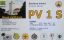
sa-077r.jpgSA-077 Brazil Rio de Janeiro State East group73 viewsSantana Island is located on the Ponta da Imbetiba about 3 km south of the center of Macaé, a seaport roughly 70 km northeast of Cabo Frio
|
|

sa-079.jpgSA-079 Brazil Rio de Janeiro State Centre group73 viewsIlha Rasa an island located 11 kilometres (6.8 mi) from Guanabara Bay, Rio de Janeiro, Brazil.
|
|

sa-081.jpgSA-081 Colombia Narino Department group73 viewsEl Morro is a rocky island that in colonial times was used as an outpost to protect the city of Santa Marta from the attacks of the pirates who were on the lookout for the Spanish treasures. Later, it was the prison of Creole insurgents and now serves as a seat for the lighthouse that guides ships entering and leaving the bay.
|
|

6y2ar.jpg73 views
|
|

jt1cor.jpgjt1co - Mongolia 73 viewsVia Winter Es - the best opening I have seen to Europe / Central Asia via Winter Es on 6m. Band open to ER, UK8, UT, ER, SM, F, OZ, DL on this day.
|
|
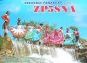
zp5sna.jpgzp5sna - Paraguay73 viewsvia summer Es polar path to South America
|
|

Abzone7.jpg73 views
|
|

czone12_28229.jpg73 views
|
|

czone13.jpg73 views
|
|

czone16.jpg73 views
|
|

Adzone5.jpg73 views
|
|

Adzone5r.jpg73 views
|
|
| 15615 files on 391 page(s) |
 |
|
|
|
|
|
|
|
|
38 | |
|
|
|
|
|
|
|
|
 Contact

