 Most viewed Most viewed |
3d2f3d2tkr~0.jpg72 views
|
|

4u1wb.jpg72 views
|
|

na-134.jpgNA-134 Greenland's Coastal Islands North West72 viewsUummannaq Island (Greenlandic: Uummannap qeqertaa) is a small (12 km2)[1] island in the Qaasuitsup municipality in northwestern Greenland. Located in the south-central part of the Uummannaq Fjord, it is home to the most prominent mountain on the Arctic coast of western Greenland and to Uummannaq, the largest town north of Ilulissat.
|
|

KS-Miami1.jpg72 views
|
|

AL-Blount.jpg72 views
|
|

na-227r.jpgNA-227 Canada Nunavut (Kitikmeot Region) West group71 viewsChantry Island is approx 70 miles from Kugluktuk a hamlet located at the mouth of the Coppermine River in the Kitikmeot Region of Nunavut, Canada, on Coronation Gulf, southwest of Victoria Island. It is the westernmost community in Nunavut, near the border with the Northwest Territories.
|
|

na-231r.jpgNA-231 Canada Nunavut (Hudson Bay - Ontario Coast) North group71 viewsEast Pen Island, sometimes referred to shortly as Pen Island, is one of several uninhabited Canadian arctic islands in Nunavut, Canada located within southwestern Hudson Bay. It is part of the Pen Islands, though West Pen Island is more properly termed a spit, rather than an island. East Pen Island is situated off the shore of Ontario, a few kilometers southeast of Manitoba. The closest community is Fort Severn, Ontario.
|
|

na-241.jpgNA-241 Alaska Kusilvak Census Area group71 viewsNeragon Island is located in the Bering Sea nearby the settlement of Scammon Bay, Alaska
|
|

na-248r.jpgNA-248 Canada NWT / Nunavut (Melville Island) group71 viewsMelville Island is an uninhabited island of the Canadian Arctic Archipelago with an area of 42,149 km2 (16,274 sq mi). It is the 33rd largest island in the world and Canada's eighth largest island. Melville Island is shared by the Northwest Territories, which is responsible for the western half of the island, and Nunavut, which is responsible for the eastern half. The border runs along the 110th meridian west. The mountains on Melville Island, some of the largest in the western Canadian Arctic, reach heights of 1,000 m (3,300 ft). There are two subnational pene-exclaves that lie west of the 110th meridian and form part of the Northwest Territories. These can only be reached by land from Nunavut or boat from the Northwest Territories.
|
|
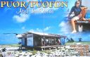
sa-038.jpgSA-038 Brazil Atol Das Rocas71 viewsThe Rocas Atoll is the only atoll in the South Atlantic Ocean. It belongs to the Brazilian State of Rio Grande do Norte. It is located approximately 260 km northeast of Natal and 145 km west of the Fernando de Noronha archipelago. The atoll is of volcanic origin and coralline formation.
|
|
sa-084r.jpgSA-084 Colombia Choco Department South group71 viewsIsla Cacagual, Chocó is an island south of Punta Charambirá and northwest of Isla Estebánico on the Pacific Coast of central Colombia
|
|

sa-092.jpgSA-092 Suriname group71 viewsPapegaaien Eiland is an island of Suriname located in the district of Distrikt Nickerie , in the north-west of the country, 210 km west of Paramaribo.
|
|

sa-094r.jpgSA-094 Chile Ultima Esperanza Province South group71 viewsThe Rennell Islands (Spanish: Islas Rennell) are two islands in the Queen Adelaide Archipelago in Magallanes y la Antártica Chilena Region, Chile. The larger island, South Rennell Island, has an area of 340 km². The smaller island, North Rennell Island, has an area of 303 km².
|
|

sa-097.jpgSA-097 Chile Diego Ramirez Islands71 viewsIsla Gonzalo is a subantarctic island, uninhabited except for a weather and research station operated by the Chilean Navy. With an area of 38 hectares (94 acres) it is the second largest of the Chilean Diego RamÃrez Archipelago after Isla Bartolomé. The archipelago lies in the Drake Passage between the continents of South America and Antarctica. It is an important breeding site for black-browed (over 6000 pairs) and grey-headed (over 4000 pairs) albatrosses, as well as for southern giant petrels.
|
|

sa-097r.jpgSA-097 Chile Diego Ramirez Islands71 viewsIsla Gonzalo is a subantarctic island, uninhabited except for a weather and research station operated by the Chilean Navy. With an area of 38 hectares (94 acres) it is the second largest of the Chilean Diego RamÃrez Archipelago after Isla Bartolomé. The archipelago lies in the Drake Passage between the continents of South America and Antarctica. It is an important breeding site for black-browed (over 6000 pairs) and grey-headed (over 4000 pairs) albatrosses, as well as for southern giant petrels.
|
|

tz4am.jpg71 views
|
|

Abzone3.jpg71 views
|
|

Abzone4.jpg71 views
|
|

Abzone9.jpg71 views
|
|

Aczone3.jpg71 views
|
|

Aczone6r.jpg71 views
|
|

Aczone8.jpg71 views
|
|

czone11.jpg71 views
|
|

czone13.jpg71 views
|
|

czone16.jpg71 views
|
|

czone23.jpg71 views
|
|

czone27.jpg71 views
|
|

czone28.jpg71 views
|
|

czone28r.jpg71 views
|
|

Adzone2.jpg71 views
|
|

Adzone6.jpg71 views
|
|

dzone12.jpg71 views
|
|

dzone22.jpg71 views
|
|

Aezone1.jpg71 views
|
|
Aezone2.jpg71 views
|
|

Aezone9R.JPG71 views
|
|

ezone12r.jpg71 views
|
|

ezone20r.jpg71 views
|
|

ezone23r.jpg71 views
|
|

Afzone7r.jpg71 views
|
|
| 15297 files on 383 page(s) |
 |
|
|
|
|
|
|
|
|
35 | |
|
|
|
|
|
|
|
|
 Contact
