 Most viewed |

ezone17_28229.jpg76 views
|
|

fzone21r.jpg76 views
|
|

zone21.jpg76 views
|
|

zone23.jpg76 views
|
|

zon3r~0.jpg76 views
|
|

zone12~0.jpg76 views
|
|

zone13r.jpg76 views
|
|

zone15r~0.jpg76 views
|
|

zone21~0.jpg76 views
|
|
zone23r.jpg76 views
|
|

zone27~0.jpg76 views
|
|

zone29~0.jpg76 views
|
|

3b8lh.jpg76 views
|
|

3b8rsr.jpg76 views
|
|

3b9sp_28229.jpg76 views
|
|

3c0acb.jpg76 views
|
|

3c0adxr.jpg76 views
|
|

3D2AMR_-_Copy.jpg76 views
|
|

3d2f3d2io.jpg76 views
|
|

3d2f3d2vdr.jpg76 views
|
|

6y5da.jpg76 views
|
|

NA-150R.jpgNA-150 Alaska Little Diomede Island76 viewsLittle Diomede Island an island of Alaska, United States. It is the smaller of the two Diomede Islands located in the middle of the Bering Strait between the Alaskan mainland and Siberia. Little Diomede's neighboring island, Big Diomede, is about 2.33 miles (3.75 kilometers) to the west, but is part of Russia and west of the International Date Line.
|
|

IA-Buena_Vista.jpg76 views
|
|

xv1x.jpgXV1X - Vietnam76 viewsvia TEP
|
|

na-231r.jpgNA-231 Canada Nunavut (Hudson Bay - Ontario Coast) North group75 viewsEast Pen Island, sometimes referred to shortly as Pen Island, is one of several uninhabited Canadian arctic islands in Nunavut, Canada located within southwestern Hudson Bay. It is part of the Pen Islands, though West Pen Island is more properly termed a spit, rather than an island. East Pen Island is situated off the shore of Ontario, a few kilometers southeast of Manitoba. The closest community is Fort Severn, Ontario.
|
|

na-239.jpgNA-239 Alaska Northern Alaska Peninsula East group75 viewsThe Seal Islands are a group of 12/+ islands in the Bering Sea, trending northeast 7 miles (11 km), close to the shores of Bristol Bay, Alaska, 33 miles (53 km) southwest of Port Heiden, Alaska Airfield; Bristol Bay Low
|
|
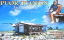
sa-038.jpgSA-038 Brazil Atol Das Rocas75 viewsThe Rocas Atoll is the only atoll in the South Atlantic Ocean. It belongs to the Brazilian State of Rio Grande do Norte. It is located approximately 260 km northeast of Natal and 145 km west of the Fernando de Noronha archipelago. The atoll is of volcanic origin and coralline formation.
|
|
sa-084r.jpgSA-084 Colombia Choco Department South group75 viewsIsla Cacagual, Chocó is an island south of Punta Charambirá and northwest of Isla Estebánico on the Pacific Coast of central Colombia
|
|

sa-089r.jpgSA-089 Venezuela Falcon State group75 viewsCayo Sombrero is the name of an island in the Caribbean Sea that belongs to the Morrocoy National Park located in the state of Falcón ,in western Venezuela .
|
|

sa-097r.jpgSA-097 Chile Diego Ramirez Islands75 viewsIsla Gonzalo is a subantarctic island, uninhabited except for a weather and research station operated by the Chilean Navy. With an area of 38 hectares (94 acres) it is the second largest of the Chilean Diego RamÃrez Archipelago after Isla Bartolomé. The archipelago lies in the Drake Passage between the continents of South America and Antarctica. It is an important breeding site for black-browed (over 6000 pairs) and grey-headed (over 4000 pairs) albatrosses, as well as for southern giant petrels.
|
|

sa-098.jpgSA-098 Peru Arequipa / Moquegua / Tacna Department group75 viewsIsla La Leona, Peru is an island in the south of the country nearby to Punta Islay Lighthouse and Puerto Matarani.
|
|

5x8cr.jpg75 views
|
|

ER1SS.jpger1ss - Moldavia75 viewsVia Winter Es - the best opening I have seen to Europe via Winter Es on 6m. Band open to JT, UK8, UT, ER, SM, F, OZ, DL on this day.
|
|

AAzone6.jpg75 views
|
|

Azone16R.JPG75 views
|
|

Abzone4.jpg75 views
|
|

bzone23.jpg75 views
|
|

Aczone6r.jpg75 views
|
|

czone21.jpg75 views
|
|

czone23.jpg75 views
|
|
| 15601 files on 391 page(s) |
 |
|
|
|
|
|
|
|
|
34 | |
|
|
|
|
|
|
|
|
 Contact

