 Most viewed |
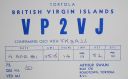
na-023.jpgNA-023 British Virgin Islands93 viewsThe British Virgin Islands, part of a volcanic archipelago in the Caribbean, is a British overseas territory. Comprising 4 main islands and many smaller ones, it's known for its reef-lined beaches and as a yachting destination. The largest island, Tortola, is home to the capital, Road Town, and rainforest-filled Sage Mountain National Park
|
|

4k9wa.jpg93 views
|
|

4u1unaa.jpg93 views
|
|

3c3v.jpg93 views
|
|

3v8sq.jpg93 views
|
|

3W6HM_28229.jpg93 views
|
|

3b8cf~1.jpg93 views
|
|

3c0er~0.jpg93 views
|
|

1S9M0Saa.jpg93 views
|
|

3c2mv.jpg93 views
|
|

4k9waaaa.jpg93 views
|
|

zzdel8z4ar~1.jpg93 views
|
|

4l5a.jpg92 views
|
|

3d2f3d2tl.jpg92 views
|
|

3d2rdxr~0.jpg92 views
|
|

3W6HM_28129.jpg92 views
|
|

4k9wr~1.jpg92 views
|
|

3c0agsr.jpg92 views
|
|

3d2f3d2rf.jpg92 views
|
|

3d6bp.jpg92 views
|
|

3b8cf~2.jpg92 views
|
|

3b9spr.jpg92 views
|
|

3d2rdxaaa.jpg92 views
|
|

3v8sqa.jpg92 views
|
|

4s7mxr.jpg92 views
|
|

IZONE38.jpg92 views
|
|

IOTABANNER.jpg92 views
|
|

na-021.jpgNA-021 Barbados91 viewsBarbados is an island country in the Lesser Antilles of the West Indies, in the Caribbean region of North America. It is 34 kilometres (21 miles) in length and up to 23 km (14 mi) in width, covering an area of 432 km2 (167 sq mi). It is situated in the western area of the North Atlantic and 100 km (62 mi) east of the Windward Islands and the Caribbean Sea;[6] therein, Barbados is east of the Windwards, part of the Lesser Antilles, roughly at 13°N of the equator
|
|

na-024.jpgNA-024 Grenada91 viewsGrenada is a Caribbean country comprising a main island, also called Grenada, and smaller surrounding islands. Dubbed the “Spice Isle,†the hilly main island is home to numerous nutmeg plantations. It’s also the site of the capital, St. George’s, whose colourful homes, Georgian buildings and early-18th-century Fort George overlook narrow Carenage Harbour.
|
|

sa-099.jpgSA-099 Curacao Island91 viewsCuraçao (/ˈkjʊərəsoʊ/ is a Lesser Antilles island in the southern Caribbean Sea and the Dutch Caribbean region, about 65 km (40 mi) north of the Venezuelan coast. It is a constituent country (Dutch: land) of the Kingdom of the Netherlands. The country was formerly part of the Curaçao and Dependencies colony (1815–1954) and is now formally called the Country of Curaçao.
|
|

3xy1tr~1.jpg91 views
|
|

4u1unr~2.jpg91 views
|
|

3af9uw.jpg91 views
|
|

4u1unaaaa.jpg91 views
|
|

3wxv7thp.jpg91 views
|
|

3d2f3d2dk.jpg91 views
|
|

ce0yhop.jpgce0yho - Easter Island91 viewsVia summer Es - ce0y using just 50 watts into a wire dipole
|
|
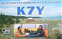
na-250.jpgNA-250 Yakutat Borough group91 viewsKhantaak Island lies of the south east shore of Yakutat Bay, Alaska. The island is 6 miles long and is 1.8 miles north west of Yakutat
|
|

3y0xr~0.jpg90 views
|
|

4u6itu.jpg90 views
|
|
| 15606 files on 391 page(s) |
 |
|
|
|
|
|
|
|
|
26 | |
|
|
|
|
|
|
|
|
 Contact

