 Most viewed |

1S9M0CR~0.jpg103 views
|
|

3b9wrr.jpg103 views
|
|

3d2rdxaa.jpg103 views
|
|

OC-016R.jpgOC-016 Fiji Viti Levu and Vanua Levu group103 viewsThe Vanua Levu Group is an archipelago in northern Fiji. It takes its name from its predominant island, Vanua Levu. Among the other islands in the group, the most important is Taveuni. Other islands in the group include Laucala, Matagi, Namena Lala, Qamea, Rabi, Vorovoro and Yadua Tabu. They have an aggregate area of 6,199 square kilometres (2,393 square miles).
|
|
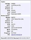
9m2tor~1.jpg9m2to - West Malaysia103 viewsvia summer Es
|
|

eu-019r.jpgEU-019 Franz Josef Land102 viewsFranz Josef Land, is a Russian archipelago, inhabited only by military personnel, located in the Arctic Ocean and constituting the northernmost part of Arkhangelsk Oblast. It consists of 192 islands, which cover an area of 16,134 square kilometers (6,229 sq mi), stretching 375 kilometers (233 mi) from east to west and 234 kilometers (145 mi) from north to south.
|
|

na-006.jpgNA-006 Canada NWT/Nunavut (Victoria Island) group102 viewsVictoria Island is a large island in the Canadian Arctic Archipelago that straddles the boundary between Nunavut and the Northwest Territories of Canada. It is the eighth largest island in the world, and at 217,291 km² in area, it is Canada's second largest island.
|
|

na-007r.jpgNA-007 Canada Nunavut (Southampton Island) group102 viewsSouthampton Island is a large island at the entrance to Hudson Bay at Foxe Basin. One of the larger members of the Canadian Arctic Archipelago, Southampton Island is part of the Kivalliq Region in Nunavut, Canada. The area of the island is stated as 41,214 km²
|
|

3xy1tr.jpg102 views
|
|

4S7BRGR.jpg102 views
|
|

4U1UN.jpg102 views
|
|

5A2AR~0.jpg102 views
|
|

3da0nx.jpg102 views
|
|

3a2mg.jpg102 views
|
|

OC-004.jpgOC-004 Lord Howe Island102 viewsLord Howe Island is an irregularly crescent-shaped volcanic remnant in the Tasman Sea between Australia and New Zealand, 600 km (320 nmi) directly east of mainland Port Macquarie, 780 km (420 nmi) northeast of Sydney, and about 900 km (490 nmi) southwest of Norfolk Island. It is about 10 km (6.2 mi) long and between 0.3 and 2.0 km (0.19 and 1.24 mi) wide with an area of 14.55 km2 (3,600 acres).
|
|

OC-016.jpgOC-016 Fiji Viti Levu and Vanua Levu group102 viewsThe Vanua Levu Group is an archipelago in northern Fiji. It takes its name from its predominant island, Vanua Levu. Among the other islands in the group, the most important is Taveuni. Other islands in the group include Laucala, Matagi, Namena Lala, Qamea, Rabi, Vorovoro and Yadua Tabu. They have an aggregate area of 6,199 square kilometres (2,393 square miles).
|
|

OC-021.jpgOC-021 Java Island102 viewsJava is an island of Indonesia, bordered by the Indian Ocean on the south and the Java Sea on the north. With a population of over 141 million (Java only) or 145 million (including the inhabitants of its surrounding islands), Java is the home to 56.7 percent of the Indonesian population and is the world's most populous island
|
|

ce0yhor.jpgce0yho - Easter Island102 viewsVia summer Es - ce0y using just 50 watts into a wire dipole
|
|

dxcc_logo.jpgdxcc logo102 views
|
|

eu-004r.jpgEU-004 Balearic Islands101 viewsThe Balearic Islands are an archipelago of Spain in the western Mediterranean Sea, near the eastern coast of the Iberian Peninsula.
The four largest islands are Mallorca, Menorca, Ibiza, and Formentera. Many minor islands and islets are close to the larger islands, including Cabrera, Dragonera, and S'Espalmador.
|
|

eu-013r.jpgEU-013 Jersey Island101 viewsJersey, officially the Bailiwick of Jersey , is a Crown dependency located near the coast of Normandy, France. It is the second closest of the Channel Islands to France, after Alderney.
|
|

eu-024.jpgEU-024 Sardinia Island101 viewsSardinia is the second-largest island in the Mediterranean Sea (after Sicily and before Cyprus). It is located west of the Italian Peninsula and to the immediate south of the French island of Corsica.
|
|

na-005.jpgNA-005 Bermuda Islands101 viewsBermuda is a British Overseas Territory in the North Atlantic Ocean. It is approximately 1,070 km (665 mi) east-southeast of Cape Hatteras, North Carolina; 1,236 km (768 mi) south of Cape Sable Island, Nova Scotia; and 1,759 km (1,093 mi) northeast of Cuba. The capital city is Hamilton. Bermuda is self-governing, with its own constitution and government and a Parliament which makes local laws.
|
|

1a0kmr~0.jpg101 views
|
|

3a2ee.jpg101 views
|
|

1a0kmaa.jpg101 views
|
|
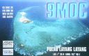
1S9M0Ca.jpg101 views
|
|

3c0ags.jpg101 views
|
|

3b9sp.jpg101 views
|
|
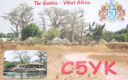
c5yk.jpgc5yk Gambia101 viewsQSO made via F2 longpath over North America - path identified via RX of 6v7six beacon which was heard for a few weeks on a daily basis around this date and time
|
|
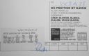
OC-004R.jpgOC-004 Lord Howe Island101 viewsLord Howe Island is an irregularly crescent-shaped volcanic remnant in the Tasman Sea between Australia and New Zealand, 600 km (320 nmi) directly east of mainland Port Macquarie, 780 km (420 nmi) northeast of Sydney, and about 900 km (490 nmi) southwest of Norfolk Island. It is about 10 km (6.2 mi) long and between 0.3 and 2.0 km (0.19 and 1.24 mi) wide with an area of 14.55 km2 (3,600 acres).
|
|

OC-009R.jpgOC-009 Palau Islands101 viewsPalau is an island country located in the western Pacific Ocean. The country contains approximately 340 islands, forming the western chain of the Caroline Islands in Micronesia, and has an area of 466 square kilometers (180 sq mi). The most populous island is Koror.
|
|

OC-012.jpgOC-012 Yap Islands101 viewsYap refers to an island located in the Caroline Islands of the western Pacific Ocean, a part of the Federated States of Micronesia. The name "Yap" in recent years has come to also refer to the state within the Federated States of Micronesia, inclusive of the Yap Main Islands and its various outer islands.
|
|

OC-024.jpgOC-24 Kiritimati Island;Christmas Island101 viewsKiritimati, or Christmas Island, is a Pacific Ocean raised coral atoll in the northern Line Islands. It is part of the Republic of Kiribati. The island has the greatest land area of any coral atoll in the world, about 388 square kilometres (150 square miles); its lagoon is roughly the same size.
|
|
izone40rr.jpg101 views
|
|

na-006r.jpgNA-006 Canada NWT/Nunavut (Victoria Island) group100 viewsVictoria Island is a large island in the Canadian Arctic Archipelago that straddles the boundary between Nunavut and the Northwest Territories of Canada. It is the eighth largest island in the world, and at 217,291 km² in area, it is Canada's second largest island.
|
|

na-008.jpgNA-008 Canada Nunavut (Ellesmere Island) group100 viewsEllesmere Island is part of the Qikiqtaaluk Region in the Canadian territory of Nunavut. Lying within the Canadian Arctic Archipelago, it is considered part of the Queen Elizabeth Islands, with Cape Columbia being the most northerly point of land in Canada.
|
|

na-018.jpgNA-018 Greenland (main island)100 viewsGreenland is a massive island and autonomous Danish territory between the North Atlantic and Arctic oceans. Much of its land surface is covered in ice. Most of its small population lives along the ice-free, fjord-lined coast, particularly in the southwest.
|
|

4o3t.jpg100 views
|
|

3b7cf.jpg100 views
|
|
| 15605 files on 391 page(s) |
 |
|
|
|
|
|
|
|
|
22 | |
|
|
|
|
|
|
|
|
 Contact

