 Most viewed |

NC-Madison1.jpg35 views
|
|

SC-Chesterfield.jpg35 views
|
|

WA-Columbia.jpg35 views
|
|

KY-Fulton~0.jpg35 views
|
|
MI-Oscoda~0.jpg35 views
|
|

OK-Washington~0.jpg35 views
|
|

SC-Marlboro1.jpg35 views
|
|

AL-Choctaw.jpg35 views
|
|

na-244.jpgNA-244 Marias Islands35 viewsThe Islas Marías ("Mary Islands") make up an archipelago in Mexico, consisting of four islands. They are located in the Pacific Ocean, some 100 km (62 mi) off the coast of the state of Nayarit and about 370 km (230 mi) southeast of the tip of Baja California. They are part of the municipality of San Blas, Nayarit. The islands were used as a penal colony until February 18, 2019, when President Andrés Manuel López Obrador ordered the closure of its operation as Islas Marías Federal Prison.
|
|

AR-Phillips.jpg35 views
|
|

ME-Piscataquis1.jpg35 views
|
|

AR-Cleburne1.jpg35 views
|
|
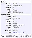
9a8ar.jpg9A8A - CROATIA35 viewsworked via F2
|
|

9a8a.jpg9A8A - CROATIA35 viewsworked via F2
|
|
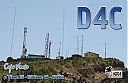
d4l.jpgD4L - CAPE VERDE ISLANDS35 viewsWorked longpath at a beam heading of 120 degrees (ie same as ea8 LP)
|
|

hb9fmt.jpgHB9FMT - SWITZERLAND35 viewsworked via F2
|
|
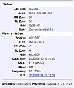
vu2dedr.jpgVU2DED - INDIA35 viewsvia TEP extension
|
|

kp4np4bmr.jpgNP4BM - PUERTO RICO35 viewsworked via F2
|
|

om5kmr.jpg35 views
|
|

sv1ga.jpg35 views
|
|

xw4kvr.jpgXW4KV - LAOS35 viewsvia F2
|
|
AL-Lamar.jpg35 views
|
|

TX-Howard1.jpg35 views
|
|

AK-Juneau_Borough.jpg35 views
|
|

kp5np3vi.jpg35 views
|
|

GA-Murray1.jpg35 views
|
|

MN-Yellow_Medicine.jpg35 views
|
|

NM-Socorro1.jpg35 views
|
|

na-099.jpgNA-099 Puerto Rico34 viewsPuerto Rico[a] (Spanish for "Rich Port"), officially the Commonwealth of Puerto Rico (Spanish: Estado Libre Asociado de Puerto Rico, lit. "Free Associated State of Puerto Rico") and briefly called Porto Rico,[c][16][17][18] is an unincorporated territory of the United States located in the northeast Caribbean Sea, approximately 1,000 miles (1,600 km) southeast of Miami, Florida.
|
|
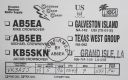
na-168.jpgNA-168 Louisiana State South East (Lafourche to Plaquemines Parish) group34 viewsGrand Isle (French: Grande-ÃŽle) is a town in Jefferson Parish, Louisiana, United States, located on a barrier island of the same name in the Gulf of Mexico. The island is at the mouth of Barataria Bay where it meets the gulf. As of the 2010 census, the town's resident population was 1,296
|
|

na-169r.jpgNA-169 Washington State West group34 viewsWaadah Island is an island situated in the Strait of Juan de Fuca, just north of Neah Bay in northwestern Clallam County, Washington, United States. The island has a land area of 164,940 square meters and has no human population.
|
|

na-194.jpgNA-194 Canada Newfoundland Province (Labrador) North group34 viewsFinger Hill Island is located on the northern most tip of the province of Labrador and 160 km N-NE of Nain the northernmost community.
|
|

j88drr~0.jpg34 views
|
|

jd1bia.jpg34 views
|
|

OJ0Xa.jpg34 views
|
|

OJ0XR~0.jpg34 views
|
|

om0wr.jpg34 views
|
|

on8rd.jpg34 views
|
|
p29vms~0.jpg34 views
|
|

p40mra.jpg34 views
|
|
| 15653 files on 392 page(s) |
 |
|
|
|
|
|
|
|
|
200 | |
|
|
|
|
|
|
|
|
 Contact

