 Most viewed Most viewed |

AF-025R.jpgAF-025 Aldabra Islands211 viewsAldabra Islands, atoll, one of the world’s largest, in the Indian Ocean about 600 miles (1,000 km) southwest of the Seychelles group, and part of the Republic of the Seychelles
|
|

AF-023.jpgAF-023 Sao Tome Island209 viewsSão Tomé Island, at 854 km2 (330 sq mi), is the largest island of São Tomé and PrÃncipe and is home in May 2018 to about 193,380 or 96% of the nation's population. The island is divided into six districts. It is located 2 km (1¼ miles) north of the equator.
|
|

AF-026R.jpgAF-026 Cosmoledo Islands207 viewsCosmoledo Atoll is an atoll of the Aldabra Group and belongs to the Outer Islands of the Seychelles, and is located 1,029 km southwest of the capital, Victoria, on Mahé Island
|
|

TN-Blount.jpg206 views
|
|

an-003.jpgAN-003 Heard Island202 viewsThe Territory of Heard Island and McDonald Islands[1][2] (HIMI[3]) is an Australian external territory comprising a volcanic group of barren Antarctic islands. The islands are among the most remote places on Earth: They are located approximately 4,099 km (2,547 mi) southwest of Perth,[4] 3,845 km (2,389 mi) southwest of Cape Leeuwin, Australia, 4,200 km (2,600 mi) southeast of South Africa, 3,830 km (2,380 mi) southeast of Madagascar, 1,630 km (1,010 mi) north of Antarctica, and 450 km (280 mi) southeast of the Kerguelen Islands.[5] The islands are currently uninhabited.
|
|

as-001.jpgAS-001 Andaman Islands200 viewsThe Andaman Islands form an archipelago in the Bay of Bengal between India, to the west, and Myanmar, to the north and east. Most are part of the Andaman and Nicobar Islands which are the Union Territory of India,
|
|

as-002.jpgAS-002 Bahrein Island199 viewsBahrain Island is located in the Persian Gulf, and is the largest island within the archipelago of Bahrain, and forms the bulk of the country's land mass while hosting the majority of its population
|
|
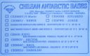
an-001.jpgAN-001 Antarctica Graham Land West (Adelaide Island) group198 viewsAdelaide Island or Isla Adelaida or Isla Belgrano is a large, mainly ice-covered island, 139 kilometres (75 nmi) long and 37 kilometres (20 nmi) wide, lying at the north side of Marguerite Bay off the west coast of the Antarctic Peninsula
|
|

an-002.jpgAN-002 Bouvet Island198 viewsBouvet Island (Norwegian: Bouvetøya[1][2]) is an uninhabited subantarctic high island and dependency of Norway located in the South Atlantic Ocean at 54°25′S 3°22′ECoordinates: 54°25′S 3°22′E, thus locating it north of and outside the Antarctic Treaty System. It lies at the southern end of the Mid-Atlantic Ridge and is the most remote island in the world, approximately 1,700 kilometres (1,100 mi) north of the Princess Astrid Coast of Queen Maud Land, Antarctica, 1,160 kilometres (720 mi) east of the South Sandwich Islands and 2,600 kilometres (1,600 mi) south-southwest of the coast of South Africa.
|
|

3d2ag.jpg3d2ag Fiji198 viewsQso made via summer Es
|
|

TN-Cheatham.jpg198 views
|
|

AN-007R.jpgAN-007 South Georgia Island196 viewsSouth Georgia (Spanish: Isla San Pedro) is an island in the southern Atlantic Ocean that is part of the British Overseas territory of South Georgia and the South Sandwich Islands. The main settlement is Grytviken. South Georgia is 167.4 kilometres (104 mi) long and 1.4 to 37 km (0.9 to 23.0 miles) wide.[1]
|
|

AN-013.jpgAN-013 Antarctica Trinity Peninsula group196 viewsDundee Island is an ice-covered island lying east of the northeastern tip of Antarctic Peninsula and south of Joinville Island.[
|
|

as-001r.jpgAS-001 Andaman Islands196 viewsThe Andaman Islands form an archipelago in the Bay of Bengal between India, to the west, and Myanmar, to the north and east. Most are part of the Andaman and Nicobar Islands which are the Union Territory of India,
|
|

AN-005.jpgAN-005 Macquarie Island195 viewsMacquarie Island, a UNESCO World Heritage Site, lies in the southwest Pacific Ocean, about halfway between New Zealand and Antarctica. Since 1948 the Australian Antarctic Division (AAD) has maintained a permanent base, the Macquarie Island Station, on the isthmus at the northern end of the island at the foot of Wireless Hill. The population of the base, the island's only human inhabitants, usually varies from 20 to 40 people over the year
|
|

AN-011.jpgAN-011 Antarctica Ross Island group195 viewsRoss Island is an island formed by four volcanoes in the Ross Sea near the continent of Antarctica, off the coast of Victoria Land in McMurdo Sound. Ross Island lies within the boundaries of Ross Dependency, an area of Antarctica claimed by New Zealand.
|
|

AN-015.jpgAN-015 Antarctica Queen Maud Land (Prince Harald etc) group195 viewsThe Flatvaer Islands (Norwegian: Flatvær, meaning "flat islands"), also known as the Ongul Islands, are a group of small islands lying at the east side of the entrance of Lützow-Holm Bay, 4 km from the coastline of Antarctica.
|
|

AF-027.jpgAF-027 Mayotte Island194 viewsMayotte is part of the Comoros archipelago, located in the northern Mozambique Channel in the Indian Ocean off the coast of Southeast Africa, between northwestern Madagascar and northeastern Mozambique
|
|

AN-007.jpgAN-007 South Georgia Island193 viewsSouth Georgia (Spanish: Isla San Pedro) is an island in the southern Atlantic Ocean that is part of the British Overseas territory of South Georgia and the South Sandwich Islands. The main settlement is Grytviken. South Georgia is 167.4 kilometres (104 mi) long and 1.4 to 37 km (0.9 to 23.0 miles) wide.[1]
|
|

ZONE18~0.jpg193 views
|
|

an-006r.jpgAN-006 Antarctica Graham Land West (Biscoe Islands) group191 viewsGalindez Island is an island 0.8 kilometres (0.5 mi) long, lying immediately east of Winter Island in the Argentine Islands, Wilhelm Archipelago. The Ukrainian Vernadsky Research Base is at Marina Point on Galindez Island
|
|
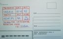
as-018r.jpgAS-018 Asiatic Russia Sakhalin Island191 viewsSakhalin is a Russian island in the Pacific Ocean, north of Japan.
|
|

as-009r.jpgAS-009 Yemen Red Sea Coast group190 viewsAbu-Ail Island is located in the Red Sea between Yemen and Eritrea
|
|

as-010.jpgAS-010 Oman Zufar Region group190 viewsThe Khuriya Muriya Islands are a group of five islands in the Arabian Sea, 40 km (25 mi) off the southeastern coast of the Sultanate of Oman. The islands form part of the province of Shalim and the Hallaniyat Islands in the governorate of Dhofar.
|
|

as-012.jpgAS-012 Japan Kyushu's Coastal Islands190 viewsAmakusa, which means "Heaven's Grass," is a series of islands off the west coast of Kyushu, the southernmost of the four main islands of Japan.
|
|

TN-Decatur.jpg189 views
|
|

an-002r.jpgAN-002 Bouvet Island188 viewsBouvet Island (Norwegian: Bouvetøya[1][2]) is an uninhabited subantarctic high island and dependency of Norway located in the South Atlantic Ocean at 54°25′S 3°22′ECoordinates: 54°25′S 3°22′E, thus locating it north of and outside the Antarctic Treaty System. It lies at the southern end of the Mid-Atlantic Ridge and is the most remote island in the world, approximately 1,700 kilometres (1,100 mi) north of the Princess Astrid Coast of Queen Maud Land, Antarctica, 1,160 kilometres (720 mi) east of the South Sandwich Islands and 2,600 kilometres (1,600 mi) south-southwest of the coast of South Africa.
|
|

as-022.jpgAS-022 Asiatic Russia Medvezh'i Islands;Bear Islands188 viewsThe Medvezhyi Islands are located about 100 kilometres (62 mi) to the north of the mouths of the Kolyma River. The coast of Siberia is about 35 kilometres (22 mi) to the southwest of the largest island, which is about 15 kilometres (9.3 mi) km long.
|
|

as-024.jpgAS-024 Japan Yaeyama Islands188 viewsThe Yaeyama Islands are an archipelago in the southwest of Okinawa Prefecture, Japan, and cover 591.46 square kilometres. The islands are located southwest of the Miyako Islands, part of the Ryukyu Islands archipelago.
|
|

as-010r.jpgAS-010 Oman Zufar Region group187 viewsThe Khuriya Muriya Islands are a group of five islands in the Arabian Sea, 40 km (25 mi) off the southeastern coast of the Sultanate of Oman. The islands form part of the province of Shalim and the Hallaniyat Islands in the governorate of Dhofar.
|
|

an-003r.jpgAN-003 Heard Island186 viewsThe Territory of Heard Island and McDonald Islands[1][2] (HIMI[3]) is an Australian external territory comprising a volcanic group of barren Antarctic islands. The islands are among the most remote places on Earth: They are located approximately 4,099 km (2,547 mi) southwest of Perth,[4] 3,845 km (2,389 mi) southwest of Cape Leeuwin, Australia, 4,200 km (2,600 mi) southeast of South Africa, 3,830 km (2,380 mi) southeast of Madagascar, 1,630 km (1,010 mi) north of Antarctica, and 450 km (280 mi) southeast of the Kerguelen Islands.[5] The islands are currently uninhabited.
|
|

AN-010.jpgAN-010 South Shetland Islands186 viewsThe South Shetland Islands are a group of Antarctic islands with a total area of 3,687 square kilometres (1,424 sq mi). They lie about 120 kilometres (75 mi) north of the Antarctic Peninsula,[1] and between 430 kilometres (270 mi) to 900 kilometres (560 mi) south-west from the nearest point of the South Orkney Islands.
|
|

as-015.jpgAS-015 Malaysia Pinang State group186 viewsPenang is a Malaysian island off the Malay Peninsula in the Strait of Malacca.
|
|

AN-017.jpgAN-017 Antarctica Adelie Land group185 viewsThe Dumont d'Urville Station (French: Base antarctique Dumont-d'Urville) is a French scientific station in Antarctica on Île des Pétrels, archipelago of Pointe-Géologie in Adélie Land. It is operated by the "French Polar Institute Paul-Émile Victor", a joint operation of French public and para-public agencies.
|
|

as-005r.jpgAS-005 Asiatic Russia Kara Sea Coast West group185 viewsDikson Island (Russian: ДиÌкÑон), initially Dickson, is the name of an island in Taymyrsky Dolgano-Nenetsky District (Russian: ТаймыÌÑ€Ñкий ДолгаÌно-ÐеÌнецкий райоÌн), Krasnoyarsk Krai, Russia, situated in the Kara Sea near the mouth of the Yenisei River.
|
|

an-006.jpgAN-006 Antarctica Graham Land West (Biscoe Islands) group184 viewsGalindez Island is an island 0.8 kilometres (0.5 mi) long, lying immediately east of Winter Island in the Argentine Islands, Wilhelm Archipelago. The Ukrainian Vernadsky Research Base is at Marina Point on Galindez Island
|
|

AN-008.jpgAN-008 South Orkney Islands184 viewsThe South Orkney Islands are a group of islands in the Southern Ocean, about 604 kilometres (375 mi) north-east of the tip of the Antarctic Peninsula[1] and 844 kilometres (524 mi) south-west of South Georgia Island. They have a total area of about 620 square kilometres (240 sq mi). The islands are claimed both by Britain (as part of the British Antarctic Territory since 1962, previously as a Falkland Islands Dependency), and by Argentina as part of Argentine Antarctica.
|
|

AN-009.jpgAN-009 South Sandwich Islands184 viewsgroup of actively volcanic islets in the South Atlantic Ocean, north of the Weddell Sea and 470 miles (760 km) southeast of the island of South Georgia. They extend for 190 miles (305 km), occupy 120 square miles (310 square km), and are covered with glaciers.
|
|
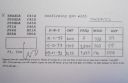
as-004r.jpgAS-004 Cyprus184 viewsCyprus (Greek ΚÏÏ€Ïος, Turkish Kıbrıs, ) is an island in the Mediterranean Sea, south of Turkey. After Sicily and Sardinia, Cyprus is the third largest island in the Mediterranean Sea.
|
|

as-023.jpgAS-023 Japan Amami Islands184 viewsThe Amami Islands is an archipelago in the Satsunan Islands, which is part of the Ryukyu Islands, and is southwest of Kyushu. Administratively, the group belongs to Kagoshima Prefecture, Japan.
|
|
| 15297 files on 383 page(s) |
2 |  |
|
|
|
|
|
|
|
|
|
|
|
|
|
|
|
|
|
 Contact
