 Most viewed |

KS-Stevens.jpg35 views
|
|

MO-Pulaski1.jpg35 views
|
|

NC-Madison1.jpg35 views
|
|

SC-Chesterfield.jpg35 views
|
|

KS-Witchita.jpg35 views
|
|

OK-Washington~0.jpg35 views
|
|

hz1ska.jpgHZ1SK - Saudi Arabia35 viewsworked via longpath direct - F2
|
|

SC-Marlboro1.jpg35 views
|
|

AL-Choctaw.jpg35 views
|
|

d4lr.jpgD4L - CAPE VERDE ISLANDS35 viewsWorked longpath at a beam heading of 120 degrees (ie same as ea8 LP)
|
|

TN-Dickson1.jpg35 views
|
|

ME-Piscataquis1.jpg35 views
|
|

OK-Custer.jpg35 views
|
|
AR-Cleburne1.jpg35 views
|
|
9a8ar.jpg9A8A - CROATIA35 viewsworked via F2
|
|

9a8a.jpg9A8A - CROATIA35 viewsworked via F2
|
|
d4l.jpgD4L - CAPE VERDE ISLANDS35 viewsWorked longpath at a beam heading of 120 degrees (ie same as ea8 LP)
|
|

hb9fmt.jpgHB9FMT - SWITZERLAND35 viewsworked via F2
|
|
vu2dedr.jpgVU2DED - INDIA35 viewsvia TEP extension
|
|

kp4np4bmr.jpgNP4BM - PUERTO RICO35 viewsworked via F2
|
|

OC-081.jpgOC-081 - JARVIS ISLAND35 viewsJarvis Island; formerly known as Bunker Island or Bunker's Shoal, is an uninhabited 4.5 km2 (1.7 sq mi) coral island located in the South Pacific Ocean, about halfway between Hawaii and the Cook Islands. The US claimed it in the 19th century and mined it for guano. In the 20th century, it was the subject of a small settlement. It was attacked during WW2 and evacuated, leaving some buildings and a day beacon. In modern times, it is managed as a nature reserve.
|
|

om5kmr.jpg35 views
|
|

sv1ga.jpg35 views
|
|

xw4kvr.jpgXW4KV - LAOS35 viewsvia F2
|
|

c21tsr.jpgC21TS - NAURU35 viewsworked via summer Es
|
|

MI-Oceana.jpg35 views
|
|

NC-Macon.jpg35 views
|
|
AL-Lamar.jpg35 views
|
|

AK-Juneau_Borough.jpg35 views
|
|

kp5np3vi.jpg35 views
|
|

NM-Socorro1.jpg35 views
|
|
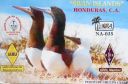
na-035.jpgNA-035 Honduras Santanilla Islands;Swan Islands;Cisne Islands34 viewsThe Swan Islands, or Islas Santanilla or Islas del Cisne, initially named Islas de las Pozas by Christopher Columbus in 1502, is a chain of three islands located in the northwestern Caribbean Sea, approximately 153 kilometres off the coastline of Honduras, with a land area of 3.1 square kilometres
|
|

na-045.jpgNA-045 Mexico Quintana Roo State North group34 viewsIsla Mujeres is a Mexican island in the Caribbean Sea, 13 kilometers off the coast from Cancún. It's a vacation destination known for beaches such as northern Playa Norte, resort hotels and for snorkeling and scuba diving on the surrounding coral reefs. At Punta Sur, the southern tip, there's a lighthouse, the remains of a Mayan temple and a sanctuary for sea turtles.
|
|

na-099.jpgNA-099 Puerto Rico34 viewsPuerto Rico[a] (Spanish for "Rich Port"), officially the Commonwealth of Puerto Rico (Spanish: Estado Libre Asociado de Puerto Rico, lit. "Free Associated State of Puerto Rico") and briefly called Porto Rico,[c][16][17][18] is an unincorporated territory of the United States located in the northeast Caribbean Sea, approximately 1,000 miles (1,600 km) southeast of Miami, Florida.
|
|

na-146r.jpgNA-146 St Barthelemy Island34 viewsSaint Barthélemy collectivity of France in the Caribbean. Often abbreviated to St-Barth in French, and St. Barths or St. Barts in English, the island lies about 35 kilometres (22 mi) south-east of the Dutch-owned Sint Maarten and north-east of the Dutch islands of Saba, Sint Eustatius, the independent country of Saint Kitts and Nevis.
|
|

na-169.jpgNA-169 Washington State West group34 viewsWaadah Island is an island situated in the Strait of Juan de Fuca, just north of Neah Bay in northwestern Clallam County, Washington, United States. The island has a land area of 164,940 square meters and has no human population.
|
|

na-194.jpgNA-194 Canada Newfoundland Province (Labrador) North group34 viewsFinger Hill Island is located on the northern most tip of the province of Labrador and 160 km N-NE of Nain the northernmost community.
|
|

na-207.jpgNA-207 Nunavut (Hudson Bay - Ontario Coast) South group34 viewsAkimiski Island is the largest island in James Bay (a southeasterly extension of Hudson Bay), Canada, which is part of the Qikiqtaaluk Region of the territory of Nunavut. It has an area of 3,001 km2 (1,159 sq mi), making it the 163rd largest island in the world, and Canada's 29th largest island. Akimiski Island is only 19 km (12 mi) from the province of Ontario. From the western side of the island, one can see the Ontario coastline.
|
|

9g1mr~1.jpg34 views
|
|

cn8wwaa.jpg34 views
|
|
| 15650 files on 392 page(s) |
 |
|
|
|
|
|
|
|
|
199 | |
|
|
|
|
|
|
|
|
 Contact

