 Most viewed |

e6zk2ylr.jpg35 views
|
|

f5tvg.jpg35 views
|
|

fpkv1er.jpg35 views
|
|

fr4fd.jpg35 views
|
|

ft5jar~2.jpg35 views
|
|

ft5tfr0flor.jpg35 views
|
|
gj5ebpr.jpg35 views
|
|
gw4hat.jpg35 views
|
|

j28dl.jpg35 views
|
|
jw8fg.jpg35 views
|
|
kh8snh8s.jpg35 views
|
|

lyup2cv.jpg35 views
|
|

oe5hil.jpg35 views
|
|

p40v.jpg35 views
|
|

t32bw.jpg35 views
|
|

tz6trb.jpg35 views
|
|

vk0mvk0pk.jpg35 views
|
|

vk0mvk0pkr.jpg35 views
|
|

vp2vej.jpg35 views
|
|

vp8fvp8qg.jpg35 views
|
|

vu7kvr~0.jpg35 views
|
|

xt2dx~0.jpg35 views
|
|

yb0acl.jpg35 views
|
|

yj8rwr.jpg35 views
|
|

yu7ajh.jpg35 views
|
|

OC-044.jpgOC-044 Pitcairn Island35 viewsThe Pitcairn Islands are a group of four volcanic islands in the southern Pacific Ocean that form the sole British Overseas Territory in the Pacific Ocean. The four islands—Pitcairn proper, Henderson, Ducie and Oeno—are scattered across several hundred miles of ocean and have a combined land area of about 18 square miles (47 km2).
|
|

oc-083r.jpgOC-083 Aitutaki group35 viewsAitutaki, also traditionally known as Araʻura and Utataki, is one of the Cook Islands, north of Rarotonga. It has a population of approximately 2,000. Aitutaki is the second most visited island of the Cook Islands. The main village is Arutanga (Arutunga) on the west side.
|
|

OC-119.jpgOC-119 Jolo group35 viewsJolo (Tausūg: Sūg) is a volcanic island in the southwest Philippines and is the primary island of the province of Sulu wherein its capital of the same name is situated. It is located in the Sulu Archipelago, between Borneo and Mindanao, and has a population of approximately 500,000 people. The island is the location of the Jolo Group of Volcanoes, and contains numerous volcanic cones and craters, including the active Bud Dajo cinder cone.
|
|

OC-125R.jpgOC-125 Semirara Islands35 viewsSemirara Island is located in the central west of the Philippines archipeleago and has an area of 55 square kilometres (21 sq mi), and is home to the Panian Mine, a vast open-pit coal mine in operation since 1999, and the Unong Mine (in production from 1984 to 2000).
|
|
OC-127.jpgOC-127 Rennell Island35 viewsRennell Island, is the main island of two inhabited islands that make up the Rennell and Bellona Province in the Solomon Islands. Rennell Island has a land area of 660 square kilometres (250 sq mi) that is about 80 kilometres (50 mi) long and 14 kilometres (8.7 mi) wide. It is the second largest raised coral atoll in the world] with the largest lake in the insular Pacific, Lake Tegano, a lake that is listed as a World Heritage Site. Rennell Island has a population of about 1,840
|
|
OC-129.jpgOC-129 Visayan Islands35 viewsThe Visayas, is one of the three principal geographical divisions of the Philippines, along with Luzon and Mindanao. Located in the central part of the archipelago, it consists of several islands, primarily surrounding the Visayan Sea, although the Visayas are also considered the northeast extremity of the entire Sulu Sea.
|
|
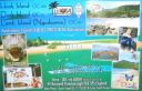
OC-160.jpgOC-160 Queensland State (South Coast) North group35 viewsHook Island is one of the Whitsunday Islands off the coast of the Australian state of Queensland. The island is almost uninhabited, quite rugged and almost completely contained within a section of the Whitsunday Islands National Park . The island has two prominent geographical features on the southern side of Hook Island; the Nara and Macona inlets, two fjord-like recesses that are used as anchorages for the Whitsunday tourist fleet. The island's northern coast is noted for its colourful underwater coral growths, to which snorkelling and diving enthusiasts are attracted.
|
|
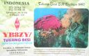
oc-219.jpgOC-219 Tukangbesi Islands; Wakatobi Islands35 viewsTukangbesi Islands, is a group of islands off the coast of Sulawesi immediately east of Buton island in the Banda Sea region, and part of Sulawesi Tenggara. "Tukang Besi" literally means "iron worker" or "blacksmith" in Indonesian. There is a Tukang Besi language. Separating Buton and the group is the Gulf of Kolowana Watabo.
|
|

OC-228R.jpgOC-228 South Australia State East group35 viewsBaudin Rocks is a group of islets on the south east coast of South Australia about 8.3 kilometres (5.2 miles) north-northwest of the town of Robe. The group consists of two major islets and at least 17 smaller islets with a total area about 5 hectares (12 acres). The maximum elevation is 12 metres (39 feet). As of 1996, the smaller northern islet is the most accessible in the group, having a sandy beach on its north-western corner
|
|
Azone30.jpg35 views
|
|

Azone31.jpg35 views
|
|

Azone33.jpg35 views
|
|

Azone34.jpg35 views
|
|
Azone34r.jpg35 views
|
|

Azone38.jpg35 views
|
|
| 15650 files on 392 page(s) |
 |
|
|
|
|
|
|
|
|
198 | |
|
|
|
|
|
|
|
|
 Contact

