 Most viewed |

6y5hnr.jpg6Y5HN - JAMAICA36 viewsProbably F2, j88 and kp2 also worked in this opening
|
|

KY-Logan1.jpg36 views
|
|

VA-Smyth1.jpg36 views
|
|

VA-Suffolk_City_1.jpg36 views
|
|

px0ff.jpgPX0FF - FERNANDO DE NORONHA36 viewsworked via F2 crooked path 120 degrees - probable vk4 shortpath distance record
|
|

IZONE37s.jpg36 views
|
|

GA-Meriwether1.jpg36 views
|
|

NC-Duplin.jpg36 views
|
|

VA-Staunton_City.jpg36 views
|
|
na-031r.jpgNA-031 Rhode Island State group35 viewsConanicut Island is the second largest island in Narragansett Bay in the US state of Rhode Island. It is connected on the east by the Claiborne Pell Bridge[1] to Newport on Aquidneck Island, and on the west by the Jamestown-Verrazano Bridge to North Kingstown on the mainland. The island comprises the town of Jamestown, Rhode Island.
|
|

na-032.jpgNA-032 St Pierre and Miquelon Islands35 viewsSaint Pierre and Miquelon, officially the Overseas Collectivity of Saint Pierre and Miquelon , is a self-governing territorial overseas collectivity of France, situated in the northwestern Atlantic Ocean near the Canadian province of Newfoundland and Labrador. It is the only part of New France that remains under French control. with an area of 242 square kilometres (93 sq mi)
|
|
na-038.jpgNA-038 Canada Quebec Province (La Madeleine Islands) group35 viewsThe Magdalen Islands is a small archipelago in the Gulf of Saint Lawrence with a land area of 205.53 square kilometres (79.36 sq mi). Administratively, the islands are part of the Gaspésie–Îles-de-la-Madeleine region in the Canadian province of Quebec, though they are geographically closer to the Maritime provinces than they are to the Gaspé Peninsula on the Quebec mainland.
|
|

na-039r.jpgNA-039 Alaska Andreanof Islands35 viewsThe Andreanof Islands are a group of islands in the Aleutian Islands, in southwestern Alaska and are located between Amchitka Pass and the Rat Islands group to the west, and Amukta Pass and the Islands of Four Mountains group to the east. The islands extend about 275 miles (440 km). The total land area of all islands (including the Delarof Islands) is 1,515.349 sq mi (3,924.737 km²). A small population of approx 500 persons live in the city of Adak on Adak Island
|
|

na-045r.jpgNA-045 Mexico Quintana Roo State North group35 viewsIsla Mujeres is a Mexican island in the Caribbean Sea, 13 kilometers off the coast from Cancún. It's a vacation destination known for beaches such as northern Playa Norte, resort hotels and for snorkeling and scuba diving on the surrounding coral reefs. At Punta Sur, the southern tip, there's a lighthouse, the remains of a Mayan temple and a sanctuary for sea turtles.
|
|

na-077.jpgNA-077 Quebec Province (Anticosti Island) group35 viewsAnticosti Island (French: Île d'Anticosti) is an island in the province of Quebec, Canada at the outlet of the Saint Lawrence River into the Gulf of Saint Lawrence, between 49° and 50° N., and between 61° 40' and 64° 30' W. At 7,892.52 km2 (3,047.32 sq mi) in size, it is the 90th largest island in the world and 20th largest island in Canada. Anticosti Island is separated on the north from the Côte-Nord region of Quebec (the Labrador Peninsula) by the Jacques Cartier Strait, and on the south from the Gaspé Peninsula by the Honguedo Strait.
|
|

na-079.jpgNA-079 Florida State (Dry Tortugas Islands) group35 viewsThe Dry Tortugas are a small group of islands, located in the Gulf of Mexico at the end of the Florida Keys, United States, about 67 miles west of Key West, and 37 miles west of the Marquesas Keys, the closest islands. Still farther west is the Tortugas Bank, which is submerged.
|
|

na-084r.jpgNA-084 Quebec Province (St Lawrence Gulf) East group35 viewsHarrington Island is located off the south east coast of Quebec . The island is home to the town of Harrington Harbor which is listed as one of the thirty most beautiful villages in Quebec. Perched on the island, it looks like a traditional Newfoundland outport. You won’t find roads or cars there, and people get around on foot or by bike or ATV (all-terrain vehicle) on raised wooden pathways.
|
|

na-098.jpgNA-098 Navassa Island35 viewsNavassa Island (/nəˈvæsə/; French: l'île de la Navasse; also La Navasse, La Navase) is a small uninhabited island in the Caribbean Sea. Located northeast of Jamaica, south of Cuba, 40 nautical miles (74 km; 46 mi) west of Jérémie on the south west peninsula of Haiti, the island is subject to an ongoing territorial dispute between Haiti and the United States, which officially administers it through the U.S. Fish and Wildlife Service.
|
|
na-102.jpgNA-102 Guadeloupe35 viewsGuadeloupe is an archipelago as well as an overseas region of France in the Caribbean. It consists of six inhabited islands, Basse-Terre, Grande-Terre, Marie-Galante, La Désirade, and the Îles des Saintes, as well as many uninhabited islands and outcroppings. Like the other overseas departments, it is an integral part of France. As a constituent territory of the European Union and the Eurozone, the euro is its official currency
|
|

na-105r.jpgNA-105 St Martin;Sint Maarten35 viewsSaint Martin (French: Saint-Martin; Dutch: Sint Maarten) is an island in the northeast Caribbean Sea, approximately 300 km (190 mi) east of Puerto Rico. The 87-square-kilometre (34 sq mi) island is divided roughly 60/40 between the French Republic (53 km2, 20 sq mi)[1] and the Kingdom of the Netherlands (34 km2, 13 sq mi),[2] but the two parts are roughly equal in population.
|
|
na-109.jpgNA-109 St Vincent35 viewsSaint Vincent is a volcanic island in the Anglo-Caribbean. It is the largest island of the country Saint Vincent and the Grenadines island chain. It is located in the Caribbean Sea, between Saint Lucia and Grenada. It is composed of partially submerged volcanic mountains. Its largest volcano and the country's highest peak, La Soufrière, is active, having last erupted in 1979.
|
|
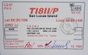
na-116.jpgNA-116 Costa Rica Puntarenas Province West group35 viewsSan Lucas Island (Spanish: Isla San Lucas) is an island located off the Pacific shore of Costa Rica in the Gulf of Nicoya. It is part of the 11th district of Puntarenas Canton of the province of Puntarenas. Formerly serving as an island prison, it is now a National Wildlife Refuge
|
|
na-122r.jpgNA-122 Dominican Republic's Coastal Islands35 viewsCayo Levantado, also known as Bacardi Island, is an islet in Samaná Bay, which belongs administratively to Samaná Province, in the Dominican Republic. It is a well-known tourist destination in the Dominican Republic.
|
|
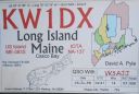
na-137.jpgNA-137 Maine State West (York to Knox County) group35 viewsLong Island is a popular destination in the summer, and is a 45-minute ferry ride from Portland, Maine in the Casco Bay.
|
|

na-141.jpgNA-141 Florida State South East (Dade to Indian River County) group35 viewsKnown for beautiful beaches, nature preserves and parks, Hutchinson Island consists of two barrier islands on the coast of Martin, St. Lucie, and Indian River counties, Florida. The two islands are separated by the Fort Pierce Inlet and are known as North Hutchinson Island and South Hutchinson Island.
|
|

na-144.jpgNA-144 California State South (Santa Barbara to Los Angeles County) group35 viewsSanta Cruz Island (Spanish: Isla Santa Cruz, Chumash: Limuw[1]) is the largest of the eight islands in the Channel Islands[2] and also the largest island in California,[3] located off the coast of California. The island, in the northern group of the Channel Islands, is 22 miles (35 km) long and from 2 to 6 miles (3.2 to 9.7 km) wide with an area of 61,764.6 acres (249.952 km2).
|
|

na-145.jpgNA-145 Sint Eustatius and Saba Islands35 viewsSint Eustatius is an island in the Caribbean. It is a special municipality (officially “public bodyâ€) of the Netherlands. The island lies in the northern Leeward Islands portion of the West Indies, southeast of the Virgin Islands. Sint Eustatius is immediately to the northwest of Saint Kitts, and to the southeast of Saba. The regional capital is Oranjestad.
|
|

na-161.jpgNA-161 Alaska Hoonah-Angoon Census Area North group35 viewsPleasant Island is the largest island in the Icy Strait between northern Chichagof Island and the mainland of the Alaska Panhandle. It lies southeast of the mainland city of Gustavus and southwest of the mainland community of Excursion Inlet. Pleasant Island has a land area of 49.192 km² (18.993 sq mi), had no population at the 2000 census, and is reported to be uninhabited as of 2012
|
|

na-163.jpgNA-163 Mexico Baja California State East group35 viewsIsla Ãngel de la Guarda, also called Archangel Island, is a large island in the Gulf of California east of BahÃa de los Ãngeles in northwestern Mexico, separated from the Baja California Peninsula by the Canal de Ballenas. It is the second largest of the eleven Midriff Islands or Islas Grandes.
|
|
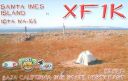
na-165.jpgNA-165 Mexico Baja California Sur State North East group35 viewsIslas Santa Inez is an island in the Gulf of California east of the Baja California Peninsula. The island is uninhabited and is part of the Mulegé Municipality in the Mexican state of Baja California Sur.
|
|

na-166r.jpgNA-166 Mexico Sonora State South group35 viewsPajaros Island is located 5 km south of the town of Guaymas on the eastern side of the Gulf of California. It has very steep cliffs and is covered by cacti
|
|

na-170r.jpgNA-170 Panama San Blas Province group35 viewsGaigirgordub, called El Porvenir (Spanish pronunciation: [el poɾ.βeˈniɾ]) until July 1, 2016, is the capital of the Panamanian comarca (indigenous territory) of Guna Yala. The settlement is located on a small island and contains a landing strip, a museum (the Museo de la Nación Guna, or Museum of the Guna Nation), a hotel, government offices, and an artisans' cooperative. There is also a small beach.
|
|

na-171r.jpgNA-171 Mexico Sinaloa State group35 viewsIsla de Venados (Deer Island) is a small island off the coast of Mazatlan, Mexico
|
|

na-182.jpgNA-182 Canada NWT (Inuvik Region) East group35 viewsGreen Island is a rocky island in the mouth of Fortune Bay, Newfoundland. It is located about 9.5 kilometres west of the Burin Peninsula of Newfoundland and 11 kilometres east of Langlade Island in Saint-Pierre and Miquelon.
|
|

na-183.jpgNA-183 Mexico Guerrero State group35 viewsThe island of La Roqueta is located in the southern part of the coast of the state of Guerrero, in front of the Acapulco bay of the port of the same name.
|
|

na-183r.jpgNA-183 Mexico Guerrero State group35 viewsThe island of La Roqueta is located in the southern part of the coast of the state of Guerrero, in front of the Acapulco bay of the port of the same name.
|
|
na-184r.jpgNA-184 California State North (Del Norte to Mendocino County) group35 viewsThe St. George Reef Light is an inactive lighthouse built on North West Seal Rock, six miles (10 km) off the coast of northern California near Crescent City.
|
|

na-186r.jpgNA-186 Nunavut (Hudson Bay - Manitoba Coast) group35 viewsFox Island island is located in Hudson Bay, 40km east of Churchill, Manitoba and 4km from the mainland
|
|

na-189.jpgNA-189 Mexico Nayarit / Jalisco State group35 viewsThe Marieta Islands are a group of small uninhabited islands a few miles off the coast of the state of Nayarit, Mexico, located in federal waters approximately 7.9 kilometres southwest of the peninsula known as Punta de Mita, in the municipality of BahÃa de Banderas.
|
|

na-189r.jpgNA-189 Mexico Nayarit / Jalisco State group35 viewsThe Marieta Islands are a group of small uninhabited islands a few miles off the coast of the state of Nayarit, Mexico, located in federal waters approximately 7.9 kilometres southwest of the peninsula known as Punta de Mita, in the municipality of BahÃa de Banderas.
|
|
| 15650 files on 392 page(s) |
 |
|
|
|
|
|
|
|
|
195 | |
|
|
|
|
|
|
|
|
 Contact

