 Most viewed |

v73n6hr.jpg36 views
|
|

vk9nsr~5.jpg36 views
|
|

vp2ml.jpg36 views
|
|

vp5wjr.jpg36 views
|
|

vp8sce9af.jpg36 views
|
|
xzxy4kq.jpg36 views
|
|

ya1rs.jpg36 views
|
|

yy5afd.jpg36 views
|
|

z28d.jpg36 views
|
|

OC-100.jpgOC-100 Nendo Island36 viewsNendo is the largest of the Santa Cruz Islands, located in the Temotu province of the Solomon Islands. Nendö is 40 km (25 mi.) long and 22 km (14 mi.) wide. Its land area is 505.5 km² (195 sq. mi.). The highest point on the island is 549 m (1,801 ft.) above sea level. Nendö's population is somewhat over 5000
|
|
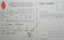
OC-143R.jpgOC-143 Sumatra Island36 viewsSumatra is a large island in western Indonesia that is part of the Sunda Islands. It is the largest island that is located entirely in Indonesia and the sixth-largest island in the world at 473,481 km2 (not including adjacent islands such as the Riau Islands and Bangka Belitung Islands).
|
|

OC-170.jpgOC-170 Western Australia State (South Coast) East Centre group36 viewsWoody Island is an island off the south coast in the Goldfields-Esperance region of Western Australia. The island located 15 kilometres (9 mi) from the town of Esperance, Western Australia. The island is part of the Recherche Archipelago and is listed as a nature reserve.[2] The island itself is reasonably small in size, about 1.5 km (0.93 mi) in length with a total area of 240 hectares (593 acres)
|
|

OC-177.jpgOC-177 Seribu Islands36 viewsThe Thousand Islands (officially Kepulauan Seribu) are a chain of islands to the north of Jakarta's coast. It forms the only regency of Jakarta, the capital of Indonesia. It consists of a string of 342 islands stretching 45 km (28 mi) north into the Java Sea at West Jakarta Bay and in fact north of Banten Province.
|
|
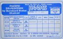
OC-178.jpgOC-178 Tikopia and Anuta Islands36 viewsTikopia is a small high island in the southwestern Pacific Ocean. It is part of the Solomon Islands of Melanesia, but is culturally Polynesian.
Tikopia's location is relatively remote. It is sometimes grouped with the Santa Cruz Islands. Administratively, Tikopia belongs to Temotu Province as the southernmost of the Solomon Islands.
|
|
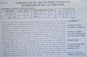
OC-196R.jpgOC-196 Victoria State East group36 viewsGabo Island is a 154-hectare (380-acre) island located off the coast of eastern Victoria, Australia, between Mallacoota and Cape Howe on the border with New South Wales. It is separated from the mainland by a 500-metre (1,600 ft) wide channel. Gabo Island is a shipping reference commonly referred to in Victorian weather warnings issued by the Australian Bureau of Meteorology. Gabo Island is well known for its historic lighthouse. This lighthouse, Australia's second tallest, was completed in 1862 and made from pink granite quarried from the island itself.
|
|
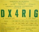
OC-202.jpgOC-202 Calagua Islands36 viewsCalaguas, also known as Calaguas Islands, is a group of islands located in the Philippine province of Camarines Norte. It includes the major islands of Tinaga Island and Guintinua Island, the minor Maculabo Island, as well as several other minor.The islands are around 200 km away from the capital city of Manila and can be accessed through the ports at Daet, Camarines Norte.
|
|
OC-209R.jpgOC-209 Talaud Islands36 viewsTalaud Islands (Indonesian: Kepulauan Talaud) is a group of islands located north of Sulawesi island in Indonesia, north-east of the Sangihe Islands. The Talaud Islands are also the northernmost region of Eastern Indonesia, bordering south of the Philippines' Davao Region. The group, with a total area of 495 square miles (1,281 square km), includes Karakelong (the largest), Salebabu, Kaburuang, and numerous islets. The coast of Karakelong Island is steep except on the southern shore, which is fringed by a wide reef. The seven tiny Nanusa Islands lie north-east of Karakelong. They are forested and with hills rising to 2,231 feet (680 metres).
|
|
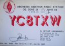
OC-210.jpgOC-210 Sangihe Islands36 viewsThe Sangihe Islands are a group of islands which constitute two regencies within the province of North Sulawesi, in northern Indonesia, the Sangihe Islands Regency (Kabupaten Kepulauan Sangihe) and the Sitaro Islands Regency (Kabupaten Siau Tagulandang Biaro). They are located north-east of Sulawesi between the Celebes Sea and the Molucca Sea, roughly halfway between Sulawesi and Mindanao, in the Philippines.
|
|

OC-248.jpgOC-248 Sonsorol Islands36 viewsSonsorol is one of the sixteen states of Palau. The administrative center, and only village, is Dongosaru on Sonsorol island. The inhabitants speak Sonsorolese, a local Trukic language, and Palauan. Sonsorol Island, also called Dongosaro or Dongosaru, is encircled by a coral reef extending 160 to 480 m offshore. It is 2 km long north south, and up to 890 m wide in the north. It is located 1.6 km south of Fanna Island. The village of Dongosaro, which is the capital of the state, is located on the west coast. The island is thickly wooded with coconut palms and other trees. Together with Fanna, it forms the Sonsorol Islands.
|
|

OC-269R.jpgOC-269 Karimata Islands36 viewsThe Karimata Islands are a chain of small islands off the west coast of Indonesian Borneo, the largest of which is (Pulau) Karimata, being about 20 km (12 mi) across (east-west), and situated at 1°37′S 108°53′E. It is part of Kayong Utara in Indonesia. A number of small villages are situated on the coast, the largest of which is Padang, on the eastern tip of the island. The island is renowned by inhabitants of the west coast of Kalimantan to have a serious malaria problem.
|
|

OC-270.jpgOC-270 Simeulue and Banyak Islands36 viewsSimeulue is an island of Indonesia, 150 kilometres (93 mi) off the west coast of Sumatra. Its capital is Sinabang. The SW facing portion of the island holds multiple world class waves and a handful of surf resorts have popped up in recent years.
|
|

Azone28r.jpg36 views
|
|

Azone35r.jpg36 views
|
|

Azone40.jpg36 views
|
|

czone29.jpg36 views
|
|

zone30~0.jpg36 views
|
|

zxv9adxr.jpg36 views
|
|

zzdelst0k5lbur_28229.jpg36 views
|
|

zzdelst0k5lbur~0.jpg36 views
|
|

vp8or~2.jpg36 views
|
|

zl5ba.jpg36 views
|
|

zl5dk0gda.jpg36 views
|
|

oa4cpi.jpg36 views
|
|

5h3ohr.jpg36 views
|
|

SD-Meade~0.jpg36 views
|
|

tg9ajrr.jpgTG9AJR - GUATEMALA36 viewsVia F2, SFI 115 but day following solar disturbance. Path also open to ea8 longpath, north to TG and south to YV
|
|

pj2cf.jpgPJ2CF-CURACAO36 viewsVia F2, SFI 115 but day following solar disturbance. Path also open to ea8 longpath, north to TG and south to YV
|
|

MN-Blue_Earth1.jpg36 views
|
|

ID-Jerome.jpg36 views
|
|

KS-McPherson1.jpg36 views
|
|
| 15650 files on 392 page(s) |
 |
|
|
|
|
|
|
|
|
194 | |
|
|
|
|
|
|
|
|
 Contact

