 Most viewed |

kl7iqm.jpg36 views
|
|

t31tb.jpg36 views
|
|

t32bwr.jpg36 views
|
|

t77cr~1.jpg36 views
|
|

t88kc6mmr.jpg36 views
|
|

tf8gx.jpg36 views
|
|

tg9us.jpg36 views
|
|

tg9usr.jpg36 views
|
|

tj1ghb.jpg36 views
|
|

tj1ghr~0.jpg36 views
|
|

tn2tr~2.jpg36 views
|
|

tt8jfc~0.jpg36 views
|
|

ty9erb.jpg36 views
|
|

ty9err~1.jpg36 views
|
|

ua1ra1tc.jpg36 views
|
|

ukui8aakr.jpg36 views
|
|

v47vp2kk.jpg36 views
|
|
v85ar~1.jpg36 views
|
|

vk9cvk9nyg.jpg36 views
|
|

vk9nsb.jpg36 views
|
|

vk9nsr~5.jpg36 views
|
|

vp2ml.jpg36 views
|
|

vp5wjr.jpg36 views
|
|

vp6brb.jpg36 views
|
|

vp6brr~3.jpg36 views
|
|

vp8sce9af.jpg36 views
|
|

vu7kvb.jpg36 views
|
|

xe2pgr.jpg36 views
|
|

xzxy4kq.jpg36 views
|
|

ya1rs.jpg36 views
|
|
yj8rw.jpg36 views
|
|
yl3ggp.jpg36 views
|
|

ynht3a.jpg36 views
|
|

yy5afd.jpg36 views
|
|

z28d.jpg36 views
|
|

OC-038R.jpgOC-038 Chatham Islands36 viewsThe Chatham Islands are a New Zealand archipelago in the Pacific Ocean about 800 kilometres (500 mi) east of the South Island of New Zealand. The archipelago consists of about ten islands within an approximate 60-kilometre (37 mi) radius, the largest of which are Chatham Island and Pitt Island. Some of these islands, formerly cleared for farming, are now preserved as nature reserves to conserve some of the unique flora and fauna. As of 2013 the islands had a resident population of 600.
|
|

OC-100.jpgOC-100 Nendo Island36 viewsNendo is the largest of the Santa Cruz Islands, located in the Temotu province of the Solomon Islands. Nendö is 40 km (25 mi.) long and 22 km (14 mi.) wide. Its land area is 505.5 km² (195 sq. mi.). The highest point on the island is 549 m (1,801 ft.) above sea level. Nendö's population is somewhat over 5000
|
|

OC-118R.jpgOC-118 Hoorn Islands36 viewsThe Hoorn Islands (also Futuna Islands) are one of the two island groups of which the French overseas collectivity (collectivité d'outre-mer, or COM) of Wallis and Futuna is geographically composed. The aggregate area is 115 km², and the population 4,873 (census of 2003).
Geographically, there are two islands: Futuna Island (in the northwest) (83 km², pop. 4871), Alofi Island (in the southeast) (32 km², pop. 2)
|
|
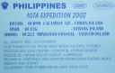
oc-126.jpgOC-126 Lubang Islands36 viewsLubang Island is the largest island in the Lubang Group of Islands, an archipelago which lies to the northwest of the northern end of Mindoro in the Philippines. The Lubang Islands are about 150 kilometres (93 mi) southwest of Manila. There are seven islands in the group,
|
|
OC-143R.jpgOC-143 Sumatra Island36 viewsSumatra is a large island in western Indonesia that is part of the Sunda Islands. It is the largest island that is located entirely in Indonesia and the sixth-largest island in the world at 473,481 km2 (not including adjacent islands such as the Riau Islands and Bangka Belitung Islands).
|
|
| 15649 files on 392 page(s) |
 |
|
|
|
|
|
|
|
|
192 | |
|
|
|
|
|
|
|
|
 Contact

