 Most viewed Most viewed |

z8st0rr.jpg34 views
|
|
zl8amor.jpg34 views
|
|
zl9zl4oy.jpg34 views
|
|

OC-044.jpgOC-044 Pitcairn Island34 viewsThe Pitcairn Islands are a group of four volcanic islands in the southern Pacific Ocean that form the sole British Overseas Territory in the Pacific Ocean. The four islands—Pitcairn proper, Henderson, Ducie and Oeno—are scattered across several hundred miles of ocean and have a combined land area of about 18 square miles (47 km2).
|
|

OC-094R.jpgOC-094 Disappointment Islands34 viewsThe Disappointment Islands are a subgroup of the Tuamotu Archipelago in French Polynesia. They are located towards the northeast, away from the main Tuamotu group. They are a small group of coral islands, which includes the island of Tepoto and the atoll of Napuka. These islands are arid, and are not especially conducive to human habitation.
|
|

OC-100.jpgOC-100 Nendo Island34 viewsNendo is the largest of the Santa Cruz Islands, located in the Temotu province of the Solomon Islands. Nendö is 40 km (25 mi.) long and 22 km (14 mi.) wide. Its land area is 505.5 km² (195 sq. mi.). The highest point on the island is 549 m (1,801 ft.) above sea level. Nendö's population is somewhat over 5000
|
|

OC-108R.jpgOC-108 Anambas Islands34 viewsAnambas Islands Regency is a small archipelago of Indonesia, located 150 nautical miles northeast of Batam Island in the North Natuna Sea between the Malaysian mainland to the west and the island of Borneo to the east.
|
|

OC-119.jpgOC-119 Jolo group34 viewsJolo (Tausūg: Sūg) is a volcanic island in the southwest Philippines and is the primary island of the province of Sulu wherein its capital of the same name is situated. It is located in the Sulu Archipelago, between Borneo and Mindanao, and has a population of approximately 500,000 people. The island is the location of the Jolo Group of Volcanoes, and contains numerous volcanic cones and craters, including the active Bud Dajo cinder cone.
|
|

OC-125R.jpgOC-125 Semirara Islands34 viewsSemirara Island is located in the central west of the Philippines archipeleago and has an area of 55 square kilometres (21 sq mi), and is home to the Panian Mine, a vast open-pit coal mine in operation since 1999, and the Unong Mine (in production from 1984 to 2000).
|
|
OC-127.jpgOC-127 Rennell Island34 viewsRennell Island, is the main island of two inhabited islands that make up the Rennell and Bellona Province in the Solomon Islands. Rennell Island has a land area of 660 square kilometres (250 sq mi) that is about 80 kilometres (50 mi) long and 14 kilometres (8.7 mi) wide. It is the second largest raised coral atoll in the world] with the largest lake in the insular Pacific, Lake Tegano, a lake that is listed as a World Heritage Site. Rennell Island has a population of about 1,840
|
|
OC-129.jpgOC-129 Visayan Islands34 viewsThe Visayas, is one of the three principal geographical divisions of the Philippines, along with Luzon and Mindanao. Located in the central part of the archipelago, it consists of several islands, primarily surrounding the Visayan Sea, although the Visayas are also considered the northeast extremity of the entire Sulu Sea.
|
|
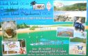
OC-160.jpgOC-160 Queensland State (South Coast) North group34 viewsHook Island is one of the Whitsunday Islands off the coast of the Australian state of Queensland. The island is almost uninhabited, quite rugged and almost completely contained within a section of the Whitsunday Islands National Park . The island has two prominent geographical features on the southern side of Hook Island; the Nara and Macona inlets, two fjord-like recesses that are used as anchorages for the Whitsunday tourist fleet. The island's northern coast is noted for its colourful underwater coral growths, to which snorkelling and diving enthusiasts are attracted.
|
|
OC-201R.jpgOC-201 North Island's Coastal Islands34 viewsWaiheke Island is the most populated and second-largest island in the Hauraki Gulf of New Zealand. Its ferry terminal in Matiatia Bay at the western end is 21.5 km (13.4 mi) from the central-city terminal in Auckland. Waiheke is the second-largest island in the gulf, after Great Barrier Island, and is the most populated island in the gulf, with 9,250 permanent residents.
|
|
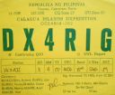
OC-202.jpgOC-202 Calagua Islands34 viewsCalaguas, also known as Calaguas Islands, is a group of islands located in the Philippine province of Camarines Norte. It includes the major islands of Tinaga Island and Guintinua Island, the minor Maculabo Island, as well as several other minor.The islands are around 200 km away from the capital city of Manila and can be accessed through the ports at Daet, Camarines Norte.
|
|
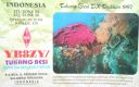
oc-219.jpgOC-219 Tukangbesi Islands; Wakatobi Islands34 viewsTukangbesi Islands, is a group of islands off the coast of Sulawesi immediately east of Buton island in the Banda Sea region, and part of Sulawesi Tenggara. "Tukang Besi" literally means "iron worker" or "blacksmith" in Indonesian. There is a Tukang Besi language. Separating Buton and the group is the Gulf of Kolowana Watabo.
|
|

OC-228R.jpgOC-228 South Australia State East group34 viewsBaudin Rocks is a group of islets on the south east coast of South Australia about 8.3 kilometres (5.2 miles) north-northwest of the town of Robe. The group consists of two major islets and at least 17 smaller islets with a total area about 5 hectares (12 acres). The maximum elevation is 12 metres (39 feet). As of 1996, the smaller northern islet is the most accessible in the group, having a sandy beach on its north-western corner
|
|
Azone30.jpg34 views
|
|

Azone31.jpg34 views
|
|
Azone31r.jpg34 views
|
|
Azone34r.jpg34 views
|
|

Azone39.jpg34 views
|
|

Azone40.jpg34 views
|
|

bzone40r.jpg34 views
|
|

zxv9adxr.jpg34 views
|
|

zzdelst0k5lbur~0.jpg34 views
|
|

y88pols.jpg34 views
|
|

zl5ba.jpg34 views
|
|

zl5dk0gdar.jpg34 views
|
|
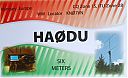
ha0dua.jpgHA0DU - HUNGARY34 viewsworked via F2
|
|

s79gj.jpgS79GJ - Seychelles34 viewsQSO made via EME Moon Bounce - op was w7gj who was in the Seychelles for a 2 week EME dxpedition. He using 8el single yagi with elev to my 8el yagi with no elev
|
|
AL-Madison.jpg34 views
|
|

sv9cvyr~0.jpgsv9cvy - Crete34 viewsvia Winter Es link to Northern hemisphere summer Es
|
|
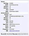
hi3tr.jpgHI - Dominican Republic34 viewsvia f2 post solar flare - many HI stations worked this day
|
|

OH-Knox1.jpg34 views
|
|

lz2xfr.jpgLZ2XF - BULGARIA34 viewsworked via F2
|
|

lz2xf.jpgLZ2XF - BULGARIA34 viewsworked via F2
|
|

hs0znr.jpgHS0ZNR - THAILAND34 viewsvia F2
|
|

AK-Valdez_Cordova_Borough.jpg34 views
|
|
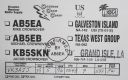
na-168.jpgNA-168 Louisiana State South East (Lafourche to Plaquemines Parish) group33 viewsGrand Isle (French: Grande-ÃŽle) is a town in Jefferson Parish, Louisiana, United States, located on a barrier island of the same name in the Gulf of Mexico. The island is at the mouth of Barataria Bay where it meets the gulf. As of the 2010 census, the town's resident population was 1,296
|
|

na-169r.jpgNA-169 Washington State West group33 viewsWaadah Island is an island situated in the Strait of Juan de Fuca, just north of Neah Bay in northwestern Clallam County, Washington, United States. The island has a land area of 164,940 square meters and has no human population.
|
|
| 15359 files on 384 page(s) |
 |
|
|
|
|
|
|
|
|
191 | |
|
|
|
|
|
|
|
|
 Contact
