 Most viewed |

as-046.jpgAS-046 Malaysia Pahang / Johor State East group109 viewsTioman Island lies off the east coast of Peninsular Malaysia, in the South China Sea.
|
|

as-057r.jpgAS-057 Asiatic Russia Uyedineniya Island109 viewsUyedineniya Island is an island located in the central part of the Kara Sea, roughly midway between Novaya Zemlya and Severnaya Zemlya. Its latitude is 77° 29' N and its longitude 82° 30' E. It is often labelled as Einsamkeit Island as well as Lonely Island or Solitude Island in English maps
|
|

as-060.jpgAS-060 South Korea Cholla-namdo Province group109 viewsJeju Island (Korean: ì œì£¼ë„; Hanja: 濟州島; Korean pronunciation: [tÍ¡É•edÍ¡Ê‘udo]) is an island in the Jeju Province of South Korea. The island lies in the Korea Strait, south of the South Jeolla Province.
|
|

as-066.jpgAS-066 Asiatic Russia Sea of Japan Coast group109 viewsRussky Island is an island in Peter the Great Gulf in the Sea of Japan, in Primorsky Krai, Russia. It is the largest island in the Eugénie Archipelago, separated from the Muravyov-Amursky Peninsula
|
|
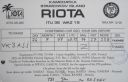
AS-095R.jpgAS-095 Asiatic Russia Bering Sea Coast South group109 viewsThe island is located in the Avacha bay of the Pacific ocean, not far from the Avacha inlet passage, opposite the Big and the Small Sarannaya bays.
|
|

AS-098R.jpgAS-098 Turkey Aydin / Mugla Province group109 viewsKara Ada, is a small Turkish island at the entrance of the harbor of Bodrum in the Aegean Sea. It is a popular tourist destination, particularly for yachting
|
|

AS-116.jpgAS-116 China Huang Yan Island (Scarborough Reef)109 viewsScarborough Shoal, also known as Panatag Shoal, Bajo de Masinloc, Huangyan Islets, and Democracy Reef are two rocks in a shoal located between the Macclesfield Bank and Luzon island in the South China Sea. It is a disputed territory claimed by the People's Republic of China, the Republic of China, and the Philippines.
|
|

as-123r.jpgAS-123 Turkey Icel / Adana / Hatay Province group109 viewsThe 7 hectares (17 acres) islet is located 200 metres (660 ft) off shore from the main land facing a small settlement with the same name. Administratively it is a part of İmamuşağı village of Silifke district which is a part of Mersin Province. It is at 36°16′02″N 33°49′36″E. The distance from the main land to Silifke is 17 kilometres (11 mi) and to Mersin is 100 kilometres (62 mi).
|
|

AS-166.jpgAS-166 Iran Hormozgan Province group109 viewsKish is a 91.5-square-kilometre resort island in Bandar Lengeh County, HormozgÄn Province off the southern coast of Iran in the Persian Gulf. Owing to its free trade zone status, the island is touted as a consumer's paradise, with numerous malls, shopping centres, tourist attractions, and resort hotels.
|
|

eu-016r.jpgEU-016 Serbia Croatia Dalmatia South group109 viewsHvar is a Croatian island in the Adriatic Sea, located off the Dalmatian coast, lying between the islands of BraÄ, Vis and KorÄula. Approximately 68 km (42.25 mi) long, with a high east-west ridge of Mesozoic limestone and dolomite, the island of Hvar is unusual in the area for having a large fertile coastal plain, and fresh water springs.
|
|

4O3AR~0.jpg109 views
|
|

4W6GH.jpg109 views
|
|

3D2XXR~0.jpg109 views
|
|

3x2dzr.jpg109 views
|
|

9m6xrop.jpg9m6xro - Sabah109 viewsQSO probably via Es
|
|

OC-018R.jpgOC-018 Banaba Island109 viewsBanaba Island, an island in the Pacific Ocean, is a solitary raised coral island west of the Gilbert Island chain and 185 miles (298 km) east of Nauru. It is part of the Republic of Kiribati. It has an area of 6.0 km2, and the highest point on the island is also the highest point in Kiribati, at 81 metres (266 ft) high.[3] Along with Nauru and Makatea (French Polynesia), it is one of the important elevated phosphate-rich islands of the Pacific
|
|

5I5TTR.jpg109 views
|
|

as-051.jpgAS-051 Spratly Islands108 viewsThe Spratly Islands are a disputed group of islands, islets and cays and more than 100 reefs, sometimes grouped in submerged old atolls, in the South China Sea. The archipelago lies off the coasts of the Philippines, Malaysia, and southern Vietnam
|
|

as-057.jpgAS-057 Asiatic Russia Uyedineniya Island108 viewsUyedineniya Island is an island located in the central part of the Kara Sea, roughly midway between Novaya Zemlya and Severnaya Zemlya. Its latitude is 77° 29' N and its longitude 82° 30' E. It is often labelled as Einsamkeit Island as well as Lonely Island or Solitude Island in English maps
|
|

AS-064R.jpgAS-064 Asiatic Russia Bering Sea Coast Centre group108 viewsKaraginsky Island is an island in the Karaginsky Gulf of the Bering Sea. The 40 km-wide strait between the Kamchatka Peninsula and this island is called Litke Strait. Karaginsky Island is a Ramsar site. Even though the island is uninhabited, the Karagin Koryaks have traditionally lived in Karaginskiy Island. Migrant reindeer herders still live in temporary shelters on the island. The island is 101 km long and up to 27 km wide, with an area of 2,404 km².
|
|
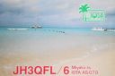
AS-079.jpgAS-079 Japan Miyako Islands108 viewsThe Miyako Islands are a group of islands in Okinawa Prefecture, Japan, east of the Yaeyama Islands. They are situated between the Ryukyu Islands and Taiwan.
|
|

AS-081R.jpgAS-081 South Korea Kyongsang-bukto / Kyongsang-namdo Province group108 viewsKadok island is South Korea's third largest and is located near the city of Busan
|
|
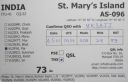
AS-096R.jpgAS-096 India Karnataka State group108 viewsSt. Mary's Islands, also known as Coconut Island and Thonsepar, are a set of four small islands in the Arabian Sea off the coast of Malpe in Udupi, Karnataka, India. They are known for their distinctive geological formation of columnar basaltic lava.
|
|

AS-101.jpgAS-101 Thailand Malay Peninsula East group108 viewsKo Samui, Thailand’s second largest island, lies in the Gulf of Thailand off the east coast of the Kra Isthmus. It's known for its palm-fringed beaches, coconut groves and dense, mountainous rainforest
|
|

AS-109R.jpgAS-109 Asiatic Russia Obskaya Gulf group108 viewsNarechi Island is located in the Obskaya Gulf, a bay of the Arctic Ocean, located in Northern Russia at the mouth of the Ob River. It is the world's longest estuary
|
|

AS-117R.jpgAS-117 Japan Honshu's Coastal Islands West108 viewsInnoshima island sits between Mukaishima and Ikuchijima islands. near the city of Hiroshima. It is now linked by bridge to the mainland
|
|

AS-136.jpgAS-136 China Shanghai Province group108 viewsThe islands of Shanghai are those under the jurisdiction of the Shanghai municipal government. They comprise three large inhabited islands and a shifting number of smaller, uninhabited ones.
|
|
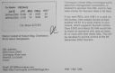
AS-140R.jpgAS-140 Bangladesh Khulna / Barisal Region group108 viewsBhola Island (also called Dakhin Shahbazpur) is the largest island of Bangladesh with an area of 1441 km². It is most of the land area of Bhola District in Barisal Division. It is situated at the mouth of the Meghna River. There are ferry and launch services from Dhaka and Barisal.The Island is 130 kilometres (81 miles) long and has a population of 1.7 million
|
|

AS-141.jpgAS-141 China Zhejiang Province South group108 viewsDongtou Island is part of “Hundred Island Countyâ€, and is located at the mouth of the Oujiang River, 16 kilometers away from Wenzhou, facing the East China Sea. Composed of 168 islands,with beautiful mountains and unique sea scenery, Dongtou is a seaside tourist resort
|
|

eu-009.jpgEU-009 Orkney Island108 viewsOrkney, also known as the Orkney Islands, is an archipelago in the Northern Isles of Scotland, situated off the north coast of the isle of Great Britain. Orkney is 10 miles (16 km) north of the coast of Caithness and comprises approximately 70 islands, of which 20 are inhabited. The largest island, Mainland, is often referred to as "the Mainland", and has an area of 523 square kilometres (202 sq mi), making it the sixth-largest Scottish island and the tenth
|
|

eu-013.jpgEU-013 Jersey Island108 viewsJersey, officially the Bailiwick of Jersey , is a Crown dependency located near the coast of Normandy, France.[10] It is the second closest of the Channel Islands to France, after Alderney.
|
|

eu-014r.jpgEU-014 Corsica Island108 viewsCorsica is an island in the Mediterranean Sea and one of the 18 regions of France. It is located southeast of the French mainland and west of the Italian Peninsula, with the nearest land mass being the Italian island of Sardinia to the immediate south. A single chain of mountains makes up two-thirds of the island.
|
|

5r8ey.jpg108 views
|
|

3B8FP.jpg108 views
|
|

3W5KDN.jpg108 views
|
|

3W5KDNR.jpg108 views
|
|

4K8F.jpg108 views
|
|

4U1ITU.jpg108 views
|
|

4s7ahg.jpg108 views
|
|

4u1itua.jpg108 views
|
|
| 15608 files on 391 page(s) |
 |
|
|
|
|
|
|
|
|
19 | |
|
|
|
|
|
|
|
|
 Contact

