 Most viewed |

t32bwr.jpg37 views
|
|

tf8gx.jpg37 views
|
|

tg9usr.jpg37 views
|
|

tn2tr~2.jpg37 views
|
|

tt8jfc~0.jpg37 views
|
|

ty9erb.jpg37 views
|
|

ua2uk2faa.jpg37 views
|
|

ukui8aakr.jpg37 views
|
|
v85ar~1.jpg37 views
|
|

vk9cvk9nyg.jpg37 views
|
|

vk9nsb.jpg37 views
|
|

vk9xtr~0.jpg37 views
|
|

vp6brb.jpg37 views
|
|

vp6brr~3.jpg37 views
|
|
vq9lw.jpg37 views
|
|

vs6agr.jpg37 views
|
|

vu4nro~2.jpg37 views
|
|

vu7kvb.jpg37 views
|
|
xe2pg.jpg37 views
|
|

xe2pgr.jpg37 views
|
|
xw8kplr~0.jpg37 views
|
|
yj8rw.jpg37 views
|
|
yl3ggp.jpg37 views
|
|

ynht3a.jpg37 views
|
|

z8st0rr.jpg37 views
|
|

oc-030r.jpgOC-030 Midway Islands37 viewsMidway Atoll is a 2.4-square-mile (6.2 km2) atoll in the North Pacific Ocean at 28°12′N 177°21′W. Midway is roughly equidistant between North America and Asia. Midway continues to be the only island in the Hawaiian archipelago that is not part of the state of Hawaii. Approximately 40 to 60 people live on the atoll, which includes staff of the U.S. Fish and Wildlife Service and contract workers
|
|

OC-035.jpgOC-035 Vanuatu37 viewsVanuatu, officially the Republic of Vanuatu, is a Pacific island country located in the South Pacific Ocean. The archipelago, which is of volcanic origin, is 1,750 kilometres (1,090 mi) east of northern Australia, 540 kilometres (340 mi) northeast of New Caledonia, east of New Guinea, southeast of the Solomon Islands,
|
|
OC-035R.jpgOC-035 Vanuatu37 viewsVanuatu, officially the Republic of Vanuatu, is a Pacific island country located in the South Pacific Ocean. The archipelago, which is of volcanic origin, is 1,750 kilometres (1,090 mi) east of northern Australia, 540 kilometres (340 mi) northeast of New Caledonia, east of New Guinea, southeast of the Solomon Islands,
|
|
OC-036.jpgOC-036 New Zealand North Island37 viewsThe North Island, also officially named Te Ika-a-MÄui, is one of the two main islands of New Zealand, separated from the larger but much less populous South Island by Cook Strait. The island's area is 113,729 square kilometres (43,911 sq mi), making it the world's 14th-largest island. It has a population of 3,749,200 (June 2018).
|
|

oc-037r.jpgOC-037 Campbell Island37 viewsCampbell Island / Motu Ihupuku is an uninhabited subantarctic island of New Zealand, and the main island of the Campbell Island group. It covers 112.68 square kilometres (43.51 sq mi) of the group's 113.31 km2 (43.75 sq mi), and is surrounded by numerous stacks, rocks and islets like Dent Island, Folly Island (or Folly Islands), Isle de Jeanette-Marie, and Jacquemart Island, the latter being the southernmost extremity of New Zealand. The island is mountainous, rising to over 500 metres (1,640 ft) in the south. A long fjord, Perseverance Harbour, nearly bisects it, opening out to sea on the east coast.
|
|

OC-038R.jpgOC-038 Chatham Islands37 viewsThe Chatham Islands are a New Zealand archipelago in the Pacific Ocean about 800 kilometres (500 mi) east of the South Island of New Zealand. The archipelago consists of about ten islands within an approximate 60-kilometre (37 mi) radius, the largest of which are Chatham Island and Pitt Island. Some of these islands, formerly cleared for farming, are now preserved as nature reserves to conserve some of the unique flora and fauna. As of 2013 the islands had a resident population of 600.
|
|

OC-041.jpgOC-041 Ninigo group37 viewsThe Ninigo Islands are a group of 31 islands within the Western Islands of the Bismarck Archipelago, Papua New Guinea. Their coordinates are WikiMiniAtlas1°16′S 144°15′ECoordinates: 1°16′S 144°15′E.
|
|
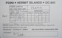
OC-041R.jpgOC-041 Ninigo group37 viewsThe Ninigo Islands are a group of 31 islands within the Western Islands of the Bismarck Archipelago, Papua New Guinea. Their coordinates are WikiMiniAtlas1°16′S 144°15′ECoordinates: 1°16′S 144°15′E.
|
|

OC-048.jpgOC-048 Tokelau Islands37 viewsTokelau previously known as the Union Islands, is a dependent territory of New Zealand in the southern Pacific Ocean. It consists of three tropical coral atolls (Atafu, Nukunonu and Fakaofo), with a combined land area of 10 km2 (4 sq mi). The capital rotates yearly between the three atolls. Tokelau lies north of the Samoan Islands, east of Tuvalu, south of the Phoenix Islands, southwest of the more distant Line Islands
|
|

OC-054R.jpgOC-054 Wallis Islands37 viewsWallis is a Polynesian island in the Pacific Ocean belonging to the French overseas collectivity of Wallis and Futuna. It lies north of Tonga, northeast of Fiji, east-northeast of the Hoorn Islands, east of Fiji's Rotuma, southeast of Tuvalu, southwest of Tokelau and west of Samoa. Its area is almost 100 km2 (39 sq mi) with almost 11,000 people. Its capital is MatÄÊ»utu.
|
|

OC-059R.jpgOC-059 Kosrae Island37 viewsKosrae formerly known as Kusaie or Strong's Island, is an island in Federated States of Micronesia. The State of Kosrae is one of the four states of the Federated States of Micronesia, and includes the main island of Kosrae and a few nearby islands and islets, the most significant of which is inhabited (1,500 people) Lelu Island.
|
|

OC-060.jpgOC-060 Rotuma Island37 viewsRotuma is a Fijian dependency, consisting of Rotuma Island and nearby islets. The island group is home to a large and unique indigenous ethnic group which constitutes a recognisable minority within the population of Fiji, known as "Rotumans". Its population at the 2007 census was 2,002, although many more Rotumans live on mainland Fijian islands, totaling 10,000.
|
|

oc-069.jpgOC-069 Lihir group37 viewsLihir Group is an island group in Papua New Guinea, located north of New Ireland, at 3°S 152.583333°ECoordinates: 3°S 152.583333°E. It is a part of Bismarck Archipelago. Largest island of the group is Lihir (a.k.a. Niolam), other islands include: Mali, Mahur, Masahet and Sanambiet.
|
|
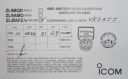
OC-074R.jpgOC-074 Auckland Islands37 viewsThe Auckland Islands are an archipelago of New Zealand, lying 465 kilometres (290 mi) south of the South Island. The main Auckland Island, occupying 510 km2 (200 sq mi), is surrounded by smaller Adams Island, Enderby Island, Disappointment Island, Ewing Island, Rose Island, Dundas Island, and Green Island, with a combined area of 625 km2 (240 sq mi). The islands have no permanent human inhabitants.
|
|
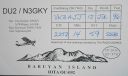
OC-092.jpgOC-092 Babuyan Islands37 viewsThe Babuyan Islands, is an archipelago in the Philippines, located in the Luzon Strait north of the main island of Luzon and south of Taiwan via Bashi Channel to Luzon Strait. The archipelago consists of five major islands and their surrounding smaller islands. These main islands are, counterclockwise starting from northeast, Babuyan, Calayan, Dalupiri, Fuga, and Camiguin. The Babuyan Islands are separated from Luzon by the Babuyan Channel
|
|
| 15650 files on 392 page(s) |
 |
|
|
|
|
|
|
|
|
188 | |
|
|
|
|
|
|
|
|
 Contact

