 Most viewed |

OC-142.jpgOC-142 Queensland State (South Coast) Centre group37 viewsHeron Island is a coral cay located near the Tropic of Capricorn in the southern Great Barrier Reef, 80 kilometres north-east of Gladstone, Queensland, Australia, and 460 km north-north-west of the state capital Brisbane.
|
|

OC-142R.jpgOC-142 Queensland State (South Coast) Centre group37 viewsHeron Island is a coral cay located near the Tropic of Capricorn in the southern Great Barrier Reef, 80 kilometres north-east of Gladstone, Queensland, Australia, and 460 km north-north-west of the state capital Brisbane.
|
|
OC-156.jpgOC-156 Yasawa group37 viewsThe Yasawa Group is an archipelago of about 20 volcanic islands in the Western Division of Fiji, with an approximate total area of 135 square kilometres (52 sq mi). Areas of the Yasawas were the locales for both the 1949, and 1980 filming of the romance adventure film The Blue Lagoon
|
|

OC-157.jpgOC-157 Banda Islands37 viewsThe Banda Islands) are a volcanic group of ten small volcanic islands in the Banda Sea, about 140 km (87 mi) south of Seram Island and about 2,000 km (1,243 mi) east of Java, and constitute an administrative district (kecamatan) within the Central Maluku Regency in the Indonesian province of Maluku. The main town and administrative centre is Bandanaira, located on the island of the same name. They rise out of 4-to-6-kilometre (2.5 to 3.7 mi) deep ocean.
|
|

OC-159R.jpgOC-159 Mangaia Island37 viewsMangaia (traditionally known as A'ua'u Enua, which means terraced) is the most southerly of the Cook Islands and the second largest, after Rarotonga. Geologists estimate the island is at least 18 million years old, making it the oldest in the Pacific. It rises 4750 m (15,600 ft) above the ocean floor and has a land area of 51.8 km. The population of Mangaia comprises about 700 people.
|
|

OC-161.jpgOC-161 Nias and Batu Islands37 viewsNias is an island located off the western coast of Sumatra, Indonesia. Nias is also the name of the archipelago (Kepulauan Nias) of which the island is the centre, but also includes the Batu Islands to the south-east and the small Hinako Islands to the west. Nias Island covers an area of 5,121.3 km2 (1,977.3 sq mi) (including the minor offshore islands). It is mostly a lowland area rising to around 800 m (2,600 ft) above sea level. There were 756,338 inhabitants
|
|

OC-163.jpgOC-163 Vanikolo and Utupua Islands37 viewsVanikoro (sometimes wrongly named Vanikolo) is an island in the Santa Cruz group, located 118 kilometres (73 miles) to the Southeast of the main Santa Cruz group. It is part of the Temotu Province of the Solomon Islands. Technically it is a group of several nearby islands surrounded by a single belt of coral reef. Only the two major islands are inhabited: the bigger one Banie and the smaller one Teanu (or Tevai).
|
|

OC-166.jpgOC-166 Kalimantan's Coastal Islands East37 viewsThe Derawan Islands are in the province of East Kalimantan in Indonesia. They consist of 31 islands, most well known among these are the islands of Derawan, Maratua, Sangalaki and Kakaban. There are also numerous submerged reefs and islets. They are located in the Sulawesi Sea, on the coastal shelf of East Kalimantan
|
|

OC-169.jpgOC-169 Ha'apai group37 viewsHaʻapai is a group of islands, islets, reefs and shoals with an area of 109.30 square kilometres (42.20 sq mi) in the central part of the Kingdom of Tonga, with the Tongatapu group to the south and the Vavaʻu group to the north. Seventeen of the Haʻapai islands are populated with altogether 6,616 people. Its highest point is Kao at almost 1,050 metres (3,440 ft). Pangai is the administrative capital village of the Haʻapai Group and is located on Lifuka.
|
|

OC-175.jpgOC-175 Sarangani Islands37 viewsBalut, Sarangani and Olanivan Islands make up the island group known as the Sarangani Islands. They are volcanic islands south of the tip of Davao Occidental province in the Mindanao region, Southern Philippines.
|
|

OC-175R.jpgOC-175 Sarangani Islands37 viewsBalut, Sarangani and Olanivan Islands make up the island group known as the Sarangani Islands. They are volcanic islands south of the tip of Davao Occidental province in the Mindanao region, Southern Philippines.
|
|

OC-176R.jpgOC-176 Chesterfield Islands37 viewsChesterfield Islands are a French archipelago of New Caledonia located in the Coral Sea, 550 km northwest of Grande Terre, the main island of New Caledonia. The archipelago is 120 km long and 70 km broad, made up of 11 uninhabited islets and many reefs. The land area of the islands is less than 10 km²
|
|

OC-184R.jpgOC-184 Brunei's Coastal Islands37 viewsPulau Muara Besar is an island connected to the Brunei mainland via a dual-carriageway bridge which connects the island in Brunei Bay, with the mainland of Brunei via Serasa in Brunei-Muara District. The bridge is part of the road infrastructure that will serve the petrochemical refinery plant on the island, which is currently under construction, and is a Chinese foreign direct investment
|
|
OC-189.jpgOC-189 Ringgold Islands37 viewsThe Ringgold Isles are an archipelago in Fiji, forming an outlier group to Vanua Levu. The Budd, Nukusemanu, and Heemskercq Reefs form part of the group. The group is mostly uninhabited, but Qelelevu has a small village.
|
|

OC-194.jpgOC-194 New South Wales State North group37 viewsSouth Solitary Island is an island within the Solitary Islands Marine Park, about 15 kilometres (9.3 mi) northeast of Coffs Harbour, New South Wales, Australia. The lighthouse located on the summit of the island is considered the most isolated lighthouse on the New South Wales coast. The island is uninhabited
|
|

OC-194R.jpgOC-194 New South Wales State North group37 viewsSouth Solitary Island is an island within the Solitary Islands Marine Park, about 15 kilometres (9.3 mi) northeast of Coffs Harbour, New South Wales, Australia. The lighthouse located on the summit of the island is considered the most isolated lighthouse on the New South Wales coast. The island is uninhabited
|
|

OC-198.jpgOC-198 Northern Territory (Gulf of Carpentaria) South group37 viewsBarranyi (North Island) National Park is in the Gulf of Carpentaria in the Northern Territory of Australia, 737 km southeast of Darwin.
|
|

OC-199.jpgOC-199 Western Australia State (N.W. Coast) Centre group37 viewsRosemary Island is an island in the Dampier Archipelago in the Pilbara region of Western Australia. With Enderby Island it forms Class A Nature Reserve 36915, part of a proposed national park. In 2016, archaeologists from the University of Western Australia excavated ancient rock shelters on Rosemary Island, between 8000 and 9000 years old. They may be the earliest known domestic structures in Australia
|
|

OC-204R.jpgOC-204 Enggano Island37 viewsEnggano Island is about 100 km (60 mi) southwest of Sumatra, Indonesia. It is one of the 92 officially listed outlying islands of Indonesia. Enggano is about 35 kilometres (22 miles) long from east to west and about 16 kilometres (9.9 miles) wide from north to south. The three largest towns on the island are Barhau, Kabuwe and Kayaapu
|
|

OC-213.jpgOC-213 Togian Islands37 viewsThe Togian Islands are an archipelago of 56 islands and islets, in the Gulf of Tomini, off the coast of Central Sulawesi, in Indonesia. The three largest islands are Batudaka, Togean, and Talakatoh. There are 37 villages on the islands, with one settled by the Bajau people, more commonly known as the sea gypsies
|
|

OC-218.jpgOC-218 Matthew and Hunter Islands37 viewsThe Matthew Island and Hunter Island are two small and uninhabited high islands in the South Pacific, located 300 kilometres (190 mi) east of New Caledonia and south-east of Vanuatu archipelago. Hunter Island and Matthew Island, 70 km (43 mi) apart, are claimed by Vanuatu as part of Tafea Province, and considered by the people of Aneityum part of their custom ownership, and as of 2007 were claimed by France as part of New Caledonia.
|
|

OC-229.JPGOC-229 Northern Territory (Arafura Sea Coast) Centre group37 viewsWarruwi is the main township on South Goulburn Island, approximately 300km east of Darwin at the eastern base of the Coburg Peninsula. The island has a stunning mix of natural landscapes including pristine beaches, rocky outcrops and sweeping marshlands, harbouring an abundance of wildlife. The community has approximately 400 residents
|
|

OC-242.jpgOC-242 Bonerate and Taka' Bonerate Islands37 viewsThe Taka Bonerate Islands in Indonesia consist of Latondu, Rajuni, Tinabo, Pasi Telu, and Taka Lumungan. They lie about 3 to 4 hours by boat from Benteng, the administrative capital of the Selayar Islands. Together they make up the Takabonerate District of Selayar Regency in South Sulawesi Province. It is part of a National Marine Park, with dive sites, pelagic fishes, dolphins, turtles, many soft corals, sea fans. Also it is the third largest atoll in the world
|
|
OC-244R.jpgOC-244 Luzon's Coastal Islands37 viewsMindoro is the seventh largest island in the Philippines by land area with a total of 10,571 km² and with a total population of 1,331,473 as of 2015. It is located off the southwestern coast of Luzon and northeast of Palawan.
|
|
OC-250R.jpgOC-250 Masalembu Islands37 viewsThe Masalembu Islands lie in the Java Sea to the north of Madura, about halfway between Madura and Borneo. The Madurese language is spoken on the islands. The three main islands are Masalembu Island, Masakambing Island, and Karamian Island. The land area of the district is 40.85 square km, and they had a population of 20,687 people in the 2000 census
|
|

OC-255.jpgOC-255 Queensland State (Gulf of Carpentaria) North group37 viewsBarn Island also called Parau Island,is located on the eastern side of the Gulf of Carpentaria, Queensland. The island lies just offshore and can be sighted from Umagico, Seisia or Loyalty Beach. The island is uninhabited
|
|
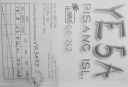
OC-262R.jpgOC-262 Sumatra's Coastal Islands South37 viewsPulau Pisang or “Banana Island†lies just 45 minutes off the coast of Krui, Sumatra, and is also home to some of the best white sand beaches, snorkeling and fishing in the Krui area. The island is home to less than 100 people,
|
|
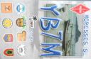
OC-268.jpgOC-268 Laut Kecil Islands37 viewsLaut Kecil Islands is an archipelago in the south of Borneo. Administratively, the islands belong to South Kalimantan province of Indonesia. The main islands include Matasiri, Kalambau, and Kadapongan.
|
|

OC-269.jpgOC-269 Karimata Islands37 viewsThe Karimata Islands are a chain of small islands off the west coast of Indonesian Borneo, the largest of which is (Pulau) Karimata, being about 20 km (12 mi) across (east-west), and situated at 1°37′S 108°53′E. It is part of Kayong Utara in Indonesia. A number of small villages are situated on the coast, the largest of which is Padang, on the eastern tip of the island. The island is renowned by inhabitants of the west coast of Kalimantan to have a serious malaria problem.
|
|

Azone30r.jpg37 views
|
|
Azone31r.jpg37 views
|
|

Azone32.jpg37 views
|
|

Azone36.jpg37 views
|
|

Azone37r.jpg37 views
|
|
Azone39r.jpg37 views
|
|

bzone40r.jpg37 views
|
|

czone40.jpg37 views
|
|

IZONE30R.jpg37 views
|
|

zone37~0.jpg37 views
|
|

vp8hlu1zc~1.jpg37 views
|
|
| 15647 files on 392 page(s) |
 |
|
|
|
|
|
|
|
|
187 | |
|
|
|
|
|
|
|
|
 Contact

