 Most viewed Most viewed |

OC-059R.jpgOC-059 Kosrae Island35 viewsKosrae formerly known as Kusaie or Strong's Island, is an island in Federated States of Micronesia. The State of Kosrae is one of the four states of the Federated States of Micronesia, and includes the main island of Kosrae and a few nearby islands and islets, the most significant of which is inhabited (1,500 people) Lelu Island.
|
|

OC-060.jpgOC-060 Rotuma Island35 viewsRotuma is a Fijian dependency, consisting of Rotuma Island and nearby islets. The island group is home to a large and unique indigenous ethnic group which constitutes a recognisable minority within the population of Fiji, known as "Rotumans". Its population at the 2007 census was 2,002, although many more Rotumans live on mainland Fijian islands, totaling 10,000.
|
|

OC-065R.jpgOC-065 Reef Islands;Swallow Islands35 viewsThe Reef Islands are a loose collection of 16 islands in the northwestern part of the Solomon Islands province of Temotu. These islands have historically also been known by the names of Swallow Islands and Matema Islands. The total population of the Reef Islands is about 5,600, according to 2003 estimates. This includes a Polynesian community, believed to be descendants of people from northern Tuvalu.
|
|
OC-074R.jpgOC-074 Auckland Islands35 viewsThe Auckland Islands are an archipelago of New Zealand, lying 465 kilometres (290 mi) south of the South Island. The main Auckland Island, occupying 510 km2 (200 sq mi), is surrounded by smaller Adams Island, Enderby Island, Disappointment Island, Ewing Island, Rose Island, Dundas Island, and Green Island, with a combined area of 625 km2 (240 sq mi). The islands have no permanent human inhabitants.
|
|

oc-083r.jpgOC-083 Aitutaki group35 viewsAitutaki, also traditionally known as Araʻura and Utataki, is one of the Cook Islands, north of Rarotonga. It has a population of approximately 2,000. Aitutaki is the second most visited island of the Cook Islands. The main village is Arutanga (Arutunga) on the west side.
|
|

OC-104.jpgOC-104 Banks Islands35 viewsThe Banks Islands (in Bislama Bankis) are a group of islands in northern Vanuatu. Together with the Torres Islands to the northwest, they make up the northernmost province of Torba. The group lies about 40 km (25 mi) north of Maewo, and includes Gaua and Vanua Lava, two of the 13 largest islands in Vanuatu. In 2009, the islands supported a population of 8,533 on a land area of 780 km².
|
|

OC-115.jpgOC-115 Trobriand Islands35 viewsThe Trobriand Islands are a 450-square-kilometre (174-square-mile) archipelago of coral atolls off the east coast of New Guinea. They are part of the nation of Papua New Guinea and are in Milne Bay Province. Most of the population of 12,000 indigenous inhabitants live on the main island of Kiriwina, which is also the location of the government station, Losuia.
|
|

OC-118R.jpgOC-118 Hoorn Islands35 viewsThe Hoorn Islands (also Futuna Islands) are one of the two island groups of which the French overseas collectivity (collectivité d'outre-mer, or COM) of Wallis and Futuna is geographically composed. The aggregate area is 115 km², and the population 4,873 (census of 2003).
Geographically, there are two islands: Futuna Island (in the northwest) (83 km², pop. 4871), Alofi Island (in the southeast) (32 km², pop. 2)
|
|

OC-120R.jpgOC-120 Cuyo Islands35 viewsThe Cuyo Archipelago or Cuyo Islands, is a group of about 45 islands lying to the northeast of the Philippines island of Palawan.] It lies south of Mindoro and between Northern Palawan and Panay. It is centered on the largest island of the archipelago, Cuyo Island, with an area of 22 square miles (57 km2) and is about 9 miles (14 km) long.
|
|
OC-124R.jpgOC-124 Palmerston Atoll35 viewsPalmerston Island is a coral atoll in the Cook Islands in the Pacific Ocean about 500 km northwest of Rarotonga. 62 people live on Palmerston, all but three descended from English sailor William Marsters.
|
|
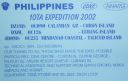
oc-126.jpgOC-126 Lubang Islands35 viewsLubang Island is the largest island in the Lubang Group of Islands, an archipelago which lies to the northwest of the northern end of Mindoro in the Philippines. The Lubang Islands are about 150 kilometres (93 mi) southwest of Manila. There are seven islands in the group,
|
|

OC-130.jpgOC-130 Mindanao Island35 viewsMindanao or still commonly known as Southern Philippines, is the second-largest island in the Philippines. Mindanao and the smaller islands surrounding it make up the island group of the same name. Located in the southern region of the archipelago, as of the 2010 census, the main island was inhabited by 20,281,545 people, while the entire Mindanao island group had an estimated total of 25,537,691 (2018) residents.
|
|
OC-130R.jpgOC-130 Mindanao Island35 viewsMindanao or still commonly known as Southern Philippines, is the second-largest island in the Philippines. Mindanao and the smaller islands surrounding it make up the island group of the same name. Located in the southern region of the archipelago, as of the 2010 census, the main island was inhabited by 20,281,545 people, while the entire Mindanao island group had an estimated total of 25,537,691 (2018) residents.
|
|

OC-142R.jpgOC-142 Queensland State (South Coast) Centre group35 viewsHeron Island is a coral cay located near the Tropic of Capricorn in the southern Great Barrier Reef, 80 kilometres north-east of Gladstone, Queensland, Australia, and 460 km north-north-west of the state capital Brisbane.
|
|
OC-143R.jpgOC-143 Sumatra Island35 viewsSumatra is a large island in western Indonesia that is part of the Sunda Islands. It is the largest island that is located entirely in Indonesia and the sixth-largest island in the world at 473,481 km2 (not including adjacent islands such as the Riau Islands and Bangka Belitung Islands).
|
|

OC-157.jpgOC-157 Banda Islands35 viewsThe Banda Islands) are a volcanic group of ten small volcanic islands in the Banda Sea, about 140 km (87 mi) south of Seram Island and about 2,000 km (1,243 mi) east of Java, and constitute an administrative district (kecamatan) within the Central Maluku Regency in the Indonesian province of Maluku. The main town and administrative centre is Bandanaira, located on the island of the same name. They rise out of 4-to-6-kilometre (2.5 to 3.7 mi) deep ocean.
|
|

OC-158.jpgOC-158 Florida Islands35 viewsThe Nggela Islands, also known as the Florida Islands, are a small island group in the Central Province of Solomon Islands, a sovereign state (since 1978) in the southwest Pacific Ocean. The chain is composed of four larger islands and about 50 smaller islands.
|
|

OC-161R.jpgOC-161 Nias and Batu Islands35 viewsNias is an island located off the western coast of Sumatra, Indonesia. Nias is also the name of the archipelago (Kepulauan Nias) of which the island is the centre, but also includes the Batu Islands to the south-east and the small Hinako Islands to the west. Nias Island covers an area of 5,121.3 km2 (1,977.3 sq mi) (including the minor offshore islands). It is mostly a lowland area rising to around 800 m (2,600 ft) above sea level. There were 756,338 inhabitants
|
|

OC-169.jpgOC-169 Ha'apai group35 viewsHaʻapai is a group of islands, islets, reefs and shoals with an area of 109.30 square kilometres (42.20 sq mi) in the central part of the Kingdom of Tonga, with the Tongatapu group to the south and the Vavaʻu group to the north. Seventeen of the Haʻapai islands are populated with altogether 6,616 people. Its highest point is Kao at almost 1,050 metres (3,440 ft). Pangai is the administrative capital village of the Haʻapai Group and is located on Lifuka.
|
|
OC-169R.jpgOC-169 Ha'apai group35 viewsHaʻapai is a group of islands, islets, reefs and shoals with an area of 109.30 square kilometres (42.20 sq mi) in the central part of the Kingdom of Tonga, with the Tongatapu group to the south and the Vavaʻu group to the north. Seventeen of the Haʻapai islands are populated with altogether 6,616 people. Its highest point is Kao at almost 1,050 metres (3,440 ft). Pangai is the administrative capital village of the Haʻapai Group and is located on Lifuka.
|
|

OC-170.jpgOC-170 Western Australia State (South Coast) East Centre group35 viewsWoody Island is an island off the south coast in the Goldfields-Esperance region of Western Australia. The island located 15 kilometres (9 mi) from the town of Esperance, Western Australia. The island is part of the Recherche Archipelago and is listed as a nature reserve.[2] The island itself is reasonably small in size, about 1.5 km (0.93 mi) in length with a total area of 240 hectares (593 acres)
|
|

OC-171.jpgOC-171 Queensland State (North Coast) South group35 viewsPalm Island is an Aboriginal community located on Great Palm Island, also called by the Aboriginal name "Bwgcolman", an island on the Great Barrier Reef in North Queensland, Australia. The settlement is also known by a variety of other names including "the Mission", Palm Island Settlement or Palm Community.
|
|
OC-178.jpgOC-178 Tikopia and Anuta Islands35 viewsTikopia is a small high island in the southwestern Pacific Ocean. It is part of the Solomon Islands of Melanesia, but is culturally Polynesian.
Tikopia's location is relatively remote. It is sometimes grouped with the Santa Cruz Islands. Administratively, Tikopia belongs to Temotu Province as the southernmost of the Solomon Islands.
|
|

oc-182.jpgOC-182 Ducie Island35 viewsDucie Island is an uninhabited atoll in the Pitcairn Islands. It lies 575 kilometres east of Pitcairn Island, and 300 kilometres east of Henderson Island, and has a total area of 1.5 square miles, which includes the lagoon. It is 1.5 miles long, measured northeast to southwest, and about 1 mile wide
|
|
OC-189.jpgOC-189 Ringgold Islands35 viewsThe Ringgold Isles are an archipelago in Fiji, forming an outlier group to Vanua Levu. The Budd, Nukusemanu, and Heemskercq Reefs form part of the group. The group is mostly uninhabited, but Qelelevu has a small village.
|
|

OC-195.jpgOC-195 Furneaux group35 viewsThe Furneaux Group (indigenous name: Tayaritja[1][2]) is a group of approximately 100 islands located at the eastern end of Bass Strait, between Victoria and Tasmania, Australia. The largest islands in the group are Flinders Island, Cape Barren Island, and Clarke Island. The group contains five settlements: Killiecrankie, Emita, Lady Barron, Cape Barren Island, and Whitemark on Flinders Island, which serves as the administrative centre of the Flinders Council. There are also some small populated ranches on the remote islands.
|
|
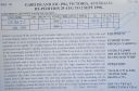
OC-196R.jpgOC-196 Victoria State East group35 viewsGabo Island is a 154-hectare (380-acre) island located off the coast of eastern Victoria, Australia, between Mallacoota and Cape Howe on the border with New South Wales. It is separated from the mainland by a 500-metre (1,600 ft) wide channel. Gabo Island is a shipping reference commonly referred to in Victorian weather warnings issued by the Australian Bureau of Meteorology. Gabo Island is well known for its historic lighthouse. This lighthouse, Australia's second tallest, was completed in 1862 and made from pink granite quarried from the island itself.
|
|
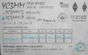
OC-197R.jpgOC-197 Bawean Island35 viewsBawean (Indonesian: Pulau Bawean) is an island of Indonesia located approximately 150 km north of Surabaya in the Java Sea, off the coast of Java. It is administered by Gresik Regency of East Java province. It is approximately 15 km in diameter and is circumnavigated by a single narrow road. Bawean is dominated by an extinct volcano at its center that rises to 655 m above sea level. Its population as of the 2010 Census is about 70,000 people
|
|

OC-198.jpgOC-198 Northern Territory (Gulf of Carpentaria) South group35 viewsBarranyi (North Island) National Park is in the Gulf of Carpentaria in the Northern Territory of Australia, 737 km southeast of Darwin.
|
|
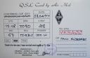
OC-209R.jpgOC-209 Talaud Islands35 viewsTalaud Islands (Indonesian: Kepulauan Talaud) is a group of islands located north of Sulawesi island in Indonesia, north-east of the Sangihe Islands. The Talaud Islands are also the northernmost region of Eastern Indonesia, bordering south of the Philippines' Davao Region. The group, with a total area of 495 square miles (1,281 square km), includes Karakelong (the largest), Salebabu, Kaburuang, and numerous islets. The coast of Karakelong Island is steep except on the southern shore, which is fringed by a wide reef. The seven tiny Nanusa Islands lie north-east of Karakelong. They are forested and with hills rising to 2,231 feet (680 metres).
|
|

OC-210.jpgOC-210 Sangihe Islands35 viewsThe Sangihe Islands are a group of islands which constitute two regencies within the province of North Sulawesi, in northern Indonesia, the Sangihe Islands Regency (Kabupaten Kepulauan Sangihe) and the Sitaro Islands Regency (Kabupaten Siau Tagulandang Biaro). They are located north-east of Sulawesi between the Celebes Sea and the Molucca Sea, roughly halfway between Sulawesi and Mindanao, in the Philippines.
|
|
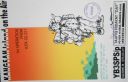
OC-217.jpgOC-217 Kangean Islands35 viewsThere are 38 Kangean Islands altogether with 6 inhabited, forming an archipelago that is part of Indonesia covering a total space of 668 square km. They are located in the Java Sea approximately 120 km north of Bali and 120 km east of Madura Island.
|
|
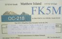
OC-218.jpgOC-218 Matthew and Hunter Islands35 viewsThe Matthew Island and Hunter Island are two small and uninhabited high islands in the South Pacific, located 300 kilometres (190 mi) east of New Caledonia and south-east of Vanuatu archipelago. Hunter Island and Matthew Island, 70 km (43 mi) apart, are claimed by Vanuatu as part of Tafea Province, and considered by the people of Aneityum part of their custom ownership, and as of 2007 were claimed by France as part of New Caledonia.
|
|

OC-242.jpgOC-242 Bonerate and Taka' Bonerate Islands35 viewsThe Taka Bonerate Islands in Indonesia consist of Latondu, Rajuni, Tinabo, Pasi Telu, and Taka Lumungan. They lie about 3 to 4 hours by boat from Benteng, the administrative capital of the Selayar Islands. Together they make up the Takabonerate District of Selayar Regency in South Sulawesi Province. It is part of a National Marine Park, with dive sites, pelagic fishes, dolphins, turtles, many soft corals, sea fans. Also it is the third largest atoll in the world
|
|

OC-248.jpgOC-248 Sonsorol Islands35 viewsSonsorol is one of the sixteen states of Palau. The administrative center, and only village, is Dongosaru on Sonsorol island. The inhabitants speak Sonsorolese, a local Trukic language, and Palauan. Sonsorol Island, also called Dongosaro or Dongosaru, is encircled by a coral reef extending 160 to 480 m offshore. It is 2 km long north south, and up to 890 m wide in the north. It is located 1.6 km south of Fanna Island. The village of Dongosaro, which is the capital of the state, is located on the west coast. The island is thickly wooded with coconut palms and other trees. Together with Fanna, it forms the Sonsorol Islands.
|
|

OC-269.jpgOC-269 Karimata Islands35 viewsThe Karimata Islands are a chain of small islands off the west coast of Indonesian Borneo, the largest of which is (Pulau) Karimata, being about 20 km (12 mi) across (east-west), and situated at 1°37′S 108°53′E. It is part of Kayong Utara in Indonesia. A number of small villages are situated on the coast, the largest of which is Padang, on the eastern tip of the island. The island is renowned by inhabitants of the west coast of Kalimantan to have a serious malaria problem.
|
|

Azone28r.jpg35 views
|
|

Azone36r.jpg35 views
|
|

Azone37r.jpg35 views
|
|
Azone39r.jpg35 views
|
|
| 15359 files on 384 page(s) |
 |
|
|
|
|
|
|
|
|
185 | |
|
|
|
|
|
|
|
|
 Contact
