 Most viewed Most viewed |

na-156.jpgNA-156 Nunavut (Hudson Bay - Quebec Coast) North West group35 viewsPitsiulartok or Pituilaktok (formerly: Fairway Island),[1] is a small, uninhabited island located at 63°15'N, 90°33'W[2] in Hudson Bay, about 13 km[3] from the community of Chesterfield Inlet, Nunavut, Canada. The narrow island is about 3.5 km in length and barely 1 km wide at its widest point. Traditionally it was a walrus-hunting ground for the local Inuit,[2] and a landmark for southern whalers.[4] It is part of a loose chain of small islands running along the coast, including Sakpik Island and Promise Island.
|
|
na-157r.jpgNA-157 Valdez-Cordova Census Area East group35 viewsKayak Island, (Eyak: Qe'yiłteh) which includes the Bering Expedition Landing Site, is located in the Gulf of Alaska, 100 km (62 mi) SE of Cordova, Alaska Malaspina Coastal Plain, on the eastern edge of Chugach National Forest. It has a land area of 73.695 km² (28.454 sq mi) and no population.
|
|

na-158.jpgNA-158 Kenai - Cook Inlet group35 viewsKalgin Island is an island in Cook Inlet of the Gulf of Alaska, southwest of the city of Kenai, Alaska, United States. It is part of the Kenai Peninsula Borough and has a land area of 58.722 km² (22.673 sq mi), is 11.5 nm long and reported an official resident population of one person as of the 2000 census.
|
|

na-164r.jpgNA-164 Mexico Baja California Sur State North West group35 viewsIsla Ascuncion is on the Pacific Coast in the central part of Baja California, Mexico near the town of Punta Ascuncion.
|
|
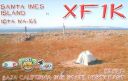
na-165.jpgNA-165 Mexico Baja California Sur State North East group35 viewsIslas Santa Inez is an island in the Gulf of California east of the Baja California Peninsula. The island is uninhabited and is part of the Mulegé Municipality in the Mexican state of Baja California Sur.
|
|
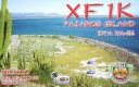
na-166.jpgNA-166 Mexico Sonora State South group35 viewsPajaros Island is located 5 km south of the town of Guaymas on the eastern side of the Gulf of California. It has very steep cliffs and is covered by cacti
|
|

na-166r.jpgNA-166 Mexico Sonora State South group35 viewsPajaros Island is located 5 km south of the town of Guaymas on the eastern side of the Gulf of California. It has very steep cliffs and is covered by cacti
|
|
na-167.jpgNA-167 Mexico Sonora State North group35 viewsEl Pelicano Island is located in the mouth of the Colorado river on the Pacific coast of Mexico. The island is uninhabited
|
|

na-170.jpgNA-170 Panama San Blas Province group35 viewsGaigirgordub, called El Porvenir (Spanish pronunciation: [el poɾ.βeˈniɾ]) until July 1, 2016, is the capital of the Panamanian comarca (indigenous territory) of Guna Yala. The settlement is located on a small island and contains a landing strip, a museum (the Museo de la Nación Guna, or Museum of the Guna Nation), a hotel, government offices, and an artisans' cooperative. There is also a small beach.
|
|

na-170r.jpgNA-170 Panama San Blas Province group35 viewsGaigirgordub, called El Porvenir (Spanish pronunciation: [el poɾ.βeˈniɾ]) until July 1, 2016, is the capital of the Panamanian comarca (indigenous territory) of Guna Yala. The settlement is located on a small island and contains a landing strip, a museum (the Museo de la Nación Guna, or Museum of the Guna Nation), a hotel, government offices, and an artisans' cooperative. There is also a small beach.
|
|

na-171r.jpgNA-171 Mexico Sinaloa State group35 viewsIsla de Venados (Deer Island) is a small island off the coast of Mazatlan, Mexico
|
|

na-175.jpgNA-175 Nunavut (Kitikmeot Region) West Centre group35 viewsThe Couper Islands are an island group located inside western Coronation Gulf, south of Victoria Island, in the Kitikmeot Region, Nunavut, Canada.
|
|

na-175r.jpgNA-175 Nunavut (Kitikmeot Region) West Centre group35 viewsThe Couper Islands are an island group located inside western Coronation Gulf, south of Victoria Island, in the Kitikmeot Region, Nunavut, Canada.
|
|

na-176.jpgNA-176 Quebec Province (St Lawrence Gulf) Centre group35 viewsThe Mingan Archipelago is an archipelago located east of Quebec, Canada. It consists of a chain of about 40 islands.
|
|
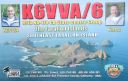
na-178.jpgNA-178 California State Centre (Sonoma to Santa Cruz County) group35 viewsThe Farallon Islands, or Farallones (from the Spanish farallón meaning "pillar" or "sea cliff"), are a group of islands and sea stacks in the Gulf of the Farallones, off the coast of San Francisco, California, United States. The islands are also sometimes referred to by mariners as the Devil's Teeth Islands, in reference to the many treacherous underwater shoals in their vicinity.[2] The islands lie 30 miles (48 km) outside the Golden Gate and 20 miles (32 km) south of Point Reyes, and are visible from the mainland on clear days.
|
|

na-182.jpgNA-182 Canada NWT (Inuvik Region) East group35 viewsGreen Island is a rocky island in the mouth of Fortune Bay, Newfoundland. It is located about 9.5 kilometres west of the Burin Peninsula of Newfoundland and 11 kilometres east of Langlade Island in Saint-Pierre and Miquelon.
|
|

na-183.jpgNA-183 Mexico Guerrero State group35 viewsThe island of La Roqueta is located in the southern part of the coast of the state of Guerrero, in front of the Acapulco bay of the port of the same name.
|
|

na-183r.jpgNA-183 Mexico Guerrero State group35 viewsThe island of La Roqueta is located in the southern part of the coast of the state of Guerrero, in front of the Acapulco bay of the port of the same name.
|
|
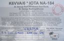
na-184r.jpgNA-184 California State North (Del Norte to Mendocino County) group35 viewsThe St. George Reef Light is an inactive lighthouse built on North West Seal Rock, six miles (10 km) off the coast of northern California near Crescent City.
|
|
na-185.jpgNA-185 Canada Nunavut (Keewatin Region) group35 viewsThompson Island is an uninhabited island off the shore of Baffin Island located in the Canadian Arctic Archipelago in the territory of Nunavut. The island lies in Frobisher Bay, south of Faris Island and Hill Island.
|
|

na-186r.jpgNA-186 Nunavut (Hudson Bay - Manitoba Coast) group35 viewsFox Island island is located in Hudson Bay, 40km east of Churchill, Manitoba and 4km from the mainland
|
|

na-187.jpgNA-187 California State Centre (Monterey / San Luis Obispo County) group35 viewsWhite Rock is located about 600 metres off the shore off Pismo Beach, California in San Luis Obispo County.
|
|

na-189.jpgNA-189 Mexico Nayarit / Jalisco State group35 viewsThe Marieta Islands are a group of small uninhabited islands a few miles off the coast of the state of Nayarit, Mexico, located in federal waters approximately 7.9 kilometres southwest of the peninsula known as Punta de Mita, in the municipality of BahÃa de Banderas.
|
|

na-189r.jpgNA-189 Mexico Nayarit / Jalisco State group35 viewsThe Marieta Islands are a group of small uninhabited islands a few miles off the coast of the state of Nayarit, Mexico, located in federal waters approximately 7.9 kilometres southwest of the peninsula known as Punta de Mita, in the municipality of BahÃa de Banderas.
|
|

na-190.jpgNA-190 El Salvador group35 viewsMeanguera del Golfo is a municipality in the La Unión department of El Salvador. Located 30 kilometres (19 mi) from department of La Unión and 213 km (132 mi) from San Salvador on the island of Meanguera in the Gulf of Fonseca. It has an area of 23.6 km2 (9.1 sq mi) with a population of 2,398 inhabitants (2007).
|
|

na-192r.jpgNA-192 Canada NWT (Inuvik Region) West group35 viewsEllice Island is located in the Beaufort Sea not far from where the border of the Yukon and North West Territories of Canada meet. Nearest human settlement is Inuvik, NWT.
|
|

na-194r.jpgNA-194 Canada Newfoundland Province (Labrador) North group35 viewsFinger Hill Island is located on the northern most tip of the province of Labrador and 160 km N-NE of Nain the northernmost community.
|
|
na-195.jpgNA-195 Nunavut (Hudson Bay - Quebec Coast) Centre group35 viewsThe Hopewell Islands are located in Quebecs Arctic region on the eastern coast of Hudson Bay offshore the community of Inukjuak
|
|

na-196.jpgNA-196 Canada Nunavut (Belcher Islands) group35 viewsFlaherty Island is the largest island of the Belcher Islands group in Hudson Bay in Qikiqtaaluk Region, Nunavut, Canada. The Inuit community of Sanikiluaq is located on its north coast. Sanikiluaq is the southernmost community in Nunavut.
|
|

na-196r.jpgNA-196 Canada Nunavut (Belcher Islands) group35 viewsFlaherty Island is the largest island of the Belcher Islands group in Hudson Bay in Qikiqtaaluk Region, Nunavut, Canada. The Inuit community of Sanikiluaq is located on its north coast. Sanikiluaq is the southernmost community in Nunavut.
|
|
na-197.jpgNA-197 Alaska Kenai Peninsula Borough group35 viewsFox Island, also known as Renard Island, is an island in Resurrection Bay near Seward in the U.S. state of Alaska.[1] The island is 3.4 miles long, two miles wide, and is primarily mountainous, consisting of 3 peaks and the saddles between them. On its east side, the remnants of a glacial moraine have created a spit. Fox Island is a popular destination for kayaking, camping, and hiking in the summer, and hosts two resorts on its shores.
|
|

na-198.jpgNA-198 Newfoundland's Coastal Islands35 viewsFogo Island is the largest of the offshore islands of Newfoundland and Labrador, Canada. It lies off the northeast coast of Newfoundland, northwest of Musgrave Harbour across Hamilton Sound, just east of the Change Islands. The island is about 25 kilometres long and 14 kilometres wide. The total area is 237.71 km²
|
|
na-198r.jpgNA-198 Newfoundland's Coastal Islands35 viewsFogo Island is the largest of the offshore islands of Newfoundland and Labrador, Canada. It lies off the northeast coast of Newfoundland, northwest of Musgrave Harbour across Hamilton Sound, just east of the Change Islands. The island is about 25 kilometres long and 14 kilometres wide. The total area is 237.71 km²
|
|

na-202.jpgNA-202 Panama Colon / Veraguas North Province group35 viewsIsla Grande is a small island and corregimiento in Portobelo District, Colón Province, Panama, off the Caribbean coast. It had a population of 1,037 as of 2010. During the right times of year, the water between the island and the mainland provides an excellent surfing environment. Most of the people found in the town are of African descent and trace it back to black African slaves and those known as Cimarrones.
|
|

na-204r.jpgNA-204 Cuba Matanzas / Villa Clara / Sancti Spiritus Province group35 viewsCayo Santa MarÃa (Cay or "Key" of Santa Maria) is an island off Cuba's north central coast in the Jardines del Rey archipelago. The island is linked by road and bridge to the town of Caibarién on the main island. Cayo Santa MarÃa is well known for its white sand beaches and luxury all inclusive resorts.
|
|
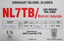
na-206.jpgNA-206 Alaska Barren Islands35 viewsThe Barren Islands are an archipelago in Alaska in the United States. They are the northernmost islands of the Kodiak Archipelago. The largest island of the group is Ushagat Island. The islands have a combined land area of 16.23 square miles (42.03 km²) and are uninhabited. The largest breeding grounds of seabirds in Alaska are located in the Barren Islands on East Amatuli Island and Nord Island. The archipelago is part of the Alaska Maritime National Wildlife Refuge.
|
|

na-207r.jpgNA-207 Nunavut (Hudson Bay - Ontario Coast) South group35 viewsAkimiski Island is the largest island in James Bay (a southeasterly extension of Hudson Bay), Canada, which is part of the Qikiqtaaluk Region of the territory of Nunavut. It has an area of 3,001 km2 (1,159 sq mi), making it the 163rd largest island in the world, and Canada's 29th largest island. Akimiski Island is only 19 km (12 mi) from the province of Ontario. From the western side of the island, one can see the Ontario coastline.
|
|

na-208r.jpgNA-208 Canada Nunavut (Kitikmeot Region) East group35 viewsUlituqisalik Island is an uninhabited island located 6km west of the hamlet Kugaaruk which is home to 760 people. Kugaaruk is located on the shore of Pelly Bay, just off the Gulf of Boothia, Simpson Peninsula, Kitikmeot, in Canada's Nunavut territory.
|
|

na-217.jpgNA-217 New Hampshire State group35 viewsThe Isles of Shoals are a group of small islands and tidal ledges situated approximately 6 miles (10 km) off the east coast of the United States, straddling the border of the states of Maine and New Hampshire.
|
|

st2yjr.jpg35 views
|
|
| 15388 files on 385 page(s) |
 |
|
|
|
|
|
|
|
|
182 | |
|
|
|
|
|
|
|
|
 Contact
