 Most viewed |

OC-183R.jpgOC-183 Western Australia State (S.W. Coast) Centre group38 viewsWedge Island is located north of Lancelin and south of Cervantes on the Western Australian coast. The island occupies an area 4.03 hectares (9.96 acres) and is situated 200 metres (656 ft) from the mainland. The island has a maximum elevation of 21 m (69 ft). It lies within the Turquoise Coast islands nature reserve group, a chain of 40 islands spread over a distance of 150 kilometres (93 mi) from north to south.
|
|

OC-191.jpgOC-191 Niuatoputapu Island38 viewsNiuatoputapu is a high island in the island nation of Tonga, Pacific Ocean, its highest point being at 157 m. Its name means sacred island. Older European names for the island are Traitors island or Keppel island. Niuatoputapu is located in the north of the country, 300 kilometres (190 miles) away from Vavaʻu near the border with Samoa. Its closest neighbours are the small island of Tafahi, only 9 km (5.6 mi) to the north-northeast, and the island of Niuafo'ou.
|
|

OC-199.jpgOC-199 Western Australia State (N.W. Coast) Centre group38 viewsRosemary Island is an island in the Dampier Archipelago in the Pilbara region of Western Australia. With Enderby Island it forms Class A Nature Reserve 36915, part of a proposed national park. In 2016, archaeologists from the University of Western Australia excavated ancient rock shelters on Rosemary Island, between 8000 and 9000 years old. They may be the earliest known domestic structures in Australia
|
|

OC-199R.jpgOC-199 Western Australia State (N.W. Coast) Centre group38 viewsRosemary Island is an island in the Dampier Archipelago in the Pilbara region of Western Australia. With Enderby Island it forms Class A Nature Reserve 36915, part of a proposed national park. In 2016, archaeologists from the University of Western Australia excavated ancient rock shelters on Rosemary Island, between 8000 and 9000 years old. They may be the earliest known domestic structures in Australia
|
|
OC-201R.jpgOC-201 North Island's Coastal Islands38 viewsWaiheke Island is the most populated and second-largest island in the Hauraki Gulf of New Zealand. Its ferry terminal in Matiatia Bay at the western end is 21.5 km (13.4 mi) from the central-city terminal in Auckland. Waiheke is the second-largest island in the gulf, after Great Barrier Island, and is the most populated island in the gulf, with 9,250 permanent residents.
|
|

OC-208.jpgOC-208 Banggai Islands38 viewsThe Banggai Archipelago (Indonesian: Kepulauan Banggai) is a group of islands, which are located at the far eastern end of Central Sulawesi, Indonesia. The archipelago is surrounded by the Banda Sea's Gulf of Tolo (Teluk Tolo), and the Molucca Sea. The Peleng Straits (Selat Peleng) separate it from mainland Sulawesi.
|
|
OC-209.jpgOC-209 Talaud Islands38 viewsTalaud Islands (Indonesian: Kepulauan Talaud) is a group of islands located north of Sulawesi island in Indonesia, north-east of the Sangihe Islands. The Talaud Islands are also the northernmost region of Eastern Indonesia, bordering south of the Philippines' Davao Region. The group, with a total area of 495 square miles (1,281 square km), includes Karakelong (the largest), Salebabu, Kaburuang, and numerous islets. The coast of Karakelong Island is steep except on the southern shore, which is fringed by a wide reef. The seven tiny Nanusa Islands lie north-east of Karakelong. They are forested and with hills rising to 2,231 feet (680 metres).
|
|
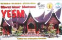
OC-215.jpgOC-215 Mentawai Islands38 viewsThe Mentawai Islands Regency are a chain of about seventy islands and islets approximately 150 kilometres off the western coast of Sumatra in Indonesia. Siberut at 4,030 square kilometres is the largest of the islands. The other major islands are Sipura, North Pagai and South Pagai.
|
|
OC-215R.jpgOC-215 Mentawai Islands38 viewsThe Mentawai Islands Regency are a chain of about seventy islands and islets approximately 150 kilometres off the western coast of Sumatra in Indonesia. Siberut at 4,030 square kilometres is the largest of the islands. The other major islands are Sipura, North Pagai and South Pagai.
|
|
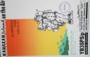
OC-217.jpgOC-217 Kangean Islands38 viewsThere are 38 Kangean Islands altogether with 6 inhabited, forming an archipelago that is part of Indonesia covering a total space of 668 square km. They are located in the Java Sea approximately 120 km north of Bali and 120 km east of Madura Island.
|
|

OC-220.jpgOC-220 South Australia State West group38 viewsSt Peter Island (originally in Dutch: Eyland St. Pierre) is an island in the Nuyts Archipelago on the west coast of Eyre Peninsula in South Australia near Ceduna. It is the second largest island in South Australia and about 13 km (8.1 mi) long.
|
|

OC-230.jpgOC-230 Rowley Shoals38 viewsThe Rowley Shoals is a group of three atoll-like coral reefs south of the Timor Sea, about 260 km (160 mi) west of Broome on the northwestern Australian coast, centered on 17°20′S 119°20′E, on the edge of one of the widest continental shelves in the world. Each atoll covers an area of around 80 to 90 km2 (31 to 35 sq mi) within the rim of the reef, including the lagoons, while the land areas are negligible. They belong to Western Australia. They all rise steeply from the surrounding ocean floor. To the northeast lie the Scott and Seringapatam Reefs which are located on the same undersea platform.
|
|
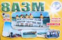
OC-250R.jpgOC-250 Masalembu Islands38 viewsThe Masalembu Islands lie in the Java Sea to the north of Madura, about halfway between Madura and Borneo. The Madurese language is spoken on the islands. The three main islands are Masalembu Island, Masakambing Island, and Karamian Island. The land area of the district is 40.85 square km, and they had a population of 20,687 people in the 2000 census
|
|

OC-256.jpgOC-256 Kilinailau Islands;Tulun Islands38 viewsThe Carteret Islands (also known as Carteret Atoll, Tulun or Kilinailau Islands/Atoll) are Papua New Guinea islands located 86 km (53 mi) north-east of Bougainville in the South Pacific. The atoll has a scattering of low-lying islands called Han, Jangain, Yesila, Yolasa and Piul, in a horseshoe shape stretching 30 km (19 mi) in north-south direction, with a total land area of 0.6 square kilometres (0.2 sq mi) and a maximum elevation of 1.5 metres (4 ft 11.1 in) above sea level.
As of 2005, about one thousand people live on the islands.
|
|
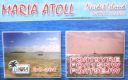
OC-264.jpgOC-264 Maria Island38 viewsÎles Maria or simply Maria, also known as Hull Island, is a small coral atoll in the Pacific Ocean. Its original name is Nororotu. The nearest island is Rimatara situated 205 kilometres (127 miles) to the ESE. The atoll consists of four islets (îles), with a dense atoll forest and a very shallow lagoon, supporting numerous bird species. The atoll is uninhabited now, but at one time was the site of a penal colony. Copra is occasionally harvested at the island.
|
|
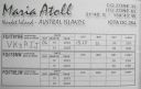
OC-264R.jpgOC-264 Maria Island38 viewsÎles Maria or simply Maria, also known as Hull Island, is a small coral atoll in the Pacific Ocean. Its original name is Nororotu. The nearest island is Rimatara situated 205 kilometres (127 miles) to the ESE. The atoll consists of four islets (îles), with a dense atoll forest and a very shallow lagoon, supporting numerous bird species. The atoll is uninhabited now, but at one time was the site of a penal colony. Copra is occasionally harvested at the island.
|
|

OC-265R.jpgOC-265 Coral Sea Islands Territory South38 viewsCato Island 23°15′S 155°32′E, is a small oval-shaped island lying approximately 375 km (233 mi) east of Gladstone, Queensland and about 270 km (170 mi) east-southeast of the southern end of the Great Barrier Reef. This island is approximately 115 km (71 mi) south of Bird Islet, part of the east end of Wreck Reefs. The island is a mound of coral debris and grit 5.8 m (19 ft) high, covered in grass and creepers up to 1 m (3.3 ft) high. An automatic weather station, with two radio masts and a silver-painted hut, stands on the northeast end of the island
|
|

OC-268R.jpgOC-268 Laut Kecil Islands38 viewsLaut Kecil Islands is an archipelago in the south of Borneo. Administratively, the islands belong to South Kalimantan province of Indonesia. The main islands include Matasiri, Kalambau, and Kadapongan.
|
|
OC-269.jpgOC-269 Karimata Islands38 viewsThe Karimata Islands are a chain of small islands off the west coast of Indonesian Borneo, the largest of which is (Pulau) Karimata, being about 20 km (12 mi) across (east-west), and situated at 1°37′S 108°53′E. It is part of Kayong Utara in Indonesia. A number of small villages are situated on the coast, the largest of which is Padang, on the eastern tip of the island. The island is renowned by inhabitants of the west coast of Kalimantan to have a serious malaria problem.
|
|

OC-270R.jpgOC-270 Simeulue and Banyak Islands38 viewsSimeulue is an island of Indonesia, 150 kilometres (93 mi) off the west coast of Sumatra. Its capital is Sinabang. The SW facing portion of the island holds multiple world class waves and a handful of surf resorts have popped up in recent years.
|
|

OC-271.jpgOC-271 Babar Islands38 viewsThe Babar Islands (Indonesian: Kepulauan Babar) are located in Maluku Province, Indonesia. Tepa (a town with a population of about 2,000 people) is the administrative center of the Babar Islands municipality. The topography of all the Babar islands is distinctive for their marked stepped appearance, the result of a combination of periodic uplifting of the tectonic plate. Small freighters that have contracts to carry passengers service the islands.
|
|

dzone40r.jpg38 views
|
|
ha0dua.jpgHA0DU - HUNGARY38 viewsworked via F2
|
|

sv9cvyr~0.jpgsv9cvy - Crete38 viewsvia Winter Es link to Northern hemisphere summer Es
|
|

WI-Portage1.jpg38 views
|
|

j35xr.jpgJ35X - Grenada38 viewsvia F2 direct path
|
|

3y0jrear~0.jpg38 views
|
|

t32tt.jpgT32TT - Christmas Island38 viewsworked via summe Es
|
|
8R7X.jpg38 views
|
|
sv1gar.jpg38 views
|
|

na-046r.jpgNA-046 Massachusetts State South (Bristol to Barnstable County) group37 viewsNantucket, a tiny, isolated island off Cape Cod, Massachusetts, is a summer destination with dune-backed beaches. It’s marked by unpainted cedar-shingled buildings, many surrounded by manicured privets. The wharves and cobblestoned streets of the Town of Nantucket are lined with restaurants, high-end boutiques and steepled churches. The town’s Whaling Museum recounts the island’s role as a 19th-century whaling hub.
|
|

na-047r.jpgNA-047 Canada Nunavut (Baffin Island) group37 viewsQikiqtarjuaq (Inuktitut pronunciation: [qikiqtaÊjuˈaq]; formerly known as Broughton Island until November 1998 /ˈbrÉ”ËtÉ™n/,[5] is a community located on the island of the same name in the Qikiqtaaluk Region of Nunavut, Canada. The island is known for Arctic wildlife, whale watching, and as the northern access point for Auyuittuq National Park (see also Pangnirtung). At the 2016 census the population was 598, an increase of 15.0% from the 2011 census.
|
|
na-058r.jpgNA-058 Georgia State group37 viewsCumberland Island, Georgia, is the largest of the Sea Islands of the southeastern United States. The long-staple Sea Island cotton was first grown here by a local family, the Millers, who helped Eli Whitney develop the cotton gin. With its unusual range of wildlife, the island has been declared a National Park and a National Seashore. Little Cumberland Island is connected to the main island by a marsh.
|
|
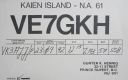
na-061.jpgNA-061 British Columbia Province North group37 viewsKaien Island is a Canadian island on the coast of British Columbia, just north of the mouth of the Skeena River and to the south of the Alaska Panhandle. The city of Prince Rupert, British Columbia is situated on it.
|
|
na-070r.jpgNA-070 Alaska Rat Islands37 viewsThe Rat Islands (Aleut: Qax̂um tanangis[1]) are a volcanic group of islands in the Aleutian Islands in southwest Alaska, between Buldir Island and the Near Islands group to its west, and Amchitka Pass and the Andreanof Islands group to its east, at about 51°47′17″N 178°18′10″ECoordinates: 51°47′17″N 178°18′10″E.
|
|

na-073.jpgNA-073 Corozal / Belize District group37 viewsAmbergris Caye, pronounced /æmˈbÉœËrÉ¡rɪs ˈkiË/ am-BUR-gris KEE, is the largest island of Belize, located northeast of the country in the Caribbean Sea. It is about 40 kilometres (25 mi) long from north to south, and about 1.6 kilometres (1 mi) wide. Where it has not been modified by man, is mostly a ring of white sand beach around mangrove swamp in the centre.
|
|
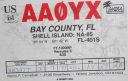
na-085.jpgNA-085 Florida State North West (Bay to Wakulla County) group37 viewsShell Island is an undeveloped barrier island between St. Andrew Bay and the Gulf of Mexico near the town of Panama Beach, Florida
|
|

na-086.jpgNA-086 Cuba Ciego de Avila / Camaguey Province North group37 viewsCayo Coco (Coco Key) is an island in central Cuba, known for its all-inclusive resorts. It lies within the Ciego de Ãvila Province and is part of a chain of islands called Jardines del Rey ("King's Gardens"). The cay is administered by the Morón municipality, has a surface area of 370 km2,[1] and is named after the white ibis, locally called coco (coconut) birds.[2] The island is known for its long beaches and many resort hotels.
|
|

na-086r.jpgNA-086 Cuba Ciego de Avila / Camaguey Province North group37 viewsCayo Coco (Coco Key) is an island in central Cuba, known for its all-inclusive resorts. It lies within the Ciego de Ãvila Province and is part of a chain of islands called Jardines del Rey ("King's Gardens"). The cay is administered by the Morón municipality, has a surface area of 370 km2,[1] and is named after the white ibis, locally called coco (coconut) birds.[2] The island is known for its long beaches and many resort hotels.
|
|

na-089.jpgNA-089 Louisiana State East (St Bernard Parish) group37 viewsBreton Island is an island (or group of islands) in the Gulf of Mexico near the mouth of the Mississippi River and part of Plaquemines Parish, Louisiana.[1] It is part of the Breton National Wildlife Refuge, which was established in 1904.
|
|
| 15648 files on 392 page(s) |
 |
|
|
|
|
|
|
|
|
180 | |
|
|
|
|
|
|
|
|
 Contact

