 Most viewed |
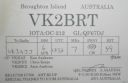
OC-212R.jpgOC-212 New South Wales State Centre group38 viewsBroughton Island is an island 14 km north-east of Port Stephens, New South Wales, Australia. It is part of the Myall Lakes National Park.
|
|
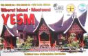
OC-215.jpgOC-215 Mentawai Islands38 viewsThe Mentawai Islands Regency are a chain of about seventy islands and islets approximately 150 kilometres off the western coast of Sumatra in Indonesia. Siberut at 4,030 square kilometres is the largest of the islands. The other major islands are Sipura, North Pagai and South Pagai.
|
|
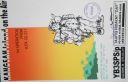
OC-217.jpgOC-217 Kangean Islands38 viewsThere are 38 Kangean Islands altogether with 6 inhabited, forming an archipelago that is part of Indonesia covering a total space of 668 square km. They are located in the Java Sea approximately 120 km north of Bali and 120 km east of Madura Island.
|
|
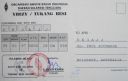
oc-219r.jpgOC-219 Tukangbesi Islands; Wakatobi Islands38 viewsTukangbesi Islands, is a group of islands off the coast of Sulawesi immediately east of Buton island in the Banda Sea region, and part of Sulawesi Tenggara. "Tukang Besi" literally means "iron worker" or "blacksmith" in Indonesian. There is a Tukang Besi language. Separating Buton and the group is the Gulf of Kolowana Watabo.
|
|

OC-220.jpgOC-220 South Australia State West group38 viewsSt Peter Island (originally in Dutch: Eyland St. Pierre) is an island in the Nuyts Archipelago on the west coast of Eyre Peninsula in South Australia near Ceduna. It is the second largest island in South Australia and about 13 km (8.1 mi) long.
|
|

OC-230.jpgOC-230 Rowley Shoals38 viewsThe Rowley Shoals is a group of three atoll-like coral reefs south of the Timor Sea, about 260 km (160 mi) west of Broome on the northwestern Australian coast, centered on 17°20′S 119°20′E, on the edge of one of the widest continental shelves in the world. Each atoll covers an area of around 80 to 90 km2 (31 to 35 sq mi) within the rim of the reef, including the lagoons, while the land areas are negligible. They belong to Western Australia. They all rise steeply from the surrounding ocean floor. To the northeast lie the Scott and Seringapatam Reefs which are located on the same undersea platform.
|
|

OC-241R.jpgOC-241 Timor Barat's Coastal Islands38 viewsSemau, also known as Pusmau and Pasar Pusmau, is an island in the Lesser Sunda Islands in Indonesia. It is located 20 miles off the harbor of Kupang. The inhabitants of Samau are the Helong people, who some believe are the original inhabitants of the Kupang area.[1] It is a supplier of firewood and charcoal and grows corn, watermelon, and mango.[1] Semau is also used as a holiday village where snorkeling, swimming, and other water sports are popular.
|
|

OC-242R.jpgOC-242 Bonerate and Taka' Bonerate Islands38 viewsThe Taka Bonerate Islands in Indonesia consist of Latondu, Rajuni, Tinabo, Pasi Telu, and Taka Lumungan. They lie about 3 to 4 hours by boat from Benteng, the administrative capital of the Selayar Islands. Together they make up the Takabonerate District of Selayar Regency in South Sulawesi Province. It is part of a National Marine Park, with dive sites, pelagic fishes, dolphins, turtles, many soft corals, sea fans. Also it is the third largest atoll in the world
|
|
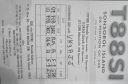
OC-248R.jpgOC-248 Sonsorol Islands38 viewsSonsorol is one of the sixteen states of Palau. The administrative center, and only village, is Dongosaru on Sonsorol island. The inhabitants speak Sonsorolese, a local Trukic language, and Palauan. Sonsorol Island, also called Dongosaro or Dongosaru, is encircled by a coral reef extending 160 to 480 m offshore. It is 2 km long north south, and up to 890 m wide in the north. It is located 1.6 km south of Fanna Island. The village of Dongosaro, which is the capital of the state, is located on the west coast. The island is thickly wooded with coconut palms and other trees. Together with Fanna, it forms the Sonsorol Islands.
|
|
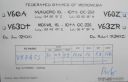
OC-259R.jpgOC-259 Nukuoro Atoll38 viewsNukuoro is an atoll in the Federated States of Micronesia. Except for Kapingamarangi, it is the southernmost atoll of the country. They both are Polynesian outliers. As of 2007, Nukuoro had a population of 372, though several hundred Nukuorans live on Pohnpei. Nukuoro is remote. It has no airstrip, and a passenger boat calls irregularly only once every few months.
|
|
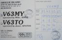
OC-260R.jpgOC-260 Oroluk Atoll38 viewsOroluk Atoll is an atoll belonging to Pohnpei State in the Micronesia. Oroluk Atoll stretches from the northwest to the southeast with a length of about 32 km (20 mi) and an average width of 20 km (12 mi). The lagoon's surface is roughly 420 km2 (162 sq mi). The inhabitants of Oroluk are only between five and ten in number. They come mainly from Sector 4 of the Kapinga Village in Kolonia, Pohnpei, and tend to the plantations of bananas and taro. A supply ship generally calls into the lagoon once every 6 months.
|
|

OC-261.jpgOC-261 South Australia State West Centre group38 viewsWaldegrave Islands is an island group in the Australian state of South Australia located in the Investigator Group about 2.5 kilometres (1.6 miles) northwest by west of Cape Finniss on the west coast of Eyre Peninsula. The group consists of Waldegrave Island, Little Waldegrave Island and according to some sources, a pair of rocks known as the Watchers. The group is notable as a breeding site for Australian sea lions and Cape Barren geese. The group has enjoyed protected area status since the 1960s and as of 1972 has been part of the Waldegrave Islands Conservation Park.
|
|

OC-264.jpgOC-264 Maria Island38 viewsÎles Maria or simply Maria, also known as Hull Island, is a small coral atoll in the Pacific Ocean. Its original name is Nororotu. The nearest island is Rimatara situated 205 kilometres (127 miles) to the ESE. The atoll consists of four islets (îles), with a dense atoll forest and a very shallow lagoon, supporting numerous bird species. The atoll is uninhabited now, but at one time was the site of a penal colony. Copra is occasionally harvested at the island.
|
|
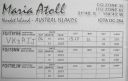
OC-264R.jpgOC-264 Maria Island38 viewsÎles Maria or simply Maria, also known as Hull Island, is a small coral atoll in the Pacific Ocean. Its original name is Nororotu. The nearest island is Rimatara situated 205 kilometres (127 miles) to the ESE. The atoll consists of four islets (îles), with a dense atoll forest and a very shallow lagoon, supporting numerous bird species. The atoll is uninhabited now, but at one time was the site of a penal colony. Copra is occasionally harvested at the island.
|
|

OC-265R.jpgOC-265 Coral Sea Islands Territory South38 viewsCato Island 23°15′S 155°32′E, is a small oval-shaped island lying approximately 375 km (233 mi) east of Gladstone, Queensland and about 270 km (170 mi) east-southeast of the southern end of the Great Barrier Reef. This island is approximately 115 km (71 mi) south of Bird Islet, part of the east end of Wreck Reefs. The island is a mound of coral debris and grit 5.8 m (19 ft) high, covered in grass and creepers up to 1 m (3.3 ft) high. An automatic weather station, with two radio masts and a silver-painted hut, stands on the northeast end of the island
|
|

OC-267.jpgOC-267 Coral Sea Islands Territory North38 viewsMarion Island is part of the Coral Islands North West Group in northern Queensland, Australia. Marion Reef is al arge circular atoll formation that is composed of three main units located on the Eastern side: Marion, Long and Wansfell; and a number of smaller reefs on the west. The formation sits atop a submarine feature known as the Marion Plateau which is separated from the larger Coral Sea Plateau to the north by the Townsville Trough. The island is uninhabited
|
|

OC-270R.jpgOC-270 Simeulue and Banyak Islands38 viewsSimeulue is an island of Indonesia, 150 kilometres (93 mi) off the west coast of Sumatra. Its capital is Sinabang. The SW facing portion of the island holds multiple world class waves and a handful of surf resorts have popped up in recent years.
|
|
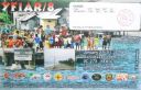
OC-273R.jpgOC-273 Gorong and Watubela Islands38 viewsGorong archipelago is a group of islands between Watubela archipelago and Ceram in the Maluku Islands, Indonesia. Gorom, is the biggest island, with the villages of Miran (Miren) on the east coast, Ondor (Ondur) in the northwest and Hur on its southwestern coast.
|
|

Azone37.jpg38 views
|
|

dzone40r.jpg38 views
|
|
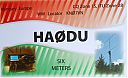
ha0dua.jpgHA0DU - HUNGARY38 viewsworked via F2
|
|

sv9cvyr~0.jpgsv9cvy - Crete38 viewsvia Winter Es link to Northern hemisphere summer Es
|
|

ea6vq.jpgea6vq - Balearic Islands38 viewsvia our winter Es into northern hemisphere summer Es season
|
|

WI-Portage1.jpg38 views
|
|

j35xr.jpgJ35X - Grenada38 viewsvia F2 direct path
|
|

v26ocr.jpgV26OC - ANTIGUA 38 viewsvia F2
|
|

3y0jrear~0.jpg38 views
|
|

t32tt.jpgT32TT - Christmas Island38 viewsworked via summe Es
|
|
8R7X.jpg38 views
|
|

VP6DAR.jpg38 views
|
|

WA-Walla_Walla1.jpg38 views
|
|

VA-Dinwiddie1.jpg38 views
|
|

lz2xfr.jpgLZ2XF - BULGARIA38 viewsworked via F2
|
|
sv1gar.jpg38 views
|
|

NY-Cattaraugus1.jpg38 views
|
|
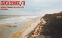
EU-132.jpgEU-132 Poland Szczecin / Koszalin Province group37 viewsWolin is the name both of a Polish island in the Baltic Sea, just off the Polish coast, and a town on that island. Administratively the island belongs to the West Pomeranian Voivodeship. Wolin is separated from the island of Usedom (Uznam) by the Strait of Åšwina, and from mainland Pomerania by the Strait of Dziwna. The island has an area of 265 km2 (102 sq mi) and its highest point is Mount Grzywacz at 116 m above sea level.
|
|
na-030r.jpgNA-030 Mexico Revillagigedo Islands37 viewsThe Revillagigedo Islands or Revillagigedo Archipelago are a group of four volcanic islands in the Pacific Ocean, known for their unique ecosystem. They lie approximately 390 kilometres southwest of Cabo San Lucas, the southern tip of the Baja California Peninsula, and 720 to 970 kilometres west of Manzanillo.
|
|

na-034.jpgNA-034 Florida State Centre West (Pasco to Sarasota County) group37 viewsAnna Maria Island, is a barrier island on the coast of Manatee County, Florida, in the United States. Named after Anna Maria Ceravolo, it is bounded on the west by the Gulf of Mexico, on the south by Longboat Pass (which separates it from Longboat Key), on the east by Anna Maria Sound, and on the north by Tampa Bay. Anna Maria Island is approximately 7 miles (11 km) long north to south.
|
|

na-040.jpgNA-040 Alaska St Lawrence Island37 viewsSt. Lawrence Island is located west of mainland Alaska in the Bering Sea, just south of the Bering Strait. The village of Gambell, located on the northwest cape of the island, is 36 miles from the Chukchi Peninsula in the Russian Far East.
|
|
na-041.jpgNA-041 Alaska Alexander Archipelago37 viewsWrangel Island is an island in the Arctic Ocean, between the Chukchi Sea and East Siberian Sea. Wrangel Island lies astride the 180° meridian. The International Date Line is displaced eastwards at this latitude to avoid the island as well as the Chukchi Peninsula on the Russian mainland.
|
|
| 15647 files on 392 page(s) |
 |
|
|
|
|
|
|
|
|
179 | |
|
|
|
|
|
|
|
|
 Contact

