 Most viewed |

s79gi.jpg38 views
|
|

st2araa.jpg38 views
|
|

sv1eog.jpg38 views
|
|

t24ja.jpg38 views
|
|

t88ii.jpg38 views
|
|

ta3xr.jpg38 views
|
|

tf3dxr~1.jpg38 views
|
|

tg9nx.jpg38 views
|
|

ti7kka.jpg38 views
|
|

ti9maa.jpg38 views
|
|

ti9mr~1.jpg38 views
|
|

v26er.jpg38 views
|
|

vp6dir~2.jpg38 views
|
|

vp8flpr.jpg38 views
|
|

vq9qm~2.jpg38 views
|
|

ynti2cf.jpg38 views
|
|

a25fcr~1.jpg38 views
|
|

ce0xxroxr~0.jpg38 views
|
|

ea9ieb.jpg38 views
|
|

fpkv1e.jpg38 views
|
|
j68lou~0.jpg38 views
|
|

oh1g1t.jpg38 views
|
|

pj7eb.jpg38 views
|
|

xx9tsw.jpg38 views
|
|

zd9bvr.jpg38 views
|
|

zs8cr.jpg38 views
|
|

OC-031.jpgOC-031 Nauru38 viewsNauru formerly known as Pleasant Island, is an island country in Micronesia, a subregion of Oceania, in the Central Pacific. With only a 21-square-kilometre (8.1 sq mi) area, Nauru is the third-smallest country in the world behind Vatican City and Monaco, making it the smallest state in the South Pacific Ocean, the smallest state outside of Europe, the smallest island state, and the smallest republic. Additionally, its population of 11,347 is the world’s third smallest, after the Vatican and Tuvalu.
|
|
OC-032.jpgOC-032 New Caledonia Island38 viewsNew Caledonia is a special collectivity of France, currently governed under the Nouméa Accord, located in the southwest Pacific Ocean, to the south of Vanuatu, about 1,210 km (750 mi) east of Australia.
|
|
OC-033.jpgOC-033 Loyalty Islands38 viewsThe Loyalty Islands Province is one of three administrative subdivisions of New Caledonia encompassing the Loyalty Islands archipelago in the Pacific located northeast of the New Caledonian mainland of Grande Terre. The provincial government seat is part of the French territory of New Caledonia, at Lifou, which is 100 kilometres (62 mi) away. The Loyalty Islands are a collectivité territoriale of France.
|
|

OC-034.jpgOC-034 New Guinea (Papua New Guinea / Indonesia West Papua)38 viewsNew Guinea is a large island separated by a shallow sea from the rest of the Australian continent. It is the world's second-largest island, after Greenland, covering a land area of 785,753 km2 (303,381 sq mi), and the largest wholly or partly within the Southern Hemisphere and Oceania. The eastern half of the island is the major land mass of the independent state of Papua New Guinea. The western half, referred to as either Western New Guinea or West Papua, has been administered by Indonesia since 1963 and comprises the provinces of Papua and West Papua.
|
|
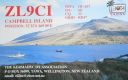
OC-037.jpgOC-037 Campbell Island38 viewsCampbell Island / Motu Ihupuku is an uninhabited subantarctic island of New Zealand, and the main island of the Campbell Island group. It covers 112.68 square kilometres (43.51 sq mi) of the group's 113.31 km2 (43.75 sq mi), and is surrounded by numerous stacks, rocks and islets like Dent Island, Folly Island (or Folly Islands), Isle de Jeanette-Marie, and Jacquemart Island, the latter being the southernmost extremity of New Zealand. The island is mountainous, rising to over 500 metres (1,640 ft) in the south. A long fjord, Perseverance Harbour, nearly bisects it, opening out to sea on the east coast.
|
|
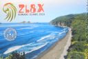
oc-039.jpgOC-039 Kermadec Islands38 viewsThe Kermadec Islands are a subtropical island arc in the South Pacific Ocean 800–1,000 km (500–620 mi) northeast of New Zealand's North Island, and a similar distance southwest of Tonga. The islands are part of New Zealand, 33.6 km2 (13.0 sq mi)] in total area and uninhabited, except for the permanently manned Raoul Island Station, the northernmost outpost of New Zealand.
|
|
oc-039r.jpgOC-039 Kermadec Islands38 viewsThe Kermadec Islands are a subtropical island arc in the South Pacific Ocean 800–1,000 km (500–620 mi) northeast of New Zealand's North Island, and a similar distance southwest of Tonga. The islands are part of New Zealand, 33.6 km2 (13.0 sq mi)] in total area and uninhabited, except for the permanently manned Raoul Island Station, the northernmost outpost of New Zealand.
|
|

OC-040.jpgOC-040 Niue Island38 viewsNiue is a small island in the South Pacific Ocean, to the east of Tonga. It has an area of 260 square kilometres, and a coastline of 64 km. It claims an exclusive economic zone of 200 nm, and a territorial sea of 12 nm. It is one of world's largest coral islands.
|
|

OC-047.jpgOC-047 Solomon Islands38 viewsSolomon Islands is a sovereign state consisting of six major islands and over 900 smaller islands in Oceania lying to the east of Papua New Guinea and northwest of Vanuatu and covering a land area of 28,400 square kilometres (11,000 sq mi).
|
|
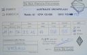
OC-050R.jpgOC-050 Rurutu and Rimatara Islands38 viewsRurutu is the northernmost island in the Austral archipelago of French Polynesia, and the name of a commune consisting solely of that island. It is situated 572 km (355 mi) south of Tahiti. Its land area is 32.7 km2 (12.6 sq mi).[1] It is 10.8 km long and 5.3 km wide. Its highest point (Manureva) is 389 m (1,276 ft).[1] At the 2017 census it had a population of 2,466
|
|

OC-052.jpgOC-052 Duke of Gloucester Islands38 viewsThe Duke of Gloucester Islands is a subgroup of the Tuamotu group in French Polynesia. They are located southeast of Tahiti and south of the main Tuamotu atoll cluster and are rather isolated. Hereheretue (19°52′S 144°58′W) is located to the northwest of the group of the other three atolls, which are located at 20°36′S 143°20′W and are uninhabited. Hereheretue is the only permanently inhabited island of the Duke of Gloucester Islands, with 57 inhabitants in 2002.
|
|

OC-058R.jpgOC-058 D'Entrecasteaux Reefs38 viewsLocated in the Coral Sea , the Entrecasteaux reefs are reefs at the water's edge in northwestern New Caledonia . Uninhabited, they are located 223 km from the northeastern tip of Grande Terre , in the extension of the Belep Islands from which they are separated by the "Grand Passage" strait 500 to 600 meters deep. They constitute the northern limit of the lagoon of the archipelago of New Caledonia .
|
|

OC-067R.jpgOC-067 Leeward Islands38 viewsThe Leeward Islands are the western part of the Society Islands in French Polynesia, an overseas collectivity of France in the South Pacific. They lie south of the Line Islands (part of Kiribati), east of the Cooks and north of the Austral Islands (also part of French Polynesia). Their area is 395 km² with a population of over 33,000.
|
|

OC-070.jpgOC-070 Seram group38 viewsAmbon Island is part of the Maluku Islands of Indonesia. The island has an area of 775 km2 (299 sq mi) and is mountainous, well watered, and fertile. Ambon Island consists of two territories - the city of Ambon to the south and various districts (kecamatan) of the Central Maluku Regency to the north. The main city and seaport is Ambon (with a 2014 population of 368,987), which is also the capital of Maluku province, while those districts of Maluku Tengah Regency situated on Ambon Island had a 2014 population of 132,377
|
|
| 15648 files on 392 page(s) |
 |
|
|
|
|
|
|
|
|
178 | |
|
|
|
|
|
|
|
|
 Contact

