 Most viewed Most viewed |

OC-054R.jpgOC-054 Wallis Islands36 viewsWallis is a Polynesian island in the Pacific Ocean belonging to the French overseas collectivity of Wallis and Futuna. It lies north of Tonga, northeast of Fiji, east-northeast of the Hoorn Islands, east of Fiji's Rotuma, southeast of Tuvalu, southwest of Tokelau and west of Samoa. Its area is almost 100 km2 (39 sq mi) with almost 11,000 people. Its capital is MatÄÊ»utu.
|
|

OC-056R.jpgOC-056 Henderson Island36 viewsHenderson Island (formerly also San Juan Bautista and Elizabeth Island) is an uninhabited member of the Pitcairn Islands archipelago in the south Pacific Ocean. Its remote location and unsuitability for human habitation have made it the subject of scientific study. Ten of its 51 flowering plants, all four of its land birds and about a third of the identified insects and gastropods are endemic – a remarkable diversity given the island's size
|
|

OC-057.jpgOC-057 Maupihaa group36 viewsMaupihaa atoll is roughly 8 km in length and contains a lagoon that is up to 40 m in depth and is surrounded by submerged reefs on three sides. The atoll's outer reefs are continuous except for a small passage on the western side of the atoll. The eastern side consists of a narrow, thickly vegetated, islet (Motu Maupihaa) and a number of smaller islets bring the total land area of Maupihaa to 2.6 km². The only village on the atoll is located on Motu Maupihaa and as of 1985, the pop. consisted of just 10
|
|

OC-058R.jpgOC-058 D'Entrecasteaux Reefs36 viewsLocated in the Coral Sea , the Entrecasteaux reefs are reefs at the water's edge in northwestern New Caledonia . Uninhabited, they are located 223 km from the northeastern tip of Grande Terre , in the extension of the Belep Islands from which they are separated by the "Grand Passage" strait 500 to 600 meters deep. They constitute the northern limit of the lagoon of the archipelago of New Caledonia .
|
|

OC-064.jpgOC-064 Vava'u group36 viewsVavaʻu is the island group of one large island (ʻUtu Vavaʻu) and 40 smaller ones in Tonga. It is part of Vavaʻu District which includes several other individual islands. According to tradition the Maui god fished up both Tongatapu and Vavaʻu but put a little more effort into the former. Vavaʻu rises 204 metres (669 ft) above sea level at Mount Talau. The capital is Neiafu, which is the fifth largest city in Tonga, situated at the Port of Refuge (Puatalefusi or Lolo-ʻa-Halaevalu).
|
|

OC-065.jpgOC-065 Reef Islands;Swallow Islands36 viewsThe Reef Islands are a loose collection of 16 islands in the northwestern part of the Solomon Islands province of Temotu. These islands have historically also been known by the names of Swallow Islands and Matema Islands. The total population of the Reef Islands is about 5,600, according to 2003 estimates. This includes a Polynesian community, believed to be descendants of people from northern Tuvalu.
|
|

OC-067R.jpgOC-067 Leeward Islands36 viewsThe Leeward Islands are the western part of the Society Islands in French Polynesia, an overseas collectivity of France in the South Pacific. They lie south of the Line Islands (part of Kiribati), east of the Cooks and north of the Austral Islands (also part of French Polynesia). Their area is 395 km² with a population of over 33,000.
|
|

oc-069.jpgOC-069 Lihir group36 viewsLihir Group is an island group in Papua New Guinea, located north of New Ireland, at 3°S 152.583333°ECoordinates: 3°S 152.583333°E. It is a part of Bismarck Archipelago. Largest island of the group is Lihir (a.k.a. Niolam), other islands include: Mali, Mahur, Masahet and Sanambiet.
|
|

OC-070.jpgOC-070 Seram group36 viewsAmbon Island is part of the Maluku Islands of Indonesia. The island has an area of 775 km2 (299 sq mi) and is mountainous, well watered, and fertile. Ambon Island consists of two territories - the city of Ambon to the south and various districts (kecamatan) of the Central Maluku Regency to the north. The main city and seaport is Ambon (with a 2014 population of 368,987), which is also the capital of Maluku province, while those districts of Maluku Tengah Regency situated on Ambon Island had a 2014 population of 132,377
|
|

OC-077R.jpgOC-077 Manua Islands36 viewsManuʻa, or the Manuʻa Islands Group, in the Samoan Islands, consists of three main islands: Taʻu, Ofu and Olosega. The latter two are now connected by a bridge over the shallow 137-meter-wide Asaga strait. The islands are located some 110 kilometres (68 miles) east of Tutuila and are a part of American Samoa, an unincorporated territory of the United States; their area is 56 square kilometres (22 square miles) with a population of 1,400.
|
|

OC-088.jpgOC-088 Borneo (East Malaysia / Brunei / Indonesia Kalimantan)36 viewsBorneo is the third-largest island in the world and the largest in Asia. At the geographic centre of Maritime Southeast Asia, in relation to major Indonesian islands, it is located north of Java, west of Sulawesi, and east of Sumatra. The island is politically divided among three countries: Malaysia and Brunei in the north, and Indonesia to the south.
|
|
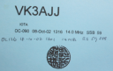
OC-090R.JPGOC-090 Calamian group36 viewsThe Calamian Islands or Calamianes is a group of islands in the Philippine province of Palawan. Busuanga Island hosts the largest town, Coron, in the Calamian Islands.
|
|
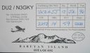
OC-092.jpgOC-092 Babuyan Islands36 viewsThe Babuyan Islands, is an archipelago in the Philippines, located in the Luzon Strait north of the main island of Luzon and south of Taiwan via Bashi Channel to Luzon Strait. The archipelago consists of five major islands and their surrounding smaller islands. These main islands are, counterclockwise starting from northeast, Babuyan, Calayan, Dalupiri, Fuga, and Camiguin. The Babuyan Islands are separated from Luzon by the Babuyan Channel
|
|

OC-094.jpgOC-094 Disappointment Islands36 viewsThe Disappointment Islands are a subgroup of the Tuamotu Archipelago in French Polynesia. They are located towards the northeast, away from the main Tuamotu group. They are a small group of coral islands, which includes the island of Tepoto and the atoll of Napuka. These islands are arid, and are not especially conducive to human habitation.
|
|

OC-098.jpgOC-098 Pukapuka Atoll;Danger Islands36 viewsPukapuka, formerly Danger Island, is a coral atoll in the northern group of the Cook Islands in the Pacific Ocean. It is one of most remote islands of the Cook Islands, situated about 1,140 kilometres (708 miles) northwest of Rarotonga. On this small island, an ancient culture and distinct language has been maintained over many centuries.
|
|
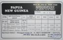
OC-099.jpgOC-099 Tabar Islands36 viewsTabar Island is the main island of the Tabar Islands and forms part of the New Ireland Province. It is located approximately 900 km north east of Port Moresby and about 24 km northeast of the province's main island New Ireland. The island is of volcanic origin and has an area of about 110 km² with a length of about 20 km and about 9 km wide. The highest altitude is approximately 400 m above sea level. Tabar Island is the largest and southernmost island in the archipelago.
|
|

OC-100R.jpgOC-100 Nendo Island36 viewsNendo is the largest of the Santa Cruz Islands, located in the Temotu province of the Solomon Islands. Nendö is 40 km (25 mi.) long and 22 km (14 mi.) wide. Its land area is 505.5 km² (195 sq. mi.). The highest point on the island is 549 m (1,801 ft.) above sea level. Nendö's population is somewhat over 5000
|
|
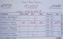
oc-101r.jpgOC-101 Feni Islands36 viewsThe Feni Islands are an island group in Papua New Guinea, located east of New Ireland, at 4°4′20.35″S 153°37′57.03″ECoordinates: 4°4′20.35″S 153°37′57.03″E. It is a part of the Bismarck Archipelago. The largest island of the group is Ambitle, the other island is Babase Island.
|
|

oc-102.jpgOC-102 Tanga Islands36 viewsThe Tanga Islands are an island group in Papua New Guinea, located north-east of New Ireland and part of the Bismarck Archipelago.Tanga is made up of four main islands—Boeng, Maledok, Lif and Tefa—and a number of smaller, uninhabited islands.
|
|

OC-104R.jpgOC-104 Banks Islands36 viewsThe Banks Islands (in Bislama Bankis) are a group of islands in northern Vanuatu. Together with the Torres Islands to the northwest, they make up the northernmost province of Torba. The group lies about 40 km (25 mi) north of Maewo, and includes Gaua and Vanua Lava, two of the 13 largest islands in Vanuatu. In 2009, the islands supported a population of 8,533 on a land area of 780 km².
|
|
OC-107.jpgOC-107 Lingga Islands36 viewsThe Lingga Regency are a group of islands in Indonesia, located south of Singapore, along both sides of the equator, off the eastern coast of Riau Province on Sumatra island. They are south of the populated Riau Archipelago, known for the industrial island of Batam and the tourist-frequented island of Bintan, although the Lingga Islands themselves are rarely visited due to the infrequent local transportation.
|
|

OC-108.jpgOC-108 Anambas Islands36 viewsAnambas Islands Regency is a small archipelago of Indonesia, located 150 nautical miles northeast of Batam Island in the North Natuna Sea between the Malaysian mainland to the west and the island of Borneo to the east.
|
|

OC-116.jpgOC-116 D'Entrecasteaux Islands36 viewsD'Entrecasteaux Islands are situated near the eastern tip of New Guinea in the Solomon Sea in Milne Bay Province of Papua New Guinea. The group spans a distance of 160 km (99 mi), has a total land area of approximately 3,100 km2 (1,197 sq mi) and is separated from the Papua New Guinea mainland by the 30 km (19 mi) wide Ward Hunt Strait in the north and the 18 km (11 mi) wide Goschen Strait in the south. D'Entrecasteaux Islands show signs of volcanism.
|
|
OC-116R.jpgOC-116 D'Entrecasteaux Islands36 viewsD'Entrecasteaux Islands are situated near the eastern tip of New Guinea in the Solomon Sea in Milne Bay Province of Papua New Guinea. The group spans a distance of 160 km (99 mi), has a total land area of approximately 3,100 km2 (1,197 sq mi) and is separated from the Papua New Guinea mainland by the 30 km (19 mi) wide Ward Hunt Strait in the north and the 18 km (11 mi) wide Goschen Strait in the south. D'Entrecasteaux Islands show signs of volcanism.
|
|

oc-117.jpgOC-117 Louisiade Archipelago36 viewsThe Louisiade Archipelago is a string of ten larger volcanic islands frequently fringed by coral reefs, and 90 smaller coral islands in Papua New Guinea. It is located 200km southeast of New Guinea, stretching over more than 160 kilometres (99 mi) and spread over an ocean area of 26,000 square kilometres (10,000 sq mi) between the Solomon Sea to the north and the Coral Sea to the south. The aggreg land area of the islands is about 1,871 square kilometres (722 sq mi) with Vanatinai (Tagula) being the largest
|
|

oc-117r.jpgOC-117 Louisiade Archipelago36 viewsThe Louisiade Archipelago is a string of ten larger volcanic islands frequently fringed by coral reefs, and 90 smaller coral islands in Papua New Guinea. It is located 200km southeast of New Guinea, stretching over more than 160 kilometres (99 mi) and spread over an ocean area of 26,000 square kilometres (10,000 sq mi) between the Solomon Sea to the north and the Coral Sea to the south. The aggreg land area of the islands is about 1,871 square kilometres (722 sq mi) with Vanatinai (Tagula) being the largest
|
|

OC-118.jpgOC-118 Hoorn Islands36 viewsThe Hoorn Islands (also Futuna Islands) are one of the two island groups of which the French overseas collectivity (collectivité d'outre-mer, or COM) of Wallis and Futuna is geographically composed. The aggregate area is 115 km², and the population 4,873 (census of 2003).
Geographically, there are two islands: Futuna Island (in the northwest) (83 km², pop. 4871), Alofi Island (in the southeast) (32 km², pop. 2)
|
|

oc-121r.jpgOC-121 Mamanuca group;Mamanutha36 viewsThe Mamanuca Islands (Fijian: [mamaˈnuða]) of Fiji are a volcanic archipelago lying to the west of Nadi and to the south of the Yasawa Islands. The group, a popular tourist destination, consists of about 20 islands, but about seven of these are covered by the Pacific Ocean at high tide. One of the islands, Monuriki, was made famous as the anonymous island that featured in the 2000 Robert Zemeckis film, Cast Away,
|
|

OC-122.jpgOC-122 Tambelan Islands36 viewsTambelan archipelago is a group of islands off the west coast of West Kalimantan, Indonesia, just north of the equator. The archipelago is located on the north opening of Karimata Strait which separates Borneo and Belitung island.
|
|

OC-124.jpgOC-124 Palmerston Atoll36 viewsPalmerston Island is a coral atoll in the Cook Islands in the Pacific Ocean about 500 km northwest of Rarotonga. 62 people live on Palmerston, all but three descended from English sailor William Marsters.
|
|

OC-131R.jpgOC-131 King George Islands36 viewsThe King George Islands (ÃŽles du Roi Georges) is a subgroup of the Tuamotus Archipelago group in French Polynesia. The King George Islands include four atolls and one island. Tikei is the easternmost island and Ahe Atoll is the westernmost of the subgroup. The distance between them is 200 km (124 mi).
|
|

OC-135.jpgOC-135 North Solomon Islands36 viewsBougainville, officially the Autonomous Region of Bougainville and previously known as North Solomons, is an autonomous region in Papua New Guinea. The largest island is Bougainville Island (also the largest of the Solomon Islands archipelago). The region also includes Buka Island and assorted outlying nearby islands including the Carterets. The interim capital is Buka, though it is expected that Arawa will become the permanent capital in the future.
|
|

OC-137R.jpgOC-137 Queensland State (South Coast) South group36 viewsLamb Island is a small island which forms part of the Moreton Bay National Marine Park located in the southern part of Moreton Bay, near Brisbane, in Queensland, Australia. It constitutes a town and locality within the Redland City. In the 2016 census, Lamb Island had a population of 432 people.
|
|

OC-138.jpgOC-138 Queensland State (Torres Strait) group36 viewsThursday Island, colloquially known as TI, or in the indigenous language, Waiben, is an island of the Torres Strait Islands archipelago located approximately 39 kilometres north of Cape York Peninsula in the Torres Strait, Queensland, Australia. It has an area of about 3.5 square kilometres.
|
|

OC-140.jpgOC-140 Western Australia State (N.W. Coast) West group36 viewsSholl Island (area about 310 hectares) is between Onslow and Dampier, off the Pilbara coast of Western Australia. Part of the Pilbara Inshore Islands Group which are important breeding and resting places for migratory and resident shorebirds and seabirds, and marine turtles.
|
|
OC-141.jpgOC-141 Northern Territory (Gulf of Carpentaria) North group36 viewsGroote Eylandt is the largest island in the Gulf of Carpentaria and the fourth largest island in Australia. It is the homeland of, and is owned by, the Warnindhilyagwa who speak the Anindilyakwa language. Groote Eylandt lies about 50 km (31 mi) from the Northern Territory mainland and eastern coast of Arnhem Land, about 630 kilometres (390 mi) from Darwin, opposite Blue Mud Bay. The island measures about 50 kilometres (31 mi) from east to west and 60 kilometres (37 mi) from north to south.
|
|

OC-142.jpgOC-142 Queensland State (South Coast) Centre group36 viewsHeron Island is a coral cay located near the Tropic of Capricorn in the southern Great Barrier Reef, 80 kilometres north-east of Gladstone, Queensland, Australia, and 460 km north-north-west of the state capital Brisbane.
|
|

OC-143.jpgOC-143 Sumatra Island36 viewsSumatra is a large island in western Indonesia that is part of the Sunda Islands. It is the largest island that is located entirely in Indonesia and the sixth-largest island in the world at 473,481 km2 (not including adjacent islands such as the Riau Islands and Bangka Belitung Islands).
|
|

OC-144.jpgOC-144 Bangka and Belitung Islands36 viewsThe Bangka Belitung Islands (Indonesian: Kepulauan Bangka Belitung) is a province of Indonesia. Lying off the southeastern coasts of Sumatra, the province comprises two main islands, Bangka and Belitung, and several smaller ones. Bangka Belitung is bordered by the Bangka Strait to the west, the Natuna Sea to the north, the Java Sea is to the south, and the Karimata Strait to the east. The capital and the largest city is Pangkal Pinang. As of the 2015 census, the population of Bangka Belitung was 1,372,813.
|
|

OC-145.jpgOC-145 Halmahera group36 viewsHalmahera, formerly known as Jilolo, Gilolo, or Jailolo, is the largest island in the Maluku Islands. It is part of the North Maluku province of Indonesia and Sofifi, the capital of the province, is located on the west coast of the island. Halmahera has a land area of 17,780 km2 (6,860 sq mi); it is the largest island of Indonesia outside the five main islands.
|
|
| 15365 files on 385 page(s) |
 |
|
|
|
|
|
|
|
|
177 | |
|
|
|
|
|
|
|
|
 Contact
