 Most viewed |

v26ocr.jpgV26OC - ANTIGUA 39 viewsvia F2
|
|

p41err.jpgP41E - ARUBA39 viewsvia F2 short path direct beam heading
|
|

hz1skr.jpgHZ1SK - Saudi Arabia39 viewsworked via longpath direct - F2
|
|

cp6uaq.jpgCP6UA - Bolivia39 viewsvia crooked path - beaming 90 degrees due east
|
|

VP6DAR.jpg39 views
|
|

WA-Walla_Walla1.jpg39 views
|
|

VA-Dinwiddie1.jpg39 views
|
|

lz2xfr.jpgLZ2XF - BULGARIA39 viewsworked via F2
|
|

hs0znr.jpgHS0ZNR - THAILAND39 viewsvia F2
|
|

PA-Bradford1.jpg39 views
|
|

AK-Valdez_Cordova_Borough.jpg39 views
|
|

NY-Cattaraugus1.jpg39 views
|
|

EU-117R.jpgEU-117 Gulf of Finland North group38 viewsMaly Vysotsky Island or Malyj Vysotskij Island is an island in northwest Russia, that was leased to Finland. It is located in Vyborg Bay, next to Vysotsk, 12 km southwest of Vyborg.
|
|

EU-119R.jpgEU-119 Russia White Sea Coast East group38 viewsMorzhovets Island is an island in the southern limit of the Barents Sea. It is located in Mezen Bay, at the entrance of the White Sea thus separating the Barents Sea and the White Sea. Morzhovets island lies 14.5 miles (23.3 km) from mainland Russia. There is a settlement on Morzhovets, Severny Gorodok, which serves the lighthouse and the meteorogical station. The population of the settlement is 12.
|
|
EU-132.jpgEU-132 Poland Szczecin / Koszalin Province group38 viewsWolin is the name both of a Polish island in the Baltic Sea, just off the Polish coast, and a town on that island. Administratively the island belongs to the West Pomeranian Voivodeship. Wolin is separated from the island of Usedom (Uznam) by the Strait of Åšwina, and from mainland Pomerania by the Strait of Dziwna. The island has an area of 265 km2 (102 sq mi) and its highest point is Mount Grzywacz at 116 m above sea level.
|
|
EU-133.jpgEU-133 Russia Gulf of Finland South group38 viewsGogland or Hogland is an island in the Gulf of Finland in the eastern Baltic Sea, about 180 km west from Saint Petersburg and 35 km from the coast of Finland (near Kotka). Hogland has an area of approximately 21 km2 (8.1 sq mi); its highest point is 173 m (568 ft). It belongs to Russia's Kingiseppsky District in the Leningrad Oblast.
|
|

EU-159R.jpgEU-159 France Aquitaine Region group38 viewsThe Banc d'Arguin is a sand bank lying in the mouth of the Gironde estuary, near the Cordouan lighthouse, which is the only remaining manned maritime lighthouse in France, the oldest lighthouse still in operation and the only one in the world open to visitors!
|
|

na-030r.jpgNA-030 Mexico Revillagigedo Islands38 viewsThe Revillagigedo Islands or Revillagigedo Archipelago are a group of four volcanic islands in the Pacific Ocean, known for their unique ecosystem. They lie approximately 390 kilometres southwest of Cabo San Lucas, the southern tip of the Baja California Peninsula, and 720 to 970 kilometres west of Manzanillo.
|
|

na-034.jpgNA-034 Florida State Centre West (Pasco to Sarasota County) group38 viewsAnna Maria Island, is a barrier island on the coast of Manatee County, Florida, in the United States. Named after Anna Maria Ceravolo, it is bounded on the west by the Gulf of Mexico, on the south by Longboat Pass (which separates it from Longboat Key), on the east by Anna Maria Sound, and on the north by Tampa Bay. Anna Maria Island is approximately 7 miles (11 km) long north to south.
|
|

na-040.jpgNA-040 Alaska St Lawrence Island38 viewsSt. Lawrence Island is located west of mainland Alaska in the Bering Sea, just south of the Bering Strait. The village of Gambell, located on the northwest cape of the island, is 36 miles from the Chukchi Peninsula in the Russian Far East.
|
|
na-041.jpgNA-041 Alaska Alexander Archipelago38 viewsWrangel Island is an island in the Arctic Ocean, between the Chukchi Sea and East Siberian Sea. Wrangel Island lies astride the 180° meridian. The International Date Line is displaced eastwards at this latitude to avoid the island as well as the Chukchi Peninsula on the Russian mainland.
|
|

na-041r.jpgNA-041 Alaska Alexander Archipelago38 viewsWrangel Island is an island in the Arctic Ocean, between the Chukchi Sea and East Siberian Sea. Wrangel Island lies astride the 180° meridian. The International Date Line is displaced eastwards at this latitude to avoid the island as well as the Chukchi Peninsula on the Russian mainland.
|
|

na-042.jpgNA-042 Alaska Valdez-Cordova Census Area West group38 viewsPerry Island is an island in Prince William Sound, Alaska, within the Chugach National Forest, located immediately east of Culross Island
|
|

na-046.jpgNA-046 Massachusetts State South (Bristol to Barnstable County) group38 viewsNantucket, a tiny, isolated island off Cape Cod, Massachusetts, is a summer destination with dune-backed beaches. It’s marked by unpainted cedar-shingled buildings, many surrounded by manicured privets. The wharves and cobblestoned streets of the Town of Nantucket are lined with restaurants, high-end boutiques and steepled churches. The town’s Whaling Museum recounts the island’s role as a 19th-century whaling hub.
|
|
na-081.jpgNA-081 Nova Scotia Province East group38 viewsCoffin Island, Nova Scotia,Canada. Located on the on the eastern side of the entrance to Liverpool Harbour. Latitude: 44.033639 Longitude: -64.628278
|
|

na-082.jpgNA-082 Mississippi State group38 viewsCat Island is a unique "T-shaped" island created by colliding Gulf of Mexico currents. Unlike the other Mississippi islands, Cat Island's sand beaches are backed by dense forests of slash pines and live oaks. Due to the dredging of the Gulfport ship channel, however, Cat Island has lost its natural westward flow of sediment which provided material for the island to combat erosion. Bayous and marshes on Cat Island are home to alligators and refuge to migratory birds.
|
|
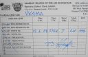
na-087r.jpgNA-087 Alaska Shumagin Islands38 viewsThe Shumagin Islands (Unangan: QagiiÄun) are a group of 20 islands in the Aleutians East Borough south of the mainland of Alaska, United States, at 54°54'–55°20' North 159°15'–160°45' West. The total land area is 1,192.369 km2 (460.376 sq mi) and their total population as of the 2000 census was 953 persons, almost entirely in the city of Sand Point, on Popof Island.
|
|

na-106.jpgNA-106 US Virgin Islands38 viewsThe United States Virgin Islands (USVI; also called the US Virgin Islands or American Virgin Islands), officially the Virgin Islands of the United States, is a group of islands in the Caribbean and an unincorporated and organized territory of the United States. The islands are geographically part of the Virgin Islands archipelago and are located in the Leeward Islands of the Lesser Antilles.
|
|

na-128.jpgNA-128 Quebec Province (St Lawrence Waterway) group38 viewsL'Isle-aux-Coudres is a municipality in Quebec, Canada, in the Charlevoix Regional County Municipality in the Charlevoix area of the Capitale-Nationale region. It is located on and contiguous with Coudres Island (ÃŽle aux Coudres), located in the St. Lawrence River about 6 kilometres (3.7 mi) south from the mainland.
|
|

na-128r.jpgNA-128 Quebec Province (St Lawrence Waterway) group38 viewsL'Isle-aux-Coudres is a municipality in Quebec, Canada, in the Charlevoix Regional County Municipality in the Charlevoix area of the Capitale-Nationale region. It is located on and contiguous with Coudres Island (ÃŽle aux Coudres), located in the St. Lawrence River about 6 kilometres (3.7 mi) south from the mainland.
|
|
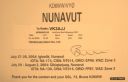
na-130r.jpgNA-130 Canada Nunavut (Baffin's Coastal Islands) East group38 viewsQikiqtarjuaq (Inuktitut pronunciation: [qikiqtaÊjuˈaq]; formerly known as Broughton Island until November 1998 /ˈbrÉ”ËtÉ™n/,[5] is a community located on the island of the same name in the Qikiqtaaluk Region of Nunavut, Canada. The island is known for Arctic wildlife, whale watching, and as the northern access point for Auyuittuq National Park (see also Pangnirtung)
|
|

na-136.jpgNA-136 Connecticut State group38 viewsThe Thimble Islands is an archipelago consisting of small islands in Long Island Sound, located in and around the harbor of Stony Creek in the southeast corner of Branford, Connecticut. The archipelago of islands made up of Stony Creek pink granite bedrock were once the tops of hills prior to the last ice age
|
|
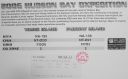
na-156r.jpgNA-156 Nunavut (Hudson Bay - Quebec Coast) North West group38 viewsPitsiulartok or Pituilaktok (formerly: Fairway Island),[1] is a small, uninhabited island located at 63°15'N, 90°33'W[2] in Hudson Bay, about 13 km[3] from the community of Chesterfield Inlet, Nunavut, Canada. The narrow island is about 3.5 km in length and barely 1 km wide at its widest point. Traditionally it was a walrus-hunting ground for the local Inuit,[2] and a landmark for southern whalers.[4] It is part of a loose chain of small islands running along the coast, including Sakpik Island and Promise Island.
|
|
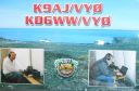
na-159.jpgNA-159 Nunavut (King George Islands) group38 viewsThe King George Islands are an archipelago in the southeast part of Hudson Bay, Canada
|
|

na-185r.jpgNA-185 Canada Nunavut (Keewatin Region) group38 viewsThompson Island is an uninhabited island off the shore of Baffin Island located in the Canadian Arctic Archipelago in the territory of Nunavut. The island lies in Frobisher Bay, south of Faris Island and Hill Island.
|
|

na-200.jpgNA-200 Mexico Quintana Roo State South group38 viewsTamalcab Island can be reached from the village of Calderitas, on the outskirts of Chetumal, in the north. This captivating uninhabited island is home to endemic wildlife, including the spider monkey, coatis, common agoutis, ospreys, and herons. There is no human habitation
|
|

oj0au.jpg38 views
|
|

t31tr.jpg38 views
|
|

t33vu.jpg38 views
|
|

tadj8qp_28229.jpg38 views
|
|
| 15648 files on 392 page(s) |
 |
|
|
|
|
|
|
|
|
175 | |
|
|
|
|
|
|
|
|
 Contact

