 Most viewed |

OC-043R.jpgOC-043 Phoenix Islands39 viewsThe Phoenix Islands or Rawaki are a group of eight atolls and two submerged coral reefs, lying in the central Pacific Ocean east of the Gilbert Islands and west of the Line Islands. They are a part of the Republic of Kiribati.
|
|

OC-046.jpgOC-046 Windward Islands39 viewsThe Windward Islands are the eastern group of the Society Islands in French Polynesia, an overseas collectivity of France in the southern Pacific Ocean. These islands were also previously named the Georgian Islands in honor of King George III of the United Kingdom.
|
|

OC-052.jpgOC-052 Duke of Gloucester Islands39 viewsThe Duke of Gloucester Islands is a subgroup of the Tuamotu group in French Polynesia. They are located southeast of Tahiti and south of the main Tuamotu atoll cluster and are rather isolated. Hereheretue (19°52′S 144°58′W) is located to the northwest of the group of the other three atolls, which are located at 20°36′S 143°20′W and are uninhabited. Hereheretue is the only permanently inhabited island of the Duke of Gloucester Islands, with 57 inhabitants in 2002.
|
|

OC-056R.jpgOC-056 Henderson Island39 viewsHenderson Island (formerly also San Juan Bautista and Elizabeth Island) is an uninhabited member of the Pitcairn Islands archipelago in the south Pacific Ocean. Its remote location and unsuitability for human habitation have made it the subject of scientific study. Ten of its 51 flowering plants, all four of its land birds and about a third of the identified insects and gastropods are endemic – a remarkable diversity given the island's size
|
|

OC-059.jpgOC-059 Kosrae Island39 viewsKosrae formerly known as Kusaie or Strong's Island, is an island in Federated States of Micronesia. The State of Kosrae is one of the four states of the Federated States of Micronesia, and includes the main island of Kosrae and a few nearby islands and islets, the most significant of which is inhabited (1,500 people) Lelu Island.
|
|

OC-064.jpgOC-064 Vava'u group39 viewsVavaʻu is the island group of one large island (ʻUtu Vavaʻu) and 40 smaller ones in Tonga. It is part of Vavaʻu District which includes several other individual islands. According to tradition the Maui god fished up both Tongatapu and Vavaʻu but put a little more effort into the former. Vavaʻu rises 204 metres (669 ft) above sea level at Mount Talau. The capital is Neiafu, which is the fifth largest city in Tonga, situated at the Port of Refuge (Puatalefusi or Lolo-ʻa-Halaevalu).
|
|

OC-067R.jpgOC-067 Leeward Islands39 viewsThe Leeward Islands are the western part of the Society Islands in French Polynesia, an overseas collectivity of France in the South Pacific. They lie south of the Line Islands (part of Kiribati), east of the Cooks and north of the Austral Islands (also part of French Polynesia). Their area is 395 km² with a population of over 33,000.
|
|

OC-073R.jpgOC-073 Minami Torishima39 viewsMinami-Tori-shima an isolated Japanese coral atoll in the northwestern Pacific Ocean, located some 1,848 kilometres (1,148 mi) southeast of Tokyo and 1,267 kilometres (787 mi) east of the closest Japanese island, South Iwo Jima of the Ogasawara Islands, and nearly on a straight line between mainland Tokyo and the United States' Wake Island, 1,415 kilometres (879 mi) further to the east-southeast. The closest island to Minami-Tori-shima is East Island in the Mariana Islands.
|
|

OC-075.jpgOC-075 Riau Islands39 viewsThe Riau Islands is a province of Indonesia. It comprises a total of 1,796 islands lying between the Malacca Strait, the Karimata Strait and the South China Sea. The province is located on one of the world's busiest shipping lanes, sharing water borders with Singapore, Malaysia, and Vietnam. Originally part of the province of Riau, the Riau Islands became Indonesia's third-youngest province in September 2002. The capital is Tanjung Pinang and the largest city is Batam.
|
|
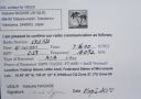
OC-078R.jpgOC-078 Ulithi Atoll39 viewsUlithi is an atoll in the Caroline Islands of the western Pacific Ocean, about 191 km (103 nmi) east of Yap. It consists of 40 islets totalling 4.5 km2 (1.7 sq mi), surrounding a lagoon about 36 km (22 mi) long and up to 24 km (15 mi) wide—at 548 km2 (212 sq mi) one of the largest in the world. It is administered by the state of Yap in the Federated States of Micronesia. Ulithi's population was 773 in 2000.
|
|

OC-079R.jpgOC-079 Belep Islands39 viewsBelep Islands (also known as the Belep Archipelago), lie to the north of New Caledonia's mainland. The two principal islands in the Belep Archipelago are Art Island (a.k.a. Aar) and Pott Island fr (a.k.a. Phwoc). The rest of the archipelago consists of the Northern and Southern Daos Islands, and several very small islets. The administrative centre of the commune is the settlement of Waala, on Art Island, the largest of the Belep Islands. The local language is Nyêlâyu
|
|

OC-082.jpgOC-082 Penrhyn Atoll;Tongareva Atoll39 viewsPenrhyn (also called Tongareva, MÄngarongaro, Hararanga, and Te Pitaka) is an island in the northern group of the Cook Islands in the south Pacific Ocean. The northernmost island in the group, it is located at 1,365 km (848 mi) north-north-east of the capital island of Rarotonga, 9 degrees south of the equator. Its nearest neighbours are Rakahanga, and Manihiki, approximately 350 kilometres (220 mi) to the southwest.
|
|

OC-088.jpgOC-088 Borneo (East Malaysia / Brunei / Indonesia Kalimantan)39 viewsBorneo is the third-largest island in the world and the largest in Asia. At the geographic centre of Maritime Southeast Asia, in relation to major Indonesian islands, it is located north of Java, west of Sulawesi, and east of Sumatra. The island is politically divided among three countries: Malaysia and Brunei in the north, and Indonesia to the south.
|
|
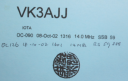
OC-090R.JPGOC-090 Calamian group39 viewsThe Calamian Islands or Calamianes is a group of islands in the Philippine province of Palawan. Busuanga Island hosts the largest town, Coron, in the Calamian Islands.
|
|

OC-095.jpgOC-095 Lau group39 viewsThe Lau Islands of Fiji are situated in the southern Pacific Ocean, just east of the Koro Sea. Of this chain of about sixty islands and islets, about thirty are inhabited. The Lau Group covers a land area of 188 square miles (487 square km), and had a population of 10,683 at the most recent census in 2007. While most of the northern Lau Group are high islands of volcanic origin, those of the south are mostly carbonate low islands.
|
|
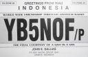
OC-108.jpgOC-108 Anambas Islands39 viewsAnambas Islands Regency is a small archipelago of Indonesia, located 150 nautical miles northeast of Batam Island in the North Natuna Sea between the Malaysian mainland to the west and the island of Borneo to the east.
|
|

oc-117.jpgOC-117 Louisiade Archipelago39 viewsThe Louisiade Archipelago is a string of ten larger volcanic islands frequently fringed by coral reefs, and 90 smaller coral islands in Papua New Guinea. It is located 200km southeast of New Guinea, stretching over more than 160 kilometres (99 mi) and spread over an ocean area of 26,000 square kilometres (10,000 sq mi) between the Solomon Sea to the north and the Coral Sea to the south. The aggreg land area of the islands is about 1,871 square kilometres (722 sq mi) with Vanatinai (Tagula) being the largest
|
|

OC-118.jpgOC-118 Hoorn Islands39 viewsThe Hoorn Islands (also Futuna Islands) are one of the two island groups of which the French overseas collectivity (collectivité d'outre-mer, or COM) of Wallis and Futuna is geographically composed. The aggregate area is 115 km², and the population 4,873 (census of 2003).
Geographically, there are two islands: Futuna Island (in the northwest) (83 km², pop. 4871), Alofi Island (in the southeast) (32 km², pop. 2)
|
|

OC-123.jpgOC-123 Niuafo'ou Island39 viewsNiuafoʻou (meaning: many new coconuts) is the most northerly island in the kingdom of Tonga. It is a volcanic rim island with an area of 15 km2 (5.8 sq mi) and a population of 650 in 2006. The Niuafoʻou language is spoken on the island.
|
|

oc-128r.jpgOC-128 Palawan Island39 viewsPalawan is the largest island of the province of Palawan in the Philippines and the fifth largest island of the country. The north west coast of the island is along the South China Sea, while the south east coast forms part of the northern limit of the Sulu Sea
|
|

OC-167.jpgOC-167 Kapingamarangi Atoll39 viewsKapingamarangi is an atoll and a municipality in the state of Pohnpei of the Federated States of Micronesia. It is by far the most southerly atoll or island of the country and of the Caroline Islands, 300 km (190 mi) south of the next southerly atoll, Nukuoro, and 740 km (460 mi) southwest of the main island of Pohnpei state; it forms a Polynesian outlier. The total area of the atoll, including the lagoon, is 74 km2 (29 sq mi). Out of this, 1.1 km2 (0.4 sq mi) is land area, spread over 33 wooded islets.
|
|

OC-173.jpgOC-173 Northern Territory (Arafura Sea Coast) West group39 viewsMelville Island, known in the Tiwi language as Yermalner, is an island in the eastern Timor Sea, off the coast of the Northern Territory, Australia. It is west of the Cobourg Peninsula in Arnhem Land and north of Darwin, with a tropical climate. The largest community/town on the island is Milikapiti, pop. 559.
|
|

OC-174R.jpgOC-174 Tawi Tawi group39 viewsTawi-Tawi (Tausug: Wilaya' sin Tawi-Tawi) is an island province in the Philippines located in the Bangsamoro Autonomous Region in Muslim Mindanao (BARMM). The capital of Tawi-Tawi is Bongao.It is the southernmost province of the country, sharing sea borders with the Malaysian state of Sabah and the Indonesian North Kalimantan province, both on the island of Borneo to the west.
|
|

OC-176.jpgOC-176 Chesterfield Islands39 viewsChesterfield Islands are a French archipelago of New Caledonia located in the Coral Sea, 550 km northwest of Grande Terre, the main island of New Caledonia. The archipelago is 120 km long and 70 km broad, made up of 11 uninhabited islets and many reefs. The land area of the islands is less than 10 km²
|
|

OC-180R.jpgOC-180 Ngulu Atoll39 viewsNgulu Atoll is a coral atoll of three islands in the Caroline Islands in the Pacific Ocean, and forms a legislative district in Yap State in the Federated States of Micronesia. Ngulu extends for 36 kilometres (22 mi) by 22 kilometres (14 mi) with 18 reef segments enclosing a deep central lagoon of 382 square kilometres (147 sq mi). The eastern portion of the reef is deeply submerged. Its total land area of the nine islets is only 0.4 square kilometres (0.15 sq mi). Nugulu is located approximately 104 kilometres (65 mi) south-southwest of Yap and is the westernmost atoll in the Federated States of Micronesia. The population of Ngulu was 26 in 2000.
|
|

OC-181.jpgOC-181 Witu Islands39 viewsThe Vitu Islands /ˈviËtuË/ are a volcanic group with an area of 37 sq mi (96 km²) located in the Bismarck Sea off New Britain, in the southwestern Pacific Ocean. They are not technically part of the Bismarck Archipelago. Administratively they are part of Papua New Guinea. Formerly called the French Islands, the group is sometimes known as the Witu Islands.
|
|

OC-183.jpgOC-183 Western Australia State (S.W. Coast) Centre group39 viewsWedge Island is located north of Lancelin and south of Cervantes on the Western Australian coast. The island occupies an area 4.03 hectares (9.96 acres) and is situated 200 metres (656 ft) from the mainland. The island has a maximum elevation of 21 m (69 ft). It lies within the Turquoise Coast islands nature reserve group, a chain of 40 islands spread over a distance of 150 kilometres (93 mi) from north to south.
|
|

OC-183R.jpgOC-183 Western Australia State (S.W. Coast) Centre group39 viewsWedge Island is located north of Lancelin and south of Cervantes on the Western Australian coast. The island occupies an area 4.03 hectares (9.96 acres) and is situated 200 metres (656 ft) from the mainland. The island has a maximum elevation of 21 m (69 ft). It lies within the Turquoise Coast islands nature reserve group, a chain of 40 islands spread over a distance of 150 kilometres (93 mi) from north to south.
|
|

OC-185.jpgOC-185 Northern Territory (Arafura Sea Coast) East group39 viewsElcho Island, known to its traditional owners as Galiwin'ku,[1] is an island off the coast of Arnhem Land, Northern Territory, Australia. It is located at the southern end of the Wessel Islands group located in the East Arnhem Region. Galiwin'ku is also the name of the settlement where the island's largest community lives. Elcho island formed part of the traditional lands of the Yan-nhaŋu, according to Norman Tindale. According to J. C. Jennison, the Aboriginal inhabitants were the Dhuwal, who he said called themselves the Kokalango Mala (mala=clan.)
|
|

OC-187R.jpgOC-187 Queensland State (North Coast) North group39 viewsTurtle Head Island is an island of the Torres Strait Islands archipelago, located in the Great Barrier Reef Marine Park, east of Cape York Peninsula, in Queensland, Australia. The island is located in Newcastle Bay at the mouth of Escape River and Middle River, not far from Jackey Jackey Creek and adjacent to the Jardine River National Park. The island lies approximately 30 km (19 mi) southeast of Bamaga.
|
|
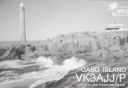
OC-196.jpgOC-196 Victoria State East group39 viewsGabo Island is a 154-hectare (380-acre) island located off the coast of eastern Victoria, Australia, between Mallacoota and Cape Howe on the border with New South Wales. It is separated from the mainland by a 500-metre (1,600 ft) wide channel. Gabo Island is a shipping reference commonly referred to in Victorian weather warnings issued by the Australian Bureau of Meteorology. Gabo Island is well known for its historic lighthouse. This lighthouse, Australia's second tallest, was completed in 1862 and made from pink granite quarried from the island itself.
|
|
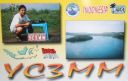
OC-197.jpgOC-197 Bawean Island39 viewsBawean (Indonesian: Pulau Bawean) is an island of Indonesia located approximately 150 km north of Surabaya in the Java Sea, off the coast of Java. It is administered by Gresik Regency of East Java province. It is approximately 15 km in diameter and is circumnavigated by a single narrow road. Bawean is dominated by an extinct volcano at its center that rises to 655 m above sea level. Its population as of the 2010 Census is about 70,000 people
|
|

OC-199.jpgOC-199 Western Australia State (N.W. Coast) Centre group39 viewsRosemary Island is an island in the Dampier Archipelago in the Pilbara region of Western Australia. With Enderby Island it forms Class A Nature Reserve 36915, part of a proposed national park. In 2016, archaeologists from the University of Western Australia excavated ancient rock shelters on Rosemary Island, between 8000 and 9000 years old. They may be the earliest known domestic structures in Australia
|
|

OC-199R.jpgOC-199 Western Australia State (N.W. Coast) Centre group39 viewsRosemary Island is an island in the Dampier Archipelago in the Pilbara region of Western Australia. With Enderby Island it forms Class A Nature Reserve 36915, part of a proposed national park. In 2016, archaeologists from the University of Western Australia excavated ancient rock shelters on Rosemary Island, between 8000 and 9000 years old. They may be the earliest known domestic structures in Australia
|
|
OC-201R.jpgOC-201 North Island's Coastal Islands39 viewsWaiheke Island is the most populated and second-largest island in the Hauraki Gulf of New Zealand. Its ferry terminal in Matiatia Bay at the western end is 21.5 km (13.4 mi) from the central-city terminal in Auckland. Waiheke is the second-largest island in the gulf, after Great Barrier Island, and is the most populated island in the gulf, with 9,250 permanent residents.
|
|

OC-205.jpgOC-205 Woodlark group;Muyua group39 viewsWoodlark Island, known to its inhabitants simply as Woodlark or Muyua, is the main island of the Woodlark Islands archipelago, located in Milne Bay Province and the Solomon Sea, Papua New Guinea. Although no formal census has been conducted since 1990, the current population is estimated at approximately 6000 people. The wider Woodlark Islands group also consists of Madau and Nusam to the west, Nubara to the east, and the Marshall Bennett group to the southwest.
|
|

OC-207R.jpgOC-207 Cagayan Islands39 viewsThe Cagayan group is situated roughly 120km west of Sipalay and consists of 31 islands, of which only a few are inhabited. Their topography is flat and covered with only bushes and palm trees. The Cagayan islands are located on the 500km long and 30km wide Cagayan ridge, which connects Cagayancillo with the Tubbataha Reef and Borneo.
|
|

OC-208.jpgOC-208 Banggai Islands39 viewsThe Banggai Archipelago (Indonesian: Kepulauan Banggai) is a group of islands, which are located at the far eastern end of Central Sulawesi, Indonesia. The archipelago is surrounded by the Banda Sea's Gulf of Tolo (Teluk Tolo), and the Molucca Sea. The Peleng Straits (Selat Peleng) separate it from mainland Sulawesi.
|
|
OC-210R.jpgOC-210 Sangihe Islands39 viewsThe Sangihe Islands are a group of islands which constitute two regencies within the province of North Sulawesi, in northern Indonesia, the Sangihe Islands Regency (Kabupaten Kepulauan Sangihe) and the Sitaro Islands Regency (Kabupaten Siau Tagulandang Biaro). They are located north-east of Sulawesi between the Celebes Sea and the Molucca Sea, roughly halfway between Sulawesi and Mindanao, in the Philippines.
|
|
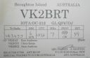
OC-212R.jpgOC-212 New South Wales State Centre group39 viewsBroughton Island is an island 14 km north-east of Port Stephens, New South Wales, Australia. It is part of the Myall Lakes National Park.
|
|
| 15649 files on 392 page(s) |
 |
|
|
|
|
|
|
|
|
174 | |
|
|
|
|
|
|
|
|
 Contact

