 Most viewed Most viewed |
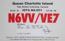
na-051.jpgNA-051 Canada BC Province (Haida Gwaii) group36 viewsHaida Gwaii, literally "Islands of the Haida people"),] is an archipelago approximately 45–60 km (30–40 mi) off the northern Pacific coast of Canada. The islands are separated from the mainland to the east by the shallow Hecate Strait. Queen Charlotte Sound lies to the south, with Vancouver Island beyond. To the north, the disputed Dixon Entrance separates Haida Gwaii from the Alexander Archipelago in the U.S. state of Alaska.
|
|
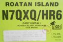
na-057.jpgNA-057 Honduras Bahia Islands36 viewsRoatán is an island in the Caribbean, about 65 kilometres off the northern coast of Honduras. It is located between the islands of Útila and Guanaja, and is the largest of the Bay Islands of Honduras. The island was formerly known as Ruatan and Rattan.
|
|
na-058r.jpgNA-058 Georgia State group36 viewsCumberland Island, Georgia, is the largest of the Sea Islands of the southeastern United States. The long-staple Sea Island cotton was first grown here by a local family, the Millers, who helped Eli Whitney develop the cotton gin. With its unusual range of wildlife, the island has been declared a National Park and a National Seashore. Little Cumberland Island is connected to the main island by a marsh.
|
|
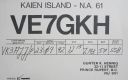
na-061.jpgNA-061 British Columbia Province North group36 viewsKaien Island is a Canadian island on the coast of British Columbia, just north of the mouth of the Skeena River and to the south of the Alaska Panhandle. The city of Prince Rupert, British Columbia is situated on it.
|
|
na-062.jpgNA-062 Florida State (Florida Keys) group36 viewsKey Largo (Spanish: Cayo Largo) is an island in the upper Florida Keys archipelago and is the largest section of the Keys, at 33 miles (53 km) long. It is one of the northernmost of the Florida Keys in Monroe County, and the northernmost of the Keys connected by U.S. Highway 1 (the Overseas Highway). Its earlier Spanish name was Cayo Largo,[1] meaning long islet.
|
|
na-066.jpgNA-066 California State South (Orange / San Diego County) group36 viewsSanta Catalina Island (Tongva: Pimugna or Pimu) is a rocky island off the coast of the U.S. state of California in the Gulf of Santa Catalina. The island is 22 mi (35 km) long and 8 mi (13 km) across at its greatest width. The island is located about 29 mi (47 km) south-southwest of Long Beach, California. The highest point on the island is 2,097 ft (639 m) Mount Orizaba. Santa Catalina is part of the Channel Islands of California archi
|
|
na-070.jpgNA-070 Alaska Rat Islands36 viewsThe Rat Islands (Aleut: Qax̂um tanangis[1]) are a volcanic group of islands in the Aleutian Islands in southwest Alaska, between Buldir Island and the Near Islands group to its west, and Amchitka Pass and the Andreanof Islands group to its east, at about 51°47′17″N 178°18′10″ECoordinates: 51°47′17″N 178°18′10″E.
|
|
na-070r.jpgNA-070 Alaska Rat Islands36 viewsThe Rat Islands (Aleut: Qax̂um tanangis[1]) are a volcanic group of islands in the Aleutian Islands in southwest Alaska, between Buldir Island and the Near Islands group to its west, and Amchitka Pass and the Andreanof Islands group to its east, at about 51°47′17″N 178°18′10″ECoordinates: 51°47′17″N 178°18′10″E.
|
|
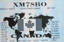
na-075.jpgNA-075 British Columbia Province (Gulf Islands) group36 viewsPender Island (Saanich: st̕ey̕əs )[2] is one of the Southern Gulf Islands located in the Gulf of Georgia, British Columbia, Canada. Pender Island is approximately 34 km2 (13 sq mi) in area and is home to about 2,250 permanent residents.
|
|
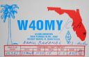
na-080.jpgNA-080 Bahamas Little Bahama Bank group36 viewsThe Abaco Islands lie in the northern Bahamas 180 miles (290 km) east of South Florida. They comprise the main islands of Great Abaco and Little Abaco, along with smaller barrier cays.
|
|
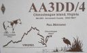
na-083.jpgNA-083 Virginia State group36 viewsChincoteague is an the island on Virginia’s Eastern Shore region. It’s a gateway to Chincoteague National Wildlife Refuge, on Assateague Island, which has beaches and wild Chincoteague ponies.
|
|

na-087.jpgNA-087 Alaska Shumagin Islands36 viewsThe Shumagin Islands (Unangan: QagiiÄun) are a group of 20 islands in the Aleutians East Borough south of the mainland of Alaska, United States, at 54°54'–55°20' North 159°15'–160°45' West. The total land area is 1,192.369 km2 (460.376 sq mi) and their total population as of the 2000 census was 953 persons, almost entirely in the city of Sand Point, on Popof Island.
|
|
na-087r.jpgNA-087 Alaska Shumagin Islands36 viewsThe Shumagin Islands (Unangan: QagiiÄun) are a group of 20 islands in the Aleutians East Borough south of the mainland of Alaska, United States, at 54°54'–55°20' North 159°15'–160°45' West. The total land area is 1,192.369 km2 (460.376 sq mi) and their total population as of the 2000 census was 953 persons, almost entirely in the city of Sand Point, on Popof Island.
|
|
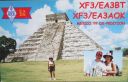
na-090.jpgNA-090 Mexico Quintana Roo State Centre group36 viewsCozumel (Spanish pronunciation: [kosu'mel], Yucatec Maya: Kùutsmil) is an island and municipality in the Caribbean Sea off the eastern coast of Mexico's Yucatán Peninsula, opposite Playa del Carmen. It is separated from mainland by Cozumel Channel and is close to the Yucatán Channel. The municipality is part of the state of Quintana Roo, Mexico.
|
|

na-090r.jpgNA-090 Mexico Quintana Roo State Centre group36 viewsCozumel (Spanish pronunciation: [kosu'mel], Yucatec Maya: Kùutsmil) is an island and municipality in the Caribbean Sea off the eastern coast of Mexico's Yucatán Peninsula, opposite Playa del Carmen. It is separated from mainland by Cozumel Channel and is close to the Yucatán Channel. The municipality is part of the state of Quintana Roo, Mexico.
|
|

na-091.jpgNA-091 British Columbia Province South group36 viewsQuadra Island is an island off the eastern coast of Vancouver Island, British Columbia, Canada, part of the Discovery Islands located within the Strathcona Regional District. Quadra Island is about 35 kilometres from its northernmost point to its southernmost point.
|
|

na-093.jpgNA-093 Cuba Pinar del Rio / La Habana Province group36 viewsThe Colorados Archipelago (Spanish: Archipiélago de los Colorados, also called Archipiélago de Santa Isabel and Archipiélago de Guaniguanico) is a chain of isles and cays on Cuba's north-western coast. The sea surrounding the islands is used mainly for fishing, with commercial captures of lobster, sponge, oysters, red snapper and tuna.[1] Tourism is also developed on cays such as Cayo Levisa, where white sand beaches, as well as snorkeling and diving sites attract tourists.
|
|

na-096.jpgNA-096 Hispaniola36 viewsHispaniola is an island in the Caribbean archipelago known as the Greater Antilles. It is the second largest island in the West Indies after Cuba, and the most populous island in the West Indies; it is also the eleventh most populous island in the world.The 76,192-square-kilometre (29,418 sq mi) island is divided into two separate, sovereign nations: the Spanish-speaking Dominican Republic (48,445 km2, 18,705 sq mi) to the east, and French / French-based Haitian Creole-speaking Haiti (27,750 km2, 10,710 sq mi) to the west.
|
|

na-097.jpgNA-097 Jamaica36 viewsJamaica (/dʒəˈmeɪkə/ (About this soundlisten)) is an island country situated in the Caribbean Sea. Spanning 10,990 square kilometres (4,240 sq mi) in area, it is the third-largest island of the Greater Antilles and the fourth-largest island country in the Caribbean. Jamaica lies about 145 kilometres (90 mi) south of Cuba, and 191 kilometres (119 mi) west of Hispaniola (the island containing the countries of Haiti and the Dominican Republic).
|
|

na-098r.jpgNA-098 Navassa Island36 viewsNavassa Island (/nəˈvæsə/; French: l'île de la Navasse; also La Navasse, La Navase) is a small uninhabited island in the Caribbean Sea. Located northeast of Jamaica, south of Cuba, 40 nautical miles (74 km; 46 mi) west of Jérémie on the south west peninsula of Haiti, the island is subject to an ongoing territorial dispute between Haiti and the United States, which officially administers it through the U.S. Fish and Wildlife Service.
|
|

na-103.jpgNA-103 Montserrat36 viewsMontserrat is a British Overseas Territory (BOT) in the Caribbean. The island is in the Leeward Islands, which is part of the chain known as the Lesser Antilles, in the West Indies. Montserrat measures approximately 16 km (10 mi) in length and 11 km (7 mi) in width, with approximately 40 km (25 mi) of coastline.[2] Montserrat is nicknamed "The Emerald Isle of the Caribbean" both for its resemblance to coastal Ireland and for the Irish ancestry of many of its inhabitants.
|
|
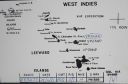
na-104.jpgNA-104 St Kitts and Nevis36 viewsSaint Kitts and Nevis, also known as the Federation of Saint Christopher and Nevis,] is an island country in the West Indies. Located in the Leeward Islands chain of the Lesser Antilles, it is the smallest sovereign state in the Western Hemisphere, in both area and population. The country is a Commonwealth realm, with Elizabeth II as queen and head of state.
|
|
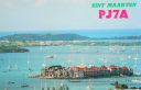
na-105.jpgNA-105 St Martin;Sint Maarten36 viewsSaint Martin (French: Saint-Martin; Dutch: Sint Maarten) is an island in the northeast Caribbean Sea, approximately 300 km (190 mi) east of Puerto Rico. The 87-square-kilometre (34 sq mi) island is divided roughly 60/40 between the French Republic (53 km2, 20 sq mi)[1] and the Kingdom of the Netherlands (34 km2, 13 sq mi),[2] but the two parts are roughly equal in population.
|
|
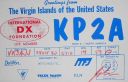
na-106.jpgNA-106 US Virgin Islands36 viewsThe United States Virgin Islands (USVI; also called the US Virgin Islands or American Virgin Islands), officially the Virgin Islands of the United States, is a group of islands in the Caribbean and an unincorporated and organized territory of the United States. The islands are geographically part of the Virgin Islands archipelago and are located in the Leeward Islands of the Lesser Antilles.
|
|
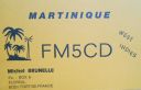
na-107.jpgNA-107 Martinique36 viewsMartinique is an insular region of France located in the Lesser Antilles of the West Indies in the eastern Caribbean Sea, with a land area of 1,128 square kilometres (436 sq mi) and a population of 376,480 inhabitants as of January 2016. Like Guadeloupe, it is an overseas region (région d'outre-mer) of France, consisting of a single overseas department.
|
|

na-107r.jpgNA-107 Martinique36 viewsMartinique is an insular region of France located in the Lesser Antilles of the West Indies in the eastern Caribbean Sea, with a land area of 1,128 square kilometres (436 sq mi) and a population of 376,480 inhabitants as of January 2016. Like Guadeloupe, it is an overseas region (région d'outre-mer) of France, consisting of a single overseas department.
|
|

na-110.jpgNA-110 South Carolina State group36 viewsSt. Helena Island is a Sea Island in Beaufort County, South Carolina, United States. The island is connected to Beaufort by U.S. Highway 21. The island has a land area of about 64 square miles and a population of 8,763 as of the 2010 census. It is included as part of the Hilton Head Island-Beaufort Micropolitan Area. The island is renowned for its rural Lowcountry character and being a major center of African-American Gullah culture and language.
|
|

na-111.jpgNA-111 New Jersey State group36 viewsLong Beach Island (colloquially known as LBI or simply The Island) is a barrier island and summer colony along the Atlantic Ocean coast of Ocean County, New Jersey in the United States. Aligned north-south, the northern portion is generally slightly higher end low-density residential, whereas the southern portion possesses higher-density housing and considerable commercial development. The primary industries include tourism, fishing, and real estate. The only access point to the island by land is a single causeway.
|
|
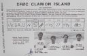
na-115r.jpgNA-115 Mexico Clarion Island 36 viewsIsla Clarión, formerly called Santa Rosa, is the second largest, westernmost and most remote of the Revillagigedo Islands (part of Mexico, specifically the state of Colima), located 314 kilometres (195 mi) west of Socorro Island and over 700 kilometres (430 mi) from the Mexican mainland. It is the location of a small military garrison manned by 9 men.
|
|

na-119.jpgNA-119 Louisiana State Centre (Terrebonne Parish) group36 viewsTimbalier Island is an island off southeastern Louisiana in the United States. The island lies near New Orleans off the southeastern coast of Terrebonne Parish. Timbalier Bay lies between the island and the Louisiana mainland, and the island separates the bay from the Gulf of Mexico
|
|
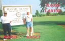
na-120.jpgNA-120 Louisiana State West (Cameron to St Mary Parish) group36 viewsMarsh Island is an uninhabited low-lying marshy island in Iberia Parish, south coastal Louisiana, lying between Vermilion Bay and the Gulf of Mexico. It is bordered on the south by the Gulf of Mexico and is separated from mainland Louisiana by East Cote Blanche Bay to its east, West Cote Blanche Bay to its north, Vermilion Bay to its northwest, and Southwest Pass to its west
|
|

na-129.jpgNA-129 Canada NWT (Banks Island) group36 viewsBanks Island is one of the larger members of the Canadian Arctic Archipelago. Situated in the Inuvik Region, and part of the Inuvialuit Settlement Region, of the Northwest Territories, it is separated from Victoria Island to its east by the Prince of Wales Strait and from the mainland by Amundsen Gulf to its south. The Beaufort Sea lies to its west, and to its northeast M'Clure Strait separates the island from Prince Patrick Island and Melville Island.
|
|

na-129r.jpgNA-129 Canada NWT (Banks Island) group36 viewsBanks Island is one of the larger members of the Canadian Arctic Archipelago. Situated in the Inuvik Region, and part of the Inuvialuit Settlement Region, of the Northwest Territories, it is separated from Victoria Island to its east by the Prince of Wales Strait and from the mainland by Amundsen Gulf to its south. The Beaufort Sea lies to its west, and to its northeast M'Clure Strait separates the island from Prince Patrick Island and Melville Island.
|
|

na-133r.jpgNA-133 Colombia Serrana Bank and Roncador Cays36 viewsRoncador Cay is a small island of the Roncador Bank, located in the west Caribbean Sea, off the coast of Central America, 150 kilometres (93 miles) east-northeast of Providencia Island.
|
|

na-138.jpgNA-138 Florida State North East (Brevard to Nassau County) group36 viewsAmelia Island is part of the Sea Islands chain of barrier islands, on the U.S. state of Florida’s Atlantic coast. It has a history of Spanish, French, British and American rule. Today it’s a popular holiday destination known for its luxury resorts, golf courses and numerous sandy beaches
|
|

na-140.jpgNA-140 Maryland State West group36 viewsHoopers Island is a chain of three islands in Dorchester County, Maryland, United States. Upper Hoopers Island, Middle Hoopers Island and Lower Hoopers Island are surrounded by water with the Chesapeake Bay on one side and the Honga River on the other side. The remote set of islands has much wildlife and is well known for sport fishing and crabbing industries. Hoopers Island is one of the oldest settled areas in Maryland.
|
|

na-146.jpgNA-146 St Barthelemy Island36 viewsSaint Barthélemy collectivity of France in the Caribbean. Often abbreviated to St-Barth in French, and St. Barths or St. Barts in English, the island lies about 35 kilometres (22 mi) south-east of the Dutch-owned Sint Maarten and north-east of the Dutch islands of Saba, Sint Eustatius, the independent country of Saint Kitts and Nevis.
|
|

na-149r.jpgNA-149 Haiti's Coastal Islands36 viewsÃŽle-Ã -Vache, is a Caribbean island, one of Haiti's satellite islands. It lies in the Baie de Cayes about 6.5 miles off the coast of the country's southwest peninsula, roughly between the town of Les Cayes and Pointe l'Abacou. It was formerly known by the name of Abacca
|
|

na-151.jpgNA-151 Greenland's Coastal Islands South East 36 viewsAmmassalik Island is on the east coast of Greenland - and the main town is Tasiilaq with it's colourful and red buildings, bakery in the middle of the harbour, a school and hospital. It is a spread out town and you can walk around the town with ease. With 2,017 inhabitants (2013), it is the most populous community on the eastern coast, and the seventh-largest town in Greenland.
|
|
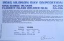
na-159r.jpgNA-159 Nunavut (King George Islands) group36 viewsThe King George Islands are an archipelago in the southeast part of Hudson Bay, Canada
|
|
| 15388 files on 385 page(s) |
 |
|
|
|
|
|
|
|
|
172 | |
|
|
|
|
|
|
|
|
 Contact
