 Most viewed |

EU-119R.jpgEU-119 Russia White Sea Coast East group38 viewsMorzhovets Island is an island in the southern limit of the Barents Sea. It is located in Mezen Bay, at the entrance of the White Sea thus separating the Barents Sea and the White Sea. Morzhovets island lies 14.5 miles (23.3 km) from mainland Russia. There is a settlement on Morzhovets, Severny Gorodok, which serves the lighthouse and the meteorogical station. The population of the settlement is 12.
|
|
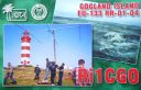
EU-133.jpgEU-133 Russia Gulf of Finland South group38 viewsGogland or Hogland is an island in the Gulf of Finland in the eastern Baltic Sea, about 180 km west from Saint Petersburg and 35 km from the coast of Finland (near Kotka). Hogland has an area of approximately 21 km2 (8.1 sq mi); its highest point is 173 m (568 ft). It belongs to Russia's Kingiseppsky District in the Leningrad Oblast.
|
|

EU-159R.jpgEU-159 France Aquitaine Region group38 viewsThe Banc d'Arguin is a sand bank lying in the mouth of the Gironde estuary, near the Cordouan lighthouse, which is the only remaining manned maritime lighthouse in France, the oldest lighthouse still in operation and the only one in the world open to visitors!
|
|

na-033.jpgNA-033 Colombia San Andres Island38 viewsSaint Andrew is a coral island in the Caribbean Sea. Politically part of Colombia, and historically tied to the United Kingdom, Saint Andrew and the nearby islands of Providencia and Santa Catalina form the department of San Andrés, Providencia and Santa Catalina. Saint Andrew, in the southern group of islands, is the largest of the department. The official languages of the department are Spanish, English, and Creole. While Saint Andrew is located 50 km (31 mi) south of Providence, the Colombian archipelago
|
|

na-035r.jpgNA-035 Honduras Santanilla Islands;Swan Islands;Cisne Islands38 viewsThe Swan Islands, or Islas Santanilla or Islas del Cisne, initially named Islas de las Pozas by Christopher Columbus in 1502, is a chain of three islands located in the northwestern Caribbean Sea, approximately 153 kilometres off the coastline of Honduras, with a land area of 3.1 square kilometres
|
|

na-036.jpgNA-036 British Columbia Province (Vancouver Island) group38 viewsVancouver Island is in the northeastern Pacific Ocean. It is part of the Canadian province of British Columbia. The island is 460 kilometres (290 mi) in length, 100 kilometres (62 mi) in width at its widest point,[5] and 32,134 km2 (12,407 sq mi) in area. It is the largest island on the West Coast of the Americas.
|
|

na-048r.jpgNA-048 Bahamas Bimini Islands38 viewsBimini is the westernmost district of the Bahamas and comprises a chain of islands located about 80 kilometres due east of Miami. Bimini is the closest point in the Bahamas to the mainland United States and approximately 210 km west-northwest of Nassau.
|
|

na-053.jpgNA-053 Alaska Trinity Islands38 viewsSitkinak Island is an island of the Kodiak Archipelago of the state of Alaska, United States. It lies south of the southern tip of Kodiak Island in the western part of the Gulf of Alaska. Tugidak Island lies to its west. The two islands are the largest components of the Trinity Islands of Alaska. The Trinity Islands, and thus Sitkinak, are part of the Gulf of Alaska unit of Alaska Maritime National Wildlife Refuge. Sitkinak Island has a land area of 235.506 km² (90.929 sq mi) and no resident population.
|
|

na-064.jpgNA-064 Alaska Near Islands (Agattu and Attu) group38 viewsThe Near Islands or Sasignan Islands are the smallest and westernmost group of the Aleutian Islands in Alaska. They are located within the Aleutian Island chain to the west of the Rat Islands and to the east of the Russian Commander Islands
|
|

na-067.jpgNA-067 North Carolina State East (Carteret to Currituck County) group38 viewsHatteras Island (historically, Croatoan Island) is a barrier island located off the North Carolina coast. Dividing the Atlantic Ocean and the Pamlico Sound, it runs parallel to the coast, forming a bend at Cape Hatteras. It is part of North Carolina's Outer Banks and includes the communities of Rodanthe, Waves, Salvo, Avon, Buxton, Frisco, and Hatteras
|
|

na-068r.jpgNA-068 Canada New Brunswick Province North group38 viewsLamèque Island (French: Île Lamèque) is a Canadian island in the Gulf of St. Lawrence at the northeastern tip of Gloucester County, New Brunswick. The island has an area of 150 square kilometres (58 sq mi).
|
|
na-070.jpgNA-070 Alaska Rat Islands38 viewsThe Rat Islands (Aleut: Qax̂um tanangis[1]) are a volcanic group of islands in the Aleutian Islands in southwest Alaska, between Buldir Island and the Near Islands group to its west, and Amchitka Pass and the Andreanof Islands group to its east, at about 51°47′17″N 178°18′10″ECoordinates: 51°47′17″N 178°18′10″E.
|
|
na-080.jpgNA-080 Bahamas Little Bahama Bank group38 viewsThe Abaco Islands lie in the northern Bahamas 180 miles (290 km) east of South Florida. They comprise the main islands of Great Abaco and Little Abaco, along with smaller barrier cays.
|
|
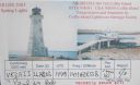
na-081.jpgNA-081 Nova Scotia Province East group38 viewsCoffin Island, Nova Scotia,Canada. Located on the on the eastern side of the entrance to Liverpool Harbour. Latitude: 44.033639 Longitude: -64.628278
|
|

na-082.jpgNA-082 Mississippi State group38 viewsCat Island is a unique "T-shaped" island created by colliding Gulf of Mexico currents. Unlike the other Mississippi islands, Cat Island's sand beaches are backed by dense forests of slash pines and live oaks. Due to the dredging of the Gulfport ship channel, however, Cat Island has lost its natural westward flow of sediment which provided material for the island to combat erosion. Bayous and marshes on Cat Island are home to alligators and refuge to migratory birds.
|
|
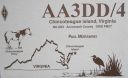
na-083.jpgNA-083 Virginia State group38 viewsChincoteague is an the island on Virginia’s Eastern Shore region. It’s a gateway to Chincoteague National Wildlife Refuge, on Assateague Island, which has beaches and wild Chincoteague ponies.
|
|

na-083r.jpgNA-083 Virginia State group38 viewsChincoteague is an the island on Virginia’s Eastern Shore region. It’s a gateway to Chincoteague National Wildlife Refuge, on Assateague Island, which has beaches and wild Chincoteague ponies.
|
|

na-087.jpgNA-087 Alaska Shumagin Islands38 viewsThe Shumagin Islands (Unangan: QagiiÄun) are a group of 20 islands in the Aleutians East Borough south of the mainland of Alaska, United States, at 54°54'–55°20' North 159°15'–160°45' West. The total land area is 1,192.369 km2 (460.376 sq mi) and their total population as of the 2000 census was 953 persons, almost entirely in the city of Sand Point, on Popof Island.
|
|
na-087r.jpgNA-087 Alaska Shumagin Islands38 viewsThe Shumagin Islands (Unangan: QagiiÄun) are a group of 20 islands in the Aleutians East Borough south of the mainland of Alaska, United States, at 54°54'–55°20' North 159°15'–160°45' West. The total land area is 1,192.369 km2 (460.376 sq mi) and their total population as of the 2000 census was 953 persons, almost entirely in the city of Sand Point, on Popof Island.
|
|
na-089r.jpgNA-089 Louisiana State East (St Bernard Parish) group38 viewsBreton Island is an island (or group of islands) in the Gulf of Mexico near the mouth of the Mississippi River and part of Plaquemines Parish, Louisiana.[1] It is part of the Breton National Wildlife Refuge, which was established in 1904.
|
|

na-098r.jpgNA-098 Navassa Island38 viewsNavassa Island (/nəˈvæsə/; French: l'île de la Navasse; also La Navasse, La Navase) is a small uninhabited island in the Caribbean Sea. Located northeast of Jamaica, south of Cuba, 40 nautical miles (74 km; 46 mi) west of Jérémie on the south west peninsula of Haiti, the island is subject to an ongoing territorial dispute between Haiti and the United States, which officially administers it through the U.S. Fish and Wildlife Service.
|
|

na-103r.jpgNA-103 Montserrat38 viewsMontserrat is a British Overseas Territory (BOT) in the Caribbean. The island is in the Leeward Islands, which is part of the chain known as the Lesser Antilles, in the West Indies. Montserrat measures approximately 16 km (10 mi) in length and 11 km (7 mi) in width, with approximately 40 km (25 mi) of coastline.[2] Montserrat is nicknamed "The Emerald Isle of the Caribbean" both for its resemblance to coastal Ireland and for the Irish ancestry of many of its inhabitants.
|
|
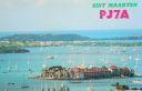
na-105.jpgNA-105 St Martin;Sint Maarten38 viewsSaint Martin (French: Saint-Martin; Dutch: Sint Maarten) is an island in the northeast Caribbean Sea, approximately 300 km (190 mi) east of Puerto Rico. The 87-square-kilometre (34 sq mi) island is divided roughly 60/40 between the French Republic (53 km2, 20 sq mi)[1] and the Kingdom of the Netherlands (34 km2, 13 sq mi),[2] but the two parts are roughly equal in population.
|
|
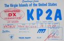
na-106.jpgNA-106 US Virgin Islands38 viewsThe United States Virgin Islands (USVI; also called the US Virgin Islands or American Virgin Islands), officially the Virgin Islands of the United States, is a group of islands in the Caribbean and an unincorporated and organized territory of the United States. The islands are geographically part of the Virgin Islands archipelago and are located in the Leeward Islands of the Lesser Antilles.
|
|

na-107r.jpgNA-107 Martinique38 viewsMartinique is an insular region of France located in the Lesser Antilles of the West Indies in the eastern Caribbean Sea, with a land area of 1,128 square kilometres (436 sq mi) and a population of 376,480 inhabitants as of January 2016. Like Guadeloupe, it is an overseas region (région d'outre-mer) of France, consisting of a single overseas department.
|
|

na-113.jpgNA-113 South Bahamas group38 viewsCrooked Island is an island and district, part of a group of Bahamian islands defining a large, shallow lagoon called the Bight of Acklins, of which the largest are Crooked Island in the north and Acklins in the south-east, and the smaller are Long Cay (once known as Fortune Island) in the north-west, and Castle Island in the south.
|
|
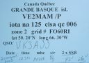
na-125.jpgNA-125 Quebec Province (St Lawrence Gulf) West group38 viewsLocated on the north shore of the Gulf of Saint Lawrence, just offshore from the town of Sept-ÃŽles lies a seven-island archipelago, of which Grand Basque is part of the island group
|
|

na-128.jpgNA-128 Quebec Province (St Lawrence Waterway) group38 viewsL'Isle-aux-Coudres is a municipality in Quebec, Canada, in the Charlevoix Regional County Municipality in the Charlevoix area of the Capitale-Nationale region. It is located on and contiguous with Coudres Island (ÃŽle aux Coudres), located in the St. Lawrence River about 6 kilometres (3.7 mi) south from the mainland.
|
|

na-128r.jpgNA-128 Quebec Province (St Lawrence Waterway) group38 viewsL'Isle-aux-Coudres is a municipality in Quebec, Canada, in the Charlevoix Regional County Municipality in the Charlevoix area of the Capitale-Nationale region. It is located on and contiguous with Coudres Island (ÃŽle aux Coudres), located in the St. Lawrence River about 6 kilometres (3.7 mi) south from the mainland.
|
|
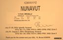
na-130r.jpgNA-130 Canada Nunavut (Baffin's Coastal Islands) East group38 viewsQikiqtarjuaq (Inuktitut pronunciation: [qikiqtaÊjuˈaq]; formerly known as Broughton Island until November 1998 /ˈbrÉ”ËtÉ™n/,[5] is a community located on the island of the same name in the Qikiqtaaluk Region of Nunavut, Canada. The island is known for Arctic wildlife, whale watching, and as the northern access point for Auyuittuq National Park (see also Pangnirtung)
|
|

na-131.jpgNA-131 Canada Nunavut (Kitikmeot Region) East Centre group38 viewsKing William Island (French: ÃŽle du Roi-Guillaume; previously: King William Land; Inuktitut: Qikiqtaq)[1] is an island in the Kitikmeot Region of Nunavut, which is part of the Canadian Arctic Archipelago. In area it is between 12,516 km2 (4,832 sq mi)[2] and 13,111 km2 (5,062 sq mi)[3] making it the 61st-largest island in the world and Canada's 15th-largest island. Its population, as of the 2011 census, was 1,279,[4] all of whom live in the island's only community, Gjoa Haven.
|
|

na-136.jpgNA-136 Connecticut State group38 viewsThe Thimble Islands is an archipelago consisting of small islands in Long Island Sound, located in and around the harbor of Stony Creek in the southeast corner of Branford, Connecticut. The archipelago of islands made up of Stony Creek pink granite bedrock were once the tops of hills prior to the last ice age
|
|

na-142.jpgNA-142 Florida State North West (Escambia to Walton County) group38 viewsSanta Rosa Island is a 40-mile barrier island located in the U.S. state of Florida, thirty miles east of the Alabama state border. The communities of Pensacola Beach, Navarre Beach, and Okaloosa Island are located on the island.
|
|

na-151.jpgNA-151 Greenland's Coastal Islands South East 38 viewsAmmassalik Island is on the east coast of Greenland - and the main town is Tasiilaq with it's colourful and red buildings, bakery in the middle of the harbour, a school and hospital. It is a spread out town and you can walk around the town with ease. With 2,017 inhabitants (2013), it is the most populous community on the eastern coast, and the seventh-largest town in Greenland.
|
|

na-152.jpgNA-152 Alaska Nome Census Area North group38 viewsSarichef Island is a long and narrow coastal island on the Chukchi Sea-facing coast of Alaska. It is located at the mouth of the Shishmaref Inlet, Kotzebue-Kobuk Low. It is located hundred miles east of Russia, which can be seen on clear days. The highest point on the island is the 6-meter cemetery in Shishmaref
|
|

na-152r.jpgNA-152 Alaska Nome Census Area North group38 viewsSarichef Island is a long and narrow coastal island on the Chukchi Sea-facing coast of Alaska. It is located at the mouth of the Shishmaref Inlet, Kotzebue-Kobuk Low. It is located hundred miles east of Russia, which can be seen on clear days. The highest point on the island is the 6-meter cemetery in Shishmaref
|
|

na-154.jpgNA-154 Nova Scotia Province North group38 viewsPictou Island is a Canadian island located in the Northumberland Strait approximately 4 NM north of Nova Scotia and 10 NM south of Prince Edward Island. Measuring 9.5 km in length and 2.5 km in width, the total area is 23.75 km². The island is administratively part of Pictou County.
|
|
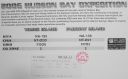
na-156r.jpgNA-156 Nunavut (Hudson Bay - Quebec Coast) North West group38 viewsPitsiulartok or Pituilaktok (formerly: Fairway Island),[1] is a small, uninhabited island located at 63°15'N, 90°33'W[2] in Hudson Bay, about 13 km[3] from the community of Chesterfield Inlet, Nunavut, Canada. The narrow island is about 3.5 km in length and barely 1 km wide at its widest point. Traditionally it was a walrus-hunting ground for the local Inuit,[2] and a landmark for southern whalers.[4] It is part of a loose chain of small islands running along the coast, including Sakpik Island and Promise Island.
|
|
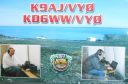
na-159.jpgNA-159 Nunavut (King George Islands) group38 viewsThe King George Islands are an archipelago in the southeast part of Hudson Bay, Canada
|
|

na-160.jpgNA-160 Honduras Cortes / Atlantida / Colon Department group38 viewsThe Cayos Cochinos or Cochinos Cays consist of two small islands and 13 more small coral cays situated 30 kilometres northeast of La Ceiba on the northern shores of Honduras. Although geographically separate, they belong to the Bay Islands department and are part of Roatán municipality.
|
|
| 15647 files on 392 page(s) |
 |
|
|
|
|
|
|
|
|
171 | |
|
|
|
|
|
|
|
|
 Contact

