 Most viewed Most viewed |

OC-228.jpgOC-228 South Australia State East group37 viewsBaudin Rocks is a group of islets on the south east coast of South Australia about 8.3 kilometres (5.2 miles) north-northwest of the town of Robe. The group consists of two major islets and at least 17 smaller islets with a total area about 5 hectares (12 acres). The maximum elevation is 12 metres (39 feet). As of 1996, the smaller northern islet is the most accessible in the group, having a sandy beach on its north-western corner
|
|

OC-230.jpgOC-230 Rowley Shoals37 viewsThe Rowley Shoals is a group of three atoll-like coral reefs south of the Timor Sea, about 260 km (160 mi) west of Broome on the northwestern Australian coast, centered on 17°20′S 119°20′E, on the edge of one of the widest continental shelves in the world. Each atoll covers an area of around 80 to 90 km2 (31 to 35 sq mi) within the rim of the reef, including the lagoons, while the land areas are negligible. They belong to Western Australia. They all rise steeply from the surrounding ocean floor. To the northeast lie the Scott and Seringapatam Reefs which are located on the same undersea platform.
|
|

OC-230R.jpgOC-230 Rowley Shoals37 viewsThe Rowley Shoals is a group of three atoll-like coral reefs south of the Timor Sea, about 260 km (160 mi) west of Broome on the northwestern Australian coast, centered on 17°20′S 119°20′E, on the edge of one of the widest continental shelves in the world. Each atoll covers an area of around 80 to 90 km2 (31 to 35 sq mi) within the rim of the reef, including the lagoons, while the land areas are negligible. They belong to Western Australia. They all rise steeply from the surrounding ocean floor. To the northeast lie the Scott and Seringapatam Reefs which are located on the same undersea platform.
|
|

oc-231.jpgOC-231 Green Islands37 viewsThe Green Islands is a small archipelago of islands in the Solomon Sea, within the Autonomous Region of Bougainville, in northeastern Papua New Guinea. They are located at 4°30′S 154°10′ECoordinates: 4°30′S 154°10′E, about 200 km (124 mi) northwest of Bougainville Island, and about 200 km (124 mi) east of Rabaul and New Britain island.
|
|

OC-233.jpgOC-233 Tasmania's Coastal Islands37 viewsBruny Island is a 362-square-kilometre island located off the south-eastern coast of Tasmania, Australia. The island is separated from the Tasmanian mainland by the D'Entrecasteaux Channel, and its east coast lies within the Tasman Sea. Storm Bay is located to the island's northeast.
|
|

OC-233R.jpgOC-233 Tasmania's Coastal Islands37 viewsBruny Island is a 362-square-kilometre island located off the south-eastern coast of Tasmania, Australia. The island is separated from the Tasmanian mainland by the D'Entrecasteaux Channel, and its east coast lies within the Tasman Sea. Storm Bay is located to the island's northeast.
|
|

OC-241T.jpgOC-241 Timor Barat's Coastal Islands37 viewsSemau, also known as Pusmau and Pasar Pusmau, is an island in the Lesser Sunda Islands in Indonesia. It is located 20 miles off the harbor of Kupang. The inhabitants of Samau are the Helong people, who some believe are the original inhabitants of the Kupang area.[1] It is a supplier of firewood and charcoal and grows corn, watermelon, and mango. Semau is also used as a holiday village where snorkeling, swimming, and other water sports are popular.
|
|

OC-241R.jpgOC-241 Timor Barat's Coastal Islands37 viewsSemau, also known as Pusmau and Pasar Pusmau, is an island in the Lesser Sunda Islands in Indonesia. It is located 20 miles off the harbor of Kupang. The inhabitants of Samau are the Helong people, who some believe are the original inhabitants of the Kupang area.[1] It is a supplier of firewood and charcoal and grows corn, watermelon, and mango.[1] Semau is also used as a holiday village where snorkeling, swimming, and other water sports are popular.
|
|

OC-242R.jpgOC-242 Bonerate and Taka' Bonerate Islands37 viewsThe Taka Bonerate Islands in Indonesia consist of Latondu, Rajuni, Tinabo, Pasi Telu, and Taka Lumungan. They lie about 3 to 4 hours by boat from Benteng, the administrative capital of the Selayar Islands. Together they make up the Takabonerate District of Selayar Regency in South Sulawesi Province. It is part of a National Marine Park, with dive sites, pelagic fishes, dolphins, turtles, many soft corals, sea fans. Also it is the third largest atoll in the world
|
|

OC-244.jpgOC-244 Luzon's Coastal Islands37 viewsMindoro is the seventh largest island in the Philippines by land area with a total of 10,571 km² and with a total population of 1,331,473 as of 2015. It is located off the southwestern coast of Luzon and northeast of Palawan.
|
|

OC-245R.jpgOC-245 Sumatra's Coastal Islands North37 viewsRupat is an island in the Strait of Malacca, and forms part of Bengkalis Regency within Riau Province of Indonesia. It lies just off the eastern coast of Sumatra, across from Dumai city, from which it is separated by the Rupat Strait. Its area is 1,490 km².
|
|

OC-246.jpgOC-246 Leti and Sermata Islands37 viewsThe Barat Daya Islands (Indonesian: Kepulauan Barat Daya) are a group of islands in the Maluku province of Indonesia. These islands are located off the eastern end of East Timor. Wetar is the largest island in the group. To the west, the Ombai Strait separates Wetar from Alor Island, part of East Nusa Tenggara. The Wetar Strait separates Wetar from Timor to the south.
|
|
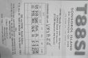
OC-248R.jpgOC-248 Sonsorol Islands37 viewsSonsorol is one of the sixteen states of Palau. The administrative center, and only village, is Dongosaru on Sonsorol island. The inhabitants speak Sonsorolese, a local Trukic language, and Palauan. Sonsorol Island, also called Dongosaro or Dongosaru, is encircled by a coral reef extending 160 to 480 m offshore. It is 2 km long north south, and up to 890 m wide in the north. It is located 1.6 km south of Fanna Island. The village of Dongosaro, which is the capital of the state, is located on the west coast. The island is thickly wooded with coconut palms and other trees. Together with Fanna, it forms the Sonsorol Islands.
|
|
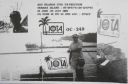
OC-249.jpgOC-249 Aru Islands37 viewsThe Aru Islands are a group of about ninety-five low-lying islands in the Maluku province of eastern Indonesia. They also form a regency of Maluku, with a land area of 8,152.42 square kilometres (3,147.67 square miles). At the 2011 Census the Regency had a population of 84,138. The islands are the easternmost in Maluku province, and are located in the Arafura Sea southwest of New Guinea and north of Australia.
|
|

OC-252.jpgOC-252 Kalimantan's Coastal Islands West37 viewsTemajo Island lies 5 km offshore the western side of Borneo. The island has a small holiday resort
|
|

OC-253R.jpgOC-253 Hall Islands37 viewsThe Hall Islands are a group of two large atolls in the northern part of the state of Chuuk, Federated States of Micronesia. Nomwin, the western atoll, and Murilo, the eastern one, are located about 9 km apart, being the emergent parts of a twin-lobed seamount. Murilo and Nomwin each harbor a population of more than 1,000 people. They lie roughly 100 km to the north of Chuuk Lagoon. Uninhabited East Fayu, lying 30+ km to the west of Nomwin, is sometimes included in the Halls
|
|
OC-254R.jpgOC-254 Mortlock Islands37 viewsThe Nomoi Islands, also known as Mortlock Islands, are a group of three large atolls in the state of Chuuk, Federated States of Micronesia. They are located about 250 kilometres (160 miles) to the southeast of Chuuk. Satawan, the southern atoll, is the largest. Both Etal, the northern one, and Lukunor in the northeast are much smaller. They are located between 6 and 9 kilometres (3.7 and 5.6 miles) from each other.
|
|
OC-258.jpgOC-258 Papua New Guinea's Coastal Islands North37 viewsMuschu Island is located in the East Sepik province of Papua New Guinea and lies just off the coast of the town of Wewak. As was much of the area during WWII the island played a large role hosting mainly Japanese soldiers before their surrender. After their surrender, the Australian army used the island for a short time as a prison for POW's.
|
|

OC-260.jpgOC-260 Oroluk Atoll37 viewsOroluk Atoll is an atoll belonging to Pohnpei State in the Micronesia. Oroluk Atoll stretches from the northwest to the southeast with a length of about 32 km (20 mi) and an average width of 20 km (12 mi). The lagoon's surface is roughly 420 km2 (162 sq mi). The inhabitants of Oroluk are only between five and ten in number. They come mainly from Sector 4 of the Kapinga Village in Kolonia, Pohnpei, and tend to the plantations of bananas and taro. A supply ship generally calls into the lagoon once every 6 months.
|
|

OC-261R.jpgOC-261 South Australia State West Centre group37 viewsWaldegrave Islands is an island group in the Australian state of South Australia located in the Investigator Group about 2.5 kilometres (1.6 miles) northwest by west of Cape Finniss on the west coast of Eyre Peninsula. The group consists of Waldegrave Island, Little Waldegrave Island and according to some sources, a pair of rocks known as the Watchers. The group is notable as a breeding site for Australian sea lions and Cape Barren geese. The group has enjoyed protected area status since the 1960s and as of 1972 has been part of the Waldegrave Islands Conservation Park.
|
|
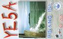
OC-262.jpgOC-262 Sumatra's Coastal Islands South37 viewsPulau Pisang or “Banana Island†lies just 45 minutes off the coast of Krui, Sumatra, and is also home to some of the best white sand beaches, snorkeling and fishing in the Krui area. The island is home to less than 100 people,
|
|
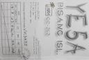
OC-262R.jpgOC-262 Sumatra's Coastal Islands South37 viewsPulau Pisang or “Banana Island†lies just 45 minutes off the coast of Krui, Sumatra, and is also home to some of the best white sand beaches, snorkeling and fishing in the Krui area. The island is home to less than 100 people,
|
|
OC-263S.jpgOC-263 Taongi Atoll;Bokaak Atoll37 viewsBokak Atoll or Taongi Atoll is an uninhabited coral atoll in the Ratak Chain of the Marshall Islands, in the North Pacific Ocean. It is located 685 km (426 mi) north of Majuro Atoll, the capital of the Marshall Islands, and 280 km (170 mi) northeast of Bikar Atoll, the closest atoll, making it the most northerly and most isolated atoll of the country. Wake Island is 348 mi (560 km) north-northwest. The land area is 3.2 km2 (1.2 sq mi), and the lagoon measures 78 km2 (30 sq mi). It consists of 36 islets. The total area is 129 km2 (50 sq mi) (including reef flat).
|
|

OC-264.jpgOC-264 Maria Island37 viewsÎles Maria or simply Maria, also known as Hull Island, is a small coral atoll in the Pacific Ocean. Its original name is Nororotu. The nearest island is Rimatara situated 205 kilometres (127 miles) to the ESE. The atoll consists of four islets (îles), with a dense atoll forest and a very shallow lagoon, supporting numerous bird species. The atoll is uninhabited now, but at one time was the site of a penal colony. Copra is occasionally harvested at the island.
|
|
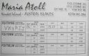
OC-264R.jpgOC-264 Maria Island37 viewsÎles Maria or simply Maria, also known as Hull Island, is a small coral atoll in the Pacific Ocean. Its original name is Nororotu. The nearest island is Rimatara situated 205 kilometres (127 miles) to the ESE. The atoll consists of four islets (îles), with a dense atoll forest and a very shallow lagoon, supporting numerous bird species. The atoll is uninhabited now, but at one time was the site of a penal colony. Copra is occasionally harvested at the island.
|
|

OC-267.jpgOC-267 Coral Sea Islands Territory North37 viewsMarion Island is part of the Coral Islands North West Group in northern Queensland, Australia. Marion Reef is al arge circular atoll formation that is composed of three main units located on the Eastern side: Marion, Long and Wansfell; and a number of smaller reefs on the west. The formation sits atop a submarine feature known as the Marion Plateau which is separated from the larger Coral Sea Plateau to the north by the Townsville Trough. The island is uninhabited
|
|

OC-270R.jpgOC-270 Simeulue and Banyak Islands37 viewsSimeulue is an island of Indonesia, 150 kilometres (93 mi) off the west coast of Sumatra. Its capital is Sinabang. The SW facing portion of the island holds multiple world class waves and a handful of surf resorts have popped up in recent years.
|
|

OC-271.jpgOC-271 Babar Islands37 viewsThe Babar Islands (Indonesian: Kepulauan Babar) are located in Maluku Province, Indonesia. Tepa (a town with a population of about 2,000 people) is the administrative center of the Babar Islands municipality. The topography of all the Babar islands is distinctive for their marked stepped appearance, the result of a combination of periodic uplifting of the tectonic plate. Small freighters that have contracts to carry passengers service the islands.
|
|

OC-277R.jpgOC-277 Sorol Atoll37 viewsSorol is a coral atoll of nine islands in the central Caroline Islands in the Pacific Ocean, and forms a legislative district in Yap State in the Federated States of Micronesia. Sorol is located approximately 150 kilometres (93 mi) south of Ulithi and 250 kilometres (160 mi) southeast of the island of Yap.
|
|
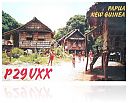
Azone28.jpg37 views
|
|

Azone37.jpg37 views
|
|
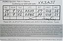
zone30r~0.jpg37 views
|
|

jy5kc.jpg37 views
|
|

OC-114R.jpgOC-114 Raivavae Island37 viewsRaivavae is one of the Austral Islands in French Polynesia. Its total land area including offshore islets is 17.9 km2 (6.9 sq mi).[1]:205 At the 2017 census it had a population of 903. The island is of volcanic origin, and rises to 437 metres (1,434 ft) elevation at Mont Hiro.
|
|

ei3kdx.jpgei3kd - Ireland37 viewsqso via EME moon bounce - although a few weeks later ei3kd completed with vk3amz via winter Es for the best qso of that season
|
|
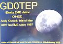
gd0tep.jpgGD0TEP Isle of Mann37 viewsvia EME - my 8el single yagi to his 10 el single yagi
|
|
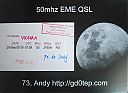
gd0tepr.jpgGD0TEP Isle of Mann37 viewsvia EME - my 8el single yagi to his 10 el single yagi
|
|

yc9fz.jpgyc9fz - Indonesia37 viewsvia Winter Es - took me 9 years to work YB on 6m but worked another 20 or so YB stations a few months later via Summer Es
|
|

IS0AWZ.jpgis0awz - Sardinia37 viewsshort opening via Winter Es link to Northern hemisphere summer Es
|
|

e73s.jpge73s - BOSNIA-HERZEGOVINA37 viewsvia our winter Es into northern hemisphere summer Es season
|
|
| 15365 files on 385 page(s) |
 |
|
|
|
|
|
|
|
|
170 | |
|
|
|
|
|
|
|
|
 Contact
