 Most viewed Most viewed |

AS-135R.jpgAS-135 China Jiangsu Province group110 viewsPing Island
|
|

AS-147R.jpgAS-147 Japan Hokkaido's Coastal Islands110 viewsOkushiri Island is an island in HokkaidÅ, Japan. It has an area of 142.97 square kilometres. The town of Okushiri and the Hiyama Prefectural Natural Park encompass the entire island. It has many pastures, beech tree forests, and a rocky coastline.
|
|

AS-154R.jpgAS-154 Turkey Black Sea Coast East group110 viewsGiresun Island is a small island that has an area of 4 hectares and lies 1.2 km from the Turkish city of Giresun on the southeastern coast of Black Sea. It is the largest island on the Turkish Black Sea coast.
|
|

na-002.jpgNA-002 Caicos Islands110 viewsThe Turks and Caicos Islands are a British Overseas Territory consisting of the larger Caicos Islands and smaller Turks Islands, two groups of tropical islands in the Lucayan Archipelago of the Atlantic Ocean and northern West Indies. They are known primarily for tourism and as an offshore financial centre.
|
|

4l1un.jpg110 views
|
|

3B93B8DLR.jpg110 views
|
|

4L5O.jpg110 views
|
|

3b8dl2hwa.jpg110 views
|
|

4k5dr.jpg110 views
|
|

4o3tr.jpg110 views
|
|
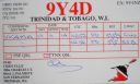
9y4d.jpg9y4d Trinidad110 viewsBig F2 opening on this day into HK, YV also Marquesas
|
|
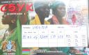
c5ykr.jpgc5yk Gambia110 viewsQSO made via F2 longpath over North America - path identified via RX of 6v7six beacon which was heard for a few weeks on a daily basis around this date and time
|
|

dxcc_logo~0.jpgdxcclogo110 views
|
|

as-032r.jpgAS-032 Japan Osumi Islands109 viewsThe ÅŒsumi Islands is an archipelago in the Nansei Islands, and are the northernmost group of the Satsunan Islands, which is in turn part of the Ryukyu Archipelago. The chain extends from the southern tip of Kyushu to Yakushima. Administratively, the group belongs within Kagoshima Prefecture,
|
|
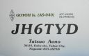
as-040.jpgAS-040 Japan Goto Islands109 viewsThe GotŠIslands are Japanese islands in the East China Sea, off the western coast of Kyūshū. They are part of Nagasaki Prefecture.
|
|

as-047.jpgAS-047 Japan Daito Islands109 viewsThe DaitÅ Islands are an archipelago consisting of three isolated coral islands in the Philippine Sea southeast of Okinawa. The islands have a total area of 44.427 square kilometres and a population of 2,107.
|
|
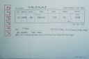
as-047r.jpgAS-047 Japan Daito Islands109 viewsThe DaitÅ Islands are an archipelago consisting of three isolated coral islands in the Philippine Sea southeast of Okinawa. The islands have a total area of 44.427 square kilometres and a population of 2,107.
|
|
as-049r.jpgAS-049 Japan Tokara Islands109 viewsThe Tokara Islands is an archipelago in the Nansei Islands, and are part of the Satsunan Islands, which is in turn part of the Ryukyu Archipelago. The 150 kilometres chain consists of twelve small islands located between Yakushima and Amami-Oshima. The islands have a total area of 101.35 square kilometres.
|
|

as-050.jpgAS-050 Asiatic Russia Sergeya Kirova Islands109 viewsThe Kirov Islands or Sergey Kirov Islands is an island group in the Kara Sea, Russian Federation. It is an archipelago of small islands covered with tundra vegetation located about 140 km from the coast of Siberia and 100 km to the northwest of the Nordenskiöld Archipelago.
|
|

as-062.jpgAS-062 Asiatic Russia Habomai Islands109 viewsThe Habomai Islands (Russian: Хабомаи (Habomai), Japanese: æ¯èˆžç¾¤å³¶ (Habomai guntÅ) or æ¯èˆžè«¸å³¶ (Habomai shotÅ) are a group of islets in the southernmost Kuril Islands. They are currently under Russian administration, but together with Iturup (Etorofu), Kunashir (Kunashiri), and Shikotan are claimed by Japan.
|
|

as-070.jpgAS-070 Japan East Siberian Sea Coast East group109 viewsGUSMP Island, russian island located in the east of the Siberian Sea
|
|

as-071.jpgAS-071 Asiatic Russia Bering Sea Coast North group109 viewsArakamchechen Island (Russian: Ðракамчечен; Eskimo–Aleut: Kigini) is an island in the Bering Sea. Arakamchechen lies north of Cape Chaplino, close to the coast of Chukotka. It is separated from the continental shore by an 8 km wide sound. This island is inhabited; the main settlement is Yanrakynnot village. Arakamchechen Island is 32 km long and has a maximum width of 21 km
|
|

as-074.jpgAS-074 Malaysia Selangor / Negeri Sembilan State group109 viewsPulau Ketam is an island located off the coast of Port Klang, Selangor, Malaysia. The island is in the intertidal zone and the chief vegetation is mangrove
|
|
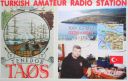
AS-099.jpgAS-099 Turkey Canakkale / Balikesir / Izmir Province group109 viewsTenedos, or Bozcaada in Turkish, is an island of Turkey in the northeastern part of the Aegean Sea. Administratively, the island constitutes the Bozcaada district of Çanakkale province. With an area of 39.9 km² it is the third largest Turkish island after Imbros and Marmara.
|
|

AS-100.jpgAS-100 Israel group109 viewsAchziv Islands (also Achziv Beach Islands) are a group of small Israel islands in the Mediterranean Sea. Each island is a few hundred square meters in area, with a reef is composed of small limestone blocks.
The islands are part of the Rosh Hanikra Islands Nature Reserve
|
|

AS-101R.jpgAS-101 Thailand Malay Peninsula East group109 viewsKo Samui, Thailand’s second largest island, lies in the Gulf of Thailand off the east coast of the Kra Isthmus. It's known for its palm-fringed beaches, coconut groves and dense, mountainous rainforest
|
|

AS-110R.jpgAS-110 Taiwan Tungsha (Pratas) Island109 viewsThe Pratas Islands, also known as the Dongsha Islands and Tungsha Islands, are three atolls in the north of the South China Sea. They consist of one island, two coral reefs and two banks, and are located about 170 nautical miles southeast of Hong Kong
|
|

AS-112R.jpgAS-112 Oman Al Batinah / Masqat Region group109 viewsBetween Barka and Sohar is the Sawadi and Daymaniyat islands. The rocky and windswept Sawadi Islands lie just offshore. The largest of the seven islands lies almost within spitting distance of the beach, a large rocky hump topped by a string of watchtowers, while the other smaller islands lie further out to sea.
|
|

AS-119R.jpgAS-119 Oman Musandam Region group109 viewsJazīrat Umm al Ghanam is a island and is located in Musandam, Oman. The estimate terrain elevation above seal level is 88 metres
|
|

AS-122.jpgAS-122 South Korea Kyonggi-do Province West group109 viewsBaengnyeong Island is a 45.8-square-kilometre, 8.45-kilometre long and 12.56-kilometre wide island in Ongjin County, Incheon, South Korea, located near the Northern Limit Line
|
|

AS-126.jpgAS-126 Thailand Malay Peninsula South West group109 viewsKo Tarutao island is the largest island of Tarutao National Marine Park in Satun Province of Thailand, close to Malaysia border. The island is 26 km long and 11 km wide.
|
|

AS-134R.jpgAS-134 China Hebei / Tianjin Province group109 viewsShijiutuo, Hebei is an island to the east of Yuetuo and southeast of Laoyujian in northern China.
|
|

AS-140.jpgAS-140 Bangladesh Khulna / Barisal Region group109 viewsBhola Island (also called Dakhin Shahbazpur) is the largest island of Bangladesh with an area of 1441 km². It is most of the land area of Bhola District in Barisal Division. It is situated at the mouth of the Meghna River. There are ferry and launch services from Dhaka and Barisal.The Island is 130 kilometres (81 miles) long and has a population of 1.7 million
|
|

AS-160R.jpgAS-160 China Shandong Province North West group109 viewsFurong Island Shandong Province
|
|

AS-165R.jpgAS-165 Myanamar Arakan Region group109 views Apawye Island near Thandwe, Arakan region
|
|

eu-009r.jpgEU-009 Orkney Island109 viewsOrkney, also known as the Orkney Islands, is an archipelago in the Northern Isles of Scotland, situated off the north coast of the isle of Great Britain. Orkney is 10 miles (16 km) north of the coast of Caithness and comprises approximately 70 islands, of which 20 are inhabited. The largest island, Mainland, is often referred to as "the Mainland", and has an area of 523 square kilometres (202 sq mi), making it the sixth-largest Scottish island and the tenth
|
|

eu-018r.jpgEU-018 Faroe Islands109 viewsThe Faroe Islands, or the Faeroe Islands, is a North Atlantic archipelago located 320 kilometres (200 mi) north-northwest of Scotland, and about halfway between Norway and Iceland. It is an autonomous country of the Kingdom of Denmark. Their total area is about 1,400 square kilometres (540 sq mi) with a population of 50,322 in October 2017.
|
|

3D2XXR.jpg109 views
|
|

3c0er.jpg109 views
|
|

3c5a.jpg109 views
|
|
| 15298 files on 383 page(s) |
 |
|
|
|
|
|
|
|
|
17 | |
|
|
|
|
|
|
|
|
 Contact
