 Most viewed |
oc-117r.jpgOC-117 Louisiade Archipelago39 viewsThe Louisiade Archipelago is a string of ten larger volcanic islands frequently fringed by coral reefs, and 90 smaller coral islands in Papua New Guinea. It is located 200km southeast of New Guinea, stretching over more than 160 kilometres (99 mi) and spread over an ocean area of 26,000 square kilometres (10,000 sq mi) between the Solomon Sea to the north and the Coral Sea to the south. The aggreg land area of the islands is about 1,871 square kilometres (722 sq mi) with Vanatinai (Tagula) being the largest
|
|

OC-118.jpgOC-118 Hoorn Islands39 viewsThe Hoorn Islands (also Futuna Islands) are one of the two island groups of which the French overseas collectivity (collectivité d'outre-mer, or COM) of Wallis and Futuna is geographically composed. The aggregate area is 115 km², and the population 4,873 (census of 2003).
Geographically, there are two islands: Futuna Island (in the northwest) (83 km², pop. 4871), Alofi Island (in the southeast) (32 km², pop. 2)
|
|

OC-123.jpgOC-123 Niuafo'ou Island39 viewsNiuafoʻou (meaning: many new coconuts) is the most northerly island in the kingdom of Tonga. It is a volcanic rim island with an area of 15 km2 (5.8 sq mi) and a population of 650 in 2006. The Niuafoʻou language is spoken on the island.
|
|

oc-128r.jpgOC-128 Palawan Island39 viewsPalawan is the largest island of the province of Palawan in the Philippines and the fifth largest island of the country. The north west coast of the island is along the South China Sea, while the south east coast forms part of the northern limit of the Sulu Sea
|
|

OC-131R.jpgOC-131 King George Islands39 viewsThe King George Islands (ÃŽles du Roi Georges) is a subgroup of the Tuamotus Archipelago group in French Polynesia. The King George Islands include four atolls and one island. Tikei is the easternmost island and Ahe Atoll is the westernmost of the subgroup. The distance between them is 200 km (124 mi).
|
|
OC-140R.jpgOC-140 Western Australia State (N.W. Coast) West group39 viewsSholl Island (area about 310 hectares) is between Onslow and Dampier, off the Pilbara coast of Western Australia. Part of the Pilbara Inshore Islands Group which are important breeding and resting places for migratory and resident shorebirds and seabirds, and marine turtles.
|
|

OC-145.jpgOC-145 Halmahera group39 viewsHalmahera, formerly known as Jilolo, Gilolo, or Jailolo, is the largest island in the Maluku Islands. It is part of the North Maluku province of Indonesia and Sofifi, the capital of the province, is located on the west coast of the island. Halmahera has a land area of 17,780 km2 (6,860 sq mi); it is the largest island of Indonesia outside the five main islands.
|
|

OC-145R.jpgOC-145 Halmahera group39 viewsHalmahera, formerly known as Jilolo, Gilolo, or Jailolo, is the largest island in the Maluku Islands. It is part of the North Maluku province of Indonesia and Sofifi, the capital of the province, is located on the west coast of the island. Halmahera has a land area of 17,780 km2 (6,860 sq mi); it is the largest island of Indonesia outside the five main islands.
|
|
OC-152R.jpgOC-152 Tubuai Island39 viewsTubuai or Tupua'i is the main island of the Tubuai Island group, located at 23°23′00″S 149°27′00″W, 640 km (400 mi) south of Tahiti. In addition to Tubuai, the group of islands include Rimatara, Rurutu, Raivavae and the uninhabited Îles Maria. They are part of the Austral Islands in the far southwest of French Polynesia in the south Pacific Ocean. Tubuai island sustains a population of 2,217 people on 45 km² of land
|
|

OC-153.jpgOC-153 Papua New Guinea's Coastal Islands South39 viewsYule Island is a small island in Central Province, Papua New Guinea. It is located 160 km NW from Port Moresby, on the south coast of Papua New Guinea. With the European missionaries came catechists from the Philippines, some of which married into the local population. Today, many inhabitants of Yule Island have distinct Filipino features
|
|
OC-156R.jpgOC-156 Yasawa group39 viewsThe Yasawa Group is an archipelago of about 20 volcanic islands in the Western Division of Fiji, with an approximate total area of 135 square kilometres (52 sq mi). Areas of the Yasawas were the locales for both the 1949, and 1980 filming of the romance adventure film The Blue Lagoon
|
|

OC-162.jpgOC-162 Shortland Islands39 viewsThe Shortland Islands are a group of islands belonging to the Western Province of the Solomon Islands, at 6.92°S 155.88°E. Named by John Shortland, they lie in the extreme northwest of the country's territory, close to the island of Bougainville, Papua New Guinea.[1] The largest island is Shortland Island. Other islands include Balalae Island, Ovau Island, Pirumeri Island, Faisi Island, Magusaiai Island, Masamasa Island, Fauro Island, and Ballale Island (which was occupied by the Japanese in World War II, and is home to many abandoned World War II aircraft).
|
|

OC-165.jpgOC-165 Sarawak's Coastal Islands39 viewsSatang Island consisting of two islands Pulau Satang Besar and Pulau Satang Kecil is located in the South China Sea and its surrounding pristine waters are protected as a sanctuary for the turtles
|
|

OC-166R.jpgOC-166 Kalimantan's Coastal Islands East39 viewsThe Derawan Islands are in the province of East Kalimantan in Indonesia. They consist of 31 islands, most well known among these are the islands of Derawan, Maratua, Sangalaki and Kakaban. There are also numerous submerged reefs and islets. They are located in the Sulawesi Sea, on the coastal shelf of East Kalimantan
|
|

OC-167.jpgOC-167 Kapingamarangi Atoll39 viewsKapingamarangi is an atoll and a municipality in the state of Pohnpei of the Federated States of Micronesia. It is by far the most southerly atoll or island of the country and of the Caroline Islands, 300 km (190 mi) south of the next southerly atoll, Nukuoro, and 740 km (460 mi) southwest of the main island of Pohnpei state; it forms a Polynesian outlier. The total area of the atoll, including the lagoon, is 74 km2 (29 sq mi). Out of this, 1.1 km2 (0.4 sq mi) is land area, spread over 33 wooded islets.
|
|

OC-173.jpgOC-173 Northern Territory (Arafura Sea Coast) West group39 viewsMelville Island, known in the Tiwi language as Yermalner, is an island in the eastern Timor Sea, off the coast of the Northern Territory, Australia. It is west of the Cobourg Peninsula in Arnhem Land and north of Darwin, with a tropical climate. The largest community/town on the island is Milikapiti, pop. 559.
|
|

OC-174R.jpgOC-174 Tawi Tawi group39 viewsTawi-Tawi (Tausug: Wilaya' sin Tawi-Tawi) is an island province in the Philippines located in the Bangsamoro Autonomous Region in Muslim Mindanao (BARMM). The capital of Tawi-Tawi is Bongao.It is the southernmost province of the country, sharing sea borders with the Malaysian state of Sabah and the Indonesian North Kalimantan province, both on the island of Borneo to the west.
|
|
OC-181.jpgOC-181 Witu Islands39 viewsThe Vitu Islands /ˈviËtuË/ are a volcanic group with an area of 37 sq mi (96 km²) located in the Bismarck Sea off New Britain, in the southwestern Pacific Ocean. They are not technically part of the Bismarck Archipelago. Administratively they are part of Papua New Guinea. Formerly called the French Islands, the group is sometimes known as the Witu Islands.
|
|

OC-181R.jpgOC-181 Witu Islands39 viewsThe Vitu Islands /ˈviËtuË/ are a volcanic group with an area of 37 sq mi (96 km²) located in the Bismarck Sea off New Britain, in the southwestern Pacific Ocean. They are not technically part of the Bismarck Archipelago. Administratively they are part of Papua New Guinea. Formerly called the French Islands, the group is sometimes known as the Witu Islands.
|
|

OC-183.jpgOC-183 Western Australia State (S.W. Coast) Centre group39 viewsWedge Island is located north of Lancelin and south of Cervantes on the Western Australian coast. The island occupies an area 4.03 hectares (9.96 acres) and is situated 200 metres (656 ft) from the mainland. The island has a maximum elevation of 21 m (69 ft). It lies within the Turquoise Coast islands nature reserve group, a chain of 40 islands spread over a distance of 150 kilometres (93 mi) from north to south.
|
|

OC-184.jpgOC-184 Brunei's Coastal Islands39 viewsPulau Muara Besar is an island connected to the Brunei mainland via a dual-carriageway bridge which connects the island in Brunei Bay, with the mainland of Brunei via Serasa in Brunei-Muara District. The bridge is part of the road infrastructure that will serve the petrochemical refinery plant on the island, which is currently under construction, and is a Chinese foreign direct investment
|
|

OC-185.jpgOC-185 Northern Territory (Arafura Sea Coast) East group39 viewsElcho Island, known to its traditional owners as Galiwin'ku,[1] is an island off the coast of Arnhem Land, Northern Territory, Australia. It is located at the southern end of the Wessel Islands group located in the East Arnhem Region. Galiwin'ku is also the name of the settlement where the island's largest community lives. Elcho island formed part of the traditional lands of the Yan-nhaŋu, according to Norman Tindale. According to J. C. Jennison, the Aboriginal inhabitants were the Dhuwal, who he said called themselves the Kokalango Mala (mala=clan.)
|
|
OC-186.jpgOC-186 Karimunjawa Islands39 viewsKarimun Java or Crimon Java (id: "Karimun Jawa") is a chain of 27 islands north of Jepara Town, off the coast of Central Java, Indonesia.
Designated as a national marine park. Karimunjava consists of many small islands, with the two main ones being Karimunjawa island and Kemujan Island, and the smaller ones being Menjangan Besar Island, and Menjangan Kecil Island and some other even smaller, uninhabited islands.
|
|

OC-186R.jpgOC-186 Karimunjawa Islands39 viewsKarimun Java or Crimon Java (id: "Karimun Jawa") is a chain of 27 islands north of Jepara Town, off the coast of Central Java, Indonesia.
Designated as a national marine park. Karimunjava consists of many small islands, with the two main ones being Karimunjawa island and Kemujan Island, and the smaller ones being Menjangan Besar Island, and Menjangan Kecil Island and some other even smaller, uninhabited islands.
|
|
OC-187.jpgOC-187 Queensland State (North Coast) North group39 viewsTurtle Head Island is an island of the Torres Strait Islands archipelago, located in the Great Barrier Reef Marine Park, east of Cape York Peninsula, in Queensland, Australia. The island is located in Newcastle Bay at the mouth of Escape River and Middle River, not far from Jackey Jackey Creek and adjacent to the Jardine River National Park. The island lies approximately 30 km (19 mi) southeast of Bamaga.
|
|

OC-187R.jpgOC-187 Queensland State (North Coast) North group39 viewsTurtle Head Island is an island of the Torres Strait Islands archipelago, located in the Great Barrier Reef Marine Park, east of Cape York Peninsula, in Queensland, Australia. The island is located in Newcastle Bay at the mouth of Escape River and Middle River, not far from Jackey Jackey Creek and adjacent to the Jardine River National Park. The island lies approximately 30 km (19 mi) southeast of Bamaga.
|
|

OC-188.jpgOC-188 Pangutaran group39 viewsPangutaran Island is located in the west-central part of the Sulu archipelago near Mindanao, Philippines
|
|

OC-192.jpgOC-192 Ontong Java Atoll39 viewsOntong Java Atoll or Luangiuais one of the largest atolls on earth. It is sometimes referred to as Lord Howe Atoll, not to be confused with Lord Howe Island. Administratively Ontong Java belongs to the Solomon Islands As an outlying part of Malaita Province. Approximately 2000 people live on the atoll. There are two main villages where the population is concentrated with 1,386 on the island of Luaniua in the eastern end and 689 on Pelau in the northeast.
|
|
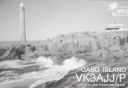
OC-196.jpgOC-196 Victoria State East group39 viewsGabo Island is a 154-hectare (380-acre) island located off the coast of eastern Victoria, Australia, between Mallacoota and Cape Howe on the border with New South Wales. It is separated from the mainland by a 500-metre (1,600 ft) wide channel. Gabo Island is a shipping reference commonly referred to in Victorian weather warnings issued by the Australian Bureau of Meteorology. Gabo Island is well known for its historic lighthouse. This lighthouse, Australia's second tallest, was completed in 1862 and made from pink granite quarried from the island itself.
|
|
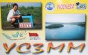
OC-197.jpgOC-197 Bawean Island39 viewsBawean (Indonesian: Pulau Bawean) is an island of Indonesia located approximately 150 km north of Surabaya in the Java Sea, off the coast of Java. It is administered by Gresik Regency of East Java province. It is approximately 15 km in diameter and is circumnavigated by a single narrow road. Bawean is dominated by an extinct volcano at its center that rises to 655 m above sea level. Its population as of the 2010 Census is about 70,000 people
|
|

OC-203.jpgOC-203 South Island's Coastal Islands39 viewsStewart Island, officially named Stewart Island/Rakiura, is the third-largest island of New Zealand. It lies 30 kilometres south of the South Island, across the Foveaux Strait. Its permanent population is 381 people as of the 2013 census, most of whom live in the settlement of Oban on the eastern side of the island.
|
|

OC-205.jpgOC-205 Woodlark group;Muyua group39 viewsWoodlark Island, known to its inhabitants simply as Woodlark or Muyua, is the main island of the Woodlark Islands archipelago, located in Milne Bay Province and the Solomon Sea, Papua New Guinea. Although no formal census has been conducted since 1990, the current population is estimated at approximately 6000 people. The wider Woodlark Islands group also consists of Madau and Nusam to the west, Nubara to the east, and the Marshall Bennett group to the southwest.
|
|
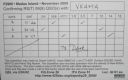
OC-205R.jpgOC-205 Woodlark group;Muyua group39 viewsWoodlark Island, known to its inhabitants simply as Woodlark or Muyua, is the main island of the Woodlark Islands archipelago, located in Milne Bay Province and the Solomon Sea, Papua New Guinea. Although no formal census has been conducted since 1990, the current population is estimated at approximately 6000 people. The wider Woodlark Islands group also consists of Madau and Nusam to the west, Nubara to the east, and the Marshall Bennett group to the southwest.
|
|

OC-206R.jpgOC-206 Western Australia State (S.W. Coast) North group39 viewsDirk Hartog Island is an island off the Gascoyne coast of Western Australia, within the Shark Bay World Heritage Area. It is about 80 kilometres (50 miles) long and between 3 and 15 kilometres (1.9 and 9.3 miles) wide and is Western Australia's largest and most western island. It covers an area of 620 square kilometres (240 square miles) and is approximately 850 kilometres (530 miles) north of Perth. It was named after Dirk Hartog, a Dutch sea captain, who first encountered the Western Australian coastline close to the 26th parallel south latitude, which runs through the island.
|
|

OC-207.jpgOC-207 Cagayan Islands39 viewsThe Cagayan group is situated roughly 120km west of Sipalay and consists of 31 islands, of which only a few are inhabited. Their topography is flat and covered with only bushes and palm trees. The Cagayan islands are located on the 500km long and 30km wide Cagayan ridge, which connects Cagayancillo with the Tubbataha Reef and Borneo.
|
|
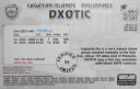
OC-207R.jpgOC-207 Cagayan Islands39 viewsThe Cagayan group is situated roughly 120km west of Sipalay and consists of 31 islands, of which only a few are inhabited. Their topography is flat and covered with only bushes and palm trees. The Cagayan islands are located on the 500km long and 30km wide Cagayan ridge, which connects Cagayancillo with the Tubbataha Reef and Borneo.
|
|

OC-208R.jpgOC-208 Banggai Islands39 viewsThe Banggai Archipelago (Indonesian: Kepulauan Banggai) is a group of islands, which are located at the far eastern end of Central Sulawesi, Indonesia. The archipelago is surrounded by the Banda Sea's Gulf of Tolo (Teluk Tolo), and the Molucca Sea. The Peleng Straits (Selat Peleng) separate it from mainland Sulawesi.
|
|

OC-211.jpgOC-211 Houtman Abrolhos39 viewsThe Houtman Abrolhos (often informally called the Abrolhos Islands) is a chain of 122 islands, and associated coral reefs, in the Indian Ocean off the west coast of Australia. Nominally located at 28°43′S 113°47′E, it lies about eighty kilometres (50 mi) west of Geraldton, Western Australia. It is the southernmost true coral reef in the Indian Ocean, and one of the highest latitude reef systems in the world. it has a small seasonal population of fishermen, and a limited number of tourists.
|
|

OC-214.jpgOC-214 Western Australia State (N.W. Coast) East group39 viewsThe Lacepede Islands, sometimes referred to simply as the Lacepedes, are a group of four islands lying off the Kimberley coast of Western Australia, about 120 kilometres (75 miles) north of Broome. They are all small, low spits of coarse sand and coral rubble, lying atop a platform coral reef. They are treeless but support low vegetation.
|
|
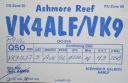
OC-216.jpgOC-216 Ashmore and Cartier Islands39 viewsThe Territory of Ashmore and Cartier Islands[1] is an uninhabited external territory of Australia consisting of four low-lying tropical islands in two separate reefs, and the 12 nautical mile territorial sea generated by the islands.[3] The territory is located in the Indian Ocean situated on the edge of the continental shelf, about 320 km (199 mi) off the northwest coast of Australia and 144 km (89 mi) south of the Indonesian island of Rote
|
|
| 15647 files on 392 page(s) |
 |
|
|
|
|
|
|
|
|
169 | |
|
|
|
|
|
|
|
|
 Contact

