 Most viewed Most viewed |

zzdeldl1hnb.jpg37 views
|
|

zzdelr1m4j1fw.jpg37 views
|
|

OC-031.jpgOC-031 Nauru37 viewsNauru formerly known as Pleasant Island, is an island country in Micronesia, a subregion of Oceania, in the Central Pacific. With only a 21-square-kilometre (8.1 sq mi) area, Nauru is the third-smallest country in the world behind Vatican City and Monaco, making it the smallest state in the South Pacific Ocean, the smallest state outside of Europe, the smallest island state, and the smallest republic. Additionally, its population of 11,347 is the world’s third smallest, after the Vatican and Tuvalu.
|
|
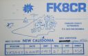
OC-032.jpgOC-032 New Caledonia Island37 viewsNew Caledonia is a special collectivity of France, currently governed under the Nouméa Accord, located in the southwest Pacific Ocean, to the south of Vanuatu, about 1,210 km (750 mi) east of Australia.
|
|
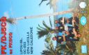
OC-033.jpgOC-033 Loyalty Islands37 viewsThe Loyalty Islands Province is one of three administrative subdivisions of New Caledonia encompassing the Loyalty Islands archipelago in the Pacific located northeast of the New Caledonian mainland of Grande Terre. The provincial government seat is part of the French territory of New Caledonia, at Lifou, which is 100 kilometres (62 mi) away. The Loyalty Islands are a collectivité territoriale of France.
|
|
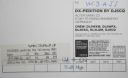
OC-033R.jpgOC-033 Loyalty Islands37 viewsThe Loyalty Islands Province is one of three administrative subdivisions of New Caledonia encompassing the Loyalty Islands archipelago in the Pacific located northeast of the New Caledonian mainland of Grande Terre. The provincial government seat is part of the French territory of New Caledonia, at Lifou, which is 100 kilometres (62 mi) away. The Loyalty Islands are a collectivité territoriale of France.
|
|

OC-034.jpgOC-034 New Guinea (Papua New Guinea / Indonesia West Papua)37 viewsNew Guinea is a large island separated by a shallow sea from the rest of the Australian continent. It is the world's second-largest island, after Greenland, covering a land area of 785,753 km2 (303,381 sq mi), and the largest wholly or partly within the Southern Hemisphere and Oceania. The eastern half of the island is the major land mass of the independent state of Papua New Guinea. The western half, referred to as either Western New Guinea or West Papua, has been administered by Indonesia since 1963 and comprises the provinces of Papua and West Papua.
|
|
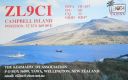
OC-037.jpgOC-037 Campbell Island37 viewsCampbell Island / Motu Ihupuku is an uninhabited subantarctic island of New Zealand, and the main island of the Campbell Island group. It covers 112.68 square kilometres (43.51 sq mi) of the group's 113.31 km2 (43.75 sq mi), and is surrounded by numerous stacks, rocks and islets like Dent Island, Folly Island (or Folly Islands), Isle de Jeanette-Marie, and Jacquemart Island, the latter being the southernmost extremity of New Zealand. The island is mountainous, rising to over 500 metres (1,640 ft) in the south. A long fjord, Perseverance Harbour, nearly bisects it, opening out to sea on the east coast.
|
|

OC-038.jpgOC-038 Chatham Islands37 viewsThe Chatham Islands are a New Zealand archipelago in the Pacific Ocean about 800 kilometres (500 mi) east of the South Island of New Zealand. The archipelago consists of about ten islands within an approximate 60-kilometre (37 mi) radius, the largest of which are Chatham Island and Pitt Island. Some of these islands, formerly cleared for farming, are now preserved as nature reserves to conserve some of the unique flora and fauna. As of 2013 the islands had a resident population of 600.
|
|

OC-040R.jpgOC-040 Niue Island37 viewsNiue is a small island in the South Pacific Ocean, to the east of Tonga. It has an area of 260 square kilometres, and a coastline of 64 km. It claims an exclusive economic zone of 200 nm, and a territorial sea of 12 nm. It is one of world's largest coral islands.
|
|

OC-041.jpgOC-041 Ninigo group37 viewsThe Ninigo Islands are a group of 31 islands within the Western Islands of the Bismarck Archipelago, Papua New Guinea. Their coordinates are WikiMiniAtlas1°16′S 144°15′ECoordinates: 1°16′S 144°15′E.
|
|
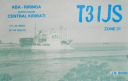
OC-043.jpgOC-043 Phoenix Islands37 viewsThe Phoenix Islands or Rawaki are a group of eight atolls and two submerged coral reefs, lying in the central Pacific Ocean east of the Gilbert Islands and west of the Line Islands. They are a part of the Republic of Kiribati.
|
|

OC-043R.jpgOC-043 Phoenix Islands37 viewsThe Phoenix Islands or Rawaki are a group of eight atolls and two submerged coral reefs, lying in the central Pacific Ocean east of the Gilbert Islands and west of the Line Islands. They are a part of the Republic of Kiribati.
|
|

OC-047.jpgOC-047 Solomon Islands37 viewsSolomon Islands is a sovereign state consisting of six major islands and over 900 smaller islands in Oceania lying to the east of Papua New Guinea and northwest of Vanuatu and covering a land area of 28,400 square kilometres (11,000 sq mi).
|
|

OC-049.jpgOC-049 Tongatapu group37 viewsTongatapu is the main island of the Kingdom of Tonga and the location of its capital Nukuʻalofa. It is located in Tonga's southern island group, to which it gives its name, and is the country's most populous island, with approximately 71,260 residents (2006), 70.5% of the national population, on 260 square kilometres (100 square miles). Its maximum height is 65 metres (213 feet). Tongatapu is Tonga's centre of government and the seat of its monarchy.
|
|

OC-052.jpgOC-052 Duke of Gloucester Islands37 viewsThe Duke of Gloucester Islands is a subgroup of the Tuamotu group in French Polynesia. They are located southeast of Tahiti and south of the main Tuamotu atoll cluster and are rather isolated. Hereheretue (19°52′S 144°58′W) is located to the northwest of the group of the other three atolls, which are located at 20°36′S 143°20′W and are uninhabited. Hereheretue is the only permanently inhabited island of the Duke of Gloucester Islands, with 57 inhabitants in 2002.
|
|

OC-057R.jpgOC-057 Maupihaa group37 viewsMaupihaa atoll is roughly 8 km in length and contains a lagoon that is up to 40 m in depth and is surrounded by submerged reefs on three sides. The atoll's outer reefs are continuous except for a small passage on the western side of the atoll. The eastern side consists of a narrow, thickly vegetated, islet (Motu Maupihaa) and a number of smaller islets bring the total land area of Maupihaa to 2.6 km². The only village on the atoll is located on Motu Maupihaa and as of 1985, the pop. consisted of just 10
|
|

OC-059.jpgOC-059 Kosrae Island37 viewsKosrae formerly known as Kusaie or Strong's Island, is an island in Federated States of Micronesia. The State of Kosrae is one of the four states of the Federated States of Micronesia, and includes the main island of Kosrae and a few nearby islands and islets, the most significant of which is inhabited (1,500 people) Lelu Island.
|
|
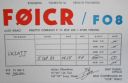
OC-066.jpgOC-066 Tuamotu Archipelago37 viewsThe Tuamotus, also referred to in English as the Tuamotu Archipelago or the Tuamotu Islands, are a French Polynesian chain of almost 80 islands and atolls forming the largest chain of atolls in the world. This archipelago in the southern Pacific Ocean stretches from the northwest to the southeast over an area roughly the size of Western Europe. The total area of land within this chain is 850 square kilometres (328 square miles)
|
|

OC-075.jpgOC-075 Riau Islands37 viewsThe Riau Islands is a province of Indonesia. It comprises a total of 1,796 islands lying between the Malacca Strait, the Karimata Strait and the South China Sea. The province is located on one of the world's busiest shipping lanes, sharing water borders with Singapore, Malaysia, and Vietnam. Originally part of the province of Riau, the Riau Islands became Indonesia's third-youngest province in September 2002. The capital is Tanjung Pinang and the largest city is Batam.
|
|
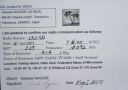
OC-078R.jpgOC-078 Ulithi Atoll37 viewsUlithi is an atoll in the Caroline Islands of the western Pacific Ocean, about 191 km (103 nmi) east of Yap. It consists of 40 islets totalling 4.5 km2 (1.7 sq mi), surrounding a lagoon about 36 km (22 mi) long and up to 24 km (15 mi) wide—at 548 km2 (212 sq mi) one of the largest in the world. It is administered by the state of Yap in the Federated States of Micronesia. Ulithi's population was 773 in 2000.
|
|

OC-079R.jpgOC-079 Belep Islands37 viewsBelep Islands (also known as the Belep Archipelago), lie to the north of New Caledonia's mainland. The two principal islands in the Belep Archipelago are Art Island (a.k.a. Aar) and Pott Island fr (a.k.a. Phwoc). The rest of the archipelago consists of the Northern and Southern Daos Islands, and several very small islets. The administrative centre of the commune is the settlement of Waala, on Art Island, the largest of the Belep Islands. The local language is Nyêlâyu
|
|

OC-080.jpgOC-080 Suwarrow Atoll;Suvorov Atoll37 viewsSuwarrow (also called Suvorov, Suvarou, or Suvarov) is an island in the northern group of the Cook Islands in the south Pacific Ocean. It is about 1,300 kilometres (810 mi) south of the equator and 930 kilometres (580 mi) north-northwest of the capital island of Rarotonga. Every five years, the Cook Islands government advertises for the Suwarrow island nature reserve caretaker position. The position is staffed between April and October by two persons.
|
|

OC-082.jpgOC-082 Penrhyn Atoll;Tongareva Atoll37 viewsPenrhyn (also called Tongareva, MÄngarongaro, Hararanga, and Te Pitaka) is an island in the northern group of the Cook Islands in the south Pacific Ocean. The northernmost island in the group, it is located at 1,365 km (848 mi) north-north-east of the capital island of Rarotonga, 9 degrees south of the equator. Its nearest neighbours are Rakahanga, and Manihiki, approximately 350 kilometres (220 mi) to the southwest.
|
|

oc-085.jpgOC-085 Palmyra Atoll37 viewsPalmyra Atoll is one of the Northern Line Islands, located almost due south of the Hawaiian Islands, roughly one-third of the way between Hawaii and American Samoa. The nearest continent is almost 3,355 miles to the northeast. The atoll is 4.6 sq mi, and it is located in the equatorial Northern Pacific Ocean.
|
|

OC-086.JPGOC-086 Northern Mariana Islands37 viewsThe Northern Mariana Islands, officially the Commonwealth of the Northern Mariana Islands is an insular area and commonwealth of the United States consisting of 14 islands in the northwestern Pacific Ocean. The CNMI includes the 14 northernmost islands in the Mariana Archipelago except the southernmost island of the chain, Guam, which is a separate U.S. territory.
|
|

OC-091R.jpgOC-091 Polillo Islands37 viewsPolillo is an island in the northeastern region of the Philippine archipelago. It is separated from Luzon Island by the Polillo Strait and forms the northern side of Lamon Bay. As of the 2010 Philippine Census, the island is home to 64,802 individuals
|
|

OC-093.jpgOC-093 Batanes group37 viewsThe Batanes group is located approximately 162 kilometres (101 mi) north of the Luzon mainland and about 190 kilometres (120 miles) south of Taiwan, separated from the Babuyan Islands of Cagayan Province by the Balintang Channel, and from Taiwan by the Bashi Channel. The entire province is listed in the UNESCO tentative list for inscription in the World Heritage List.
|
|

OC-095.jpgOC-095 Lau group37 viewsThe Lau Islands of Fiji are situated in the southern Pacific Ocean, just east of the Koro Sea. Of this chain of about sixty islands and islets, about thirty are inhabited. The Lau Group covers a land area of 188 square miles (487 square km), and had a population of 10,683 at the most recent census in 2007. While most of the northern Lau Group are high islands of volcanic origin, those of the south are mostly carbonate low islands.
|
|
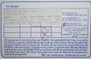
OC-095R.jpgOC-095 Lau group37 viewsThe Lau Islands of Fiji are situated in the southern Pacific Ocean, just east of the Koro Sea. Of this chain of about sixty islands and islets, about thirty are inhabited. The Lau Group covers a land area of 188 square miles (487 square km), and had a population of 10,683 at the most recent census in 2007. While most of the northern Lau Group are high islands of volcanic origin, those of the south are mostly carbonate low islands.
|
|

OC-097.jpgOC-097 Samoa Islands37 viewsThe Samoan Islands are an archipelago covering 3,030 km2 (1,170 sq mi) in the central South Pacific, forming part of Polynesia and the wider region of Oceania. Administratively, the archipelago comprises all of Samoa and most of American Samoa (apart from Swains Island, which is part of the Tokelau Islands). The two Samoan jurisdictions are separated by 64 km (40 mi) of ocean. The population of the Samoan Islands is approximately 250,000
|
|

oc-102r.jpgOC-102 Tanga Islands37 viewsThe Tanga Islands are an island group in Papua New Guinea, located north-east of New Ireland and part of the Bismarck Archipelago.Tanga is made up of four main islands—Boeng, Maledok, Lif and Tefa—and a number of smaller, uninhabited islands.
|
|
OC-106.jpgOC-106 Natuna Besar Islands37 viewsGreat Natuna Island or just Natuna is the main island of the Middle Natuna Archipelago, which is part of the Riau Islands Province, Indonesia. It is also called Great Bunguran Island. The area of Great Natuna is 1,720 km². The highest point is Mount Ranai at 1,035 metres.
|
|
OC-109R.jpgOC-109 Natuna Selatan Islands;Subi Besar Islands37 viewsThe Natuna Regency is an archipelago of 272 islands located in the south part of the South China Sea in the Natuna Sea. It is part of the larger Tudjuh Archipelago, off the northwest coast of Borneo. Administratively, the islands (including the central Bunguran Islands and various outliers) constitute a regency within the Riau Islands Province of Indonesia and are the northernmost non-disputed island group of Indonesia.
|
|
OC-110R.jpgOC-110 Torres Islands37 viewsThe Torres Islands are in the Torba Province of Vanuatu, the northernmost island group in the country. The chain of islands that make up this micro-archipelago straddle the broader cultural boundary that distinguishes Island Melanesia from several Polynesian outliers located in the neighbouring Solomon Islands. To the north is Temotu Province of the Solomon Islands, to the south Espiritu Santo, and to the southeast the Banks Islands. To the west, in the ocean, is the deep Torres Trench, the subduction zone between the Australian and Pacific Plates.
|
|
oc-112.jpgOC-112 Conway Reef37 viewsConway Reef, known since 1976 by its Fijian name Ceva-I-Ra Reef, is a coral reef of atoll type 450 km southwest of the Fiji Islands and part of the Republic of Fiji. It is 2.5 km long in an east-west direction. On the middle of the reef is a small sand cay, 1.8 meters high and about 320 metres long and 73 metres wide, with a land area of two hectares. A stranded wreck of a coaster lies 240 metres south of the centre of the cay, and the wreck of a fishing vessel (Sang Sheng 168) lies on the northeast end
|
|

OC-115R.jpgOC-115 Trobriand Islands37 viewsThe Trobriand Islands are a 450-square-kilometre (174-square-mile) archipelago of coral atolls off the east coast of New Guinea. They are part of the nation of Papua New Guinea and are in Milne Bay Province. Most of the population of 12,000 indigenous inhabitants live on the main island of Kiriwina, which is also the location of the government station, Losuia.
|
|

OC-118.jpgOC-118 Hoorn Islands37 viewsThe Hoorn Islands (also Futuna Islands) are one of the two island groups of which the French overseas collectivity (collectivité d'outre-mer, or COM) of Wallis and Futuna is geographically composed. The aggregate area is 115 km², and the population 4,873 (census of 2003).
Geographically, there are two islands: Futuna Island (in the northwest) (83 km², pop. 4871), Alofi Island (in the southeast) (32 km², pop. 2)
|
|

OC-122R.jpgOC-122 Tambelan Islands37 viewsTambelan archipelago is a group of islands off the west coast of West Kalimantan, Indonesia, just north of the equator. The archipelago is located on the north opening of Karimata Strait which separates Borneo and Belitung island.
|
|

oc-128r.jpgOC-128 Palawan Island37 viewsPalawan is the largest island of the province of Palawan in the Philippines and the fifth largest island of the country. The north west coast of the island is along the South China Sea, while the south east coast forms part of the northern limit of the Sulu Sea
|
|
| 15365 files on 385 page(s) |
 |
|
|
|
|
|
|
|
|
168 | |
|
|
|
|
|
|
|
|
 Contact
