 Most viewed |
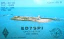
EU-143.jpgEU-143 Spain Cadiz / Huelva Province group39 viewsThe Islote de Sancti Petri is a small barren island belonging to the municipality of San Fernando, Cádiz in the province of Cádiz and the autonomous region of Andalusia, Spain. For many years, the island was a restricted military zone, but it is now under the control of the Spanish Environment Ministry.
|
|

EU-144.jpgEU-144 Italy Calabria / Basilicata region group39 viewsCirella Island is located in the Tyrrhenian Sea alongside the Italian town of Diamante.
|
|
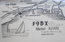
EU-148.jpgEU-148 France Languedoc-Roussillon Region group39 viewsThe island of Brescou is in the territory of the town of Agde ( Hérault ), about half a nautical mile from the entrance of port Richelieu (Cap d'Agde) and a little less than three miles from the sea. mouth of the Hérault . Of volcanic origin, it has an area of 0.5 hectares .On this island is a disused fort , which includes an old lantern, still visible, and a modern lighthouse .
|
|

EU-148R.jpgEU-148 France Languedoc-Roussillon Region group39 viewsThe island of Brescou is in the territory of the town of Agde ( Hérault ), about half a nautical mile from the entrance of port Richelieu (Cap d'Agde) and a little less than three miles from the sea. mouth of the Hérault . Of volcanic origin, it has an area of 0.5 hectares .On this island is a disused fort , which includes an old lantern, still visible, and a modern lighthouse .
|
|

EU-158.jpgEU-158 Greece Peloponnisos (Messinia) Region group39 viewsProti Island of Messenia is an island in the Ionian Sea, on the west coast of the Peloponnese; it is counted as one of the Ionian Islands, though administratively, it is part of the municipality of Gargalianoi, in the regional unit of Messenia. The 2001 census reported a population of four inhabitants.
|
|
EU-162.jpgEU-162 Russia White Sea Coast group39 viewsGlov Island is located in the Kandalaksha Nature Reserve on the south shore of Kandalaksha Bay in the Murmansk and Karelia regions on the opening to the White Sea, Russia
|
|

EU-162R.jpgEU-162 Russia White Sea Coast group39 viewsGlov Island is located in the Kandalaksha Nature Reserve on the south shore of Kandalaksha Bay in the Murmansk and Karelia regions on the opening to the White Sea, Russia
|
|
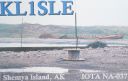
na-037.jpgNA-037 Alaska Near Islands (Semichi Islands) group39 viewsShemya or Simiya is a small island in the Semichi Islands group of the Near Islands chain in the Aleutian Islands archipelago southwest of Alaska, at 52°43′27″N 174°07′08″E. It has a land area of 5.903 sq mi, and is about 1,200 miles southwest of Anchorage, Alaska. It is 2.73 miles wide and 4.32 miles long.
|
|

na-038r.jpgNA-038 Canada Quebec Province (La Madeleine Islands) group39 viewsThe Magdalen Islands is a small archipelago in the Gulf of Saint Lawrence with a land area of 205.53 square kilometres (79.36 sq mi). Administratively, the islands are part of the Gaspésie–Îles-de-la-Madeleine region in the Canadian province of Quebec, though they are geographically closer to the Maritime provinces than they are to the Gaspé Peninsula on the Quebec mainland.
|
|

na-044r.jpgNA-044 Newfoundland Province (Labrador) South group39 viewsBattle Harbour located on Battle Island is a summer fishing station, formerly a permanent settlement, located on the Labrador coast in the province of Newfoundland and Labrador, Canada. Battle Harbour was for two centuries the economic and social centre of the southeastern Labrador coast.
|
|
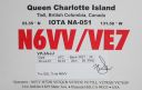
na-051.jpgNA-051 Canada BC Province (Haida Gwaii) group39 viewsHaida Gwaii, literally "Islands of the Haida people"),] is an archipelago approximately 45–60 km (30–40 mi) off the northern Pacific coast of Canada. The islands are separated from the mainland to the east by the shallow Hecate Strait. Queen Charlotte Sound lies to the south, with Vancouver Island beyond. To the north, the disputed Dixon Entrance separates Haida Gwaii from the Alexander Archipelago in the U.S. state of Alaska.
|
|
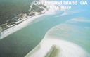
na-058.jpgNA-058 Georgia State group39 viewsCumberland Island, Georgia, is the largest of the Sea Islands of the southeastern United States. The long-staple Sea Island cotton was first grown here by a local family, the Millers, who helped Eli Whitney develop the cotton gin. With its unusual range of wildlife, the island has been declared a National Park and a National Seashore. Little Cumberland Island is connected to the main island by a marsh.
|
|
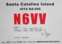
na-066.jpgNA-066 California State South (Orange / San Diego County) group39 viewsSanta Catalina Island (Tongva: Pimugna or Pimu) is a rocky island off the coast of the U.S. state of California in the Gulf of Santa Catalina. The island is 22 mi (35 km) long and 8 mi (13 km) across at its greatest width. The island is located about 29 mi (47 km) south-southwest of Long Beach, California. The highest point on the island is 2,097 ft (639 m) Mount Orizaba. Santa Catalina is part of the Channel Islands of California archi
|
|

na-072.jpgNA-072 Panama / Darien Province group39 viewsIsla Contadora (or Contadora Island in English) is a Panamanian island on the Pearl Islands archipelago (Spanish: Archipielago de las Perlas) in the Gulf of Panama. It has an area of 1.39 km², which makes it the 11th largest island of the archipelago.
|
|
na-072r.jpgNA-072 Panama / Darien Province group39 viewsIsla Contadora (or Contadora Island in English) is a Panamanian island on the Pearl Islands archipelago (Spanish: Archipielago de las Perlas) in the Gulf of Panama. It has an area of 1.39 km², which makes it the 11th largest island of the archipelago.
|
|
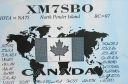
na-075.jpgNA-075 British Columbia Province (Gulf Islands) group39 viewsPender Island (Saanich: st̕ey̕əs )[2] is one of the Southern Gulf Islands located in the Gulf of Georgia, British Columbia, Canada. Pender Island is approximately 34 km2 (13 sq mi) in area and is home to about 2,250 permanent residents.
|
|

na-088.jpgNA-088 Panama Bocas del Toro Province group39 viewsLocated along the Caribbean coast in the northwestern part of Panama, the Bocas del Toro islands are known for their laid back tourist vibe.
|
|

na-097.jpgNA-097 Jamaica39 viewsJamaica (/dʒəˈmeɪkə/ (About this soundlisten)) is an island country situated in the Caribbean Sea. Spanning 10,990 square kilometres (4,240 sq mi) in area, it is the third-largest island of the Greater Antilles and the fourth-largest island country in the Caribbean. Jamaica lies about 145 kilometres (90 mi) south of Cuba, and 191 kilometres (119 mi) west of Hispaniola (the island containing the countries of Haiti and the Dominican Republic).
|
|
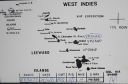
na-104.jpgNA-104 St Kitts and Nevis39 viewsSaint Kitts and Nevis, also known as the Federation of Saint Christopher and Nevis,] is an island country in the West Indies. Located in the Leeward Islands chain of the Lesser Antilles, it is the smallest sovereign state in the Western Hemisphere, in both area and population. The country is a Commonwealth realm, with Elizabeth II as queen and head of state.
|
|

na-108.jpgNA-108 St Lucia39 viewsSaint Lucia is a sovereign island country in the West Indies in the eastern Caribbean Sea on the boundary with the Atlantic Ocean. The island was previously called Iyonola, the name given to the island by the native Amerindians and later, Hewanorra, the name given by the native Caribs. Part of the Lesser Antilles, it is located north/northeast of the island of Saint Vincent, northwest of Barbados and south of Martinique.
|
|

na-112r.jpgNA-112 North Carolina State West (Brunswick to Carteret County) group39 viewsEmerald Isle is located in southwestern Carteret County at 34°40′1″N 77°0′49″W (34.666994, -77.013482),[11] at the western end of Bogue Banks, a barrier island. To the south is the Atlantic Ocean, and to the north is Bogue Sound separating the island from mainland North Carolina. The town extends to the western tip of the island, ending at Bogue Inlet, while to the east the town is bordered by Indian Beach.
|
|

na-114r.jpgNA-114 Les Saintes Islands39 viewsThe Îles des Saintes ("Islands of the Saints"), also known as Les Saintes is a group of small islands in the archipelago of Guadeloupe, an overseas department of France. It is part of the Canton of Trois-Rivières and is divided into two communes: Terre-de-Haut and Terre-de-Bas. It is in the arrondissement of Basse-Terre and also in Guadeloupe's 4th constituency.
|
|
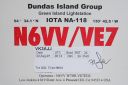
na-118.jpgNA-118 British Columbia Province (Dundas Islands) group39 viewsDundas Island (French: île Dundas) is an island on the North Coast of British Columbia, Canada, located on the west side of Chatham Sound to the northwest of Prince Rupert. It is the largest of a group of islands known as the Dundas Islands.
|
|

na-119.jpgNA-119 Louisiana State Centre (Terrebonne Parish) group39 viewsTimbalier Island is an island off southeastern Louisiana in the United States. The island lies near New Orleans off the southeastern coast of Terrebonne Parish. Timbalier Bay lies between the island and the Louisiana mainland, and the island separates the bay from the Gulf of Mexico
|
|
na-119r.jpgNA-119 Louisiana State Centre (Terrebonne Parish) group39 viewsTimbalier Island is an island off southeastern Louisiana in the United States. The island lies near New Orleans off the southeastern coast of Terrebonne Parish. Timbalier Bay lies between the island and the Louisiana mainland, and the island separates the bay from the Gulf of Mexico
|
|

na-120r.jpgNA-120 Louisiana State West (Cameron to St Mary Parish) group39 viewsMarsh Island is an uninhabited low-lying marshy island in Iberia Parish, south coastal Louisiana, lying between Vermilion Bay and the Gulf of Mexico. It is bordered on the south by the Gulf of Mexico and is separated from mainland Louisiana by East Cote Blanche Bay to its east, West Cote Blanche Bay to its north, Vermilion Bay to its northwest, and Southwest Pass to its west
|
|

na-124.jpgNA-124 Mexico Baja California Sur State South East group 39 viewsIsla Cerralvo (Spanish: [ˈizla seˈralβo]), as is commonly named, whose official name is Isla Jacques Cousteau (French: [Ê’ak kusto]; Spanish: [Êak ˈkusto]), is an island located off the Cerralvo Canal coast near La Paz, Baja California Sur, Mexico. It is 18 miles (29 km) long with a land area of 136.498 square kilometres (52.702 sq mi), and is the ninth-largest island in Mexico.
|
|

na-127.jpgNA-127 Nova Scotia Province West group39 viewsSituated in the Bay of Fundy immediately southwest of the Digby Neck, Brier Island is located immediately west. Long Island is separated from the Digby Neck by the "Petit Passage" and from Brier Island by the "Grand Passage". Route 217 runs the length of Long Island from the ferry crossing at Tiverton at the eastern end of the island (connecting to East Ferry on the Digby Neck) to the ferry crossing at Freeport at the western end of the island (connecting to Westport)
|
|

na-129.jpgNA-129 Canada NWT (Banks Island) group39 viewsBanks Island is one of the larger members of the Canadian Arctic Archipelago. Situated in the Inuvik Region, and part of the Inuvialuit Settlement Region, of the Northwest Territories, it is separated from Victoria Island to its east by the Prince of Wales Strait and from the mainland by Amundsen Gulf to its south. The Beaufort Sea lies to its west, and to its northeast M'Clure Strait separates the island from Prince Patrick Island and Melville Island.
|
|
na-130.jpgNA-130 Canada Nunavut (Baffin's Coastal Islands) East group39 viewsQikiqtarjuaq (Inuktitut pronunciation: [qikiqtaÊjuˈaq]; formerly known as Broughton Island until November 1998 /ˈbrÉ”ËtÉ™n/,[5] is a community located on the island of the same name in the Qikiqtaaluk Region of Nunavut, Canada. The island is known for Arctic wildlife, whale watching, and as the northern access point for Auyuittuq National Park (see also Pangnirtung)
|
|
na-132.jpgNA-132 Colombia Bajo Nuevo and Serranilla Bank Cays39 viewsSerranilla Bank is a partially submerged reef, with small uninhabited islets, in the western Caribbean Sea. It is situated about 350 kilometres (220 mi) northeast of Punta Gorda, Nicaragua, and roughly 280 kilometres (170 mi) southwest of Jamaica. It is administered by Colombia as part of the department of San Andrés and Providencia. The reef is subject to a sovereignty dispute involving Colombia, Honduras and the United States
|
|

na-140.jpgNA-140 Maryland State West group39 viewsHoopers Island is a chain of three islands in Dorchester County, Maryland, United States. Upper Hoopers Island, Middle Hoopers Island and Lower Hoopers Island are surrounded by water with the Chesapeake Bay on one side and the Honga River on the other side. The remote set of islands has much wildlife and is well known for sport fishing and crabbing industries. Hoopers Island is one of the oldest settled areas in Maryland.
|
|
na-140r.jpgNA-140 Maryland State West group39 viewsHoopers Island is a chain of three islands in Dorchester County, Maryland, United States. Upper Hoopers Island, Middle Hoopers Island and Lower Hoopers Island are surrounded by water with the Chesapeake Bay on one side and the Honga River on the other side. The remote set of islands has much wildlife and is well known for sport fishing and crabbing industries. Hoopers Island is one of the oldest settled areas in Maryland.
|
|

na-147.jpgNA-147 The Grenadines39 viewsCarriacou is an island of the Grenadine Islands located in the southeastern Caribbean Sea, northeast of Grenada and the north coast of South America. It is also the largest island in the Grenadine Islands (Vincentian and Grenadian Grenadines). It is located at latitude 12° 28' N, longitude 61° 27' W.
|
|

na-155.jpgNA-155 Costa Rica Limon Province group39 viewsUvita Island, or Isla Uvita, officially Isla QuiribrÃ, is a small 0.8-square-kilometre island 885 metres offshore of the port at Limón on the Caribbean coast of Costa Rica. The island is 420 metres long from north to south and 315 metres wide, northwest to southeast.
|
|

na-177.jpgNA-177 Quebec Province (Gaspe Peninsula) group39 viewsBonaventure Island is a Canadian island in the Gulf of St. Lawrence located 3.5 kilometres off the southern coast of Quebec's Gaspé Peninsula, 5 kilometres southeast of the village of Percé. Roughly circular in shape, it has an area measuring 4.16 square kilometres.
|
|

na-178r.jpgNA-178 California State Centre (Sonoma to Santa Cruz County) group39 viewsThe Farallon Islands, or Farallones (from the Spanish farallón meaning "pillar" or "sea cliff"), are a group of islands and sea stacks in the Gulf of the Farallones, off the coast of San Francisco, California, United States. The islands are also sometimes referred to by mariners as the Devil's Teeth Islands, in reference to the many treacherous underwater shoals in their vicinity.[2] The islands lie 30 miles (48 km) outside the Golden Gate and 20 miles (32 km) south of Point Reyes, and are visible from the mainland on clear days.
|
|
hc3kd6ww.jpg39 views
|
|
hk0a3jbr.jpg39 views
|
|

is0lyn.jpg39 views
|
|
| 15647 files on 392 page(s) |
 |
|
|
|
|
|
|
|
|
162 | |
|
|
|
|
|
|
|
|
 Contact

