 Most viewed |

hk0gur~0.jpg40 views
|
|

hl1ssgr~0.jpg40 views
|
|

hp3dxa.jpg40 views
|
|

hr9wq7rr.jpg40 views
|
|

hv5pul.jpg40 views
|
|

5n3rtfr.jpg40 views
|
|

9v1bg.jpg40 views
|
|

a35dx.jpg40 views
|
|

lz1kx.jpg40 views
|
|

zf2ag.jpg40 views
|
|

zl2ifbb.jpg40 views
|
|

zl2ifbr~0.jpg40 views
|
|

zl7zm7zb~0.jpg40 views
|
|

oc-121.jpgOC-121 Mamanuca group;Mamanutha40 viewsThe Mamanuca Islands (Fijian: [mamaˈnuða]) of Fiji are a volcanic archipelago lying to the west of Nadi and to the south of the Yasawa Islands. The group, a popular tourist destination, consists of about 20 islands, but about seven of these are covered by the Pacific Ocean at high tide. One of the islands, Monuriki, was made famous as the anonymous island that featured in the 2000 Robert Zemeckis film, Cast Away,
|
|

oc-128.jpgOC-128 Palawan Island40 viewsPalawan is the largest island of the province of Palawan in the Philippines and the fifth largest island of the country. The north west coast of the island is along the South China Sea, while the south east coast forms part of the northern limit of the Sulu Sea
|
|

oc-133.jpgOC-133 Sabah's Coastal Islands40 viewsLabuan Island and six smaller islands, are located off the coast of the state of Sabah in East Malaysia. Labuan's capital is Victoria and is best known as an offshore financial centre offering international financial and business services via Labuan IBFC since 1990 as well as being an offshore support hub for deepwater oil and gas activities in the region.
|
|
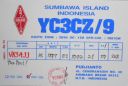
OC-150.jpgOC-150 Tenggara Barat Islands40 viewsWest Nusa Tenggara, comprising the western Lesser Sunda Islands of Lombok, Sumbawa, Moyo, and Sangeang. Nusa Tenggara is Indonesian for “southeast islands.†The province fronts the Flores Sea to the northeast, the Sape Strait to the east, the Indian Ocean to the south, Lombok Strait to the west, and the Bali Sea to the northwest. The capital is Mataram, in west-central Lombok.
|
|
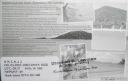
OC-160R.jpgOC-160 Queensland State (South Coast) North group40 viewsHook Island is one of the Whitsunday Islands off the coast of the Australian state of Queensland. The island is almost uninhabited, quite rugged and almost completely contained within a section of the Whitsunday Islands National Park . The island has two prominent geographical features on the southern side of Hook Island; the Nara and Macona inlets, two fjord-like recesses that are used as anchorages for the Whitsunday tourist fleet. The island's northern coast is noted for its colourful underwater coral growths, to which snorkelling and diving enthusiasts are attracted.
|
|

OC-177R.jpgOC-177 Seribu Islands40 viewsThe Thousand Islands (officially Kepulauan Seribu) are a chain of islands to the north of Jakarta's coast. It forms the only regency of Jakarta, the capital of Indonesia. It consists of a string of 342 islands stretching 45 km (28 mi) north into the Java Sea at West Jakarta Bay and in fact north of Banten Province.
|
|
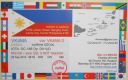
OC-188R.jpgOC-188 Pangutaran group40 viewsPangutaran Island is located in the west-central part of the Sulu archipelago near Mindanao, Philippines
|
|

oc-191r.jpgOC-191 Niuatoputapu Island40 viewsNiuatoputapu is a high island in the island nation of Tonga, Pacific Ocean, its highest point being at 157 m. Its name means sacred island. Older European names for the island are Traitors island or Keppel island. Niuatoputapu is located in the north of the country, 300 kilometres (190 miles) away from Vavaʻu near the border with Samoa. Its closest neighbours are the small island of Tafahi, only 9 km (5.6 mi) to the north-northeast, and the island of Niuafo'ou.
|
|

OC-195.jpgOC-195 Furneaux group40 viewsThe Furneaux Group (indigenous name: Tayaritja[1][2]) is a group of approximately 100 islands located at the eastern end of Bass Strait, between Victoria and Tasmania, Australia. The largest islands in the group are Flinders Island, Cape Barren Island, and Clarke Island. The group contains five settlements: Killiecrankie, Emita, Lady Barron, Cape Barren Island, and Whitemark on Flinders Island, which serves as the administrative centre of the Flinders Council. There are also some small populated ranches on the remote islands.
|
|
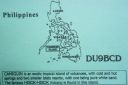
OC-235.jpgOC-235 Mindanao's Coastal Islands40 viewsCamiguin is an island province in the Philippines located in the Bohol Sea, about 10 kilometres (6.2 mi) off the northern coast of Mindanao. Camiguin Island is a pearl-shaped island with an area of approximately 238 km2 (92 sq mi). The island measures about 23 kilometres (14 mi) at its longest and 14.5 kilometres (9.0 mi) at its widest breadth.[11] The island is mountainous with the highest elevation reaching over 5,000 ft (1,500 m).
|
|
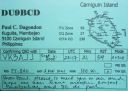
OC-235R.jpgOC-235 Mindanao's Coastal Islands40 viewsCamiguin is an island province in the Philippines located in the Bohol Sea, about 10 kilometres (6.2 mi) off the northern coast of Mindanao. Camiguin Island is a pearl-shaped island with an area of approximately 238 km2 (92 sq mi). The island measures about 23 kilometres (14 mi) at its longest and 14.5 kilometres (9.0 mi) at its widest breadth.[11] The island is mountainous with the highest elevation reaching over 5,000 ft (1,500 m).
|
|
OC-238R.jpgOC-238 Pukarua and Reao Atolls40 viewsReao or Natūpe is an atoll in the eastern expanses of the Tuamotu group in French Polynesia. The closest land is Pukarua Atoll, located 48 km to the WNW. Reao is 24.5 km long and its maximum width is 5 km. The whole length of its north-eastern rim is occupied by a single long island. There is no navigable pass into the lagoon. Reao Atoll's population is 351 inhabitants
|
|

OC-244.jpgOC-244 Luzon's Coastal Islands40 viewsMindoro is the seventh largest island in the Philippines by land area with a total of 10,571 km² and with a total population of 1,331,473 as of 2015. It is located off the southwestern coast of Luzon and northeast of Palawan.
|
|

OC-246.jpgOC-246 Leti and Sermata Islands40 viewsThe Barat Daya Islands (Indonesian: Kepulauan Barat Daya) are a group of islands in the Maluku province of Indonesia. These islands are located off the eastern end of East Timor. Wetar is the largest island in the group. To the west, the Ombai Strait separates Wetar from Alor Island, part of East Nusa Tenggara. The Wetar Strait separates Wetar from Timor to the south.
|
|

OC-251.jpgOC-251 Victoria State West group40 viewsLady Julia Percy Island, lies 6 kilometres (3.7 mi) off the coast, in the Barwon South West region of Victoria, Australia in Bass Strait. It is 12 kilometres (7.5 mi) south-south-west of Yambuk, and 22 kilometres (14 mi) south-west of Port Fairy. The island is about 2 kilometres (1.2 mi) in length by 1 kilometre (0.62 mi) in width, with an area of 1.33 square kilometres (0.51 sq mi), comprising a plateau, varying in height from 32–46 metres (105–151 ft) asl, surrounded by cliffs, rock platforms and reefs. It contains an important seal breeding colony.
|
|

OC-252.jpgOC-252 Kalimantan's Coastal Islands West40 viewsTemajo Island lies 5 km offshore the western side of Borneo. The island has a small holiday resort
|
|
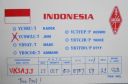
OC-252R.jpgOC-252 Kalimantan's Coastal Islands West40 viewsTemajo Island lies 5 km offshore the western side of Borneo. The island has a small holiday resort
|
|

OC-253R.jpgOC-253 Hall Islands40 viewsThe Hall Islands are a group of two large atolls in the northern part of the state of Chuuk, Federated States of Micronesia. Nomwin, the western atoll, and Murilo, the eastern one, are located about 9 km apart, being the emergent parts of a twin-lobed seamount. Murilo and Nomwin each harbor a population of more than 1,000 people. They lie roughly 100 km to the north of Chuuk Lagoon. Uninhabited East Fayu, lying 30+ km to the west of Nomwin, is sometimes included in the Halls
|
|
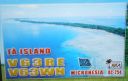
OC-254.jpgOC-254 Mortlock Islands40 viewsThe Nomoi Islands, also known as Mortlock Islands, are a group of three large atolls in the state of Chuuk, Federated States of Micronesia. They are located about 250 kilometres (160 miles) to the southeast of Chuuk. Satawan, the southern atoll, is the largest. Both Etal, the northern one, and Lukunor in the northeast are much smaller. They are located between 6 and 9 kilometres (3.7 and 5.6 miles) from each other.
|
|

OC-255R.jpgOC-255 Queensland State (Gulf of Carpentaria) North group40 viewsBarn Island also called Parau Island,is located on the eastern side of the Gulf of Carpentaria, Queensland. The island lies just offshore and can be sighted from Umagico, Seisia or Loyalty Beach. The island is uninhabited
|
|

OC-259.jpgOC-259 Nukuoro Atoll40 viewsNukuoro is an atoll in the Federated States of Micronesia. Except for Kapingamarangi, it is the southernmost atoll of the country. They both are Polynesian outliers. As of 2007, Nukuoro had a population of 372, though several hundred Nukuorans live on Pohnpei. Nukuoro is remote. It has no airstrip, and a passenger boat calls irregularly only once every few months.
|
|
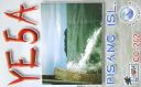
OC-262.jpgOC-262 Sumatra's Coastal Islands South40 viewsPulau Pisang or “Banana Island†lies just 45 minutes off the coast of Krui, Sumatra, and is also home to some of the best white sand beaches, snorkeling and fishing in the Krui area. The island is home to less than 100 people,
|
|
OC-263S.jpgOC-263 Taongi Atoll;Bokaak Atoll40 viewsBokak Atoll or Taongi Atoll is an uninhabited coral atoll in the Ratak Chain of the Marshall Islands, in the North Pacific Ocean. It is located 685 km (426 mi) north of Majuro Atoll, the capital of the Marshall Islands, and 280 km (170 mi) northeast of Bikar Atoll, the closest atoll, making it the most northerly and most isolated atoll of the country. Wake Island is 348 mi (560 km) north-northwest. The land area is 3.2 km2 (1.2 sq mi), and the lagoon measures 78 km2 (30 sq mi). It consists of 36 islets. The total area is 129 km2 (50 sq mi) (including reef flat).
|
|

OC-277.jpgOC-277 Sorol Atoll40 viewsSorol is a coral atoll of nine islands in the central Caroline Islands in the Pacific Ocean, and forms a legislative district in Yap State in the Federated States of Micronesia. Sorol is located approximately 150 kilometres (93 mi) south of Ulithi and 250 kilometres (160 mi) southeast of the island of Yap.
|
|
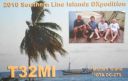
OC-279.jpgOC-279 Malden Island40 viewsMalden Island, sometimes called Independence Island in the nineteenth century, is a low, arid, uninhabited atoll in the central Pacific Ocean, about 39 km2 (15 sq mi) in area. It is one of the Line Islands belonging to the Republic of Kiribati. The island is chiefly notable for its mysterious prehistoric ruins, its once-extensive deposits of phosphatic guano (exploited by Australian interests from c. 1860–1927), its former use as the site of the first British H-bomb tests (Operation Grapple, 1957), and its current importance as a protected area for breeding seabirds.
|
|

OC-279R.jpgOC-279 Malden Island40 viewsMalden Island, sometimes called Independence Island in the nineteenth century, is a low, arid, uninhabited atoll in the central Pacific Ocean, about 39 km2 (15 sq mi) in area. It is one of the Line Islands belonging to the Republic of Kiribati. The island is chiefly notable for its mysterious prehistoric ruins, its once-extensive deposits of phosphatic guano (exploited by Australian interests from c. 1860–1927), its former use as the site of the first British H-bomb tests (Operation Grapple, 1957), and its current importance as a protected area for breeding seabirds.
|
|

Azone29.jpg40 views
|
|
| 15647 files on 392 page(s) |
 |
|
|
|
|
|
|
|
|
161 | |
|
|
|
|
|
|
|
|
 Contact

