 Most viewed Most viewed |

EU-058.jpgEU-058 France Provence-Cote d'Azur (Alpes Maritimes) Region group37 viewsThe Lérins Islands are a group of four Mediterranean islands off the French Riviera, in Cannes. The two largest islands in this group are the Île Sainte-Marguerite and the Île Saint-Honorat. The smaller Îlot Saint-Ferréol and Îlot de la Tradelière are uninhabited. Administratively, the islands belong to the commune of Cannes.
|
|
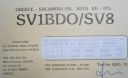
EU-075.jpgEU-075 Greece Peloponnisos (Argolis) / Attiki Region group37 viewsSalamis, is the largest Greek island in the Saronic Gulf, about 1 nautical mile off-coast from Piraeus and about 16 kilometres west of central Athens. The chief city, Salamina, lies in the west-facing core of the crescent on Salamis Bay, which opens into the Saronic Gulf
|
|

EU-081.jpgEU-081 France Basse-Normandie (Manche East) Region group37 viewsÃŽles Saint-Marcouf comprise two small uninhabited islands off the coast of Normandy, France. They lie in the Baie de la Seine region of the English Channel and are 6.5 km (4.0 mi) east of the coast of the Cotentin peninsula at Ravenoville and 13 km (8 mi) from the island of Tatihou and the harbour at Saint-Vaast-la-Hougue
|
|
EU-099R.jpgEU-099 England Les Minquiers Islands37 viewsThe Minquiers are a group of islands and rocks, about 15 km (9.3 mi) south of Jersey. The Minquiers forms part of the Bailiwick of Jersey.[2] They are administratively part of the Parish of Grouville. At low tide, the rock shelf around the Minquiers has a larger surface area than Jersey itself but at high tide only a few of the main heads remain above water.
|
|

EU-105.jpgEU-105 France Bretagne (Finistere North) Region group37 viewsThe Île de Batz (Enez Vaz in Breton) is an island off Roscoff in Brittany, France. Administratively, it is a commune in the Finistère department of Brittany in north-western France.
|
|

EU-110.jpgEU-110 Croatia Istra group37 viewsThe Brijuni or the Brijuni Islands are a group of fourteen small islands in the Croatian part of the northern Adriatic Sea, separated from the west coast of the Istrian peninsula by the narrow Fažana Strait. The largest island, Veliki Brijun Island, lies 2 kilometres off the coast.
|
|

EU-112.jpgEU-112 Scotland Shiant Islands37 viewsThe Shiant Isles are a privately owned island group in the Minch, east of Harris in the Outer Hebrides of Scotland. They are five miles south east of Lewis. The simple bothy restored by Nigel Nicolson on Eilean an Taighe is the only habitable structure on the islands.
|
|

EU-117R.jpgEU-117 Gulf of Finland North group37 viewsMaly Vysotsky Island or Malyj Vysotskij Island is an island in northwest Russia, that was leased to Finland. It is located in Vyborg Bay, next to Vysotsk, 12 km southwest of Vyborg.
|
|
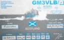
EU-118.jpgEU-118 Scotland Flannan Isles37 viewsThe Flannan Isles (Seven Hunters) are a small island group in the Outer Hebrides of Scotland, approximately 32 kilometres (20 mi) west of the Isle of Lewis. The islands have been devoid of permanent residents since the automation of Flannan Isles Lighthouse in 1971. They are the location of an enduring mystery that occurred in December 1900, when all three lighthouse keepers vanished without trace.
|
|

EU-119R.jpgEU-119 Russia White Sea Coast East group37 viewsMorzhovets Island is an island in the southern limit of the Barents Sea. It is located in Mezen Bay, at the entrance of the White Sea thus separating the Barents Sea and the White Sea. Morzhovets island lies 14.5 miles (23.3 km) from mainland Russia. There is a settlement on Morzhovets, Severny Gorodok, which serves the lighthouse and the meteorogical station. The population of the settlement is 12.
|
|

EU-121.jpgEU-121 Irish Coastal Islands37 viewsBere Island is an island off the Beara Peninsula in County Cork Ireland. It is roughly 10 km x 3 km in dimension, with an area of 17.68 km², and, as of 2012, had a population of between 210 and 220 people.
|
|

EU-121R.jpgEU-121 Irish Coastal Islands37 viewsBere Island is an island off the Beara Peninsula in County Cork Ireland. It is roughly 10 km x 3 km in dimension, with an area of 17.68 km², and, as of 2012, had a population of between 210 and 220 people.
|
|
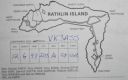
EU-122R.jpgEU-122 Northern Irish Coastal Islands37 viewsRathlin is the only inhabited offshore island of Northern Ireland, with a steadily growing population of approximately 150 people, and is the most northerly inhabited island off the coast of the island of Ireland. The reverse L-shaped Rathlin Island is 4 miles (6 km) from east to west, and 2.5 miles (4 km) from north to south.
|
|

EU-124R.jpgEU-124 Welsh Coastal Islands37 viewsFlat Holm is a limestone island lying in the Bristol Channel approximately 6 km from Lavernock Point in the Vale of Glamorgan. It includes the most southerly point of Wales. The island has a long history of occupation, dating at least from Anglo-Saxon and Viking age.
|
|

EU-126R.jpgEU-126 Finland Lappi Province group37 viewsKuljunkari Island lies in the Bothnian Bay in northern Finland. If an island is defined as an area of land more than 20 square metres (220 sq ft) that is surrounded by water, the Bay of Bothnia has 4,001 islands. Many of the islands are uninhabited and in a natural state. In the winter the larger islands may be accessed via ice roads. Some of them are inhabited or have seasonal fishing villages used by people from the mainland
|
|

EU-132R.jpgEU-132 Poland Szczecin / Koszalin Province group37 viewsWolin is the name both of a Polish island in the Baltic Sea, just off the Polish coast, and a town on that island. Administratively the island belongs to the West Pomeranian Voivodeship. Wolin is separated from the island of Usedom (Uznam) by the Strait of Åšwina, and from mainland Pomerania by the Strait of Dziwna. The island has an area of 265 km2 (102 sq mi) and its highest point is Mount Grzywacz at 116 m above sea level.
|
|
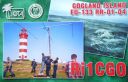
EU-133.jpgEU-133 Russia Gulf of Finland South group37 viewsGogland or Hogland is an island in the Gulf of Finland in the eastern Baltic Sea, about 180 km west from Saint Petersburg and 35 km from the coast of Finland (near Kotka). Hogland has an area of approximately 21 km2 (8.1 sq mi); its highest point is 173 m (568 ft). It belongs to Russia's Kingiseppsky District in the Leningrad Oblast.
|
|

EU-140.jpgEU-140 Finland Etela-Suomi (Kymi) Province group37 viewsKuutsalo is an island and village on the Gulf of Finland in the city of Kotka . The island is located three kilometers southeast of the city center of Kotka Island . The village of Kuutsalo also includes several other islands, the largest of which is Kirkonmaa , located to the south of it. Kuutsalo has 27 inhabitants and Rankki-Kirkonmaa has 17 inhabitants (31.12.2012).
|
|

EU-142R.jpgEU-142 Spain Oviedo / Santander Province group37 viewsMouro Island, originally Mogro Island, is a small uninhabited island in the Bay of Biscay, located off the Magdalena Peninsula. It lies close to the entrance to the Bay of Santander near the city of Santander, Cantabria along the north coast of Spain
|
|
EU-148.jpgEU-148 France Languedoc-Roussillon Region group37 viewsThe island of Brescou is in the territory of the town of Agde ( Hérault ), about half a nautical mile from the entrance of port Richelieu (Cap d'Agde) and a little less than three miles from the sea. mouth of the Hérault . Of volcanic origin, it has an area of 0.5 hectares .On this island is a disused fort , which includes an old lantern, still visible, and a modern lighthouse .
|
|

EU-148R.jpgEU-148 France Languedoc-Roussillon Region group37 viewsThe island of Brescou is in the territory of the town of Agde ( Hérault ), about half a nautical mile from the entrance of port Richelieu (Cap d'Agde) and a little less than three miles from the sea. mouth of the Hérault . Of volcanic origin, it has an area of 0.5 hectares .On this island is a disused fort , which includes an old lantern, still visible, and a modern lighthouse .
|
|

EU-158.jpgEU-158 Greece Peloponnisos (Messinia) Region group37 viewsProti Island of Messenia is an island in the Ionian Sea, on the west coast of the Peloponnese; it is counted as one of the Ionian Islands, though administratively, it is part of the municipality of Gargalianoi, in the regional unit of Messenia. The 2001 census reported a population of four inhabitants.
|
|

EU-159R.jpgEU-159 France Aquitaine Region group37 viewsThe Banc d'Arguin is a sand bank lying in the mouth of the Gironde estuary, near the Cordouan lighthouse, which is the only remaining manned maritime lighthouse in France, the oldest lighthouse still in operation and the only one in the world open to visitors!
|
|
EU-162.jpgEU-162 Russia White Sea Coast group37 viewsGlov Island is located in the Kandalaksha Nature Reserve on the south shore of Kandalaksha Bay in the Murmansk and Karelia regions on the opening to the White Sea, Russia
|
|

EU-162R.jpgEU-162 Russia White Sea Coast group37 viewsGlov Island is located in the Kandalaksha Nature Reserve on the south shore of Kandalaksha Bay in the Murmansk and Karelia regions on the opening to the White Sea, Russia
|
|

EU-163.jpgEU-163 Montenegro group;Crna Gora group37 viewsSveti Nikola Island is an island in the Adriatic Sea, in the Montenegrin municipality of Budva. Sveti Nikola island is located opposite to the town of Budva, 1 kilometre (0.6 miles) from Budva's old town. The island is 2 kilometres (1 mile) long, and it has an area of 36 hectares (89 acres). The highest point on the island is a cliff that rises 121 metres (397 feet) above the sea.
|
|

EU-165R.jpgEU-165 Sardinia's Coastal Islands37 viewsSan Pietro Island is an island approximately 7 kilometres off the South western Coast of Sardinia, Italy, facing the Sulcis peninsula. With 51 square kilometres it is the sixth largest island of Italy by area.
|
|

EU-167.jpgEU-167 Portugal Baixo Alentejo Province group37 viewsPessegueiro Island (Portuguese: Ilha do Pessegueiro), literally island of the Peachtree, is a small island/islet located along the southwest coast of the civil parish of Porto Covo in the municipality of Sines. The island and the adjacent coast are part of Southwest Alentejo and Vicentine Coast Natural Park, but Pessegueiro island is also notable for the 15th-16th century fort located at its centre and Roman ruins along the coast.
|
|

EU-173R.jpgEU-173 Finland Lansi-Suomi (Pori) Province group37 viewsSandström reef is an island like that about 4 kilometers from mainland (loc KP01RH, OH county Luvia, OHC 147). It is located about 20 kilometers south of city of Pori on southwest coast of Finland. The island does not have a historical significance and there has never been regular settlement. The size of the island is only about 100x50 meters.
|
|
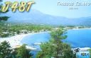
EU-174.jpgEU-174 Greece Makedonia / Thraki Region group37 viewsThasos or Thassos is a Greek island, geographically part of the North Aegean Sea, but administratively part of the Kavala regional unit. It is the northernmost major Greek island, and 12th largest by area. Thasos is also the name of the largest town of the island (officially known as Limenas Thasou, "Port of Thasos"), situated at the northern side, opposite the mainland and about 10 kilometres (6 miles) from Keramoti.
|
|

EU-174R.jpgEU-174 Greece Makedonia / Thraki Region group37 viewsThasos or Thassos is a Greek island, geographically part of the North Aegean Sea, but administratively part of the Kavala regional unit. It is the northernmost major Greek island, and 12th largest by area. Thasos is also the name of the largest town of the island (officially known as Limenas Thasou, "Port of Thasos"), situated at the northern side, opposite the mainland and about 10 kilometres (6 miles) from Keramoti.
|
|

na-033.jpgNA-033 Colombia San Andres Island37 viewsSaint Andrew is a coral island in the Caribbean Sea. Politically part of Colombia, and historically tied to the United Kingdom, Saint Andrew and the nearby islands of Providencia and Santa Catalina form the department of San Andrés, Providencia and Santa Catalina. Saint Andrew, in the southern group of islands, is the largest of the department. The official languages of the department are Spanish, English, and Creole. While Saint Andrew is located 50 km (31 mi) south of Providence, the Colombian archipelago
|
|

na-035r.jpgNA-035 Honduras Santanilla Islands;Swan Islands;Cisne Islands37 viewsThe Swan Islands, or Islas Santanilla or Islas del Cisne, initially named Islas de las Pozas by Christopher Columbus in 1502, is a chain of three islands located in the northwestern Caribbean Sea, approximately 153 kilometres off the coastline of Honduras, with a land area of 3.1 square kilometres
|
|

na-038r.jpgNA-038 Canada Quebec Province (La Madeleine Islands) group37 viewsThe Magdalen Islands is a small archipelago in the Gulf of Saint Lawrence with a land area of 205.53 square kilometres (79.36 sq mi). Administratively, the islands are part of the Gaspésie–Îles-de-la-Madeleine region in the Canadian province of Quebec, though they are geographically closer to the Maritime provinces than they are to the Gaspé Peninsula on the Quebec mainland.
|
|

na-044r.jpgNA-044 Newfoundland Province (Labrador) South group37 viewsBattle Harbour located on Battle Island is a summer fishing station, formerly a permanent settlement, located on the Labrador coast in the province of Newfoundland and Labrador, Canada. Battle Harbour was for two centuries the economic and social centre of the southeastern Labrador coast.
|
|

na-047r.jpgNA-047 Canada Nunavut (Baffin Island) group37 viewsQikiqtarjuaq (Inuktitut pronunciation: [qikiqtaÊjuˈaq]; formerly known as Broughton Island until November 1998 /ˈbrÉ”ËtÉ™n/,[5] is a community located on the island of the same name in the Qikiqtaaluk Region of Nunavut, Canada. The island is known for Arctic wildlife, whale watching, and as the northern access point for Auyuittuq National Park (see also Pangnirtung). At the 2016 census the population was 598, an increase of 15.0% from the 2011 census.
|
|
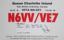
na-051.jpgNA-051 Canada BC Province (Haida Gwaii) group37 viewsHaida Gwaii, literally "Islands of the Haida people"),] is an archipelago approximately 45–60 km (30–40 mi) off the northern Pacific coast of Canada. The islands are separated from the mainland to the east by the shallow Hecate Strait. Queen Charlotte Sound lies to the south, with Vancouver Island beyond. To the north, the disputed Dixon Entrance separates Haida Gwaii from the Alexander Archipelago in the U.S. state of Alaska.
|
|

na-053.jpgNA-053 Alaska Trinity Islands37 viewsSitkinak Island is an island of the Kodiak Archipelago of the state of Alaska, United States. It lies south of the southern tip of Kodiak Island in the western part of the Gulf of Alaska. Tugidak Island lies to its west. The two islands are the largest components of the Trinity Islands of Alaska. The Trinity Islands, and thus Sitkinak, are part of the Gulf of Alaska unit of Alaska Maritime National Wildlife Refuge. Sitkinak Island has a land area of 235.506 km² (90.929 sq mi) and no resident population.
|
|

na-055r.jpgNA-055 Maine State East (Knox to Washington County) group37 viewsNorth Haven is an island in Knox County, Maine, United States, in Penobscot Bay. The island has both a year-round island community and a prominent summer colony. The population was 355 at the 2010 census. North Haven is accessed by three-times daily ferry service from Rockland, or by air taxi from Knox County Regional Airport.
|
|

na-064.jpgNA-064 Alaska Near Islands (Agattu and Attu) group37 viewsThe Near Islands or Sasignan Islands are the smallest and westernmost group of the Aleutian Islands in Alaska. They are located within the Aleutian Island chain to the west of the Rat Islands and to the east of the Russian Commander Islands
|
|
| 15388 files on 385 page(s) |
 |
|
|
|
|
|
|
|
|
160 | |
|
|
|
|
|
|
|
|
 Contact
