 Most viewed Most viewed |
OC-103.jpgOC-103 St Matthias group38 viewsThe St Matthias Islands (also known as the Mussau islands) are a small archipelago group of islands in the Bismarck Archipelago, in northern Papua New Guinea. They are within New Ireland Province. There are at least 10 islands. The largest and most northerly is Mussau.
|
|
OC-110.jpgOC-110 Torres Islands38 viewsThe Torres Islands are in the Torba Province of Vanuatu, the northernmost island group in the country. The chain of islands that make up this micro-archipelago straddle the broader cultural boundary that distinguishes Island Melanesia from several Polynesian outliers located in the neighbouring Solomon Islands. To the north is Temotu Province of the Solomon Islands, to the south Espiritu Santo, and to the southeast the Banks Islands. To the west, in the ocean, is the deep Torres Trench, the subduction zone between the Australian and Pacific Plates.
|
|

OC-120.jpgOC-120 Cuyo Islands38 viewsThe Cuyo Archipelago or Cuyo Islands, is a group of about 45 islands lying to the northeast of the Philippines island of Palawan.] It lies south of Mindoro and between Northern Palawan and Panay. It is centered on the largest island of the archipelago, Cuyo Island, with an area of 22 square miles (57 km2) and is about 9 miles (14 km) long.
|
|

oc-121.jpgOC-121 Mamanuca group;Mamanutha38 viewsThe Mamanuca Islands (Fijian: [mamaˈnuða]) of Fiji are a volcanic archipelago lying to the west of Nadi and to the south of the Yasawa Islands. The group, a popular tourist destination, consists of about 20 islands, but about seven of these are covered by the Pacific Ocean at high tide. One of the islands, Monuriki, was made famous as the anonymous island that featured in the 2000 Robert Zemeckis film, Cast Away,
|
|

OC-123R.jpgOC-123 Niuafo'ou Island38 viewsNiuafoʻou (meaning: many new coconuts) is the most northerly island in the kingdom of Tonga. It is a volcanic rim island with an area of 15 km2 (5.8 sq mi) and a population of 650 in 2006. The Niuafoʻou language is spoken on the island.
|
|

OC-125.jpgOC-125 Semirara Islands38 viewsSemirara Island is located in the central west of the Philippines archipeleago and has an area of 55 square kilometres (21 sq mi), and is home to the Panian Mine, a vast open-pit coal mine in operation since 1999, and the Unong Mine (in production from 1984 to 2000).
|
|
OC-126R.jpgOC-126 Lubang Islands38 viewsLubang Island is the largest island in the Lubang Group of Islands, an archipelago which lies to the northwest of the northern end of Mindoro in the Philippines. The Lubang Islands are about 150 kilometres (93 mi) southwest of Manila. There are seven islands in the group,
|
|

OC-131.jpgOC-131 King George Islands38 viewsThe King George Islands (ÃŽles du Roi Georges) is a subgroup of the Tuamotus Archipelago group in French Polynesia. The King George Islands include four atolls and one island. Tikei is the easternmost island and Ahe Atoll is the westernmost of the subgroup. The distance between them is 200 km (124 mi).
|
|

oc-133.jpgOC-133 Sabah's Coastal Islands38 viewsLabuan Island and six smaller islands, are located off the coast of the state of Sabah in East Malaysia. Labuan's capital is Victoria and is best known as an offshore financial centre offering international financial and business services via Labuan IBFC since 1990 as well as being an offshore support hub for deepwater oil and gas activities in the region.
|
|

oc-133r.jpgOC-133 Sabah's Coastal Islands38 viewsLabuan Island and six smaller islands, are located off the coast of the state of Sabah in East Malaysia. Labuan's capital is Victoria and is best known as an offshore financial centre offering international financial and business services via Labuan IBFC since 1990 as well as being an offshore support hub for deepwater oil and gas activities in the region.
|
|
OC-140R.jpgOC-140 Western Australia State (N.W. Coast) West group38 viewsSholl Island (area about 310 hectares) is between Onslow and Dampier, off the Pilbara coast of Western Australia. Part of the Pilbara Inshore Islands Group which are important breeding and resting places for migratory and resident shorebirds and seabirds, and marine turtles.
|
|
OC-150.jpgOC-150 Tenggara Barat Islands38 viewsWest Nusa Tenggara, comprising the western Lesser Sunda Islands of Lombok, Sumbawa, Moyo, and Sangeang. Nusa Tenggara is Indonesian for “southeast islands.†The province fronts the Flores Sea to the northeast, the Sape Strait to the east, the Indian Ocean to the south, Lombok Strait to the west, and the Bali Sea to the northwest. The capital is Mataram, in west-central Lombok.
|
|
OC-160R.jpgOC-160 Queensland State (South Coast) North group38 viewsHook Island is one of the Whitsunday Islands off the coast of the Australian state of Queensland. The island is almost uninhabited, quite rugged and almost completely contained within a section of the Whitsunday Islands National Park . The island has two prominent geographical features on the southern side of Hook Island; the Nara and Macona inlets, two fjord-like recesses that are used as anchorages for the Whitsunday tourist fleet. The island's northern coast is noted for its colourful underwater coral growths, to which snorkelling and diving enthusiasts are attracted.
|
|

OC-167R.jpgOC-167 Kapingamarangi Atoll38 viewsKapingamarangi is an atoll and a municipality in the state of Pohnpei of the Federated States of Micronesia. It is by far the most southerly atoll or island of the country and of the Caroline Islands, 300 km (190 mi) south of the next southerly atoll, Nukuoro, and 740 km (460 mi) southwest of the main island of Pohnpei state; it forms a Polynesian outlier. The total area of the atoll, including the lagoon, is 74 km2 (29 sq mi). Out of this, 1.1 km2 (0.4 sq mi) is land area, spread over 33 wooded islets.
|
|

OC-173.jpgOC-173 Northern Territory (Arafura Sea Coast) West group38 viewsMelville Island, known in the Tiwi language as Yermalner, is an island in the eastern Timor Sea, off the coast of the Northern Territory, Australia. It is west of the Cobourg Peninsula in Arnhem Land and north of Darwin, with a tropical climate. The largest community/town on the island is Milikapiti, pop. 559.
|
|
oc-182r.jpgOC-182 Ducie Island38 viewsDucie Island is an uninhabited atoll in the Pitcairn Islands. It lies 575 kilometres east of Pitcairn Island, and 300 kilometres east of Henderson Island, and has a total area of 1.5 square miles, which includes the lagoon. It is 1.5 miles long, measured northeast to southwest, and about 1 mile wide
|
|
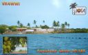
OC-187.jpgOC-187 Queensland State (North Coast) North group38 viewsTurtle Head Island is an island of the Torres Strait Islands archipelago, located in the Great Barrier Reef Marine Park, east of Cape York Peninsula, in Queensland, Australia. The island is located in Newcastle Bay at the mouth of Escape River and Middle River, not far from Jackey Jackey Creek and adjacent to the Jardine River National Park. The island lies approximately 30 km (19 mi) southeast of Bamaga.
|
|
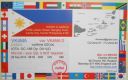
OC-188R.jpgOC-188 Pangutaran group38 viewsPangutaran Island is located in the west-central part of the Sulu archipelago near Mindanao, Philippines
|
|

OC-191.jpgOC-191 Niuatoputapu Island38 viewsNiuatoputapu is a high island in the island nation of Tonga, Pacific Ocean, its highest point being at 157 m. Its name means sacred island. Older European names for the island are Traitors island or Keppel island. Niuatoputapu is located in the north of the country, 300 kilometres (190 miles) away from Vavaʻu near the border with Samoa. Its closest neighbours are the small island of Tafahi, only 9 km (5.6 mi) to the north-northeast, and the island of Niuafo'ou.
|
|

OC-192.jpgOC-192 Ontong Java Atoll38 viewsOntong Java Atoll or Luangiuais one of the largest atolls on earth. It is sometimes referred to as Lord Howe Atoll, not to be confused with Lord Howe Island. Administratively Ontong Java belongs to the Solomon Islands As an outlying part of Malaita Province. Approximately 2000 people live on the atoll. There are two main villages where the population is concentrated with 1,386 on the island of Luaniua in the eastern end and 689 on Pelau in the northeast.
|
|
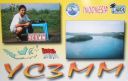
OC-197.jpgOC-197 Bawean Island38 viewsBawean (Indonesian: Pulau Bawean) is an island of Indonesia located approximately 150 km north of Surabaya in the Java Sea, off the coast of Java. It is administered by Gresik Regency of East Java province. It is approximately 15 km in diameter and is circumnavigated by a single narrow road. Bawean is dominated by an extinct volcano at its center that rises to 655 m above sea level. Its population as of the 2010 Census is about 70,000 people
|
|

OC-201.jpgOC-201 North Island's Coastal Islands38 viewsWaiheke Island is the most populated and second-largest island in the Hauraki Gulf of New Zealand. Its ferry terminal in Matiatia Bay at the western end is 21.5 km (13.4 mi) from the central-city terminal in Auckland. Waiheke is the second-largest island in the gulf, after Great Barrier Island, and is the most populated island in the gulf, with 9,250 permanent residents.
|
|

OC-203R.jpgOC-203 South Island's Coastal Islands38 viewsStewart Island, officially named Stewart Island/Rakiura, is the third-largest island of New Zealand. It lies 30 kilometres south of the South Island, across the Foveaux Strait. Its permanent population is 381 people as of the 2013 census, most of whom live in the settlement of Oban on the eastern side of the island.
|
|

OC-205.jpgOC-205 Woodlark group;Muyua group38 viewsWoodlark Island, known to its inhabitants simply as Woodlark or Muyua, is the main island of the Woodlark Islands archipelago, located in Milne Bay Province and the Solomon Sea, Papua New Guinea. Although no formal census has been conducted since 1990, the current population is estimated at approximately 6000 people. The wider Woodlark Islands group also consists of Madau and Nusam to the west, Nubara to the east, and the Marshall Bennett group to the southwest.
|
|

OC-208R.jpgOC-208 Banggai Islands38 viewsThe Banggai Archipelago (Indonesian: Kepulauan Banggai) is a group of islands, which are located at the far eastern end of Central Sulawesi, Indonesia. The archipelago is surrounded by the Banda Sea's Gulf of Tolo (Teluk Tolo), and the Molucca Sea. The Peleng Straits (Selat Peleng) separate it from mainland Sulawesi.
|
|
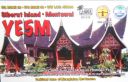
OC-215.jpgOC-215 Mentawai Islands38 viewsThe Mentawai Islands Regency are a chain of about seventy islands and islets approximately 150 kilometres off the western coast of Sumatra in Indonesia. Siberut at 4,030 square kilometres is the largest of the islands. The other major islands are Sipura, North Pagai and South Pagai.
|
|

OC-220R.jpgOC-220 South Australia State West group38 viewsSt Peter Island (originally in Dutch: Eyland St. Pierre) is an island in the Nuyts Archipelago on the west coast of Eyre Peninsula in South Australia near Ceduna. It is the second largest island in South Australia and about 13 km (8.1 mi) long.
|
|

OC-221.jpgOC-221 Kai Islands38 viewsThe Kai Islands (also Kei Islands) of Indonesia are a group of islands in the southeastern part of the Maluku Islands, located in the province of Maluku. The islands are on the edge of the Banda Sea, south of the Bird's Head Peninsula of New Guinea, west of the Aru Islands, and northeast of the Tanimbar Islands.
|
|
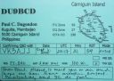
OC-235R.jpgOC-235 Mindanao's Coastal Islands38 viewsCamiguin is an island province in the Philippines located in the Bohol Sea, about 10 kilometres (6.2 mi) off the northern coast of Mindanao. Camiguin Island is a pearl-shaped island with an area of approximately 238 km2 (92 sq mi). The island measures about 23 kilometres (14 mi) at its longest and 14.5 kilometres (9.0 mi) at its widest breadth.[11] The island is mountainous with the highest elevation reaching over 5,000 ft (1,500 m).
|
|

OC-237R.jpgOC-237 Java's Coastal Islands38 viewsMadura is an Indonesian island off the northeastern coast of Java. The island comprises an area of approximately 4,078.67 km² (administratively 5,168 km² including various smaller islands to the east and north). Madura is administered as part of the East Java province. It is separated from Java by the narrow Strait of Madura. The administered area has a density of 702 people per km², while that of the island itself (3,630,000 people in 2012 count) is higher at 817/km².
|
|
OC-238R.jpgOC-238 Pukarua and Reao Atolls38 viewsReao or Natūpe is an atoll in the eastern expanses of the Tuamotu group in French Polynesia. The closest land is Pukarua Atoll, located 48 km to the WNW. Reao is 24.5 km long and its maximum width is 5 km. The whole length of its north-eastern rim is occupied by a single long island. There is no navigable pass into the lagoon. Reao Atoll's population is 351 inhabitants
|
|

OC-239.jpgOC-239 West Papua Coastal Islands West38 viewsLocated off the northwest tip of Bird's Head Peninsula on the island of New Guinea, in Indonesia's West Papua province, Raja Ampat, or the Four Kings, is an archipelago comprising over 1,500 small islands, cays, and shoals surrounding the four main islands of Misool, Salawati, Batanta, and Waigeo, and the smaller island of Kofiau. The Raja Ampat archipelago straddles the Equator and forms part of Coral Triangle which contains the richest marine biodiversity on earth.
|
|
OC-243R.jpgOC-243 Western Australia State (South Coast) West group38 viewsBreaksea Island in King George Sound in the Great Southern region of Western Australia is 12 kilometres (7 mi) south-east of Albany. The island is 103 hectares (250 acres) in area, 3 kilometres (1.9 mi) in length, and 600 metres (2,000 ft) at its widest part. The closest island is Michaelmas Island, located 1.5 kilometres (0.93 mi) north of Breaksea Island. The original lighthouse was replaced in 1902 by a cylindrical granite tower which remains in good condition.
|
|
OC-245.jpgOC-245 Sumatra's Coastal Islands North38 viewsRupat is an island in the Strait of Malacca, and forms part of Bengkalis Regency within Riau Province of Indonesia. It lies just off the eastern coast of Sumatra, across from Dumai city, from which it is separated by the Rupat Strait. Its area is 1,490 km².
|
|

OC-247.jpgOC-247 Sabalana and Tengah Islands38 viewshe Sabalana Islands (Kepulauan Sabalana) are an Atoll in the Flores Sea in Indonesia, lying just north of the Lesser Sunda Islands, closer to Sumbawa than Sulawesi. They are west of Tanahjampea Island and north-east of the Tengah Islands (Central Islands). Administratively, the atoll belongs to the province of South Sulawesi. The total area, including the large lagoon, is 2694 km², making Sabalana one of the largest atolls by total area. The land area of the largest individual island, Pulau Sabalana, measures about 7 km², followed by Pulau Banawaja with 3 km² and Pulau Sabaru with 1.4 km².
|
|

OC-247R.jpgOC-247 Sabalana and Tengah Islands38 viewshe Sabalana Islands (Kepulauan Sabalana) are an Atoll in the Flores Sea in Indonesia, lying just north of the Lesser Sunda Islands, closer to Sumbawa than Sulawesi. They are west of Tanahjampea Island and north-east of the Tengah Islands (Central Islands). Administratively, the atoll belongs to the province of South Sulawesi. The total area, including the large lagoon, is 2694 km², making Sabalana one of the largest atolls by total area. The land area of the largest individual island, Pulau Sabalana, measures about 7 km², followed by Pulau Banawaja with 3 km² and Pulau Sabaru with 1.4 km².
|
|

OC-251.jpgOC-251 Victoria State West group38 viewsLady Julia Percy Island, lies 6 kilometres (3.7 mi) off the coast, in the Barwon South West region of Victoria, Australia in Bass Strait. It is 12 kilometres (7.5 mi) south-south-west of Yambuk, and 22 kilometres (14 mi) south-west of Port Fairy. The island is about 2 kilometres (1.2 mi) in length by 1 kilometre (0.62 mi) in width, with an area of 1.33 square kilometres (0.51 sq mi), comprising a plateau, varying in height from 32–46 metres (105–151 ft) asl, surrounded by cliffs, rock platforms and reefs. It contains an important seal breeding colony.
|
|
OC-251R.jpgOC-251 Victoria State West group38 viewsLady Julia Percy Island, lies 6 kilometres (3.7 mi) off the coast, in the Barwon South West region of Victoria, Australia in Bass Strait. It is 12 kilometres (7.5 mi) south-south-west of Yambuk, and 22 kilometres (14 mi) south-west of Port Fairy. The island is about 2 kilometres (1.2 mi) in length by 1 kilometre (0.62 mi) in width, with an area of 1.33 square kilometres (0.51 sq mi), comprising a plateau, varying in height from 32–46 metres (105–151 ft) asl, surrounded by cliffs, rock platforms and reefs. It contains an important seal breeding colony.
|
|
OC-252R.jpgOC-252 Kalimantan's Coastal Islands West38 viewsTemajo Island lies 5 km offshore the western side of Borneo. The island has a small holiday resort
|
|
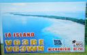
OC-254.jpgOC-254 Mortlock Islands38 viewsThe Nomoi Islands, also known as Mortlock Islands, are a group of three large atolls in the state of Chuuk, Federated States of Micronesia. They are located about 250 kilometres (160 miles) to the southeast of Chuuk. Satawan, the southern atoll, is the largest. Both Etal, the northern one, and Lukunor in the northeast are much smaller. They are located between 6 and 9 kilometres (3.7 and 5.6 miles) from each other.
|
|
| 15377 files on 385 page(s) |
 |
|
|
|
|
|
|
|
|
158 | |
|
|
|
|
|
|
|
|
 Contact
