 Most viewed |

gm3poi.jpggm3poi - Scotland41 viewsvia EME Moon Bounce - my 8el yagi with no elev to his 10 el yagi no elev
|
|
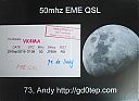
gd0tepr.jpgGD0TEP Isle of Mann41 viewsvia EME - my 8el single yagi to his 10 el single yagi
|
|

s79gjr.jpgS79GJ - Seychelles41 viewsQSO made via EME Moon Bounce - op was w7gj who was in the Seychelles for a 2 week EME dxpedition. He using 8el single yagi with elev to my 8el yagi with no elev
|
|

jw7qia.jpgjw7qia - Svalbard41 viewsvia eme - my single 8el yagi to single 6el yagi in JW
|
|
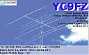
yc9fz.jpgyc9fz - Indonesia41 viewsvia Winter Es - took me 9 years to work YB on 6m but worked another 20 or so YB stations a few months later via Summer Es
|
|

ey8mm~0.jpgey8mm - Tadjikistan41 viewsshort opening via Winter Es link to Northern hemisphere summer Es
|
|

IS0AWZ.jpgis0awz - Sardinia41 viewsshort opening via Winter Es link to Northern hemisphere summer Es
|
|
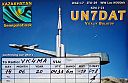
un7datr.jpgun7dat - Kazakhstan41 viewsvia Winter Es
|
|

j79wtar.jpgJ79WTA - Dominica41 viewsvia F2 short path direct beam heading
|
|

hc2fgP.jpgHC2FG - Ecuador41 viewsvia crooked path beaming due east -
|
|

ft5wwb.jpg41 views
|
|

TN-Grundy1.jpg41 views
|
|

OH-Knox1.jpg41 views
|
|

a52ci.jpgA52CI - BHUTAN41 viewsworked via TEP extension
|
|

oh2xxr.jpgOH2XX - FINLAND41 viewsworked via F2
|
|

px0ffr.jpgPX0FF - FERNANDO DE NORONHA41 viewsworked via F2 crooked path 120 degrees - probable vk4 shortpath distance record
|
|

HC2FGR.jpgHC2FG - ECUADOR41 viewsvia crooked path beaming due east -
|
|
eu-041r.jpgEU-041 Italy Maddalena Archipelago40 viewsThe 'Maddalena Archipelago' is a group of islands in the Strait of Bonifacio between Corsica (France) and north-eastern Sardinia (Italy). The whole archipelago makes the territory of the La Maddalena comune. The archipelago consists of seven main islands and numerous small islets
|
|

eu-053.jpgEU-053 Finland Market reef 40 viewsMärket is a small 3.3-hectare (8.2-acre) uninhabited skerry in the Baltic Sea between Sweden and Finland (in the area of the autonomous Åland Islands), with a lighthouse as its salient manmade feature. Märket has been divided between the two countries since the Treaty of Fredrikshamn of 1809 defined the border between Sweden and the Russian Empire as going through the middle of the island.
|
|
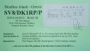
EU-072.jpgEU-072 Greece Thessalia Region group40 viewsSkiathos is a small Greek island in the northwest Aegean Sea. Skiathos is the westernmost island in the Northern Sporades group, east of the Pelion peninsula in Magnesia on the mainland, and west of the island of Skopelos.
|
|
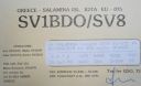
EU-075.jpgEU-075 Greece Peloponnisos (Argolis) / Attiki Region group40 viewsSalamis, is the largest Greek island in the Saronic Gulf, about 1 nautical mile off-coast from Piraeus and about 16 kilometres west of central Athens. The chief city, Salamina, lies in the west-facing core of the crescent on Salamis Bay, which opens into the Saronic Gulf
|
|

EU-088.jpgEU-088 Denmark Kattegat group40 viewsLæsø is the largest island in the North Sea bay of Kattegat, and is located 19 kilometres off the northeast coast of the Jutland Peninsula, the Danish mainland. Læsø is also the name of the municipality on that island.
|
|

EU-094.jpgEU-094 France Bretagne (Finistere South) Region group40 viewsThe Glénan islands are an archipelago located off the coast of France. They are located in the south of Finistère, near Concarneau and Fouesnant, and comprise nine major islands: Saint-Nicolas, the Loc'h, Penfret, Cigogne, Drenec, Bananec, Brunec, Guiriden and Guéotec.
|
|
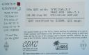
EU-099R.jpgEU-099 England Les Minquiers Islands40 viewsThe Minquiers are a group of islands and rocks, about 15 km (9.3 mi) south of Jersey. The Minquiers forms part of the Bailiwick of Jersey.[2] They are administratively part of the Parish of Grouville. At low tide, the rock shelf around the Minquiers has a larger surface area than Jersey itself but at high tide only a few of the main heads remain above water.
|
|

EU-100.jpgEU-100 Corsica Cerbicales Islands40 viewsThe Cerbicale Islands (Corsican I Ciarbicali ) are a small archipelago of the Tyrrhenian Sea located in Corsica-South , in the municipality of Porto-Vecchio , off the Punta Cerbicale. They belong since 1999 to the Bouches de Bonifacio Reserve.
|
|

EU-107.jpgEU-107 France Bretagne (Cotes-d'Armor West) Region group40 viewsSept-Îles (French for seven islands) a small archipelago off the north coast of Brittany, in the Perros-Guirec commune of Côtes-d'Armor. This group of islands is home to an important bird reserve, and is the home of various seabirds, including northern gannets, cormorants, and members of the Alcidae family (puffins, common guillemots, razorbills). This is also a reserve for grey seals
|
|
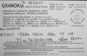
EU-109R.jpgEU-109 England Farne Islands40 viewsThe Farne Islands are a group of islands off the coast of Northumberland, England. There are between 15 and 20 islands depending on the state of the tide. They are scattered about 1 1â„2 to 4 3â„4 miles (2.4–7.6 km) from the mainland, divided into two groups, the Inner Group and the Outer Group.
|
|

EU-116R.jpgEU-116 Isle of Man40 viewsThe Isle of Man, is a self-governing British Crown dependency in the Irish Sea between Great Britain and Ireland. The head of state is Queen Elizabeth II, who holds the title of Lord of Mann and is represented by a lieutenant governor. Defence is the responsibility of the United Kingdom.
|
|
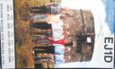
EU-121.jpgEU-121 Irish Coastal Islands40 viewsBere Island is an island off the Beara Peninsula in County Cork Ireland. It is roughly 10 km x 3 km in dimension, with an area of 17.68 km², and, as of 2012, had a population of between 210 and 220 people.
|
|
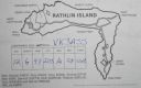
EU-122R.jpgEU-122 Northern Irish Coastal Islands40 viewsRathlin is the only inhabited offshore island of Northern Ireland, with a steadily growing population of approximately 150 people, and is the most northerly inhabited island off the coast of the island of Ireland. The reverse L-shaped Rathlin Island is 4 miles (6 km) from east to west, and 2.5 miles (4 km) from north to south.
|
|

EU-124R.jpgEU-124 Welsh Coastal Islands40 viewsFlat Holm is a limestone island lying in the Bristol Channel approximately 6 km from Lavernock Point in the Vale of Glamorgan. It includes the most southerly point of Wales. The island has a long history of occupation, dating at least from Anglo-Saxon and Viking age.
|
|
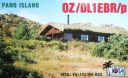
EU-125.jpgEU-125 Denmark Jylland West group40 viewsFanø is a Danish island in the North Sea off the coast of southwestern Denmark, and is the very northernmost of the Danish Wadden Sea Islands. Fanø municipality is the municipality that covers the island and its seat is the town of Nordby
|
|
EU-140.jpgEU-140 Finland Etela-Suomi (Kymi) Province group40 viewsKuutsalo is an island and village on the Gulf of Finland in the city of Kotka . The island is located three kilometers southeast of the city center of Kotka Island . The village of Kuutsalo also includes several other islands, the largest of which is Kirkonmaa , located to the south of it. Kuutsalo has 27 inhabitants and Rankki-Kirkonmaa has 17 inhabitants (31.12.2012).
|
|
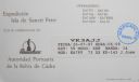
EU-143R.jpgEU-143 Spain Cadiz / Huelva Province group40 viewsThe Islote de Sancti Petri is a small barren island belonging to the municipality of San Fernando, Cádiz in the province of Cádiz and the autonomous region of Andalusia, Spain. For many years, the island was a restricted military zone, but it is now under the control of the Spanish Environment Ministry.
|
|

EU-145.jpgEU-145 Portugal Algarve Province group40 viewsCulatra Island is an island in the Algarve, Portugal. It is divided into three parts: Farol, Hângares and Culatra. The island is a short distant east from the Algarve capital of Faro and the island is 6 kilometres (3.7 miles) in length and 100 to 900 metres (330 to 2,950 feet) width, with no roads or vehicles, but interlaced with wooden walkways. There are about 1,000 inhabitants on the island year round.
|
|
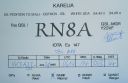
EU-147.jpgEU-147 Russia White Sea Coast group40 viewsOstrov Sonostrov, Karelia island is located in the White Sea and is north of Sonostrov and southeast of Mys Voroniy.
|
|

EU-149.jpgEU-149 Estonia Tallinn & Harjumaa / Virumaa County group40 viewsMohni island (area 62.5 ha) is situated on the territory of Lahemaa National Park, north-east of Eru Bay, 4.5 kilometres from the coastline of Viinistu. The island’s landmarks feature a lighthouse and remains of a Soviet era border guard station’s auxiliary buildings.
|
|
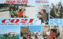
EU-150.jpgEU-150 Portugal Minho / Douro Litoral / Beira Litoral Province group40 viewsFortress of Insua Island (Portugal), of the XVII century, located in the Minho River estuary, between the coast of Caminha (Portugal) and La Guardia (Spain). Inside the fort is the Franciscan convent of Saint Mary of Insua, built in 1471.
|
|

eu-155.jpgEU-155 Italy (DELETED: SCANNO DI PIALLAZZA island)40 viewsIsland appears to no longer exist - refer - http://www.yf1ar.com/2011/10/eu-155-neverland.html
|
|

EU-163R.jpgEU-163 Montenegro group;Crna Gora group40 viewsSveti Nikola Island is an island in the Adriatic Sea, in the Montenegrin municipality of Budva. Sveti Nikola island is located opposite to the town of Budva, 1 kilometre (0.6 miles) from Budva's old town. The island is 2 kilometres (1 mile) long, and it has an area of 36 hectares (89 acres). The highest point on the island is a cliff that rises 121 metres (397 feet) above the sea.
|
|
| 15644 files on 392 page(s) |
 |
|
|
|
|
|
|
|
|
151 | |
|
|
|
|
|
|
|
|
 Contact

