 Most viewed |

AP2N~0.jpg41 views
|
|

c31ctr.jpg41 views
|
|

cy9ss~1.jpg41 views
|
|

e51szk1hjr.jpg41 views
|
|

ey8cq~2.jpg41 views
|
|

fk0bcr.jpg41 views
|
|

fw5jja.jpg41 views
|
|

z36w.jpg41 views
|
|

zl9ciaaaaa.jpg41 views
|
|

zs6avm.jpg41 views
|
|

7p8ccr.jpg41 views
|
|

pa0cor.jpg41 views
|
|

pj2n5hz.jpg41 views
|
|

tn2tb.jpg41 views
|
|

zl7zm7zbr~1.jpg41 views
|
|

zp7apo.jpg41 views
|
|

zzdel8z4ab.jpg41 views
|
|

zzdeldl1hnb.jpg41 views
|
|
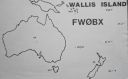
OC-054.jpgOC-054 Wallis Islands41 viewsWallis is a Polynesian island in the Pacific Ocean belonging to the French overseas collectivity of Wallis and Futuna. It lies north of Tonga, northeast of Fiji, east-northeast of the Hoorn Islands, east of Fiji's Rotuma, southeast of Tuvalu, southwest of Tokelau and west of Samoa. Its area is almost 100 km2 (39 sq mi) with almost 11,000 people. Its capital is MatÄÊ»utu.
|
|
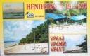
OC-056.jpgOC-056 Henderson Island41 viewsHenderson Island (formerly also San Juan Bautista and Elizabeth Island) is an uninhabited member of the Pitcairn Islands archipelago in the south Pacific Ocean. Its remote location and unsuitability for human habitation have made it the subject of scientific study. Ten of its 51 flowering plants, all four of its land birds and about a third of the identified insects and gastropods are endemic – a remarkable diversity given the island's size
|
|

OC-060R.jpgOC-060 Rotuma Island41 viewsRotuma is a Fijian dependency, consisting of Rotuma Island and nearby islets. The island group is home to a large and unique indigenous ethnic group which constitutes a recognisable minority within the population of Fiji, known as "Rotumans". Its population at the 2007 census was 2,002, although many more Rotumans live on mainland Fijian islands, totaling 10,000.
|
|
OC-067.jpgOC-067 Leeward Islands41 viewsThe Leeward Islands are the western part of the Society Islands in French Polynesia, an overseas collectivity of France in the South Pacific. They lie south of the Line Islands (part of Kiribati), east of the Cooks and north of the Austral Islands (also part of French Polynesia). Their area is 395 km² with a population of over 33,000.
|
|
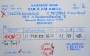
OC-076.jpgOC-076 Sula Islands41 viewsThe Sula Islands Regency is one of the regencies in North Maluku province of Indonesia. It consists of two of the three large islands comprising the Sula Archipelago, together with minor adjacent islands. The third island, Taliabu, was split off from the Sula Islands Regency in 2013 to form a separate regency.
|
|
OC-082R.jpgOC-082 Penrhyn Atoll;Tongareva Atoll41 viewsPenrhyn (also called Tongareva, MÄngarongaro, Hararanga, and Te Pitaka) is an island in the northern group of the Cook Islands in the south Pacific Ocean. The northernmost island in the group, it is located at 1,365 km (848 mi) north-north-east of the capital island of Rarotonga, 9 degrees south of the equator. Its nearest neighbours are Rakahanga, and Manihiki, approximately 350 kilometres (220 mi) to the southwest.
|
|
OC-083.jpgOC-083 Aitutaki group41 viewsAitutaki, also traditionally known as Araʻura and Utataki, is one of the Cook Islands, north of Rarotonga. It has a population of approximately 2,000. Aitutaki is the second most visited island of the Cook Islands. The main village is Arutanga (Arutunga) on the west side.
|
|

OC-086.JPGOC-086 Northern Mariana Islands41 viewsThe Northern Mariana Islands, officially the Commonwealth of the Northern Mariana Islands is an insular area and commonwealth of the United States consisting of 14 islands in the northwestern Pacific Ocean. The CNMI includes the 14 northernmost islands in the Mariana Archipelago except the southernmost island of the chain, Guam, which is a separate U.S. territory.
|
|
OC-091.jpgOC-091 Polillo Islands41 viewsPolillo is an island in the northeastern region of the Philippine archipelago. It is separated from Luzon Island by the Polillo Strait and forms the northern side of Lamon Bay. As of the 2010 Philippine Census, the island is home to 64,802 individuals
|
|
OC-095R.jpgOC-095 Lau group41 viewsThe Lau Islands of Fiji are situated in the southern Pacific Ocean, just east of the Koro Sea. Of this chain of about sixty islands and islets, about thirty are inhabited. The Lau Group covers a land area of 188 square miles (487 square km), and had a population of 10,683 at the most recent census in 2007. While most of the northern Lau Group are high islands of volcanic origin, those of the south are mostly carbonate low islands.
|
|

OC-098R.jpgOC-098 Pukapuka Atoll;Danger Islands41 viewsPukapuka, formerly Danger Island, is a coral atoll in the northern group of the Cook Islands in the Pacific Ocean. It is one of most remote islands of the Cook Islands, situated about 1,140 kilometres (708 miles) northwest of Rarotonga. On this small island, an ancient culture and distinct language has been maintained over many centuries.
|
|
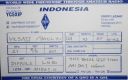
OC-109R.jpgOC-109 Natuna Selatan Islands;Subi Besar Islands41 viewsThe Natuna Regency is an archipelago of 272 islands located in the south part of the South China Sea in the Natuna Sea. It is part of the larger Tudjuh Archipelago, off the northwest coast of Borneo. Administratively, the islands (including the central Bunguran Islands and various outliers) constitute a regency within the Riau Islands Province of Indonesia and are the northernmost non-disputed island group of Indonesia.
|
|
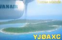
OC-110.jpgOC-110 Torres Islands41 viewsThe Torres Islands are in the Torba Province of Vanuatu, the northernmost island group in the country. The chain of islands that make up this micro-archipelago straddle the broader cultural boundary that distinguishes Island Melanesia from several Polynesian outliers located in the neighbouring Solomon Islands. To the north is Temotu Province of the Solomon Islands, to the south Espiritu Santo, and to the southeast the Banks Islands. To the west, in the ocean, is the deep Torres Trench, the subduction zone between the Australian and Pacific Plates.
|
|

oc-112r.jpgOC-112 Conway Reef41 viewsConway Reef, known since 1976 by its Fijian name Ceva-I-Ra Reef, is a coral reef of atoll type 450 km southwest of the Fiji Islands and part of the Republic of Fiji. It is 2.5 km long in an east-west direction. On the middle of the reef is a small sand cay, 1.8 meters high and about 320 metres long and 73 metres wide, with a land area of two hectares. A stranded wreck of a coaster lies 240 metres south of the centre of the cay, and the wreck of a fishing vessel (Sang Sheng 168) lies on the northeast end
|
|

OC-131.jpgOC-131 King George Islands41 viewsThe King George Islands (ÃŽles du Roi Georges) is a subgroup of the Tuamotus Archipelago group in French Polynesia. The King George Islands include four atolls and one island. Tikei is the easternmost island and Ahe Atoll is the westernmost of the subgroup. The distance between them is 200 km (124 mi).
|
|

OC-152.jpgOC-152 Tubuai Island41 viewsTubuai or Tupua'i is the main island of the Tubuai Island group, located at 23°23′00″S 149°27′00″W, 640 km (400 mi) south of Tahiti. In addition to Tubuai, the group of islands include Rimatara, Rurutu, Raivavae and the uninhabited Îles Maria. They are part of the Austral Islands in the far southwest of French Polynesia in the south Pacific Ocean. Tubuai island sustains a population of 2,217 people on 45 km² of land
|
|

OC-164R.jpgOC-164 Western Australia State (S.W. Coast) South group41 viewsRottnest Island sits just offshore from the city of Perth, in Western Australia. A protected nature reserve, it's home to the quokka, a small wallaby-like marsupial.
|
|

OC-201.jpgOC-201 North Island's Coastal Islands41 viewsWaiheke Island is the most populated and second-largest island in the Hauraki Gulf of New Zealand. Its ferry terminal in Matiatia Bay at the western end is 21.5 km (13.4 mi) from the central-city terminal in Auckland. Waiheke is the second-largest island in the gulf, after Great Barrier Island, and is the most populated island in the gulf, with 9,250 permanent residents.
|
|
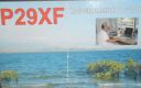
OC-240.jpgOC-240 Papua New Guinea's Coastal Islands East41 viewsLoloata Island is in Bootless Bay, near Port Moresby. It is a small, elongated island with a steep ridge line that extends the length of the island. It is sparsely vegetated and surrounded by a shallow coral reef. It is home to a 5 star resort
|
|
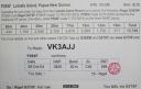
OC-240R.jpgOC-240 Papua New Guinea's Coastal Islands East41 viewsLoloata Island is in Bootless Bay, near Port Moresby. It is a small, elongated island with a steep ridge line that extends the length of the island. It is sparsely vegetated and surrounded by a shallow coral reef. It is home to a 5 star resort
|
|
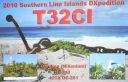
OC-281.jpgOC-281 Caroline Island;Millennium Island41 viewsCaroline Island or Caroline Atoll (also known as Millennium Island and Beccisa Island), is the easternmost of the uninhabited coral atolls which comprise the southern Line Islands in the central Pacific Ocean, part of the Republic of Kiribati since the island nation's independence in 1979.
Caroline Island has remained relatively untouched and is considered one of the world's most pristine tropical islands. It is home to one of the world's largest populations of the coconut crab and is an important breeding site for seabirds, most notably the sooty tern.
|
|
IZONE30.jpg41 views
|
|
| 15647 files on 392 page(s) |
 |
|
|
|
|
|
|
|
|
150 | |
|
|
|
|
|
|
|
|
 Contact

