 Most viewed |

VK0Avk2akp.jpg42 views
|
|

VK0EKR~0.jpg42 views
|
|

vp2ec.jpg42 views
|
|

vq9dmr.jpg42 views
|
|

xw8dxr.jpg42 views
|
|

xx9as.jpg42 views
|
|

ya5t.jpg42 views
|
|

a52a~2.jpg42 views
|
|

a92ior~0.jpg42 views
|
|

d44bs~0.jpg42 views
|
|

ei2go.jpg42 views
|
|

er1lwr.jpg42 views
|
|

f1ohsr.jpg42 views
|
|

ft5zmaaa.jpg42 views
|
|

gd4uolr~0.jpg42 views
|
|

gwmw0zzka.jpg42 views
|
|

hb9azx.jpg42 views
|
|

tz6tr.jpg42 views
|
|

yt1adr.jpg42 views
|
|

zd8tr.jpg42 views
|
|

zl7zm7zb.jpg42 views
|
|

5a7ar~0.jpg42 views
|
|
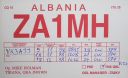
za1mh~3.jpg42 views
|
|
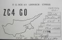
zc4go.jpg42 views
|
|

zd7hh~0.jpg42 views
|
|

zk3yl.jpg42 views
|
|

zzdelkz5ek.jpg42 views
|
|

zzdelpj0k.jpg42 views
|
|

zzdelr1m4j1fwr.jpg42 views
|
|

OC-028S.jpgOC-028 Marshall Islands Ralik Chain42 viewsThe Ralik Chain is a chain of islands within the island nation of the Marshall Islands. Ralik means "sunset". It is west of the Ratak Chain. In 1999 the total population of the Ralik islands was 19,915
|
|

OC-029.jpgOC-029 Marshall Islands Ratak Chain42 viewsThe Ratak Chain is a chain of islands within the island nation of the Marshall Islands. Ratak means "sunrise". It lies to the east of the country's other island chain, the Ralik Chain. In 1999 the total population of the Ratak islands was 30,925
|
|

OC-055.jpgOC-055 French Frigate Shoals42 viewsThe French Frigate Shoals is the largest atoll in the Northwestern Hawaiian Islands. It consists of a 20-mile (32 km) long crescent-shaped reef, twelve sandbars, and the 120-foot (37 m) high La Perouse Pinnacle, the only remnant of its volcanic origins. It is maintained as a field station in the Hawaiian Islands National Wildlife Refuge by the United States Fish and Wildlife Service.
|
|
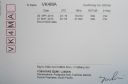
OC-062r.jpgOC-062 Pukapuka Atoll42 viewsPuka-Puka is a small coral atoll in the north-eastern Tuamotu Archipelago, sometimes included as a member of the Disappointment Islands. This atoll is quite isolated, the nearest land being Fakahina, located 182 km to the southwest. Puka-Puka Atoll has an elliptical shape. Its length is 6 km and its maximum width 3.3 km. Its land area is about 5 km2. The lagoon is filled with silt and has become very small. According to the 2017 census, the total population was 163
|
|
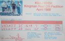
OC-096R.jpgOC-096 Kingman Reef (deleted)42 viewsDescriptionKingman Reef is a largely submerged, uninhabited triangular-shaped reef, 9.5 nautical miles east-west and 5 nmi north-south, located in the North Pacific Ocean, roughly halfway between the Hawaiian Islands and American Samoa.
|
|
OC-103.jpgOC-103 St Matthias group42 viewsThe St Matthias Islands (also known as the Mussau islands) are a small archipelago group of islands in the Bismarck Archipelago, in northern Papua New Guinea. They are within New Ireland Province. There are at least 10 islands. The largest and most northerly is Mussau.
|
|

OC-120.jpgOC-120 Cuyo Islands42 viewsThe Cuyo Archipelago or Cuyo Islands, is a group of about 45 islands lying to the northeast of the Philippines island of Palawan.] It lies south of Mindoro and between Northern Palawan and Panay. It is centered on the largest island of the archipelago, Cuyo Island, with an area of 22 square miles (57 km2) and is about 9 miles (14 km) long.
|
|

OC-125.jpgOC-125 Semirara Islands42 viewsSemirara Island is located in the central west of the Philippines archipeleago and has an area of 55 square kilometres (21 sq mi), and is home to the Panian Mine, a vast open-pit coal mine in operation since 1999, and the Unong Mine (in production from 1984 to 2000).
|
|

oc-133r.jpgOC-133 Sabah's Coastal Islands42 viewsLabuan Island and six smaller islands, are located off the coast of the state of Sabah in East Malaysia. Labuan's capital is Victoria and is best known as an offshore financial centre offering international financial and business services via Labuan IBFC since 1990 as well as being an offshore support hub for deepwater oil and gas activities in the region.
|
|

OC-154.jpgOC-154 Western Australia State (North Coast) East group42 viewsTroughton Island is an island located off the Kimberley coast of Western Australia. The Sir Graham Moore Islands Airline company ShoreAir Pty Ltd has opened and operated an airport on the island since the 1960s.
|
|

OC-180.jpgOC-180 Ngulu Atoll42 viewsNgulu Atoll is a coral atoll of three islands in the Caroline Islands in the Pacific Ocean, and forms a legislative district in Yap State in the Federated States of Micronesia. Ngulu extends for 36 kilometres (22 mi) by 22 kilometres (14 mi) with 18 reef segments enclosing a deep central lagoon of 382 square kilometres (147 sq mi). The eastern portion of the reef is deeply submerged. Its total land area of the nine islets is only 0.4 square kilometres (0.15 sq mi). Nugulu is located approximately 104 kilometres (65 mi) south-southwest of Yap and is the westernmost atoll in the Federated States of Micronesia. The population of Ngulu was 26 in 2000.
|
|
| 15647 files on 392 page(s) |
 |
|
|
|
|
|
|
|
|
142 | |
|
|
|
|
|
|
|
|
 Contact

