 Most viewed |
zone30r~0.jpg42 views
|
|

jy5kc.jpg42 views
|
|

ei3kd.jpgei3kd - Ireland42 viewsqso via EME moon bounce - although a few weeks later ei3kd completed with vk3amz via winter Es for the best qso of that season
|
|

OH-Licking.jpg42 views
|
|

tg9ajr.jpgTG9AJR - GUATEMALA42 viewsVia F2, SFI 115 but day following solar disturbance. Path also open to ea8 longpath, north to TG and south to YV
|
|

ft5wws.jpg42 views
|
|

ft5wwr.jpg42 views
|
|

hi3t.jpgHI3T - Dominican Republic42 viewsvia f2 post solar flare - many HI stations worked this day
|
|

tr8cag.jpgTR8CA - GABON42 viewsworked longpath direct via F2
|
|

OH-Carroll1.jpg42 views
|
|

7q6ujr.jpg7Q6UJ - MALAWI42 viewsworked via direct long path over top of North America - my furtherest distance on 6m to date
|
|

OH-Logan1.jpg42 views
|
|

eu-045.jpgEU-045 Italy Lazio Region group41 viewsThe Pontine Islands are an archipelago in the Tyrrhenian Sea off the west coast of Italy. The islands were collectively named after the largest island in the group, Ponza. The other islands in the archipelago are Palmarola, Zannone, and Gavi to the northwest, Ventotene and Santo Stefano to the southeast.
|
|

eu-051.jpgEU-051 Italy Ustica Island41 viewsUstica is the name of a small island, about 5 kilometres across, situated 52 kilometres north of Capo Gallo, Italy in the Tyrrhenian Sea. Roughly 1,300 people live in the comune of the same name. There is regular ferry service from the island to Palermo, Italy.
|
|

EU-054R_28229.jpgEU-054 Italy Egadi Islands41 viewsThe Aegadian Islands are a group of five small mountainous islands in the Mediterranean Sea off the northwest coast of Sicily, Italy, near the cities of Trapani and Marsala, with a total area of 37.45 square kilometres (14.46 sq mi).
|
|

eu-055r.jpgEU-055 Norway Sogn og Fjordane / Hordaland / Rogaland County group41 viewsBorøya or Borøy is an island in Tvedestrand municipality in Aust-Agder county, Norway. The 3.4-square-kilometre island lies along the Oksefjorden between the islands of Sandøya and Tverrdalsøya. Some of the villages on the island include Sandvika, Borøkilen, Utgårdstrand, and Snarsund.
|
|

EU-057.jpgEU-057 Germany Mecklenburg-Vorpommern State group41 viewsRügen is Germany's largest island by area. It is located off the Pomeranian coast in the Baltic Sea and belongs to the state of Mecklenburg-Western Pomerania.
|
|

EU-058.jpgEU-058 France Provence-Cote d'Azur (Alpes Maritimes) Region group41 viewsThe Lérins Islands are a group of four Mediterranean islands off the French Riviera, in Cannes. The two largest islands in this group are the Île Sainte-Marguerite and the Île Saint-Honorat. The smaller Îlot Saint-Ferréol and Îlot de la Tradelière are uninhabited. Administratively, the islands belong to the commune of Cannes.
|
|

EU-060R.jpgEU-060 Greece Sterea Ellas Region group41 viewsSkyros is an island in Greece, the southernmost of the Sporades, an archipelago in the Aegean Sea. At 209 square kilometres (81 sq mi) it is the largest island of the Sporades, and has a population of about 3,000 (in 2011). It is part of the regional unit of Euvoia.
|
|

EU-067.jpgEU-067 Greece Kyklades (Cyclades)41 viewsThe Cyclades (Greek: Κυκλάδες Kykládes) are Greek islands located in the southern part of the Aegean Sea. The archipelago contains some 2,200 islands, islets and rocks; just 33 islands are inhabited.
|
|

EU-067R.jpgEU-067 Greece Kyklades (Cyclades)41 viewsThe Cyclades (Greek: Κυκλάδες Kykládes) are Greek islands located in the southern part of the Aegean Sea. The archipelago contains some 2,200 islands, islets and rocks; just 33 islands are inhabited.
|
|

EU-068.jpgEU-068 France Bretagne (Finistere South West) Region group41 viewsThe Île de Sein is a French island in the Atlantic Ocean, off Finistère, eight kilometres from the Pointe du Raz (raz meaning "water current"), from which it is separated by the Raz de Sein. Its Breton name is Enez Sun. The island, with its neighbouring islets, forms the commune of Île-de-Sein in the Finistère department of Brittany in north-western France. Inhabitants of Île-de-Sein are called in French Sénans.
|
|
EU-070R.jpgEU-070 France Provence-Cote d'Azur (Var) Region group41 viewsPorquerolles, also known as the Île de Porquerolles, is an island in the Îles d'Hyères, Var, Provence-Alpes-Côte d'Azur, France. Its land area is 1,254 hectares and in 2004 its population was about 200. Porquerolles is the largest, most westerly of the three Îles d'Hyères.
|
|

EU-078.jpgEU-078 Spain Gerona Province group41 viewsThe Illes Medes is a small and craggy group of seven islets in the northwestern Mediterranean Sea. Administratively, the Medes Archipelago belongs to the Baix Empordà comarca, Catalonia, Spain. The islands are located close to the shore, east of the coastal town of L'Estartit
|
|

EU-080.jpgEU-080 Spain Pontevedra Province group41 viewsThe Ons Island is the main island of a small archipelago in the coast of Pontevedra in Galicia, Spain. Ons belongs administratively to the municipality of Bueu, which has a regular ferry boat connection to the island, as have the mainland towns of Portonovo, Sanxenxo, MarÃn and Aldán
|
|

EU-083.jpgEU-083 Italy Liguria Region group41 viewsTino is an Italian island situated in the Ligurian Sea, at the westernmost end of the Gulf of La Spezia. It is part of an archipelago of three closely spaced islands jutting out south from the mainland at Portovenere. The largest of the three, Palmaria, lies to the north and the tiny Tinetto to the south
|
|

EU-103.jpgEU-103 Ireland Saltee Islands41 viewsThe Saltee Islands are a pair of small islands lying 5 kilometres off the southern coast of County Wexford in Ireland. The two islands are Great Saltee (89 hectares) and Little Saltee (37 hectares). They have been largely unoccupied since the early 20th century and have been privately owned by the Neale family since 1943. Together the islands cover an area of 1.2 square kilometers.
|
|

EU-108R.jpgEU-108 Scotland Treshnish Isles41 viewsThe Treshnish Isles is an archipelago of small islands and skerries, lying west of Mull, in Scotland. They are part of the Inner Hebrides. Trips to the Treshnish Isles operate from Tobermory and Ardnamurchan in the summer months.
|
|
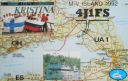
EU-117.jpgEU-117 Gulf of Finland North group41 viewsMaly Vysotsky Island or Malyj Vysotskij Island is an island in northwest Russia, that was leased to Finland. It is located in Vyborg Bay, next to Vysotsk, 12 km southwest of Vyborg.
|
|
EU-121R.jpgEU-121 Irish Coastal Islands41 viewsBere Island is an island off the Beara Peninsula in County Cork Ireland. It is roughly 10 km x 3 km in dimension, with an area of 17.68 km², and, as of 2012, had a population of between 210 and 220 people.
|
|

EU-124.jpgEU-124 Welsh Coastal Islands41 viewsFlat Holm is a limestone island lying in the Bristol Channel approximately 6 km from Lavernock Point in the Vale of Glamorgan. It includes the most southerly point of Wales. The island has a long history of occupation, dating at least from Anglo-Saxon and Viking age.
|
|
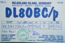
EU-127.jpgEU-127 Germany Schleswig-Holstein State South West group41 viewsHeligoland is a small archipelago in the North Sea. Today a part of the German state of Schleswig-Holstein, the islands have historically been possessions of Denmark and later the United Kingdom. The islands are located in the Heligoland Bight (part of the German Bight) in the southeastern corner of the North Sea and had a population of 1,127 at the end of 2016.
|
|
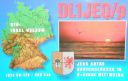
EU-129.jpgEU-129 Germany Usedom Island;Uznam Island41 viewsUsedom is a Baltic Sea island in Pomerania, divided since 1945 between Germany and Poland. It is the second biggest Pomeranian island after Rügen. It is situated north of the Szczecin Lagoon estuary of the River Oder.
|
|

EU-129R.jpgEU-129 Germany Usedom Island;Uznam Island41 viewsUsedom is a Baltic Sea island in Pomerania, divided since 1945 between Germany and Poland. It is the second biggest Pomeranian island after Rügen. It is situated north of the Szczecin Lagoon estuary of the River Oder.
|
|
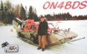
EU-135.jpgEU-135 Sweden Vasterbotten County group41 viewsHolmöarna is an island group in the Kvarken narrows of the Gulf of Bothnia between Sweden and Finland. The islands form part of Umeå Municipality in Västerbotten County. The islands have 75 year-round inhabitants[and the largest islands are Holmön, Ängesön, Grossgrunden, Holmögadd and Lilla and Stora Fjäderägg. Large areas of the islands have been set aside as nature reserves.
|
|

EU-142.jpgEU-142 Spain Oviedo / Santander Province group41 viewsMouro Island, originally Mogro Island, is a small uninhabited island in the Bay of Biscay, located off the Magdalena Peninsula. It lies close to the entrance to the Bay of Santander near the city of Santander, Cantabria along the north coast of Spain
|
|
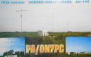
EU-146.jpgEU-146 Netherlands Zuid Holland / Zeeland Province group41 viewsGoeree-Overflakkee is the southernmost delta island of the province of South Holland, Netherlands. It is separated from Voorne-Putten and Hoeksche Waard by the Haringvliet, from the mainland of North Brabant by the Volkerak, and from Schouwen-Duiveland by Lake Grevelingen.
|
|

EU-150R.jpgEU-150 Portugal Minho / Douro Litoral / Beira Litoral Province group41 viewsFortress of Insua Island (Portugal), of the XVII century, located in the Minho River estuary, between the coast of Caminha (Portugal) and La Guardia (Spain). Inside the fort is the Franciscan convent of Saint Mary of Insua, built in 1471.
|
|

EU-157.jpgEU-157 France Bretagne (Cotes-d'Armor East / Ille et Vilaine) Region group41 viewsCézembre is an island in Brittany, in the Ille-et-Vilaine département of France, near Saint-Malo. The island is uninhabited, with a surface area of approximately 18 hectares (44 acres), a length of 750 metres (2,461 ft), and a maximum width of 250 metres (820 ft).The island features a fine sandy beach facing Saint-Malo on the south, and a steep and rocky coast around the rest of the island. As elsewhere in northern Brittany, the tidal range is among the highest in the world.
|
|

EU-157R.jpgEU-157 France Bretagne (Cotes-d'Armor East / Ille et Vilaine) Region group41 viewsCézembre is an island in Brittany, in the Ille-et-Vilaine département of France, near Saint-Malo. The island is uninhabited, with a surface area of approximately 18 hectares (44 acres), a length of 750 metres (2,461 ft), and a maximum width of 250 metres (820 ft).The island features a fine sandy beach facing Saint-Malo on the south, and a steep and rocky coast around the rest of the island. As elsewhere in northern Brittany, the tidal range is among the highest in the world.
|
|
| 15641 files on 392 page(s) |
 |
|
|
|
|
|
|
|
|
141 | |
|
|
|
|
|
|
|
|
 Contact

