 Most viewed Most viewed |

3d2Rdx.jpg116 views
|
|

5B4AGC.jpg116 views
|
|

3B7CF.jpg116 views
|
|

3d2rdxr.jpg116 views
|
|

4o3abr.jpg116 views
|
|

OC-111A.jpgOC-111 Shepherd Islands116 viewsThe Shepherd Islands (coordinates 16.8°S 168.5°ECoordinates: 16.8°S 168.5°E) are a group of islands lying between the larger islands of Epi and Éfaté, in the Shefa province of Vanuatu. They were named by Captain Cook after Anthony Shepherd, a British astronomer and friend of Cook. In the 2009 census the population numbered 3634. The Shepherd Islands are quite densely populated. There is little economic activity although fishing is very good.
|
|

AS-038R.jpgAS-038 Asiatic Russia East Siberian Sea Coast group115 viewsThe Routan Islands(Chukot: Ровтын иӆирти Rovtįn iłirti) are two islands in the eastern coast of the Chaunskaya Bay of the East Siberian Sea. They are located directly off Pevek, separated from the shore of the Pevek Peninsula by a 4.7 km wide sound.
|
|

as-040r.jpgAS-040 Japan Goto Islands115 viewsThe GotŠIslands are Japanese islands in the East China Sea, off the western coast of Kyūshū. They are part of Nagasaki Prefecture.
|
|

as-061r.jpgAS-061 Asiatic Russia Ratmanova (Big Diomede) Island115 viewsBig Diomede Island or "Tomorrow Island" (due to the International Date Line) is the western island of the two Diomede Islands in the middle of the Bering Strait. The island is a part of the Chukotsky District of the Chukotka Autonomous Okrug of Russia. The border separating Russia and the United States runs north-south between the Diomede Islands.
|
|

AS-082R.jpgAS-082 Asiatic Russia Laptev Sea Coast Centre group115 viewsBrusneva Island (Russian: ОÑтров БруÑнева, Ostrov Brusneva), is a small island in the Laptev Sea. It is located off the eastern side of the Lena delta in the Tiksi Bay, only 5 km ENE of Tiksi. Its length is 2.3 km and its maximum breadth less than 1 km. The name of this island is also spelt as "Brusnova" in some maps.
|
|

AS-095.jpgAS-095 Asiatic Russia Bering Sea Coast South group115 viewsThe island is located in the Avacha bay of the Pacific ocean, not far from the Avacha inlet passage, opposite the Big and the Small Sarannaya bays.
|
|

AS-112.jpgAS-112 Oman Al Batinah / Masqat Region group115 viewsBetween Barka and Sohar is the Sawadi and Daymaniyat islands. The rocky and windswept Sawadi Islands lie just offshore. The largest of the seven islands lies almost within spitting distance of the beach, a large rocky hump topped by a string of watchtowers, while the other smaller islands lie further out to sea.
|
|

AS-125.jpgAS-125 Thailand Gulf of Thailand North East group115 viewsKo Chang, one of the largest Thai islands in the Gulf of Thailand, contains dense, steep jungle. Mu Ko Chang National Park, a preserve with hiking trails and waterfalls such as tiered Klong Plu, covers the interior and extends to offshore coral reefs
|
|

AS-157.jpgAS-157 Vietnam South China Sea Coast Centre group115 viewsHon Tam Island is located offshore the coastal city of Nha Trang
|
|

AS-164.jpgAS-164 Asiatic Russia East Siberian Sea Coast West group115 viewsDerevannyy Island, East Siberian Sea
|
|

AS-173R.jpgAS-173 India Tamil Nadu State group115 viewsPamban Island, also known as Rameswaram Island, is an island located between peninsular India and Sri Lanka. The island is a part of India and forms the Rameswaram taluk of the Ramanathapuram district of the state of Tamil Nadu. It is the largest island in Tamil Nadu by area
|
|

4lup3ba.jpg115 views
|
|

4u1itur.jpg115 views
|
|

3d2cir.jpg115 views
|
|
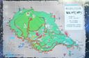
as-049.jpgAS-049 Japan Tokara Islands114 viewsThe Tokara Islands is an archipelago in the Nansei Islands, and are part of the Satsunan Islands, which is in turn part of the Ryukyu Archipelago. The 150 kilometres chain consists of twelve small islands located between Yakushima and Amami-Oshima. The islands have a total area of 101.35 square kilometres.
|
|

AS-077.jpgAS-077 Japan Kyushu Island114 viewsKyushu (ä¹å·ž KyÅ«shÅ«, literally "Nine Provinces"; Japanese: [kʲɯꜜËɕɯË]) is the third largest island of Japan and most southwesterly of its four main islands.
|
|

AS-084.jpgAS-084 South Korea Cheju-do Province (Ch'uja Islands) group114 viewsThe Chuja Islands are a group of 42 islands in the Jeju Strait, about halfway between Jejudo and the southern coast of Jeollanamdo. Only four islands are inhabited: Sangchuja, which is connected by a bridge to Hachuja, the largest by area; Hoengang; and Chupo. The Chuja Islands are administered by Jeju City
|
|

AS-139.jpgAS-139 China Guangxi Autonomous Region group114 viewsWeizhou Island is a Chinese island in the Gulf of Tonkin. The largest island of Guangxi province, Weizhou is west of Leizhou Peninsula, south of Beihai, and east of Vietnam. Administratively, it is part of Weizhou Town, Haicheng District of Beihai City.
|
|

AS-145.jpgAS-145 Thailand Malay Peninsula South East group114 viewsKo Nu (Mouse Island) and Ko Maeo (Cat Island) Beloved in local lore, these islands are situated off Hat Samila in Thailand
|
|

AS-148.jpgAS-148 South Korea Cholla-bukto Province group114 viewsWi Island , Cholla-bukto Province, South Korea
|
|
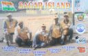
AS-153.jpgAS-153 India West Bengal State group114 viewsSagar Island is an island in the Ganges delta, lying on the Continental Shelf of Bay of Bengal about 100 km south of Kolkata.
|
|

AS-158.jpgAS-158 China Liaoning Province East group114 viewsChangshan Islands (zh:长山列岛) in the Bohai Sea, north of Penglai. They are known for their sandy beaches and picturesque limestone cliffs
|
|

3b7rfaa.jpg114 views
|
|

3b9oe4aacr.jpg114 views
|
|

na-153.jpgNA-153 Mexico Yucatan State group114 viewsIsla Pérez is an island located in the Gulf of Mexico, 130 km (80.7 mi) north of Progreso, Mexico, off the coast of the Yucatán Peninsula. It belongs to the Arrecife Alacranes National Park, and is the largest island in the archipelago. The island has little vegetation, with a hot and dry climate that is not hospitable to human life. Historically, the island has been used as a navigation reference point in the southern Gulf of Mexico, particularly for mariners between the Yucatán Channel and Bay of Campeche
|
|

AS-037R.jpgAS-037 Japan Koshikijima Islands113 viewsThe Koshikijima Islands (甑島列島 Koshikishima-rettÅ[1]) in the East China Sea are an island chain located 38 km west of the port city of Ichikikushikino, Kagoshima.
|
|

as-044.jpgAS-044 Asiatic Russia Sea of Okhotsk Coast Centre group113 viewsThe Shantar Islands are a group of fifteen islands located off the northwestern shore of the Sea of Okhotsk east of Uda Gulf and north of Academy Bay.[1] Most of the islands have rugged cliffs, but they are of moderate height; the highest point in the island group is 720 metres.
|
|

as-045r.jpgAS-045 South Korea Kyongsang-bukto Prov (Ullung Island) group113 viewsUlleung-do is an island east of mainland South Korea. It’s home to the rugged Seonginbong Mountain Range, with forested foothills and the often fog-covered summit of Seonginbong Peak.
|
|

AS-083R.jpgAS-083 Asiatic Russia Kara Sea Coast East group113 viewsBely Island is a relatively large island in the Kara Sea off the tip of the Yamal Peninsula, Siberia, Russia. Close to the island's northwest tip, there is the Russian Experiment Station Popov Station.
|
|

AS-086R.jpgAS-086 Asiatic Russia Izvestiy TS.I.K Islands113 viewsThe archipelago includes two large and two small islands covered with tundra vegetation, shingle and ice. It is located in the Kara Sea, about 150 km from the coast of Siberia and just 45 km north of the nearest island group, the Arkticheskiy Institut Islands. The largest island is Troynoy with a length of 27 km.
|
|

AS-103R.jpgAS-103 Taiwan P'enghu (Pescadores) Islands113 viewsThe Penghu or Pescadores Islands are an archipelago of 90 islands and islets in the Taiwan Strait. The largest city is Magong, located on the largest island, which is also named Magong.
|
|

AS-120.jpgAS-120 Cyprus Cyprus's Coastal Islands113 viewsAgios Georgios or San Giorgio is a Greek uninhabited island in the entry of Saronic Gulf. It’s the largest uninhabited island of the Saronic Islands with an area of 4.3 km²
|
|

AS-122R.jpgAS-122 South Korea Kyonggi-do Province West group113 viewsBaengnyeong Island is a 45.8-square-kilometre, 8.45-kilometre long and 12.56-kilometre wide island in Ongjin County, Incheon, South Korea, located near the Northern Limit Line
|
|

AS-141R.jpgAS-141 China Zhejiang Province South group113 viewsDongtou Island is part of “Hundred Island Countyâ€, and is located at the mouth of the Oujiang River, 16 kilometers away from Wenzhou, facing the East China Sea. Composed of 168 islands,with beautiful mountains and unique sea scenery, Dongtou is a seaside tourist resort
|
|

AS-144R.jpgAS-144 Myanamar Tenasserim Region South group113 viewsMergui (or Myeik) Archipelago lies off the far south coast of Myanmar (formerly Burma). It's comprised of hundreds of islands that have coral reefs and beaches. Lampi Island, in Lampi Marine National Park, is home to the seafaring indigenous Moken people. It's a haven for birds, notably the plain-pouched hornbill, plus marine life like dugongs and turtles. Myeik, a port town, is a gateway to islands close to shore.
|
|
| 15298 files on 383 page(s) |
 |
|
|
|
|
|
|
|
|
14 | |
|
|
|
|
|
|
|
|
 Contact
