 Most viewed Most viewed |

OC-278R.jpgOC-278 Ujelang Atoll40 viewsUjelang Atoll (Marshallese: Wūjlan̄, [u̯u͡izʲ(e)lʲæ͡ɑŋ][1]) is a coral atoll of 30 islands in the Pacific Ocean, in the Ralik Chain of the Marshall Islands. It is the westernmost island in the Marshall Islands, approximately 217 kilometres (135 mi) southeast of Enewetak, and approximately 600 kilometres (370 mi) west of the main Ralik Chain. In 1989 Ujelang became permanently uninhabited. Ujelang Atoll is currently owned by the Enewetak Council and is now very rarely visited.
|
|

OC-280R.jpgOC-280 Starbuck Island40 viewsStarbuck Island (or Volunteer Island) is an uninhabited coral island in the central Pacific, and is part of the Central Line Islands of Kiribati. The island boasts a large colony of sooty terns, estimated at 1.5 million pairs, together with Polynesian rats, feral cats, green turtles, and around fifteen other species of seabirds. There is no freshwater on the island, which is one of the drier atolls in the Line Island group.
|
|
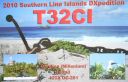
OC-281.jpgOC-281 Caroline Island;Millennium Island40 viewsCaroline Island or Caroline Atoll (also known as Millennium Island and Beccisa Island), is the easternmost of the uninhabited coral atolls which comprise the southern Line Islands in the central Pacific Ocean, part of the Republic of Kiribati since the island nation's independence in 1979.
Caroline Island has remained relatively untouched and is considered one of the world's most pristine tropical islands. It is home to one of the world's largest populations of the coconut crab and is an important breeding site for seabirds, most notably the sooty tern.
|
|
IZONE30.jpg40 views
|
|

EU-190.jpgEU-190 Russia Viktoriya Island40 viewsVictoria Island (Russian: ОÑтров ВикториÑ; Ostrov Viktoriya) is a small Arctic island of the Russian Federation. It is located at 80°9′N 36°46′E, halfway between the Norwegian archipelago of Svalbard and the Russian archipelago of Franz Josef Land. This westernmost of all Russian Arctic islands is administered as part of Franz Josef Land and belongs to the Arkhangelsk Oblast administrative division of the Russian Federation.
|
|

OC-105.jpgOC-105 Cagayan de Sulu group40 viewsMapun is an island municipality in the Sulu Sea on the south-western extreme of the Philippines, located very close to Sabah, Malaysia. The people inhabiting the island are known as Jama Mapun or "people of Mapun". Their dialect is Pullun Mapun, which means "Mapun language".
|
|

OC-058S.jpgOC-058 D'Entrecasteaux Reefs40 viewsLocated in the Coral Sea , the Entrecasteaux reefs are reefs at the water's edge in northwestern New Caledonia . Uninhabited, they are located 223 km from the northeastern tip of Grande Terre , in the extension of the Belep Islands from which they are separated by the "Grand Passage" strait 500 to 600 meters deep. They constitute the northern limit of the lagoon of the archipelago of New Caledonia .
|
|

OC-090A.jpgOC-090 Calamian group40 viewsThe Calamian Islands or Calamianes is a group of islands in the Philippine province of Palawan. Busuanga Island hosts the largest town, Coron, in the Calamian Islands.
|
|

kp5k5d.jpg40 views
|
|

9j2la.jpg40 views
|
|

tr8cag.jpgTR8CA - GABON40 viewsworked longpath direct via F2
|
|

OH-Gallila1.jpg40 views
|
|
AL-Henry.jpg40 views
|
|

OH-Ashland2.jpg40 views
|
|

MO-Howell.jpg40 views
|
|

PA-Jefferson.jpg40 views
|
|

AK-Denali_Borough.jpg40 views
|
|

AK-Kusilvak_Borough.jpg40 views
|
|

AK-Yukon_Koyukuk_Borough.jpg40 views
|
|

eu-028r.jpgEU-028 Italy Toscana (Tuscany) Region group39 viewsIsola del Giglio; English: Giglio Island is an Italian island and comune situated in the Tyrrhenian Sea, off the coast of Tuscany, and is part of the Province of Grosseto. The island is one of seven that form the Tuscan Archipelago, lying within the Arcipelago Toscano National Park. In 2012, the cruise ship Costa Concordia foundered off the coast of the island.
|
|
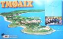
eu-032.jpgEU-032 France Poitou-Charentes Region group39 viewsÃŽle-d'Aix is a commune in the Charente-Maritime department off the west coast of France. It occupies the territory of small island of ÃŽle d'Aix in the Atlantic. It is a popular place for tourist day-trips during the summer months.
|
|

eu-033.jpgEU-033 Norway Vesteralen Islands / Troms County South group39 viewsVesterålen is a district and archipelago in Nordland county, Norway. It is located just north of the Lofoten district and archipelago and west of the town of Harstad. It is the northernmost part of Nordland county, including the municipalities of Andøy, Bø, Hadsel, Sortland, and Øksnes
|
|
eu-035.jpgEU-035 Russia Novaya Zemlya39 viewsNovaya Zemlya is an archipelago in the Arctic Ocean in northern Russia and the extreme northeast of Europe, the easternmost point of Europe lying at Cape Flissingsky on the Northern island. West of Novaya Zemlya is the Barents Sea, and to the east is the Kara Sea. Novaya Zemlya is composed of two main islands, the northern Severny Island and the southern Yuzhny Island.
|
|

eu-038.jpgEU-038 Netherlands Noord Holland / Friesland / Groningen Province group39 viewsTexel is a municipality and an island with a population of 13,641 in the province of North Holland in the Netherlands. It is the largest and most populated island of the West Frisian Islands in the Wadden Sea. The island is situated north of Den Helder, northeast of Noorderhaaks, also known as "Razende Bol" and southwest of Vlieland.
|
|

eu-040.jpgEU-040 Portugal Estremadura Province group39 viewsThe Berlengas archipelago is a group of small islands 10 to 15 kilometres (6.2–9.3 miles) off the Portuguese coast, west of the town of Peniche in Oeste region. These islands were traditionally known to British mariners as "the Burlings". The only habitable island is the largest island, Berlenga Grande, although there is no permanent habitation there at present. The other islands are grouped into two groups of islets, the Estelas Islets and the Farilhões-Forcados Islets.
|
|

eu-041.jpgEU-041 Italy Maddalena Archipelago39 viewsThe 'Maddalena Archipelago' is a group of islands in the Strait of Bonifacio between Corsica (France) and north-eastern Sardinia (Italy). The whole archipelago makes the territory of the La Maddalena comune. The archipelago consists of seven main islands and numerous small islets
|
|

eu-042r.jpgEU-042 Germany Schleswig-Holstein State North West group39 viewsPellworm is a municipality in the district of Nordfriesland,in Schleswig-Holstein, Germany. The municipality is located on the island of Pellworm – one of the North Frisian Islands on the North Sea coast of Germany. Its area is 37 km², and its population is roughly 1,200.
|
|
eu-044.jpgEU-044 Norway Finnmark County West group39 viewsKvaløya is an island in Tromsø Municipality in Troms county, Norway. At 737 square kilometres (285 sq mi), it is the fifth largest island in mainland Norway. It is connected to the neighboring island of Tromsøya to the east by the Sandnessund Bridge, to the island of Ringvassøya to the north by the sub-sea Kvalsund Tunnel, to the small island of Sommarøya to the west by the Sommarøy Bridge, and to the mainland to the south by the Rya Tunnel.
|
|

eu-045.jpgEU-045 Italy Lazio Region group39 viewsThe Pontine Islands are an archipelago in the Tyrrhenian Sea off the west coast of Italy. The islands were collectively named after the largest island in the group, Ponza. The other islands in the archipelago are Palmarola, Zannone, and Gavi to the northwest, Ventotene and Santo Stefano to the southeast.
|
|

eu-048r.jpgEU-048 France Bretagne (Morbihan) Region group39 viewsBelle-Île, Belle-Île-en-Mer, or Belle Isle is a French island off the coast of Brittany in the département of Morbihan, and the largest of Brittany's islands. It is 14 kilometres (8.7 miles) from the Quiberon peninsula. The island measures 17 by 9 kilometres (10.6 by 5.6 miles) and has an average altitude of 40 metres (130 feet). The area is about 84 square kilometres (32 square miles).
|
|
eu-049r.jpgEU-049 Greece North Aegean Islands (Voreio Aigaio)39 viewsLesbos is an island located in the northeastern Aegean Sea. It has an area of 1,633 km2 (631 sq mi) with 320 kilometres (199 miles) of coastline, making it the third largest island in Greece. It is separated from Turkey by the narrow Mytilini Strait.
|
|
eu-053r.jpgEU-053 Finland Market reef 39 viewsMärket is a small 3.3-hectare (8.2-acre) uninhabited skerry in the Baltic Sea between Sweden and Finland (in the area of the autonomous Åland Islands), with a lighthouse as its salient manmade feature. Märket has been divided between the two countries since the Treaty of Fredrikshamn of 1809 defined the border between Sweden and the Russian Empire as going through the middle of the island.
|
|

EU-058R.jpgEU-058 France Provence-Cote d'Azur (Alpes Maritimes) Region group39 viewsThe Lérins Islands are a group of four Mediterranean islands off the French Riviera, in Cannes. The two largest islands in this group are the Île Sainte-Marguerite and the Île Saint-Honorat. The smaller Îlot Saint-Ferréol and Îlot de la Tradelière are uninhabited. Administratively, the islands belong to the commune of Cannes.
|
|
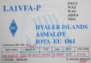
EU-061.jpgEU-061 Norway Vest Agder to Ostfold County group39 viewsHvaler is a municipality that is a group of islands in the southwestern part of Østfold County, Norway. The Hvaler archipelago consists of 833 islands, islets, and skerries.
|
|

EU-067R.jpgEU-067 Greece Kyklades (Cyclades)39 viewsThe Cyclades (Greek: Κυκλάδες Kykládes) are Greek islands located in the southern part of the Aegean Sea. The archipelago contains some 2,200 islands, islets and rocks; just 33 islands are inhabited.
|
|

EU-068R.jpgEU-068 France Bretagne (Finistere South West) Region group39 viewsThe Île de Sein is a French island in the Atlantic Ocean, off Finistère, eight kilometres from the Pointe du Raz (raz meaning "water current"), from which it is separated by the Raz de Sein. Its Breton name is Enez Sun. The island, with its neighbouring islets, forms the commune of Île-de-Sein in the Finistère department of Brittany in north-western France. Inhabitants of Île-de-Sein are called in French Sénans.
|
|

EU-071R.jpgEU-071 Iceland Vestmannaeyjar (Westman Islands)39 viewsVestmannaeyjar (Western Islands) is an archipelago off Iceland’s south coast, formed by underwater volcanic eruptions. The youngest island, Surtsey, was formed in 1963. Heimaey is the largest and only inhabited island. It has 2 volcanoes, Helgafell and Eldfell.
|
|

EU-073R.jpgEU-073 Italy Puglia (Taranto) Region group39 viewsThe Cheradi Islands in the Gulf of Taranto are a small archipelago of the harbor basin of the Mar Grande of Taranto. The island group consists of the two islands of San Pietro and San Paolo. Previously, there was still a third island, San Nicolicchio, but was destroyed through the expansion of the cargo port. Administratively, the islands belong to the old town of Taranto (municipality III Città Vecchia - Borgo).
|
|

EU-077.jpgEU-077 Spain La Coruna / Lugo Province group39 viewsIlla Coelleira, or Colleira, is a small island located in the mouth of the Barqueiro river, off the town of Viveiro, in the Rias Altas coastal region of Galicia, Spain. The island is part of O Vicedo municipality. It is known best as the site of a former monastery, and today houses a lighthouse to aid navigation
|
|

EU-084R.jpgEU-084 Sweden Uppsala / Stockholm County group39 viewsThe Stockholm archipelago extends from Stockholm roughly 60 kilometres (37 miles) to the east. In a north–south direction, it mainly follows the coastline of the Södermanland and Uppland provinces, reaching roughly from Öja island, south of Nynäshamn, to Väddö, north of Norrtälje. It is separated from Åland by a stretch of water named South Kvarken.
|
|
| 15391 files on 385 page(s) |
 |
|
|
|
|
|
|
|
|
135 | |
|
|
|
|
|
|
|
|
 Contact
