 Most viewed Most viewed |

e51szk1hjr.jpg40 views
|
|
ea6lp~0.jpg40 views
|
|

fjto2dr~0.jpg40 views
|
|

fk0bcr.jpg40 views
|
|

fo0amizr~1.jpg40 views
|
|
fskt8xp.jpg40 views
|
|
g0mmir.jpg40 views
|
|

gd4uolaa.jpg40 views
|
|

gwmw0zzka.jpg40 views
|
|

tz6tr.jpg40 views
|
|
zd9zm~1.jpg40 views
|
|

zk3cwa.jpg40 views
|
|

zl2ifb.jpg40 views
|
|

zl2ifbr.jpg40 views
|
|

zl7zm7zb.jpg40 views
|
|

zl7zm7zbr~0.jpg40 views
|
|

zp5ko.jpg40 views
|
|

zzdelok1dla.jpg40 views
|
|

zzdelr1m4j1fwr.jpg40 views
|
|

OC-028S.jpgOC-028 Marshall Islands Ralik Chain40 viewsThe Ralik Chain is a chain of islands within the island nation of the Marshall Islands. Ralik means "sunset". It is west of the Ratak Chain. In 1999 the total population of the Ralik islands was 19,915
|
|

OC-084.jpgOC-084 Fanning and Washington Islands40 viewsTabuaeran or Tahanea, known in English as Fanning Atoll, is an atoll that is part of the Line Islands of the central Pacific Ocean and part of Kiribati. The land area is 33.73 square kilometres, and the population in 2010 was 1,960. The maximum elevation is about 3 m above high tide.
|
|

OC-098R.jpgOC-098 Pukapuka Atoll;Danger Islands40 viewsPukapuka, formerly Danger Island, is a coral atoll in the northern group of the Cook Islands in the Pacific Ocean. It is one of most remote islands of the Cook Islands, situated about 1,140 kilometres (708 miles) northwest of Rarotonga. On this small island, an ancient culture and distinct language has been maintained over many centuries.
|
|
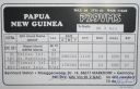
OC-103.jpgOC-103 St Matthias group40 viewsThe St Matthias Islands (also known as the Mussau islands) are a small archipelago group of islands in the Bismarck Archipelago, in northern Papua New Guinea. They are within New Ireland Province. There are at least 10 islands. The largest and most northerly is Mussau.
|
|

oc-133.jpgOC-133 Sabah's Coastal Islands40 viewsLabuan Island and six smaller islands, are located off the coast of the state of Sabah in East Malaysia. Labuan's capital is Victoria and is best known as an offshore financial centre offering international financial and business services via Labuan IBFC since 1990 as well as being an offshore support hub for deepwater oil and gas activities in the region.
|
|

oc-133r.jpgOC-133 Sabah's Coastal Islands40 viewsLabuan Island and six smaller islands, are located off the coast of the state of Sabah in East Malaysia. Labuan's capital is Victoria and is best known as an offshore financial centre offering international financial and business services via Labuan IBFC since 1990 as well as being an offshore support hub for deepwater oil and gas activities in the region.
|
|

OC-154.jpgOC-154 Western Australia State (North Coast) East group40 viewsTroughton Island is an island located off the Kimberley coast of Western Australia. The Sir Graham Moore Islands Airline company ShoreAir Pty Ltd has opened and operated an airport on the island since the 1960s.
|
|

OC-180.jpgOC-180 Ngulu Atoll40 viewsNgulu Atoll is a coral atoll of three islands in the Caroline Islands in the Pacific Ocean, and forms a legislative district in Yap State in the Federated States of Micronesia. Ngulu extends for 36 kilometres (22 mi) by 22 kilometres (14 mi) with 18 reef segments enclosing a deep central lagoon of 382 square kilometres (147 sq mi). The eastern portion of the reef is deeply submerged. Its total land area of the nine islets is only 0.4 square kilometres (0.15 sq mi). Nugulu is located approximately 104 kilometres (65 mi) south-southwest of Yap and is the westernmost atoll in the Federated States of Micronesia. The population of Ngulu was 26 in 2000.
|
|

oc-191r.jpgOC-191 Niuatoputapu Island40 viewsNiuatoputapu is a high island in the island nation of Tonga, Pacific Ocean, its highest point being at 157 m. Its name means sacred island. Older European names for the island are Traitors island or Keppel island. Niuatoputapu is located in the north of the country, 300 kilometres (190 miles) away from Vavaʻu near the border with Samoa. Its closest neighbours are the small island of Tafahi, only 9 km (5.6 mi) to the north-northeast, and the island of Niuafo'ou.
|
|

OC-203R.jpgOC-203 South Island's Coastal Islands40 viewsStewart Island, officially named Stewart Island/Rakiura, is the third-largest island of New Zealand. It lies 30 kilometres south of the South Island, across the Foveaux Strait. Its permanent population is 381 people as of the 2013 census, most of whom live in the settlement of Oban on the eastern side of the island.
|
|

OC-206.jpgOC-206 Western Australia State (S.W. Coast) North group40 viewsDirk Hartog Island is an island off the Gascoyne coast of Western Australia, within the Shark Bay World Heritage Area. It is about 80 kilometres (50 miles) long and between 3 and 15 kilometres (1.9 and 9.3 miles) wide and is Western Australia's largest and most western island. It covers an area of 620 square kilometres (240 square miles) and is approximately 850 kilometres (530 miles) north of Perth. It was named after Dirk Hartog, a Dutch sea captain, who first encountered the Western Australian coastline close to the 26th parallel south latitude, which runs through the island.
|
|

OC-214R.jpgOC-214 Western Australia State (N.W. Coast) East group40 viewsThe Lacepede Islands, sometimes referred to simply as the Lacepedes, are a group of four islands lying off the Kimberley coast of Western Australia, about 120 kilometres (75 miles) north of Broome. They are all small, low spits of coarse sand and coral rubble, lying atop a platform coral reef. They are treeless but support low vegetation.
|
|
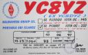
OC-222.jpgOC-222 Obi Islands40 viewsThe Obi Islands (also known as Ombirah, Indonesian: Kepulauan Obi) are a group of islands in the Indonesian province of North Maluku. They lie north of Buru and Ceram. The largest in the group is Obi Island.
|
|

OC-223R.jpgOC-223 New South Wales State South group40 viewsMontague Island is a continental island contained within the Montague Island Nature Reserve, a protected nature reserve that is located offshore from the South Coast region of New South Wales, in eastern Australia. The nearest town located onshore from the 81-hectare (200-acre) reserve and island is Narooma, situated approximately 9 kilometres (5.6 mi) to the northwest. Montague Island is a popular tourist destination, known for its lighthouse, wildlife, most especially little penguins
|
|

OC-236.jpgOC-236 Celebes's Coastal Islands40 viewsLembeh is an island off the north east coast of Sulawesi near the town of Bitung. Lembeh Island is 25km long and 2km wide. Lembeh Island is separated from the mainland of Sulawesi by a narrow stretch of water known as the Lembeh Strait. Several dive resorts are available on Lembeh Island.
|
|

OC-238.jpgOC-238 Pukarua and Reao Atolls40 viewsReao or Natūpe is an atoll in the eastern expanses of the Tuamotu group in French Polynesia. The closest land is Pukarua Atoll, located 48 km to the WNW. Reao is 24.5 km long and its maximum width is 5 km. The whole length of its north-eastern rim is occupied by a single long island. There is no navigable pass into the lagoon. Reao Atoll's population is 351 inhabitants
|
|

OC-250.jpgOC-249 Aru Islands40 viewsThe Aru Islands are a group of about ninety-five low-lying islands in the Maluku province of eastern Indonesia. They also form a regency of Maluku, with a land area of 8,152.42 square kilometres (3,147.67 square miles). At the 2011 Census the Regency had a population of 84,138. The islands are the easternmost in Maluku province, and are located in the Arafura Sea southwest of New Guinea and north of Australia.
|
|

OC-266.jpgOC-266 Western Australia State (North Coast) Centre group40 viewsViney is an uninhabited island located in the remote north west of Western Australia north east of the town of Derby and the Dampier Peninsula.
|
|
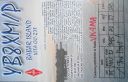
OC-271R.jpgOC-271 Babar Islands40 viewsThe Babar Islands (Indonesian: Kepulauan Babar) are located in Maluku Province, Indonesia. Tepa (a town with a population of about 2,000 people) is the administrative center of the Babar Islands municipality. The topography of all the Babar islands is distinctive for their marked stepped appearance, the result of a combination of periodic uplifting of the tectonic plate. Small freighters that have contracts to carry passengers service the islands.
|
|
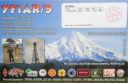
OC-275R.jpgOC-275 West Papua's Coastal Islands South40 viewsPulau Yos Sudarso or Pulau Dolak is an island separated only by the narrow Muli Strait from the main island of New Guinea. It is part of the Merauke Regency, in the Indonesian province of Papua. The island is leaf-shaped, about 165 km (103 mi) long with an area of 11,740 km2 (4,530 sq mi). It was known as Frederik Hendrik Island until 1963. Local and alternative names of the island include Dolok, Kimaam and Kolepom. The island has a pop of 11,000 approx,
|
|

OC-276.jpgOC-276 Mapia Islands40 viewsMapia Atoll (Indonesian: Kepulauan Mapia), historically known as the Freewill Islands or San David, is an atoll in the Pacific Ocean. It is located in Papua province of Indonesia, approximately 290 kilometers north of the city of Manokwari and 630 kilometers from the islands of Palau.
|
|
| 15391 files on 385 page(s) |
 |
|
|
|
|
|
|
|
|
134 | |
|
|
|
|
|
|
|
|
 Contact
